- Joined
- Oct 16, 2019
- Messages
- 8,867
- Location
- Atlanta / Marietta
- Display Name
- Vintage Snazzy (so my adult children say)
- Home Airfield
- KPUJ
Yes, agree that as well.Night, Weather, Terrain: pick any two.

Yes, agree that as well.Night, Weather, Terrain: pick any two.

I personally take myself through an instrument approach briefing. One of the items I check off, other than the obvious ones, is to make sure I'm aware of the terrain profile. If the conditions are such that the airport may be intermittendly masked by terrain along with cloud conditions, I'm going to be cognizant of the possibility and pay close attention to my descent slope, MDA, and altitude stepdowns.He perhaps saw the airport at a higher altitude and began decent. When he lost sight of the runway in the decent, he may have thought it was obscured by clouds, not a mountain. Continue decent, airport will pop out shortly. But he flew below the MDA when he shouldn't have, and that's why he crashed.
In this case, he let the autopilot fly the approach using Vertical Guidance that really wasn't there, he trusted it when he shouldn't have and/or didn't understand what it was doing.
My learning from this I can use in my own flying: The auto pilot flying an approach can be a great aid. But it doesn't think, the PIC has to. Be proficient in general at knowing how to use the autopilot, what it's actually doing. Garmin autopilot programming / approaches aren't infallible.
I haven't kept up with all of the nuances of this accident. What does the bolded part mean?In this case, he let the autopilot fly the approach using Vertical Guidance that really wasn't there, he trusted it when he shouldn't have and/or didn't understand what it was doing.

The approach is an LNAV approach, meaning there is lateral guidance only and no legal provision for a continuous glidepath from the FAF. However, many Garmin units have a feature called advisory glidepath, which tacks on to a lateral-only RNAV approach. Also known as “+V.” So you can get an LNAV +V or LP +V.I haven't kept up with all of the nuances of this accident. What does the bolded part mean?

The approach is an LNAV approach, meaning there is lateral guidance only and no legal provision for a continuous glidepath from the FAF. However, many Garmin units have a feature called advisory glidepath, which tacks on to a lateral-only RNAV approach. Also known as “+V.” So you can get an LNAV +V or LP +V.
The issue is that a “+V” is advisory only and the pilot is still required to meet all published minimum altitudes along the way. Most of the time this isn’t an issue as a nominal continuous final descent glidepath, as indicated by a +V will be at or above published minimum altitudes prior to the MDA. Unfortunately, that isn’t the case on this approach.
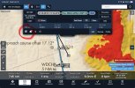
Where this particular approach gets tricky is that the MDA occurs at a waypoint 5.5nm from the runway and the advisory glidepath, if followed, takes the aircraft into a mountain between that and the airport.
Where it gets even more tricky is that a pilot could ostensibly get a visual on the airport at that waypoint and begin a descent below MDA from there, either visually or on the advisory glidepath, and still run into that mountain. The fact that the apex of the ridge only sticks up a hundred feet or so into the glidepath means the runway behind it would be obscured only a few moments prior to impact. This is much more likely at night, but even during the day you’d have to have some awareness of what that collision course looks like.
Tacking on, the Garmin gear in the E1000 is capable of reporting the autopilot mode in the ADSB data. There are two clues from that data in post #23 that seem to indicate that it was following the advisory glidepath.The approach is an LNAV approach, meaning there is lateral guidance only and no legal provision for a continuous glidepath from the FAF. However, many Garmin units have a feature called advisory glidepath, which tacks on to a lateral-only RNAV approach. Also known as “+V.” So you can get an LNAV +V or LP +V.
The issue is that a “+V” is advisory only and the pilot is still required to meet all published minimum altitudes along the way. Most of the time this isn’t an issue as a nominal continuous final descent glidepath, as indicated by a +V will be at or above published minimum altitudes prior to the MDA. Unfortunately, that isn’t the case on this approach.
Where this particular approach gets tricky is that the MDA occurs at a waypoint 5.5nm from the runway and the advisory glidepath, if followed, takes the aircraft into a mountain between that and the airport.
Where it gets even more tricky is that a pilot could ostensibly get a visual on the airport at that waypoint and begin a descent below MDA from there, either visually or on the advisory glidepath, and still run into that mountain. The fact that the apex of the ridge only sticks up a hundred feet or so into the glidepath means the runway behind it would be obscured only a few moments prior to impact. This is much more likely at night, but even during the day you’d have to have some awareness of what that collision course looks like.
Even given the approach speed, I'm trying to wrap my head around how the terrain wouldn't have been visible (1/2 mile out would leave something less than 15 seconds for reaction time). Or perhaps he DID see it and pulled up but was unable to clear the ridge?


Night, Weather, Terrain: pick any two.

sure, but you didn't incur a $3.8M capex (financed millionaire he prob didn't either but you get the gist) to have to suffer the indignity of gaining no better block time into that mountain town than my outgrouper hind quarter could easily match (2 days of daytime MVFR-effectively limited) in the $50K underpowered POS I used to own.Now that I am older, and no longer get paid to fly much, I stick to picking just one. There is no where I need to be that bad, and my Marriott status and points take care of the rest.

THIS. Remember the Challenger that stalled about 1/2 mile short of the runway at KASE? The client was on the CVR saying he could not go to Rifle, he had to host a party at 19:00........just explaining it's a powerful incentive to want to save face in light of such expenditure. Monied folk tend to struggle with the concept of being told No in this life.
THIS. Remember the Challenger that stalled about 1/2 mile short of the runway at KASE? The client was on the CVR saying he could not go to Rifle, he had to host a party at 19:00.....
The aircraft was a G3. This mishap was caused by the charter client's bullying of the operator's personnel and the crew. It is one of the most egregious incidents of that type I can recall. The three crew members and fifteen passengers died as a result.THIS. Remember the Challenger that stalled about 1/2 mile short of the runway at KASE? The client was on the CVR saying he could not go to Rifle, he had to host a party at 19:00.....

Holy cow!THIS. Remember the Challenger that stalled about 1/2 mile short of the runway at KASE? The client was on the CVR saying he could not go to Rifle, he had to host a party at 19:00.....
And the pilot was found to be at fault and the company paid out $12M. UnbelievableThe aircraft was a G3. This mishap was caused by the charter client's bullying of the operator's personnel and the crew. It is one of the most egregious incidents of that type I can recall. The three crew members and fifteen passengers died as a result.
The flight had left LAX forty one minutes after the planned departure time, because several of the passengers had shown up more than thirty minutes late to the FBO. The crew had the added stricture of a time limit on operations into ASE, and the aircraft crashed and exploded four minutes after the curfew went into effect.
Earlier during the flight, the pilot was heard on the CVR telling the passengers the plane was possibly going to divert to Rifle because of weather conditions and time constraints.
One of the passengers had entered the cockpit while the plane was on final. It could not be determined if that person was the client, who had earlier instructed his assistant to call the operator's LAX office during the descent into Aspen to tell the operations desk to instruct the pilot to keep his comments to himself.
In the half hour before the crash, several other aircraft had declared missed and gone to Rifle.

Remember the Challenger that stalled about 1/2 mile short of the runway at KASE?
No I don't, but I'd love to learn about it. Have you a link?
No I don't, but I'd love to learn about it. Have you a link?


There’s a lot of info in the Blancolorio video as to the results of the flight tests performed for this approach. Many issues were noted and it even received an “unsat” rating. Those records are also publicly available, but it was summarized nicely in the video. I’m surprised the approach existed in that form, but it’s now NOTAMed NA.Regarding the approach itself, I do wonder how detailed the FAA is when they come up with approach. How well it's designed, modeled and what their process is for approving it.
I know they have specially outfitted biz jets for test flying different approaches. I wonder how this particular approach was tested? Did the FAA actually fly it before approving it? Did they fly in daytime and night, or just day? Or was it approved without flying (some kind of paper-based approval, or approval-by-similarity to another approach, etc).
I recall during discussions on the PSA / Blackhawk collision in DC, when people dug into how exactly the FAA decided to approve the exiting approach and helicopter routes, it was a lot of pen and paper analysis. It just seemed like the FAA had not leveraged any kind of technology in designing and analyzing approaches. 3D modeling, virtual reality, etc.
On another topic, I don't know all the details of the pilot and the flight itself, but it does seem like some echoes of the May 2025 Citation crash in San Diego. Executive ends a full day of work, and hops in the jet that evening to go blast across the country. Does a gas stop 1/2 way. Ends up over their destination in the middle of the night (midnight or later), and has to do an approach through the weather. **** happens, the holes in the swiss cheese line up, and there is a smoking hole in the ground.
Perhaps I'm just getting old, but the last couple times I had to take a long flight leaving in the evening, it's been a miserable experience. Just tires and wears me out. And that's sitting in economy plus in the back of an airliner. I can't imagine working all day, then having the stress of flying a full flight into a challenging approach at a time when I'm usually in bed.
I go back to my earlier post - what’s the intent of this design? If you stay at the MDA to the mountain, it’s nearly as steep as the RNAV-E that’s actually aligned with the runway. So the intent is to allow an earlier descent below MDA to allow a straight-in designation? Makes no sense other than an “at your own risk” way to get down on a shallower angle.
It would be NA at night as well as NA in IMC. So basically it just shouldn’t exist.
True, but at which point I'd go back to @Flying Keys previous posts. The RVAV in question isn't needed as you already have RNAV E. M2C the RNAV even with modification will never be as safe as RNAV E, and will still be more restricted/less available (day only, etc.)Day IMC is ok. If ceiling above MDA and visibility under ceiling sufficient to see the runway, you can see the mountain to avoid.

If my math is mathing, it’s 3.2nm or about 19,500’ from the ridge to the runway. The MDA is 9100’ or roughly 2200’ above the TDZE.With the descent angle on RNAV E being 7.75 degrees…. What type of maneuvering would be done to land on 32? The approach seems to be designed to land “straight in” on 32, but based on the naming and required descent rate, you can’t/shouldnt land straight in.
If my math is mathing
Hah. True, but this is actually a pretty new approach - created in the last couple years. I don’t think it’s long for the world. Not in its current form, at least.There must be someone out there these days that will say the approach was there before the mountain was.

Wealthy folks frequently have a problem with “no!”
I learned that lesson many many years ago.

Wealthy folks frequently have a problem with “no!”
I learned that lesson many many years ago.