VOR with no Compass Rose?

A1Topgun

Cleared for Takeoff
Joined
Sep 6, 2015
Messages
1,485
Location
Central Maine
Display Name
Ron
Home Airfield
1B0
.
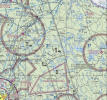
Punched in the FAA airport designation for Princeton and GPS was taking us ten miles north of airport. WTF! Did not notice the PNN VOR on the sectional chart until later.
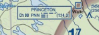
First time I've seen a VOR on the chart without a compass rose.
VOR.png.
 
I'll just say it. It's a DME and only DME. RFD has it as well after they decommissioned the vor portion.

For future reference, punch in that "K" otherwise youll get the navaid.
 
First time I've seen a VOR on the chart without a compass rose.
Well, if it were a VOR it would have hexagon symbol and probably compass rose.

But if you check the legend or the handy little Chart Users Guide, you'll find out that the blue box is for a DME. And if you happen to use ForeFlight (and prob. the other EFBs), if you Tap on it, you will see "DME" in the info box. :p
 
Last edited:
The chart guys will omit compass roses on VORs if they decide it was too cluttered. It means diddly squat other than that.
 
Another clue is the frequency. It’s in parentheses, suggesting that it’s not the real frequency of the navaid, but it’s the one that will cause a VOR/DME receiver to tune in the right DME channel.
 
.
Punched in the FAA airport designation for Princeton and GPS was taking us ten miles north of airport. WTF! Did not notice the PNN VOR on the sectional chart until later.
First time I've seen a VOR on the chart without a compass rose.
View attachment 141709.
It’s a stand alone DME. They have those to accommodate DME/DME/RNAV for the VOR Minimum Operational Network (MON)
 
The chart guys will omit compass roses on VORs if they decide it was too cluttered. It means diddly squat other than that.

Yep, SSF doesn't have a rose on the chart.

Probably more concerning should be the number of VORs with compass roses still on the chart which have been decommissioned or aren't being maintained anymore. THX in my area.
 
Well, if it were a VOR it would have compass rose.
Not necessarily. The charting office can and does sometimes omit the compass rose for chart clutter concerns. Note for example the Cowboy and Rangers VORs in the DFW area (CVE and FUZ).
 
Not necessarily. The charting office can and does sometimes omit the compass rose for chart clutter concerns. Note for example the Cowboy and Rangers VORs in the DFW area (CVE and FUZ).
FUZ has a rose on the High Chart. I can’t see it but I’d guess both are on the A-2. CVE is on the TCA chart but not the Sectional
 
FUZ has a rose on the High Chart. I can’t see it but I’d guess both are on the A-2. CVE is on the TCA chart but not the Sectional
I didn't check those others, just the sectional, but that does kind of prove the point that compass rose are definitely not required on the chart.
 
Seems like a DME without a VOR would be of limited use, especially in today’s MON era.
 
Seems like a DME without a VOR would be of limited use, especially in today’s MON era.
The whole reason they are kept around as DME-only stations is that they are used, and necessary for, DME/DME RNAV, which is used by airliners and many other turbine aircraft. More or less as a backup to GPS.

Look at a few RNAV SIDS and STARS and you'll see the note "DME/DME/IRU or GPS required."
 
It’s not that a DME only isn’t of no use, rather adding a VOR radial would be much more useful.

I am X miles from a point, but can’t tell you where except that it must be somewhere on a circle from that point with a radius X.
 
So you tune another dme, then you get down to 2 possible fixes, then tune up a 3rd and you get where you are.
 
It’s not that a DME only isn’t of no use, rather adding a VOR radial would be much more useful.

I am X miles from a point, but can’t tell you where except that it must be somewhere on a circle from that point with a radius X.
You're right, if you're receiving only one DME source. But receive 3, 4 or 10 DME sources and now you have a good position. That's DME/DME RNAV, which is essentially a ground-based "GPS".

And most (almost all) of the DME-only facilities USED TO be a VOR/DME or VORTAC, but the VOR portion was decommissioned as part of the MON program. So adding a VOR is not an option, the reverse was already decided, as a VOR is much more costly to maintain than a DME-only facility.
 
  • Like
Reactions: WDD
But receive 3, 4 or 10 DME sources and now you have a good position. That's DME/DME RNAV, which is essentially a ground-based "GPS".
Didn’t know that was a thing, or that there were navigation boxes that could compute that.
 
In the early 80's King had one that was IFR approved. KNS 80 I believe. Worked great. Most airlines have that built into the FMS as a backup if GPS goes out. And the DME portion of ILS-DME's are used too.
 
  • Like
Reactions: WDD
The chart guys will omit compass roses on VORs if they decide it was too cluttered. It means diddly squat other than that.
True, but not in this case. That part of the chart is not cluttered and it’s not a VOR.

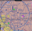
Here’s a VOR with no compass rose due to clutter.
1749208167101.png
 
In the early 80's King had one that was IFR approved. KNS 80 I believe. Worked great. Most airlines have that built into the FMS as a backup if GPS goes out. And the DME portion of ILS-DME's are used too.
I think that one did use radials to calculate position.
 
It’s not that a DME only isn’t of no use, rather adding a VOR radial would be much more useful.

I am X miles from a point, but can’t tell you where except that it must be somewhere on a circle from that point with a radius X.
You are x miles from two or more different points. VOR radials are subject to the accuracy within +/- 4 degrees thing.
 
Seems like a DME without a VOR would be of limited use, especially in today’s MON era.
You're thinking about this from a G.A. viewpoint. The National Airspace System (NAS) is designed primarily for commercial aviation with G.A. as an additional user.

Large airplanes have inertial navigation systems that provide data to their flight management systems. They'll have at least two inertial reference units, many have three. The IRUs can dead reckon, from an initial position when aligned before takeoff, and maintain a fairly accurate position without external input. The IRUs also provide attitude references for the flight instrumentation systems.

The FMS position(s) would drift over time from IRU precession. Various systems have been used to update the position including manually entering a position when flying over a VHF fix. Most commonly, with a system known as DME/DME/IRU. That used DME fixes, from multiple stations, to update the FMS position by tracking the amount of drift in the IRS position. For that to work, the FMS had to have a current database of the area in which it was flying and there must be ground stations with good geometry within range. When you fly out of range of the ground stations, or out of the limits of your onboard database, DME updating wasn't possible and the FMS would dead reckon from the IRS data.

The 767, without GPS for example, could cross an ocean for up to six hours without any position updating other than the IRS. At the end of the crossing, it might be a mile or two off course due to map shift but the separation standards for oceanic airspace, at that time, allowed for that and position updating would resume as VHF ground stations came within range. Today, heavily traveled oceanic airspace require higher accuracy.

When GPS came along it provided a much more accurate and reliable method for updating the FMS(s) position(s). Normally, the GPS updating is the most accurate and that is what the FMS(s) use. When GPS isn't available, DME updating is used. If both are unavailable, the system degrades to dead reckoning.

The accuracy of your position(s) is displaced as an Actual Navigation Performance (ANP) figure. With GPS updating, it might be 0.2 or 0.3. The type of airspace, or type of procedure, you're flying will have a Required Navigation Performance (RNP) requirement. A standard RNAV approach will have an RNP of 0.30. RNAV RNP approaches can go as low as RNP 0.10. Oceanic airspace can be either RNP 10.0 or RNP 4.0. Domestic enroute is RNP 2.0 and terminal (App/Dep) is RNP 1.0. If your ANP falls below your current ANP (a higher number) you'll get an alert similarly to how a bad VOR signal will produce a flag.

You'll see some RNAV procedures with the note "DME/DME/IRU - N/A". That means that even if your non-GPS FMS is achieving an otherwise sufficient RNP for the procedure, you are not authorized to fly it with only DME/DME/IRU.

That is why the DME only stations are valuable in the NAS. They provide a fallback for position updating when reliable GPS is lost.

 
In the early 80's King had one that was IFR approved. KNS 80 I believe. Worked great. Most airlines have that built into the FMS as a backup if GPS goes out. And the DME portion of ILS-DME's are used too.
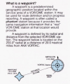
The KNS80 created waypoints by using both VOR and DME information. From the manual:
1749220631523.png
 
You're right, if you're receiving only one DME source. But receive 3, 4 or 10 DME sources and now you have a good position. That's DME/DME RNAV, which is essentially a ground-based "GPS".

And most (almost all) of the DME-only facilities USED TO be a VOR/DME or VORTAC, but the VOR portion was decommissioned as part of the MON program. So adding a VOR is not an option, the reverse was already decided, as a VOR is much more costly to maintain than a DME-only facility.
I had assumed that they all had been and they just turned the azimuth off. So there have been some newly commissioned stand alone DME’s ??
 
The KNS80 created waypoints by using both VOR and DME information
The KNS80 is a course-line computer. Back in the 1980s, we all just called then an "RNAV" because they were pretty much the only type of RNAV that was available to G.A. airplanes. I didn't even learn the name "course-line computer" until many years later.

In the mid-1990s, I flew DC8s that had VLF/OMEGA as their only RNAV. The nav units were replaced by a GA-style GPS when the VLF/OMEGA system was shut down in late 1997.
 
Learn something all the time on this site. And here I thought RNAV was created when GPS came on line. Which now explains why they don’t call approaches GPS but RNAV, because it existed before GPS.
 
You're thinking about this from a G.A. viewpoint. The National Airspace System (NAS) is designed primarily for commercial aviation with G.A. as an additional user.

Large airplanes have inertial navigation systems that provide data to their flight management systems. They'll have at least two inertial reference units, many have three. The IRUs can dead reckon, from an initial position when aligned before takeoff, and maintain a fairly accurate position without external input. The IRUs also provide attitude references for the flight instrumentation systems.

The FMS position(s) would drift over time from IRU precession. Various systems have been used to update the position including manually entering a position when flying over a VHF fix. Most commonly, with a system known as DME/DME/IRU. That used DME fixes, from multiple stations, to update the FMS position by tracking the amount of drift in the IRS position. For that to work, the FMS had to have a current database of the area in which it was flying and there must be ground stations with good geometry within range. When you fly out of range of the ground stations, or out of the limits of your onboard database, DME updating wasn't possible and the FMS would dead reckon from the IRS data.

The 767, without GPS for example, could cross an ocean for up to six hours without any position updating other than the IRS. At the end of the crossing, it might be a mile or two off course due to map shift but the separation standards for oceanic airspace, at that time, allowed for that and position updating would resume as VHF ground stations came within range. Today, heavily traveled oceanic airspace require higher accuracy.

When GPS came along it provided a much more accurate and reliable method for updating the FMS(s) position(s). Normally, the GPS updating is the most accurate and that is what the FMS(s) use. When GPS isn't available, DME updating is used. If both are unavailable, the system degrades to dead reckoning.

The accuracy of your position(s) is displaced as an Actual Navigation Performance (ANP) figure. With GPS updating, it might be 0.2 or 0.3. The type of airspace, or type of procedure, you're flying will have a Required Navigation Performance (RNP) requirement. A standard RNAV approach will have an RNP of 0.30. RNAV RNP approaches can go as low as RNP 0.10. Oceanic airspace can be either RNP 10.0 or RNP 4.0. Domestic enroute is RNP 2.0 and terminal (App/Dep) is RNP 1.0. If your ANP falls below your current ANP (a higher number) you'll get an alert similarly to how a bad VOR signal will produce a flag.

You'll see some RNAV procedures with the note "DME/DME/IRU - N/A". That means that even if your non-GPS FMS is achieving an otherwise sufficient RNP for the procedure, you are not authorized to fly it with only DME/DME/IRU.

That is why the DME only stations are valuable in the NAS. They provide a fallback for position updating when reliable GPS is lost.
Supposedly there is a thing where ‘offset’ is used oceanically in RVSM sky. A couple miles left or right of centerline so planes ain’t merged a 1000 feet apart. But ATC doesn’t assign the offsets. The pilots manage that themselves.
 
The KNS80 is a course-line computer. Back in the 1980s, we all just called then an "RNAV" because they were pretty much the only type of RNAV that was available to G.A. airplanes. I didn't even learn the name "course-line computer" until many years later.

In the mid-1990s, I flew DC8s that had VLF/OMEGA as their only RNAV. The nav units were replaced by a GA-style GPS when the VLF/OMEGA system was shut down in late 1997.
When I got my instrument rating in 1992, the C172 I flew had 2 VORs and an ADF. Not even DME. Less than a year later after we moved to Colorado, I had access to a rental TR182 with a KNS80. I would get the radial/distance for mountain passes and program them in. I thought comparing it to sliced bread was a gross understatement.
 
Supposedly there is a thing where ‘offset’ is used oceanically in RVSM sky. A couple miles left or right of centerline so planes ain’t merged a 1000 feet apart. But ATC doesn’t assign the offsets. The pilots manage that themselves.
That is called SLOP for Strategic Lateral Offset Procedure.

When you enter oceanic airspace, you randomly select an offset anywhere from 0.0 to 2.0 nautical miles RIGHT of course. The idea is to spread aircraft out laterally a bit so that if a gross navigational error is made there's a better chance of the big sky theory working. It can also be used for wake turbulence avoidance. It has become more important now with everyone using GPS updating and aircraft being exactly on centerline. Pre-GPS, you were already SLOP(py) due to the inaccuracy of your RNAV.

Here's more information with additional links. https://skybrary.aero/articles/strategic-lateral-offset

Instrument pilots today, particularly in the CONUS, have an incomplete view of the ATC system. The system's foundation is non-RADAR separation and published airways. RADAR coverage allows reductions in the separation standard, and more efficient routings, but the foundation is non-RADAR.

For example, on the WATRS oceanic airspace, L451, L452, etc. between the northeast coast and the Caribbean, the standard separation is 10 MINUTES in trail for aircraft on the same route. We'll have an assigned Mach number and give position reports to New York ARINC on HF (8825, 11397, etc.). SATCOM equipped aircraft make their position reports electronically through CPDLC. Sometimes we'll be given a restriction to pass [fix] at, or after (or before), a particular time. Before entry into oceanic airspace, we'll give them our requested altitude and Mach number. Often our requested altitude isn't available so its important to have enough fuel in case you're several thousand feet below planned altitude. You ability to change altitude due to turbulence is also restricted.

While oceanic, we'll monitor the oceanic air-to-air frequency, 123.45, on one VHF radio and Guard on the other. The air-to-air is useful for relaying ride reports, information on storms encroaching on your track, etc. If you have trouble raising ARINC on HF, you can also rely your position report through another aircraft on air-to-air though that rarely happens on WATRS.

One nice thing is that there's far fewer cats on Guard in oceanic airspace.
 
Does the military still use TACAN?
Only in the planes new enough to have a TACAN receiver. I bet a few of our .mil members can tell stories about that. As one T-38 pilot at a fly-in told me, regarding the avionics, "If you can say 'unable,' you can fly this plane."
 
I had assumed that they all had been and they just turned the azimuth off. So there have been some newly commissioned stand alone DME’s ??
I intentionally used the ambiguity of "almost all" since I'm sure there is at least one somewhere that was installed directly as a DME-only.
 
Seems like a DME without a VOR would be of limited use, especially in today’s MON era.
DME/DME navigation is used by airlines now and it is one of the potential replacements for MON and the remaining VORs.
 
I intentionally used the ambiguity of "almost all" since I'm sure there is at least one somewhere that was installed directly as a DME-only.
There are some that I’m aware of that were installed collocated with NDBs. KSUN used to have an NDB DME approach, as did KULM. I don’t think the approaches are active anymore, but the DMEs might remain.
 
Back
Top