In addition to the baseline moving-map navigation, Garmin Pilot will display synthetic vision with all sources, including runway graphics, terrain, airport identifiers, and so forth. The only difference is quality of the instrument display based on the input source:
GPS only (e.g. running only on the iPad internal GPS) -- Will always display a level attitude, with GPS-derived groundspeed (in place of the airspeed), altitude, and heading.
External source with AHRS (e.g., GDL 50, GNX 375) -- All of the above, but additionally with attitude information based on that device.
External source with ADAHRS (e.g., GI 275) -- Full data display similar to what would be seen on a G3X or similar PFD.
External source with ADAHRS and EIS (e.g., GI 275 EIS) -- Full display, along with full engine data display and recording.
As a nice bonus, you can set it up so that GP automatically exports engine data post-flight to Savvy and your flight data to FlySto, if you're so inclined.
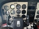
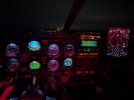
My plane has two GI 275s (AI and HSI), legacy back-up steam gauges, a GI 275 EIS, a GNX-375, and a GNC 215. I'm in the process of setting up an install of a GFC-500 and a PMA450C.
It's going to be the world's most unstoppable Cherokee 180C.
 View attachment 147959