IFR X-country requirement - what are "three different kinds" of approaches?

Lack of reality. You generally have RNAV approaches to the same runway. Generally equivalent to the ILS and better than the LOC. Definitely better than the VOR. And typically no operational advantage over the RNAV.

Given all that, why would you fly a LOC or VOR as opposed to the RNAV?

I think the answer is, “during a GPS failure.” But you can’t. You don’t have the required DME.

You have an exception? There’s some advantage to the DME required approach? There’s no equivalent/superior RNAV? No RNAV approaches like at VNY? Sure, I’d do the VOR-B there.

(And notice I said “avoid” not “exclude.” In a pinch, I’ll use them if I need to and because of the pink/green/pink CDI source switching task.)
 
took me a little bit to figure out one of our other instructors was doing that and then not re-enabling WAAS when he was done. I was trying to figure out why I couldn't get vertical navigation on an LPV approach.

If we don't have ground navigation available. I usually try to do an LPV approach, an LNAV approach, and a Circling approach off the LNAV or LPV. We are fortunate that one of the approaches to our airport is strictly an LNAV approach so it easy to have students fly that one. If flying an LPV as an LNAV approach, Disabling the WAAS works well, or as a minimum, make sure they fly it all the way to the MAP.

Brian
CFIIG/ASEL
Flying either an "ILS or LOC" approach to the LOC MDA or an RNAV with both LPV and LNAV minimums to the LNAV MDA don't need to have the vertical guidance turned off to qualify. I find that the GS may actually be distracting when flying to an a LOC or LNAV MDA. In the case of an ILS to a circling MDA, one must be flying the "or LOC" NPA procedure to the circling MDA. There won't be circling minimums charted on an ILS or LPV if there isn't respectively a LOC or LNAV option. Turning off WAAS doesn't disable +V on my GTN 750Xi, so WAAS on or off, there will likely be advisory vertical guidance available in either case.
 
One other note, early G1000 WAAS systems don't support LP procedures. The NXi does and if the manufacturer has updated their software, some G1000 WAAS systems also support LP.
 
I'm curious where the FAA says that. I'm not sure why it would make a difference unless there's a LOC stepdown the GS will make you bust.

Although not technically prohibited, I am not aware of any ILS procedures in the US where the LOC stepdown is above glideslope. That would be a very nonstandard construction. Even considering temperature effects on altimetry, at such low altitudes above the field the error is pretty small and in practice, inconsequential.

If there is one out there, I would appreciate seeing it to put in my "interesting approaches" list.
If that were to occur, what would the profile view and notes look like?
 
In the case of an ILS to a circling MDA, one must be flying the "or LOC" NPA procedure to the circling MDA. There won't be circling minimums charted on an ILS or LPV if there isn't respectively a LOC or LNAV option. Turning off WAAS doesn't disable +V on my GTN 750Xi, so WAAS on or off, there will likely be advisory vertical guidance available in either case.
This sounds like a requirement you made up. If the second sentence ("There won't be circling minimums charted on an ILS...") is meant to be your evidence, that is inductive reasoning which is unreliable.
 
I just did this exact requirement for a student this evening. We did an LP, LNAV and ILS.

It can be any combination of approaches as long as they’re not the same.
 
Although not technically prohibited, I am not aware of any ILS procedures in the US where the LOC stepdown is above glideslope. That would be a very nonstandard construction. Even considering temperature effects on altimetry, at such low altitudes above the field the error is pretty small and in practice, inconsequential.

If there is one out there, I would appreciate seeing it to put in my "interesting approaches" list.
I phrased it that way just in case. I’ve never heard of one and with stepdowns typically being for obstacles, I have a hard time imagining one. And really, why worry about busting it if following the published glidepath to a straight in or circling MDA anyway?

I really questioned John’s comment because of real “straight in minimums NA” NOTAM. If ILS why wouldn’t one still load the ILS (without the stepdown) version of the approach and follow the official vertical guidance to the circling MDA?

If they are charted separately, ie, no MDA in the ILS-only chart, the issue is different. And I’d expect the NOTAM to be different as well.
 
If that were to occur, what would the profile view and notes look like?
I'm really not even sure. The TERPS addresses the general case of a final stepdown fix altitude being above glidepath in this way (paraphrased):

1. Try to move the stepdown fix (typically further from the runway) so that the altitude at the fix is lower than the glidepath - typical solution, I did this many times.
2. If the location can't be moved, try moving the PFAF (such as to come in offset), OR raise the PFAF altitude (creating a steeper descent) so that the stepdown altitude is now under the glidepath.
3. When neither option works, determine the angle from the stepdown fix to the runway and chart that in the profile view between the runway threshold and the stepdown fix (instead of near the FAF) - I never thought this was a great solution, because what pilots know there's any meaning to where on the profile view the "<3.00 deg/TCH 50" is placed?

But for an ILS, if you couldn't do 1, you certainly can't easily do 2 (since it would require reengineering the actual Loc and/or GS systems, and I have no idea how you would chart 3, since for an ILS you chart the ILS glideslope angle, not the stepdown to threshold descent angle, which would of necessity in this situation be different.

So that's why I said it may be technically possible, but not likely to ever be seen.

In fact, in writing this, I only found one LNAV procedure with such an SDF (and then I didn't write down which airport it was, so I can't find it again. Somewhere in ID or MT maybe). That's to say, the whole situation is pretty rare and I've only ever seen it on LNAV-only procedures.

The final option, option 4, really is just do away with the stepdown fix and accept higher minimums. Which is usually what has to happen in these situations.
 
Update: We ended up flying an ILS, an RNAV to LPV minimus, and a VOR to avoid any ambiguity. Thanks for all the feedback!
Excellent. Any real ambiguity aside, you had a wider variety of experience. Now, if your CFII was really exceptional, the VOR would have been flown without GPS assist.
 
I'm curious where the FAA says that. I'm not sure why it would make a difference unless there's a LOC stepdown the GS will make you bust.

It is not said explicitly, but since circling uses an MDA and an MDA is only associated with a Non Precision Approach (NPA) procedure, the only NPA procedure on an "ILS or LOC" procedure is the LOC procedure. An ILS GS can be used as an advisory GS as long as any step downs and the MDA are complied with. A Circling Minimum Descent Altitude (CMDA) is always to an MDA, never a DA. So the only procedure on the chart that has an MDA or CMDA is the Localizer procedure. You will never see a CMDA on any FAA chart that provides "only" a vertically guided procedure option (ILS, LDA/GS, LPV, LNAV/VNAV). Also, a CMDA may not be lower than the highest Straight-In MDA when the approach procedure has a straight-in option.

Current Definitions from the PCG are:

MINIMUM DESCENT ALTITUDE (MDA)− The lowest altitude, expressed in feet above mean sea level, to
which descent is authorized on final approach or during circle-to-land maneuvering in execution of a standard
instrument approach procedure where no electronic glideslope is provided.

DECISION ALTITUDE (DA)− A specified altitude (mean sea level (MSL)) on an instrument approach
procedure (ILS, GLS, vertically guided RNAV) at which the pilot must decide whether to continue the approach
or initiate an immediate missed approach if the pilot does not see the required visual references.

NONPRECISION APPROACH PROCEDURE− A standard instrument approach procedure in which no
electronic glideslope is provided; e.g., VOR, TACAN, NDB, LOC, ASR, LDA, or SDF approaches.

PRECISION APPROACH PROCEDURE− A standard instrument approach procedure in which an electronic
glideslope or other type of glidepath is provided; e.g., ILS, PAR, and GLS.

APPROACH WITH VERTICAL GUIDANCE (APV)– A term used to describe RNAV approach procedures that
provide lateral and vertical guidance but do not meet the requirements to be considered a precision approach.

 
It is not said explicitly, but since
IOW, your interpretation. Mine is different. I generally see definitions as descriptive, not as automatically creating regulatory prohibitions. I don't agree that from a regulatory (or safety or logical) standpoint, following a functioning ILS glideslope and disregarding a LOC-only stepdown which the glideslope will clear becomes prohibited (or "advisory only") because you are going to end the descent at an altitude other than the published DA. Yes, it's "nonprecision" from definitional standpoint because it's not to a DA, but so what?
 
It is not said explicitly, but since circling uses an MDA and an MDA is only associated with a Non Precision Approach (NPA) procedure, the only NPA procedure on an "ILS or LOC" procedure is the LOC procedure.
So I was correct. You made it up. This is how misinformation gets spread. Someone guesses that something must be true, and passes that off as fact.
 
This sounds like a requirement you made up. If the second sentence ("There won't be circling minimums charted on an ILS...") is meant to be your evidence, that is inductive reasoning which is unreliable.
Not a requirement I made up. From TERPS 8260.3G, 3.3.1 (my emphasis):

b. Circling visibility minimums are authorized when:
(1) Straight-in alignment requirements cannot be met, or
(2) Straight-in alignment requirements are met, but descent angle precludes publication of straight-in minimums (see paragraph 2-6-2.c), or
(3) Published in conjunction with straight-in NPA minimums.
Note: Do not establish circling minimums when PA or APV procedures are established without accompanying straight-in NPA minimums.

Also, a vertically guided procedure to a DA evaluates obstacle clearance on a sloping surface. A NPA evaluates obstacle clearance on a level OCS, so once past the FAF, one can almost immediately descend to the the MDA or the to a step down fix minimum. A circling approach is to an MDA and if there is a straight-in option, must not be below the highest MDA.
 
IOW, your interpretation. Mine is different. I generally see definitions as descriptive, not as automatically creating regulatory prohibitions. I don't agree that from a regulatory (or safety or logical) standpoint, following a functioning ILS glideslope and disregarding a LOC-only stepdown which the glideslope will clear becomes prohibited (or "advisory only") because you are going to end the descent at an altitude other than the published DA. Yes, it's "nonprecision" from definitional standpoint because it's not to a DA, but so what?
Is it legal to bust a step down altitude if you are following the GS? What would you advise a student on a check ride to do if this came up?
 
Is it legal to bust a step down altitude if you are following the GS?
Show me an approach where following the ILS GS will bust a FAS stepdown. If there is one, I guess it's busted every time the ILS is flown.
What would you advise a student on a check ride to do if this came up?
I still want to know where it would be busted. Aside from that, if flying the LOC, I'd expect them to load the LOC not the ILS as a matter of good practice. If it were to come up in the oral and I knew the DPE had some oddball interpretation on pretty much anything I'd brief my student about it. But that's easy to say since I'm more interested in competence and proficiency than passing artificial checkride questions. .
 
Show me an approach where following the ILS GS will bust a FAS stepdown. If there is one, I guess it's busted every time the ILS is flown.

I still want to know where it would be busted. Aside from that, if flying the LOC, I'd expect them to load the LOC not the ILS as a matter of good practice. If it were to come up in the oral and I knew the DPE had some oddball interpretation on pretty much anything I'd brief my student about it. But that's easy to say since I'm more interested in competence and proficiency than passing artificial checkride questions. .
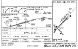
Are you saying that it is legal to fly a circle to land on an ILS or LOC approach and ignore complying with a stepdown fix minimum altitude as long as the pilot is at or above the GS? Step down fixes are MSL altitudes which are affected by temperature so on any given day, the GS may cross above or below the step down fix MSL altitude. The same applies to the FAF crossing altitude, the GS may be intercepted well before reaching the FAF fix. Would it be legal to begin the descent on a LOC procedure for circle to land prior to crossing the FAF as long as one remained at or above the GS? What about this approach (KORL ILS or LOC Rwy &) on a hot or a colder day than ISA where the crossing altitude at SWLTR is not going to be at 1020 MSL?
 
Are you saying that it is legal to fly a circle to land on an ILS or LOC approach and ignore complying with a stepdown fix minimum altitude as long as the pilot is at or above the GS? Step down fixes are MSL altitudes which are affected by temperature so on any given day, the GS may cross above or below the step down fix MSL altitude. The same applies to the FAF crossing altitude, the GS may be intercepted well before reaching the FAF fix. Would it be legal to begin the descent on a LOC procedure for circle to land prior to crossing the FAF as long as one remained at or above the GS? What about this approach (KORL ILS or LOC Rwy &) on a hot or a colder day than ISA where the crossing altitude at SWLTR is not going to be at 1020 MSL?
Are you using the ORL approaches as examples of when it’s unsafe to fly the ILS? If so, I agree. Don’t fly the ILS. If that’s not the case, I simply disagree with your view that it is illegal to fly an ILS to minimums higher than DA.
 
Years ago a buddy gave me the ILS frequency to Pratt & Whitney airport north palm beach.
Practiced when tower was closed. I suppose they left it on all the time. It was never published as far as I could tell.
 
Are you saying that it is legal to fly a circle to land on an ILS or LOC approach and ignore complying with a stepdown fix minimum altitude as long as the pilot is at or above the GS? Step down fixes are MSL altitudes which are affected by temperature so on any given day, the GS may cross above or below the step down fix MSL altitude. The same applies to the FAF crossing altitude, the GS may be intercepted well before reaching the FAF fix. Would it be legal to begin the descent on a LOC procedure for circle to land prior to crossing the FAF as long as one remained at or above the GS? What about this approach (KORL ILS or LOC Rwy &) on a hot or a colder day than ISA where the crossing altitude at SWLTR is not going to be at 1020 MSL?
SWLTR being a mandatory altitude instead of the usual minimum altitude does throw another aspect at this. You could follow the Glideslope for a little while before you’d have to get off it to make the 1020 at SWLTR, except on the rare perfect ISA. That aside, I don’t see anything illegal about following the Glideslope provided you comply with any altitude restrictions. Let’s look at it another way. Suppose you just happened to have your configuration and power settings just so and the wind was cooperating so that you just happened to be, by coincidence, on the Glideslope. Would it be illegal to stay there?
 
Years ago a buddy gave me the ILS frequency to Pratt & Whitney airport north palm beach.
Practiced when tower was closed. I suppose they left it on all the time. It was never published as far as I could tell.
It was probably published but not for public use. There would have been a Special IAP there.
 
Are you using the ORL approaches as examples of when it’s unsafe to fly the ILS? If so, I agree. Don’t fly the ILS. If that’s not the case, I simply disagree with your view that it is illegal to fly an ILS to minimums higher than DA.
Huh? Why is there an ILS if it's unsafe to fly it?
 
You could follow the Glideslope for a little while before you’d have to get off it to make the 1020 at SWLTR
So we are buying his argument that you can't fly the ILS to a circling MDA? 1020 at SWLTR is a LOC-only restriction.
 
Are you using the ORL approaches as examples of when it’s unsafe to fly the ILS? If so, I agree. Don’t fly the ILS. If that’s not the case, I simply disagree with your view that it is illegal to fly an ILS to minimums higher than DA.
No. I am saying there are two procedures printed on the same chart. Pilots must comply with the LOC only procedure if they circle to land. Following the GS inside the FAF provided by the ILS procedure can be used as advisory vertical guidance, but compliance with the LOC procedure minimums is mandatory. On a checkride, if you fly to an MDA, the tolerance is +100/-0. In my opinion, the same tolerance applies to a step-down fix inside the FAF. The MDA and step-down fixes inside the FAF have the same ROC criteria in TERPS. In effect, a step-down fix inside the FAF is the MDA for that segment of the FAC until the controlling obstacle is passed and a lower MDA can be achieved. TERPS no longer permits charting circle to land minimums when the approach has only vertically guided options. This was not always the case. It changed in 2010 with FAA order 8260-68 which was subsequently cancelled after incorporation into the main TERPS order 8260.3.
 
No. I am saying there are two procedures printed on the same chart. Pilots must comply with the LOC only procedure if they circle to land. Following the GS inside the FAF provided by the ILS procedure can be used as advisory vertical guidance, but compliance with the LOC procedure minimums is mandatory. On a checkride, if you fly to an MDA, the tolerance is +100/-0. In my opinion, the same tolerance applies to a step-down fix inside the FAF. The MDA and step-down fixes inside the FAF have the same ROC criteria in TERPS. In effect, a step-down fix inside the FAF is the MDA for that segment of the FAC until the controlling obstacle is passed and a lower MDA can be achieved. TERPS no longer permits charting circle to land minimums when the approach has only vertically guided options. This was not always the case. It changed in 2010 with FAA order 8260-68 which was subsequently cancelled after incorporation into the main TERPS order 8260.3.
I think what most here are interested in is your reference for the statement "compliance with the LOC procedure minimums is mandatory".

Here's a specific example, chosen at random and is a pretty normal ILS OR LOC approach.

1792430902787.png
You let ATC know you need to circle. They tell you to expect to circle SE of the field for runway 3R. You are cleared for the ILS. You fly the glideslope down final. The 6440 stepdown altitude does not apply because you are cleared for the ILS. You break out of the clouds at 6000. You continue to descend on glideslope to 5540, the Circling MDA for your Cat A airplane, and level off -0/+100 to begin your circling maneuver once within the circling radius for Cat A.

Is this a violation? I don't see what regulation was violated.
Is it unsafe? I can't see how.
 
It was probably published but not for public use. There would have been a Special IAP there.
Oh it was published somewhere because P&W flew a shuttle in every week from Hartford hence the ILS
 
No. I am saying there are two procedures printed on the same chart. Pilots must comply with the LOC only procedure if they circle to land. Following the GS inside the FAF provided by the ILS procedure can be used as advisory vertical guidance, but compliance with the LOC procedure minimums is mandatory. On a checkride, if you fly to an MDA, the tolerance is +100/-0. In my opinion, the same tolerance applies to a step-down fix inside the FAF. The MDA and step-down fixes inside the FAF have the same ROC criteria in TERPS. In effect, a step-down fix inside the FAF is the MDA for that segment of the FAC until the controlling obstacle is passed and a lower MDA can be achieved. TERPS no longer permits charting circle to land minimums when the approach has only vertically guided options. This was not always the case. It changed in 2010 with FAA order 8260-68 which was subsequently cancelled after incorporation into the main TERPS order 8260.3.
I think you are misapplying the intent of the TERPS rules you refer to in your post #56. They give the circumstances when Circling Minimums may not be established. We are talking about Approaches where they have been established. TERPS does not establish the rules pilots follow when flying the Approach.
 
Huh? Why is there an ILS if it's unsafe to fly it?
It's not. That's the point. There's nothing that you are going to run afoul of by following the official TERPS-vetted glideslope. I guess if ATC clears someone specifically for the LOC, there might be an issue if the GS crosses enough above or below 1020 at SWLTR, but I have a hard time imagining that unless the temperature change is enough to cause an altitude differential that will cause a traffic problem (which is going to affect the ILS at MCO also). (And yes, I have been cleared for the ILS at a towered airport with an instruction to circle to land.)

Now, if we're talking about mandatory altitudes outside the PFAF, as with DANDY on the TEB ILZ or LOC Z Runway 6, then there's an issue.
 
Now, if we're talking about mandatory altitudes outside the PFAF, as with DANDY on the TEB ILZ or LOC Z Runway 6, then there's an issue.
Now there's a fun approach! Just flew it a few days ago. VINGS and DANDY are both hard altitudes, and well below glideslope.


Both approaches to and departures from TEB are "interesting" because of the proximity of EWR among other things, and are some of the most frequently screwed up procedures in the NAS.
So I've heard. I can see how easy it is to screw up. On the ILS 6, all you have to do is pick up the glideslope well before VINGS. I've played with it in sims. Seems best to stay with GPS as the source until 1300 for DANDY before switching to LOC and arming the approach. Garmin VNAV does a decent job with meeting the mandatory stepdowns.
 
It's not. That's the point. There's nothing that you are going to run afoul of by following the official TERPS-vetted glideslope. I guess if ATC clears someone specifically for the LOC, there might be an issue if the GS crosses enough above or below 1020 at SWLTR, but I have a hard time imagining that unless the temperature change is enough to cause an altitude differential that will cause a traffic problem (which is going to affect the ILS at MCO also). (And yes, I have been cleared for the ILS at a towered airport with an instruction to circle to land.)

Now, if we're talking about mandatory altitudes outside the PFAF, as with DANDY on the TEB ILZ or LOC Z Runway 6, then there's an issue.
I think we pretty much got it that you can fly an ILS to Circling. This Approach has other interesting things. Let’s play. You cross the FAF and start down. You get an unsafe gear indication, or something else that makes you say ‘I ain’t got time to trouble shoot this on final, gotta go missed.’ Whadda ya do?
 
So I've heard. I can see how easy it is to screw up. On the ILS 6, all you have to do is pick up the glideslope well before VINGS. I've played with it in sims. Seems best to stay with GPS as the source until 1300 for DANDY before switching to LOC and arming the approach. Garmin VNAV does a decent job with meeting the mandatory stepdowns.
Hmmm.

Thinking back to how this went, and thinking about how it would have worked with a Garmin autopilot. We were on the JAIKE4 which ends at SBJ, which is also an IAF for the approach. After the REGLE crossing at 7000, but still several miles prior to SBJ, descending through 5000 feet for 3000, we were given direct VINGS and cleared for the approach.

Doing this with a Garmin, we'd have been in NAV and VNAV on the arrival. Upon getting direct VINGS the lateral would stay in NAV but I'd have to bug 2000 (or better yet, 1300) and I'd probably do a VNAV Direct to the 2000 at VINGS just to be sure. All good so far.

However... My mantra with the Garmin autopilots has always been "hit the APR button when you are cleared for the approach." But, the APR button would arm LOC and GS, and we can't arm GS yet at that point or we'll miss the DANDY restriction by about 500 feet. So really, we need NAV and VNAV still.

As far as intercepting the localizer at VINGS, I expect that my GTN would still auto-switch to the localizer and we could leave the autopilot in NAV and it'd work as intended. We would need to leave the vertical mode in VNAV, with 1300 bugged, until after crossing DANDY and *then* hit the APR button.

So much for "always hit the APR button when cleared for the approach."
 
So much for "always hit the APR button when cleared for the approach.
There are alway exceptions to techniques. Maybe that’s the difference between “technique” and “procedure,” and the reason to understand them. Perhaps better stated as “don’t hit the APR button until cleared for the approach.”
 
So I've heard. I can see how easy it is to screw up. On the ILS 6, all you have to do is pick up the glideslope well before VINGS. I've played with it in sims. Seems best to stay with GPS as the source until 1300 for DANDY before switching to LOC and arming the approach. Garmin VNAV does a decent job with meeting the mandatory stepdowns.
Seems like the principle of Threat & Error Management would suggest it would be useful to add a note, such as "glideslope NA above 1300".

edit: wrote Message instead of Management
 
Last edited:
Back
Top