Estimate of flight time

Do students learn how to mark up paper charts, use rulers, protractors, and an E6b anymore? I don’t know, that’s how I learned. I think it’s becoming more common to just put the flight plan together and press the “calculate” button.

Draw each leg of the flight. Do the math for each leg, add them together, done.
I know a number of flight schools and have seen online in a number of training sites how students/learners are required to use paper. In some cases it is only in the beginning to get the concepts down, but some schools don't like EFBs at all. (I'm all for understanding the concepts and starting with paper, but don't get me started on this really dumb policy that doesn't teach them to use an EFB which is what 99.9% are going to be flying with...)

But to your post about doing the math... Not the question asked. The OP is asking about how to plan a future flight and didn't mention at all about how they were doing the calculations. They're trying to learn how you plan ahead for that vacation, taking a friend for a flight that will be visiting in two weeks, etc., etc.
 
I'm all for understanding the concepts and starting with paper, but don't get me started on this really dumb policy that doesn't teach them to use an EFB which is what 99.9% are going to be flying with...)
That dumb policy predates EFBs by a lot. Two examples.

In the early days of GPS, a flight school I knew would not allow GPS to be used by student pilots on much the same theory as requiring paper now. That is, until one fine day when one of the airplanes had an engine problem and sustained damage (no one was injured) when it landed in a field...well within gliding distance of a runway that a tap on NRST would have led them to.

On student pilot cross countries, long before GPS, we required dead reckoning checkpoints every 10 miles, give or take a few (probably still do). That's fine; we did that so it would be done often enough for the lesson to take. But what many CFIs didn't do was explain that this was for training and that, in real life our checkpoints would be further away and be primarily to monitor fuel usage. The result I saw was new private pilots deciding the whole ide of checkpoint was silly and doing nothing.
 
I know more pilots without Foreflight than do. I've also only had 1 student that used it.
Really? Interesting. My experience is like @TommyG 's. The last time I flew with someone using something other than FF was 2018, he used Garmin Pilot. Before that it was 2016, with someone who used Avare. Every other pilot has shown up with FF. Some student pilots in that mix, but mostly certificated pilots.

What strikes me as especially salient is that these occasions were so rare, that I actually remember them.
 
A quick and dirty way is to total up the legs and divide by your desired cruise speed. Add an extra 5-10 minutes for the climb to altitude (which will be slower). This will work pretty well for a light single. This is the MINIMUM flight time required with no wind. You can easily account for headwinds by subtracting from your cruise speed and recalculating. Don't count on tailwinds unless you want to join the fuel exhaustion club. If any of your calculations come anywhere close to your fuel range -2 gallons or so for climb and a 1 hour reserve, you will plan a fuel stop. (Unless you are trying out for the fuel exhaustion club.) I've never encountered a pilot that regretted making an extra fuel stop.

If you own a plane or fly one frequently, you will figure out pretty quickly what your typical reasonable max range is going to be eastbound and westbound. TBH, I like planning the other way around. If I have 4 hours 30 minutes endurance, I want to be on the ground before 3 hours 30 minutes. I typically plan for 3 hour legs in this circumstance, especially if IFR. Then the day of the flight, I see how far that will take me with prevailing winds aloft and plan a stop accordingly. If I have to stretch that 3 hours 30 minutes, I will either (1) just make an earlier fuel stop, or in rare instances where it is feasible to do so for a 1-leg flight (2) reduce cruise speed to conserve fuel and extend range by up to 30 minutes. Option #2 can be painfully slow, but is workable in some circumstances, usually in neutral or slight tailwinds. Remember, you are flying by the watch, not by the mile. (Unless you want to join the fuel exhaustion club.)
 
Really? Interesting. My experience is like @TommyG 's. The last time I flew with someone using something other than FF was 2018, he used Garmin Pilot. Before that it was 2016, with someone who used Avare. Every other pilot has shown up with FF. Some student pilots in that mix, but mostly certificated pilots.

What strikes me as especially salient is that these occasions were so rare, that I actually remember them.
The reality is, FF has a big share of the EFB market. But that's not the same as the tendency of some to act as if it's the only one there or the only one that has any value.
 
The reality is, FF has a big share of the EFB market. But that's not the same as the tendency of some to act as if it's the only one there or the only one that has any value.
There's a lot of people out there that think that about their particular thing. I see it across all hobbies and household things. The world is filled with self absorbed idiots that think just because they have x/use x, everyone does.
 
That dumb policy predates EFBs by a lot. Two examples.
Again, no problem with teaching the basics first. There may be a time someone taps in a number and the EFB spits something back that they do a double take because that just doesn't seem right. So I'm all for that basic knowledge.

But I've talked/typed with brand new Private Pilots that now that they got their PPC they just downloaded ForeFlight (or whatever) and they're off to go fly around to learn how to use it.... Just what I want is someone flying around with their head buried inside trying to figure out how their new EFB works. I really think it ranks right up there with not teaching slow flight, what flaps are for, what the mixture is for, etc., by not introducing an EFB and having the CFI sitting next to you every time you hit one of those "now let's see, how did I do that before..." So once you get your Private, off you go using your EFB the same way you know how to use everything else in the plane.

Same with the GPS. I guess you've let them use it now :eek: but had we been sitting over a beer I would have told you how short sighted you were on that. Sure, fail it every so often so they know what to do. But it was and is a game changer. And if you don't want to let them use the GPS, might as well send them back to the days of using road maps. :cool::p
What you learn is one thing, then what you do can be very different. I pretty much use the flight planner on the 1800wxbrief website. Enter the from and to info, let it calculate an ET and then add a few minutes for an approach, then I can file if I want to. That seems to work out pretty well. I don't use the paper and pencil anymore either. But I can see the problem with PP students now. Back when I started there were no EFBs, so there weren't any gadgets other than what was installed. Getting that brand new tablet or iPad and related S/W and then trying to learn that in-flight after the checkride instead of a little at a time during training is something to think about. I've had that discussion with more than one CFI: "You CFIs get to play with your iPads all day. I'm trying to fly, I don't get much chance to learn it in-flight."

I've gotten pretty good at fuel calculations, I can usually nail that within a tight margin of error.

I'll be doing a nice xc next week, I'll verify my math on that one.
 
Why do you need to be drunk to "discuss" aviation. :cool:
You don’t.

But it seems to me that one would have to be somewhat impaired to take a position that it’s short sighted to know a flight school or to not teach GPS before GPS.
 
Last edited:
I pretty much use the flight planner on the 1800wxbrief website...
I've gotten pretty good at fuel calculations, I can usually nail that within a tight margin of error.
You don't use the fuel calculator that's part of the flight planner on 1800wxbrief?
 
You don't use the fuel calculator that's part of the flight planner on 1800wxbrief?
Yeah, but that’s just a gal/hr calculator that figures the math for different phases of flight. Still have to figure out those values from the POH tables.
 
Yeah, but that’s just a gal/hr calculator that figures the math for different phases of flight. Still have to figure out those values from the POH tables.
Oh, you mean in-flight calculations then?
 
FlightPlan.com has historical winds and I believe FF has them too. If you enter a flight for two weeks in the future FP.com will show the historical winds for that date and route.
 
Oh, you mean in-flight calculations then?
No, preflight. Mostly from the power settings tables, those are normally based on proper leaning. I think the calculator has gph entry values for climb, cruise, and descent, plus gallons for taxi. Only one of the planes I rent has a fuel totalizer and I haven’t flown that one in a long time.
 
FlightPlan.com has historical winds and I believe FF has them too. If you enter a flight for two weeks in the future FP.com will show the historical winds for that date and route.
I’ll check that out, I didn’t know that.

Edit:

I just checked, that’s pretty good. It shows headwinds for my trip next week… of course.
 
Last edited:
what is the best way to make a rough estimate of flight time for a flight in the future? Of course if you are doing a flight in the near future, you calculate the times and speeds based on current wind and conditions. But if it is for example 2 weeks in the future, how is the best way to roughly estimate the time and fuel required etc.?
It takes however long it takes. But you know your cruise speed and the distance, just divide those, that’s the best that you can do. Going east is usually faster and slower when returning west. But that doesn’t work out in reality, I’d of course prefer to fly VFR and not in turbulence, so you have altitudes that won’t work for you, higher up can be slower ground speeds, lower can be more turbulent, what’s the weather like at your destination (can you get down below any cloud layers), not to mention airspace restrictions en route, but really any variety is possible.
 
The real difficulty is getting reliable weather and winds aloft. Generally, if a flight plan has legs exceeding 65% of your "still air" range, a flight plan, planned 2 weeks ahead has a high chance of disappointment which can't be much recduced until about 72 hours prior. At 24 hours ahead you can get a pretty good handle.
 
Two weeks out is a long time considering accurate forecasts aren’t available. Use best available information and refine it along the way.

With GA the real questions are will I be able to fly that day and when will I need gas.
Ultimately, I think this is the answer. @bdoss2006 hasn't responded to the other posts to clarify, but my answer is different depending on the flight.

If it's a 1-hour direct point to point flight for a $100 hamburger in a 172 with enough fuel for 5 hours, I don't care. A no-wind flight plan is fine 2 weeks or 2 months out. Who cares? Not much future planning required.

OTOH, take my bucket list trip - North Carolina to Colorado - which I've been playing with for a few years. Now we're talking multiple days, multiple fuel stops. For that "maybe" trip the considerations are different. Routing will take fuel stops, my bladder, and overnight lodging into consideration. How many legs will I accomplish in any given day. I may be looking at those things based on no-wind or historical winds aloft for the period (which both Foreflight and Garmin Pilot do; I don't know about the other EFBs). I'm satisfied with those guesses, so long as I think of those "alternatives available if the planned flight cannot be completed." For me, that means (along with a bunch of other stuff) considering enroute alternates - stops short of the planned destination for that day and even alternates to extend a leg if the winds are better than expected.

But ultimately, as you said,
the real questions are will I be able to fly that day and when will I need gas.
 
Ultimately, I think this is the answer. @bdoss2006 hasn't responded to the other posts to clarify, but my answer is different depending on the flight.

If it's a 1-hour direct point to point flight for a $100 hamburger in a 172 with enough fuel for 5 hours, I don't care. A no-wind flight plan is fine 2 weeks or 2 months out. Who cares? Not much future planning required.

OTOH, take my bucket list trip - North Carolina to Colorado - which I've been playing with for a few years. Now we're talking multiple days, multiple fuel stops. For that "maybe" trip the considerations are different. Routing will take fuel stops, my bladder, and overnight lodging into consideration. How many legs will I accomplish in any given day. I may be looking at those things based on no-wind or historical winds aloft for the period (which both Foreflight and Garmin Pilot do; I don't know about the other EFBs). I'm satisfied with those guesses, so long as I think of those "alternatives available if the planned flight cannot be completed." For me, that means (along with a bunch of other stuff) considering enroute alternates - stops short of the planned destination for that day and even alternates to extend a leg if the winds are better than expected.

But ultimately, as you said,
For me, as I've gotten older, and married, flight planning has gone out the window for any trips where I start with full tanks. Airplane range is close to 7 hours. Neither I, nor my wife, nor our kids are flying that long without stopping. 3.5 hours is about our limit. That's 525 miles no wind. For that 525 to turn into a fuel planning issue, we are looking at 65kt headwinds for the duration, and now we're trying to do that in one leg. I'm not even starting that flight.

Edit: I do know that other pilots do not have that flight duration or range, so yeah, that 172 at 100kts and only 4 hours of fuel, planning does become more of an issue.
 
For me, as I've gotten older, and married, flight planning has gone out the window for any trips where I start with full tanks. Airplane range is close to 7 hours. Neither I, nor my wife, nor our kids are flying that long without stopping. 3.5 hours is about our limit. That's 525 miles no wind. For that 525 to turn into a fuel planning issue, we are looking at 65kt headwinds for the duration, and now we're trying to do that in one leg. I'm not even starting that flight.
For a trip that will take one day/ 1 leg, I agree. That's more like the 1 hour hamburger flight than a multi-leg/multi-day trip. Yep, my leg limit is less than the amount of fuel I am carrying. Although I always consider the route. I guess flying in the Rockies does that to a person ;)
 
For a trip that will take one day/ 1 leg, I agree. That's more like the 1 hour hamburger flight than a multi-leg/multi-day trip. Yep, my leg limit is less than the amount of fuel I am carrying. Although I always consider the route. I guess flying in the Rockies does that to a person ;)

The mountains for me are the red prices on the fuel map in the iFlyEFB app. :D

I also consider the route, mostly fuel prices. But I haven't done a multi day trip since 2016. And that turned into a 1 day trip (UP of MI -> MT) because the weather from MT -> AK went BAD. I stayed for a day in MT then turned around and headed home. Seeing that we will do maybe 8 hours in a day, with no wind that gives us a 1200 mile no-wind range. The only states in the CONUS we can't get with that range in a day are AK, CA, NV, OR, and WA. Even a San Diego trip for us is under 11 hours no wind. We split that in half and end up in Amarillo-ish for the night with a stop between here and there and a stop the next day before San Diego. I'm still looking at 40-50 knot headwinds the whole way before fuel planning is an issue. Probably still saying no to launching because who wants to fly into headwinds that are almost 25% of your TAS?
 
Winds aloft can and do differ from forecast and reported. Also, winds on a longer trip will shift several times along the route, and vary by altitude.

That is where EFBs rock. They can look at winds aloft at multiple segments of route and select best altitude for each. Nobody is doing all that with paper charts and phone briefs.

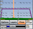
Screenshot_20250605-120331.png

I plan winds agnostic until day of trip. About an hour before flight, I get latest weather and review flight plan, changing stops if needed. Sometimes I change my plan in the air because winds are better, fuel burn is worse, or I really gotta go to the bathroom.

I know most of you know that, but I suspect students aren't used to the level of flexibility you will exercise once you are a PPL.

With IFR I assume there is more pressure to dive the plan.
 
Last edited:
For me, as I've gotten older, and married, flight planning has gone out the window for any trips where I start with full tanks. Airplane range is close to 7 hours. Neither I, nor my wife, nor our kids are flying that long without stopping. 3.5 hours is about our limit.
Yeah, I did a six hour leg recently. That's a lot of time in a cramped cockpit listening to podcasts...

If I continue my present pace of doing one flight like that every 8-10 years due to special circumstances, that will be plenty.
 
The reality is, FF has a big share of the EFB market. But that's not the same as the tendency of some to act as if it's the only one there or the only one that has any value.
Sure, but what I'm most amazed at is @EdFred 's experience that FF is in very limited use in his aviation circles. For me, it has been the exact opposite - almost 100% FF usage. In my experience, it's become almost ubiquitous, to the point where FF as a term is almost to the point of being genericized, like Kleenex or Aspirin or Coke.
 
Sure, but what I'm most amazed at is @EdFred 's experience that FF is in very limited use in his aviation circles. For me, it has been the exact opposite - almost 100% FF usage. In my experience, it's become almost ubiquitous, to the point where FF as a term is almost to the point of being genericized, like Kleenex or Aspirin or Coke.
It will be genericized, until it's not. My circle was all about WingX, until it was not. I forget why, but I think it was lack of customer support and some bugginess. Then the circle went to FF, and has been quite pleased. But the Garmin Pilot SmartCharts situation has certainly generated some buzz. Things change.
 
It will be genericized, until it's not. My circle was all about WingX, until it was not.
I used WingX for years. But then there was the stink about Garmin not letting them talk to their devices because they had their own EFB. And later WingX lost their contract to the military, which I think was the real killer of WingX.

I had to switch away from WingX when I got new Garmin Navigators installed. And I think the only reason FF was allowed to connect was because so many of the airlines were using FF (Boeing, duh), so Garmin had to let them have access.
 
Sure, but what I'm most amazed at is @EdFred 's experience that FF is in very limited use in his aviation circles. For me, it has been the exact opposite - almost 100% FF usage. In my experience, it's become almost ubiquitous, to the point where FF as a term is almost to the point of being genericized, like Kleenex or Aspirin or Coke.
That depends on your circles :D Yes, with all the different pilots I fly with, very few are not using FF.

Lots of interest right now about GP due to the SmartCharts (it really is an excellent charting advance IMO). But I don’t see a huge movement from long-term FF users based on a single feature due to the feel and flow differences between them.
 
Sure, but what I'm most amazed at is @EdFred 's experience that FF is in very limited use in his aviation circles. For me, it has been the exact opposite - almost 100% FF usage. In my experience, it's become almost ubiquitous, to the point where FF as a term is almost to the point of being genericized, like Kleenex or Aspirin or Coke.
Most of my circle didn't like the attitude of Foreflight and their "**** you if you don't knobslobber Steve Jobs" attitude. They were Android people, or I was even a Win guy with TrueFlight. They did more than FF did, and WAY before FF did. Unfortunately it was a one man operation that never got much traction, and you had the fan boys rah-rahing and shoving FF in our faces like it was some messiah, when all they did was rip off from other developers and pass it off as their great invention. When TrueFlight closed shop, my dad was using iFly - which I could mount on my panel (something I couldn't do with any tablet) and after just 1 flight, I loved it, bought the 740 and then installed it on my Samsung tablet. AND you can run it on a Surface if you want, or Android, and yes even the messiah of all tablets. I will NEVER use ForeFlight because of their **** you attitude. That and their paying off of Garmin to block everyone else from interfacing with Garmin products.
 
... My E6b still hangs out in a pocket of my kneeboard. I haven’t touched it in at least a year, though. I think used the wind correction side to remember how it worked. I used to set my estimated GS on the pointer before each flight. ...
I still use my E6B on every long flight. In flight, the DA calculation to get TAS. After refueling, computing average fuel burn for the prior legs. I find these quicker & easier than using a calculator, and the in-flight DA is a sanity check for the DA that my instruments display.

I haven't used the back side (wind calculations) of the E6B in 20 years. Knowing that sin(30) = 0.5 and sin(45) = 0.7 is enough to estimate crosswinds mentally.
 
It's worth mention that winds aloft are more likely to harm than help. Consider a compass centered on the airplane. It's obvious that wind in front of you slows you down, wind behind you speeds you up. Yet wind directly from the side also slows you down because you must turn into it to maintain your course. So the compass range of wind that slows you down spans more than just the 180* in front of you, but stretches down the sides a little. If wind direction is random, equally likely to come from any direction, it slows you down more often than it speeds you up.

Also, doing long x-country flights over the years I concur with others who said winds aloft forecasts aren't all that reliable. They aren't wrong often enough to ignore, but they aren't right often enough to trust.
60R% of the time they hurt every time.
 
I personally know only one pilot that doesn’t have foreflight. All the other pilots I know have and use foreflight.
You now know another. I don’t use it.
 
I'm really surprised the depth of thought put into this thread and flight planning two weeks out.

Two weeks out I'm only doing the most basic of flight planning, because there are still way too many unknowns. Winds, weather, airspace, can all impact the route and time.

I just do basic math. For example, the trip is about 300 miles, the Comanche goes about 150kts (conservatively), its going to be about 2 hours roughly. If it looks to be close to max range, then just know I may have a fuel stop somewhere in the middle.
 
Two weeks out I'm only doing the most basic of flight planning, because there are still way too many unknowns. Winds, weather, airspace, can all impact the route and time. ...
Same here. 2 weeks out I'm checking weather along the route with sources like Weather Underground. This gives me an idea whether I should expect to route differently or cancel flying altogether. When it's 24 hours away, the usual aviation weather sources start to become useful.
 
I don't change estimated flight time based on weather at all. I estimate 30 knot direct headwind for all legs, and it's more right than not. Just like I'm always in the slowest line in the supermarket. What I change for the weather is planned altitude. If it's a forecast headwind, it'll usually be less lower, so I'll plan to go lower. If a leg is forecast tailwind, it's usually more higher, so I'll plan to go higher. That kinda works.
 
... What I change for the weather is planned altitude. If it's a forecast headwind, it'll usually be less lower, so I'll plan to go lower. If a leg is forecast tailwind, it's usually more higher, so I'll plan to go higher. That kinda works.
Yes, this can make a big difference in effective cruise efficiency, especially in slower airplanes. Also consider how wind direction changes with altitude. "Veering" is wind direction shifting clockwise, "backing" is shifting counter-clockwise. Most of the time (though not always) wind veers as you ascend and backs as you descend.
 
I don't change estimated flight time based on weather at all. I estimate 30 knot direct headwind for all legs, and it's more right than not. Just like I'm always in the slowest line in the supermarket. What I change for the weather is planned altitude. If it's a forecast headwind, it'll usually be less lower, so I'll plan to go lower. If a leg is forecast tailwind, it's usually more higher, so I'll plan to go higher. That kinda works.
So you would launch anyway if winds at 2500 were 50kts on the nose?
 
So you would launch anyway if winds at 2500 were 50kts on the nose?
Oh, no, I left that part out. If it's forecast to be 30 knots at 3000 at the day of travel, which is as low as I like to plan for, I'm probably not going to fly. Because around here that means a good chance of gusts 20 at 2k and below. If it's steady winds all the way down and a local flight then I might, but then I'll plan on just having lots of fuel so as not to have to do much math.

The other part I left out that for local flights with a slow airplane, where I'm just flying for the fun of it, I'll check weather on the day of the flight and I do the first half of the flight into the wind. Wind is from the west, I have 3 hours of fuel, I'll head west for an hour and come back.
 
Back
Top