what is the best way to make a rough estimate of flight time for a flight in the future? Of course if you are doing a flight in the near future, you calculate the times and speeds based on current wind and conditions. But if it is for example 2 weeks in the future, how is the best way to roughly estimate the time and fuel required etc.?

You are using an out of date browser. It may not display this or other websites correctly.
You should upgrade or use an alternative browser.
You should upgrade or use an alternative browser.
Estimate of flight time
- Thread starter bdoss2006
- Start date

eman1200
Touchdown! Greaser!
What stage of flight training are you in? That would help me answer your question.
bonefishpete
Cleared for Takeoff
- Joined
- Nov 10, 2024
- Messages
- 1,361
- Display Name
- Bonefishpete
What the GPS says it is?
Cruise speed/distance?
Cruise speed/distance?
eman1200
Touchdown! Greaser!
Be conservative. Since the winds are normally from the west if going east plan on no winds and going west plan on a 20 knot headwind.
You spelled “plan on headwinds both directions, because aviation” wrong

Two weeks out is a long time considering accurate forecasts aren’t available. Use best available information and refine it along the way.
With GA the real questions are will I be able to fly that day and when will I need gas.
With GA the real questions are will I be able to fly that day and when will I need gas.

dmspilot
Final Approach
- Joined
- Oct 20, 2006
- Messages
- 6,772
- Display Name
- DISPLAY NAME
You could plan a few different scenarios — no wind, 10 knot headwind, 20 knot headwind, etc. From there you can only make probabilistic guesses, e.g. if you're going west you're more likely to have a headwind, a tailwind is more likely if going east, etc.what is the best way to make a rough estimate of flight time for a flight in the future? Of course if you are doing a flight in the near future, you calculate the times and speeds based on current wind and conditions. But if it is for example 2 weeks in the future, how is the best way to roughly estimate the time and fuel required etc.?
Clip4
Touchdown! Greaser!
It depends on the KTAS of your aircraft, but for longer flights I take the drive time multiplied by .33 for the higher performance singles (SR22, 182RG, 210, M20J) and drive time multiplied by .5 for lower performance stuff like a 172.
I have my foreflight to understate my planes speed by 10kt to account for the fact that every flight I've ever done has had a headwind. If you're a student, just do neutral winds and be prepared to explain how you will use real data closer to the flight. If you're already licensed and planning a trip, be conservative. It's no fun planning something that turns out to be sketchy because of weather and/or lack of alternates for fuel/rest/food.what is the best way to make a rough estimate of flight time for a flight in the future? Of course if you are doing a flight in the near future, you calculate the times and speeds based on current wind and conditions. But if it is for example 2 weeks in the future, how is the best way to roughly estimate the time and fuel required etc.?

rhkennerly
Line Up and Wait
- Joined
- Jun 10, 2021
- Messages
- 663
- Location
- Virginia Beach, VA
- Display Name
- rhkennerly
- Home Airfield
- KCPK Chesapeake Regional
Distance is a dangerous concept in flight planning. You only ever have one max: time (4 hours with full tanks, in my case.) How far will I go? Depends on the winds. But it’s always 4 hr max. Having said that, a long way out from the flight I plan 300 miles max with zero wind. Be conservative. This far out, have 3 flight planning options with say a 200 mile, a 250 mile and 300 legs.
————
Btw, when you plan an alternate, plan it behind you, over ground you’ve already flown over, & where you’ve seen the weather.
————
Btw, when you plan an alternate, plan it behind you, over ground you’ve already flown over, & where you’ve seen the weather.
Last edited:

Half Fast
Touchdown! Greaser!
- Joined
- May 7, 2016
- Messages
- 21,190
- Location
- Central Florida
- Display Name
- Half Fast
- Home Airfield
- KGIF
what is the best way to make a rough estimate of flight time for a flight in the future?
The "best" way depends on how "rough" of an estimate is acceptable and why you want to know.
- If you're trying to guess whether you'll need a fuel stop, for example, you'll want a very conservative estimate, so you might assume a 20 knot headwind.
- If you're trying to tell a traveling companion approximately how long a trip will take, you might calculate the time assuming no wind, then put a +20% boundary around it so you can tell them, "Oh, about two and a half hours, give or take thirty minutes."
- If you're trying to decide whether to fly your Ercoupe or your Gulfstream, just assume no wind.
- If you're trying to satisfy a DPE's question, obtain 20 years of historical wind data all along the route, determine the mean and standard deviation, then run Monte Carlo simulations of your proposed flight at each of the altitudes that would be appropriate for the direction of flight.
You had me at monte carlo simulations...- If you're trying to satisfy a DPE's question, obtain 20 years of historical wind data all along the route, determine the mean and standard deviation, then run Monte Carlo simulations of your proposed flight at each of the altitudes that would be appropriate for the direction of flight.

Daleandee
Final Approach
- Joined
- Mar 4, 2020
- Messages
- 8,354
- Display Name
- Dale Andee
Use a wind history map and take your best guess: https://windhistory.com/map.html#5.00/37.129/-85.947
rhkennerly
Line Up and Wait
- Joined
- Jun 10, 2021
- Messages
- 663
- Location
- Virginia Beach, VA
- Display Name
- rhkennerly
- Home Airfield
- KCPK Chesapeake Regional
Something else to consider. During the summer, how far & long you can go is likely going to be determined by your tolerance for turbulence & how much punishment you can take. Turbulence is quite tiring after a while. I like to start very early but be bedded down by noon, one pm at the latest.

EdFred
Taxi to Parking
- Joined
- Feb 25, 2005
- Messages
- 31,402
- Location
- Michigan
- Display Name
- The Ed
- Home Airfield
- 9D9 / 6Y9 / 88TN
Figure it for no winds and for plus minus 10 20 and 30
Once you have the distances it's not hard to divide by x and multiply by 60 for minutes each leg. I did this in training and just used the closest one day of.
Once you have the distances it's not hard to divide by x and multiply by 60 for minutes each leg. I did this in training and just used the closest one day of.

RussR
Final Approach
For what purpose? Need more information to be able to provide a useful answer. Upcoming check ride? To be able to tell your spouse it takes "about 3 hours"? Trying to figure a fuel stop? Seeing if you need to leave a fat friend behind to make it with no stops?
I can't imagine a reason you'd really need to be precise 2 weeks out.
I can't imagine a reason you'd really need to be precise 2 weeks out.


Matthew
Touchdown! Greaser!
Welp…airplane performance and distances aren’t going to change in the next two weeks, so you can do that math now.
You asked, “…best way to make a rough estimate…” Winds aloft are pretty much estimates anyway, so either do a no-wind calculation or check the winds aloft just before you need them.
You asked, “…best way to make a rough estimate…” Winds aloft are pretty much estimates anyway, so either do a no-wind calculation or check the winds aloft just before you need them.
If you know someone with ForeFlight, it will do a Briefing with Historical Winds. But if the trip is really a week or weeks out, I don't really do any specific planning. Many of our long trips (X-US) we usually plan stops at places we want to go to. So we may only fly one leg in the morning to get somewhere that we want to spend the afternoon and evening at. Then we'll move on the next day to either continue to our final destination or for another overnight.
But if you really need to have the "what ifs" now, just plan two trips... One with zero winds or light headwinds and then figure out your fuel stops. Then plan another trip with major headwinds and plan a flight for those required fuel stops. There's a chance one or the other will be usable when you get close to your Departure Date. But odds are you'll have to recalculate the specific times the night before the flight. So that may mean picking a whole new set of fuel stops based on the current Wx.
But if you really need to have the "what ifs" now, just plan two trips... One with zero winds or light headwinds and then figure out your fuel stops. Then plan another trip with major headwinds and plan a flight for those required fuel stops. There's a chance one or the other will be usable when you get close to your Departure Date. But odds are you'll have to recalculate the specific times the night before the flight. So that may mean picking a whole new set of fuel stops based on the current Wx.
Yes because everyone uses or has ForeFlight.
I personally know only one pilot that doesn’t have foreflight. All the other pilots I know have and use foreflight.

- Joined
- May 25, 2006
- Messages
- 22,002
- Location
- KTTA, North Carolina
- Display Name
- Who you kiddin?
- Home Airfield
- KTTA
ForeFlight zombies.Yes because everyone uses or has ForeFlight.
You need to get out moreI personally know only one pilot that doesn’t have foreflight. All the other pilots I know have and use foreflight.

TruckerJoe28
Pre-Flight
- Joined
- Nov 17, 2022
- Messages
- 40
- Display Name
- TruckerJoe28
I’m amazed how frequently my flights are almost exactly a third of drive time.It depends on the KTAS of your aircraft, but for longer flights I take the drive time multiplied by .33 for the higher performance singles (SR22, 182RG, 210, M20J) and drive time multiplied by .5 for lower performance stuff like a 172.

Ed Haywood
Final Approach
Use whatever EFB app you prefer on your phone. Ignore the winds until 18 hours prior.
Ed Haywood
Final Approach
Yes because everyone uses or has ForeFlight.
That's true. Some people use Garmin Pilot. Others use iFly, Avare, etc.
EdFred
Taxi to Parking
- Joined
- Feb 25, 2005
- Messages
- 31,402
- Location
- Michigan
- Display Name
- The Ed
- Home Airfield
- 9D9 / 6Y9 / 88TN
I know more pilots without Foreflight than do. I've also only had 1 student that used it.I personally know only one pilot that doesn’t have foreflight. All the other pilots I know have and use foreflight.

Pinecone
Final Approach
I actually had a trip last fall that was tailwinds BOTH directions. Not much of one westbound, but still 4 knots tailwind component is fine by me.You spelled “plan on headwinds both directions, because aviation” wrong
Matthew
Touchdown! Greaser!
Do students learn how to mark up paper charts, use rulers, protractors, and an E6b anymore? I don’t know, that’s how I learned. I think it’s becoming more common to just put the flight plan together and press the “calculate” button.what is the best way to make a rough estimate of flight time for a flight in the future? Of course if you are doing a flight in the near future, you calculate the times and speeds based on current wind and conditions. But if it is for example 2 weeks in the future, how is the best way to roughly estimate the time and fuel required etc.?
Draw each leg of the flight. Do the math for each leg, add them together, done.
As wind speeds and direction predictions start coming in, adjust the groundspeed calculations for each leg. These winds then change your expected heading. And now you just completed a nav log, too. Repeat as necessary, even during the flight. This isn’t rocket surgery.
MauleSkinner
Touchdown! Greaser!
I carried a CR-5 in my pocket for 35 years…No wind, ground speed and time; forecast winds, ground speed and time; 20 knots extra headwind, ground speed and time.Do students learn how to mark up paper charts, use rulers, protractors, and an E6b anymore? I don’t know, that’s how I learned. I think it’s becoming more common to just put the flight plan together and press the “calculate” button.
Draw each leg of the flight. Do the math for each leg, add them together, done.
As wind speeds and direction predictions start coming in, adjust the groundspeed calculations for each leg. These winds then change your expected heading. And now you just completed a nav log, too. Repeat as necessary, even during the flight. This isn’t rocket surgery.
Takes way more time to type it than to calculate it.
Ed Haywood
Final Approach
Do students learn how to mark up paper charts, use rulers, protractors, and an E6b anymore? I don’t know, that’s how I learned. I think it’s becoming more common to just put the flight plan together and press the “calculate” button.
I no longer churn my own butter either.
Half Fast
Touchdown! Greaser!
- Joined
- May 7, 2016
- Messages
- 21,190
- Location
- Central Florida
- Display Name
- Half Fast
- Home Airfield
- KGIF
I no longer churn my own butter either.
But would you be able to understand and appreciate grocery store butter if you hadn’t first learned to churn your own? And how can you detect bad butter without knowing how to churn it by hand?

Matthew
Touchdown! Greaser!
I have one of those, too. My E6b still hangs out in a pocket of my kneeboard. I haven’t touched it in at least a year, though. I think used the wind correction side to remember how it worked. I used to set my estimated GS on the pointer before each flight. It’s pretty simple to eyeball time and distance that way, but GPS is already doing that for you.I carried a CR-5 in my pocket for 35 years…No wind, ground speed and time; forecast winds, ground speed and time; 20 knots extra headwind, ground speed and time.
Takes way more time to type it than to calculate it.
Matthew
Touchdown! Greaser!
Same here, now.I no longer churn my own butter either.
But I still think pilotage is one of the great pleasures of flying. In my world that’s looking out the window at landmarks to figure out time, distance, and direction and then checking my math against the GPS.
Ed Haywood
Final Approach
But would you be able to understand and appreciate grocery store butter if you hadn’t first learned to churn your own? And how can you detect bad butter without knowing how to churn it by hand?
Most importantly, if my EFB and my two backup devices failed, would I be able to navigate using the paper charts that I have not carried for 10 years? I had a protractor but it broke in 2012.
I mean, I still have charts labeled with TCA and ARSA ...
Last edited:
Matthew
Touchdown! Greaser!
I don’t remember when WACs were discontinued, but I still have a few somewhere. I used to have a good time laying one open on the kitchen table and doing a “what if” xc. I can’t remember how many I planned like that, but I actually flew a couple of them. For long trips it’s hard for me to visualize, or whatever you want to call it, the whole route when I can only see a zoomed in area on my tablet. If I zoom out to see the whole route I lose the details. I think I can find my protractor and scale, maybe.Most importantly, if my EFB and my two backup devices failed, would I be able to navigate using the paper charts that I have not carried for 10 years? I used to have a protractor but it broke in 2012.
I mean, I still have charts labeled with TCA and ARSA ...
I never expected to be that guy that says, “Back in MY day!” But the OP asked a simple question that can be handled with a pencil and paper, and some educated guesses on winds.
MauleSkinner
Touchdown! Greaser!
Bu not until you’re in flight, and it doesn’t account for changes later in the flight.It’s pretty simple to eyeball time and distance that way, but GPS is already doing that for you.
- Joined
- May 25, 2006
- Messages
- 22,002
- Location
- KTTA, North Carolina
- Display Name
- Who you kiddin?
- Home Airfield
- KTTA
To some degree yes. Going though those processes can teach the underpinning of what the EFB is doing behind the scenes. I have always liked the wind triangle side of the manual E6B because it helps pilots who learn visually picture how the wind is affecting flight. And there's a good case to be made for spreading a paper sectional (if you can find one these days) on a table to discuss airspace and chart markings as part of the ground for the first dual cross country flight.Do students learn how to mark up paper charts, use rulers, protractors, and an E6b anymore? I don’t know, that’s how I learned. I think it’s becoming more common to just put the flight plan together and press the “calculate” button.
But the good instructor is teaching those things without needing to rely on paper, slide rule, and plotter. The reality is that the pilot will almost invariably toss that paper chart when it expires (or use it as cool wrapping paper) so it's far more important to teach the use - and limitations - of the tools the pilot with actually use than stuff they will throw away the day after the realize how unnecessary it is.
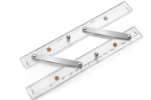
I still have my manual E6B and plotter. I even have a parallel plotter - a gimmick that is apparently no longer available, which allowed you to get the magnetic course directly from nearby VORs. But they sit in a binder I created for teaching a long time ago and, except for teaching primary, I haven't used any of them myself since 1992.
- Joined
- May 25, 2006
- Messages
- 22,002
- Location
- KTTA, North Carolina
- Display Name
- Who you kiddin?
- Home Airfield
- KTTA
2015.I don’t remember when WACs were discontinued,
- Joined
- May 25, 2006
- Messages
- 22,002
- Location
- KTTA, North Carolina
- Display Name
- Who you kiddin?
- Home Airfield
- KTTA
I had to search. Looks like it was based on parallel rulers still available for marine navigation (this is a marine one available on Amazon).I even have a parallel plotter - a gimmick that is apparently no longer available,