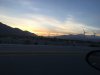
Transitioning through the LAX area

cowman

Final Approach
Joined
Aug 12, 2012
Messages
5,281
Location
Danger Zone
Display Name

Display name:
Cowman
Thought I’d seek advice from locals about the best way to do this traffic and ATC wise. I would probably file IFR but I can go VFR too.

Assuming I use the refueling point I planned on I’ll be going KTNP -> KSBA. A direct route would take me over some high terrain which I’d prefer to avoid. The nicest route terrain wise looks like if I just went KTNP - PSP - KSBA. That gets me out of the mountains but puts me right though what looks like it might be some pretty busy airspace that I’m totally unfamiliar with.

Option 2 would be to head north, skirting around the restricted airspace and towards KAPV or some waypoint in that area the direct to SBA. Airspace doesn’t look as bad but I wonder if I’ll be able to get radar coverage out there. I’d prefer to be at or below 10,000 if possible but 12,000 is doable.

Anyone who knows the area please advise.
 
the only feedback I can give you is from the one time I flew from van nuys to catalina. we did the mini route southbound and LA special flight rules area route northbound, both over LAX. lot of freq changes but they worked us in with no prob and it wasn't all that tough (although I'm glad I had a cfi with me at the time). I know that's south of your route so prob not much help to u.
 
Option 1 looks good and will take you past both Chino (CNO) and Camarillo (CMA) which are both good stops for lunch and to gawk at warbirds. If you don't stop at one of those, I will beseech the mods to permanently ban you from POA.

That's right, beseech. I consider it that serious. :yesnod:

Oh, VFR with flight following is fine.

Ha, thanks. I don’t think we’ll be stopping on the way into SBA as it will be the end of over 7hrs in the air with spouse but we will have several days in the area and no specific plans so maybe then.
 
I do look forward to the story of this awesome xc adventure at The Dam.
 
If it were me I'd fly along the coast, or at least that's how I used to do it.
 
Thought I’d seek advice from locals about the best way to do this traffic and ATC wise. I would probably file IFR but I can go VFR too.

Assuming I use the refueling point I planned on I’ll be going KTNP -> KSBA. A direct route would take me over some high terrain which I’d prefer to avoid. The nicest route terrain wise looks like if I just went KTNP - PSP - KSBA. That gets me out of the mountains but puts me right though what looks like it might be some pretty busy airspace that I’m totally unfamiliar with.

Option 2 would be to head north, skirting around the restricted airspace and towards KAPV or some waypoint in that area the direct to SBA. Airspace doesn’t look as bad but I wonder if I’ll be able to get radar coverage out there. I’d prefer to be at or below 10,000 if possible but 12,000 is doable.

Anyone who knows the area please advise.

Radar coverage is good up around APV then west if you don’t get real low. I’d consider the Banning Pass. KTNP KBNG KSBA. Ya might get bumped around a bit but you have a good chance of that over the high desert anyway. Banning Pass then direct SBA takes you north of the Class B. I’ve done it many times and never got grief from SoCal Approach. Even if they won’t give you Flight Following you can get through over the C’s and north of the B. Get weather briefs and beware of winds in excess of around 20-25 knots. Ask locally for advice.
 
If I were flying TNP->SBA, I'd probably go KTNP -> L80 -> LUCER -> L70 -> KSBA. Banning Pass can be a bear in the springtime with wind and turbulence; and west of Banning Pass there's a ton of traffic, and LAX arrivals to deal with, descending out of 10-12K'. The north side of the mountains is generally smoother than the pass, and far less traffic. This route will cross some rough terrain, but nothing too high, and never far from decent emergency options. Joshua Approach will pick you up around KAPV for Flight Following. Do be mindful of glider traffic out of Crystal; and at UMBER you're crossing the ILS into Van Nuys.

Just my $.02; YMMV.
 
I've also thought of landing short of the final destination at Palm Springs or somewhere else around that general area partly to avoid flying through the mountainous area in the mid-late afternoon and partly just because we don't have a specific plan and have a few days to explore the area.

Oh and another question- at SBA do I want to go to Signature or Atlantic? Sounds like both will have some fees and I might not want to spend more than a day or two there.

SBA will charge you ether way

If you're not looking to get sporty, forget the banning pass and go over at BALDI, hook it left and bobs your uncle for PSP.
 
I've also thought of landing short of the final destination at Palm Springs or somewhere else around that general area partly to avoid flying through the mountainous area in the mid-late afternoon and partly just because we don't have a specific plan and have a few days to explore the area.

Oh and another question- at SBA do I want to go to Signature or Atlantic? Sounds like both will have some fees and I might not want to spend more than a day or two there.
If you are going to hang around in Palm Springs for awhile consider this. https://www.pstramway.com/. It’s pretty cool if you like that kinda thing. I’ve used Atlantic and Signature at both PSP and SBA. Both treated me good but it’s been a few years
 
If you are going to hang around in Palm Springs for awhile consider this. https://www.pstramway.com/. It’s pretty cool if you like that kinda thing. I’ve used Atlantic and Signature at both PSP and SBA. Both treated me good but it’s been a few years

That tram actually looks like it might be interesting. We’re now thinking about flying into Palm Springs tomorrow and doing the tram/dinner thing, then we can proceed to the obligatory lunch stop and SBA the next day.
 
Thought I’d seek advice from locals about the best way to do this traffic and ATC wise. I would probably file IFR but I can go VFR too.

Assuming I use the refueling point I planned on I’ll be going KTNP -> KSBA. A direct route would take me over some high terrain which I’d prefer to avoid. The nicest route terrain wise looks like if I just went KTNP - PSP - KSBA. That gets me out of the mountains but puts me right though what looks like it might be some pretty busy airspace that I’m totally unfamiliar with.

Option 2 would be to head north, skirting around the restricted airspace and towards KAPV or some waypoint in that area the direct to SBA. Airspace doesn’t look as bad but I wonder if I’ll be able to get radar coverage out there. I’d prefer to be at or below 10,000 if possible but 12,000 is doable.

Anyone who knows the area please advise.

I just got back to San Jose from LA today. If you can file IFR, it’s pretty much a piece of cake. Assuming your radio skills are decent, and you know how to hold an assigned heading an altitude, it’s really a non-event. Filing IFR makes all of the airspace considerations just ... vanish. Simple.

For your route, try: KTNP PSP V388 PDZ KSBA.

I took off from Hawthorne, KHHR, today which is right next to LAX, and after vectoring me around a bit till I got to the altitude they wanted, it was “direct LAX, depart LAX on the 280 radial. Then shortly after that, direct Ventura (VTU), and I was on my way.

Really, don’t let the LA area intimidate you. Particularly if you file IFR. Easy-Peasy.


Sent from my iPad using Tapatalk
 
If you do do Banning Pass past PSP that flight is a piece of cake on Flight Following. No need to go IFR. Think the need ya at 6500' for radar coverage. Just stay north of the Bravo and all the C and D wall disappear on FF. Head for ONT and you will stay on the North side of I-10 then right towards BUR then SBA up the coast. Do that all the time. Lots of radio work and lost of traffic call outs, but SoCal is VERY accommodating and helpful and they WANT to be talking to you and if you are IFR rated, it will be a cakewalk...just busy.

That northern route avoids Banning Pass but honestly if Banning is that bad, those areas north will be just as bad. Some on my most intense turbulence and up/downdrafts have been in that area. Unless there is a Airment Tango and/or high winds forecast, Banning is not that bad.

I have been to Atlantic at SBS a few times this year in my put put plane and had great service.
 
Last edited:
If you are doing the flight to Santa Barbara tomorrow, be aware that the Santa Ana winds (along with hot temperatures) will be blowing from the north tomorrow. That brings turbulence over the mountains and passes. When nearing Palm Springs, I would ask ATC for PIREPS thru the Banning Pass. It it's not terrible, I would fly thru there then more or less direct to KSBA. Flying the northern route will take you over some terrain that might be a little bumpy (or a lot) tomorrow.

I just did a flight this evening between KCMA and KWHP and the winds were blowing pretty good from the north around the Newhall Pass (LANGE waypoint). If you fly thru the LA basin, it will be a little less bumpy. If you are on flight following...it's really easy. Just beware of the Bravo shelves b/w 7-9k near KPOC. Otherwise airspace isn't an issue (did I already mention flight following )

My 2 cents
 
Last edited:
We ended up going to KTRM, going to leave tomorrow morning for SBA. Looks like most logical thing to do from here is to go KTRM - PSP - KBNG - KSBA.

The flight in yesterday was uncomfortable for me and the spouse with nearly 6 hours in the air with mountainy turbulence. This is much shorter flight but I’d like things to be smoother. If we’re off no later than 9am and through the pass no later than 10am should I be able to get that or do we need to start even earlier or take a different route entirely?


....and after I ask this I see possibility of high winds tomorrow which might require a total abort mission. I guess I can look at actual winds at big bear and preps as a guide in the morning and decide then.
 
Last edited:
I really appreciate the second looks at my plans from people who know the area. I’m not used to terrain that varies more than 500’ most of the places I fly.

Have to admit it is slightly intimidating. I assume I want all the altitude I can get when crossing which is probably 10,500-12,500
 
Are you familiar with mountain wave?

Basically, if the winds at ridge-top level are above 20 kts and at an angle to the ridge lines, there can be a pattern of updrafts and downdrafts that exceed the climb capability of the airplane, and rotors which are extremely turbulent.
 
Have to admit it is slightly intimidating. I assume I want all the altitude I can get when crossing which is probably 10,500-12,500

Not at all...only reason you need to get to 6500 is for radar coverage through banning...otherwise you can get there at any altitude you want through SoCal meandering through the hills of the LA basin. It is really all wide open once you see it. I do that route all the time at 6500 or 8500 VFR and only that to stay above the other airspace, not terrain.

If winds are outta the west, higher above the terrain will probably actually be more turbulent as the air get pushed up and through the mountains vs staying lower though the open valley

Once you are past LAX Bravo I typically head over to the coastline then up rather than direct SBA. It will makes sesne more why once you see it.
 
Last edited:
I second both leaving early and a stop at the Waypoint Cafe. Wx permitting, I'd leave at 6:45 to 7 am (light enough to see the mountains clearly) to minimize turbulence through the Banning Pass, then a late breakfast at Camarillo. Thursday looks like a good day to stay on the ground...excellent that you're planning a multi-day stay in Santa Barbara. Aside from the winds, the VFR outlook is great for tomorrow...minimal to no pesky marine layer to deal with at CMA or SBA.

As Shawn said, you'll be fine at 6500' for this leg, as you just follow the basin once past the Banning Pass. Ceilings of all the Class C airports are anywhere from 4800' to 5500'. Very easy to stay north of LAX Class B...I always fly just north of El Monte (EMT) and then over Burbank/Van Nuys for a straight shot to Camarillo from there. Heads up when you're exiting the Banning Pass, as airliners pop over the mountains from the north to descend into Ontario.

When the winds kick up, I'd take Banning Pass over Cajon Pass any day.
 
Are you familiar with mountain wave?

Basically, if the winds at ridge-top level are above 20 kts and at an angle to the ridge lines, there can be a pattern of updrafts and downdrafts that exceed the climb capability of the airplane, and rotors which are extremely turbulent.

Only in general, I was able to maintain 2-4k or better above most of the stuff on the way in but I guess I'm not capable of that here so low is better to keep under the turbulent wind off the peaks? And with wind out of the WSW I want to stay closer to the northern side of the pass to stay out of rotors and give myself room to turn around right?

Not at all...only reason you need to get to 6500 is for radar coverage through banning...otherwise you can get there at any altitude you want through SoCal meandering through the hills of the LA basin. It is really all wide open once you see it. I do that route all the time at 6500 or 8500 VFR and only that to stay above the other airspace, not terrain.

If winds are outta the west, higher above the terrain will probably actually be more turbulent as the air get pushed up and through the mountains vs staying lower though the open valley

Once you are past LAX Bravo I typically head over to the coastline then up rather than direct SBA. It will makes sesne more why once you see it.

Ok, 6500 works. My flatlander instincts are to get as high above any terrain as practical but I guess that doesn't make sense here since I could only barely get above the peaks.
 
Heads up when you're exiting the Banning Pass, as airliners pop over the mountains from the north to descend into Ontario.

If on FF expect to be told to remain on the North side of I-10 freeway which will keep ya clear of the approach path.
 
I just drove by the pass, not sure if it shows in the picture but I’m pretty sure that’s a lenticular cloud and rotors up there. I don’t like seeing that. Hopefully none of that in the morning.
 

Attachments

  • 7B3F7F3E-DF78-4CB3-B6AF-48C3A5035B36.jpeg
    7B3F7F3E-DF78-4CB3-B6AF-48C3A5035B36.jpeg
    83.1 KB · Views: 46
Ok, 6500 works. My flatlander instincts are to get as high above any terrain as practical but I guess that doesn't make sense here since I could only barely get above the peaks.

Yeah, it may look daunting on the sectional but once you are through Banning Pass it is a lot of hills on your right but wide open sea level flat on your left all the way on your route.
 
Really appreciate the help, guys. I'll run the possible food stops by my wife but she doesn't like to eat and fly so... we'll see.
 
Really appreciate the help, guys. I'll run the possible food stops by my wife but she doesn't like to eat and fly so... we'll see.

Ok. Here on POA we can argue about high wing versus low wing, LOP or ROP, chute or no chute, plastic or metal, which 178 second video is best, and any other of a myriad of topics, but...

Stopping at the Waypoint Cafe or not stopping is not debatable.

Well that is unless the wife says not to then of course a man has to do what he has to do. Which is to obey.

;)
 
That's probably about what I'd do too.
^^ What they said (KTNP L80 LUCER L70 KSBA) except it skips Camarillo (KCMA) which is really a great place to stop for lunch at the Waypoint Cafe.
 
We ended up going to KTRM, going to leave tomorrow morning for SBA. Looks like most logical thing to do from here is to go KTRM - PSP - KBNG - KSBA.

The flight in yesterday was uncomfortable for me and the spouse with nearly 6 hours in the air with mountainy turbulence. This is much shorter flight but I’d like things to be smoother. If we’re off no later than 9am and through the pass no later than 10am should I be able to get that or do we need to start even earlier or take a different route entirely?


....and after I ask this I see possibility of high winds tomorrow which might require a total abort mission. I guess I can look at actual winds at big bear and preps as a guide in the morning and decide then.

Earlier is better than later. Your probably in the air anyway. Don't rely on just the surface winds at Big Bear. Winds aloft is what you need.

EDIT: all I needed to do was read a few more posts. Glad the Banning Pass treated you well. Let us know how it was around BUR/VNY. I have been through there many times and it's never been smooth. Never bad, but never smooth even if the rest of the flight before and after there was smooth.
 
Last edited:
If it were me in my Archer in VFR conditions, I’d go KTNP PMD KSBA

Every time I end up transiting LA at low altitude I end up losing all kinds of time to random BS, the Palmdale route takes all that out
 
They didn’t give me any trouble. “Navigate North of Ontario” was the only instruction I got between the pass and SBA
 
Another LAX question if you guys aren’t tired of me yet.... from Santa Barbara I want to start home taking a farther south route. The direct course to my next likely destination would take me almost directly over LAX it’s self which I’d assume is no bueno. I want to go SBA - SXC - CXL but that takes me through warning areas w-289e and/or w. Info on foreflight says “intermittent by NOTAM” so hopefully I can find out if it’s going to be active with a briefing.... any other sources of information on it? Can I expect to probably just get cleared through(probably departing Saturday morning)?
 
It is possible to fly VFR over LAX, or nearly so. The "Los Angeles Special Flight Rules Area" allows flight directly over LAX, without a clearance, under certain circumstances. In addition, there are a number of published VFR routes that are available with ATC clearance. Information is in the "Los Angeles TAC Supplemental" in the "Documents" section of Foreflight.
 
It is easy to duck east of Point Magoo then around LAX.

...but there are several published LAX VFR transition corridors if you do not wanna go over water. There is the SFRA noted above where you do not need to talk to ATC then there are 4 routes at varying altitudes that you get clearance for from ATC. Look at the LAX TAC. They hand out Bravo clearances like candy but you are expected to know and fly the routes with no help from ATC or you will get shooed away

I fly the Coastal route (5500/6500) all the time and it is easy peasy and you get an awesome view of LAX and the LA Basin. This would essentially be your route at 5500' though LAX.

https://skyvector.com/?ll=33.93728362393866,-118.6730346641952&chart=301&zoom=4&fpl= KSBA 3408N11832W 3400N11829W 3344N11815W KCXL

If you are interested in that I can talk ya through how to get a clearance in just three words and what to do and expect. Flying inside Bravo is the most relaxing part of a SoCal flight for me!

You can also go East of and under Bravo. As crazy as it looks BUR>EMT>FUL at 3500' is easy on FF under the 4000' shelf but a lot of traffic calls and radio work. Just watch the Disney TFR...I mean PFR.
 
Last edited:
Back
Top