Source for ATC Letters of Agreement (LOAs)?

DaveInPA

Pre-Flight
Joined
Sep 21, 2019
Messages
60
Display Name
Dave
i’m doing a research project to map out the busy northeast airspace from DC to Boston. Ultimately trying to paint a picture of hand off points, preferred altitudes and routes etc. For instance I filed this week from DC to north of philly at 10k and got routed around the bravo. In the air I ask if I could do direct through philly bravo and they said no problem and they brought me down to 5k - saved like 15 mins.

A lot of this I believe can be unlocked from the different facility LOAs between them. Besides filing a big Freedom of Information Act request which will take months wondering if any other nerds out there have a good source of these LOAs?
 
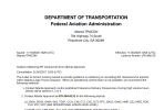
I'm not aware of a general source. Some TRACON facilities publish them (or at least some of them). Here, for example, is the one between Atlanta TRACON and Atlanta Tower.

Personally, if I were researching a specific facility, I'd start by contacting the facility.

Interesting project. It will be interesting to see how you deal with the variables. I can definitely see your initial routing around the PHL Bravo being the Center computer default routing, with the through you received being based on then current traffic.
 
wondering if any other nerds out there have a good source of these LOAs?
Perhaps contact this department. Hit the "Catalog" menu button and it gives some idea of the info they deal with.

1787492261289.png
 
I also see LTA - Letters to Airmen - from ATC outlining new policies, etc. Here's a local example:

1787495965828.png
 
I also see LTA - Letters to Airmen - from ATC outlining new policies, etc. Here's a local example:
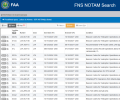
Those - letters directed to pilots about applicable local procedures - are widely available. They can be located via the FAA's NOTAM site (picture). Some EFBs integrate them. For example, ForeFlight includes them on the Procedures > Airport tab.

1787496572717.png
 
Yep - ForeFlight is where I picked this one up.

PSA - while checking NOTAMs, as mentioned above hit “Procedures - Airport” and you might see something new from time to time.
 
i’m doing a research project to map out the busy northeast airspace from DC to Boston. Ultimately trying to paint a picture of hand off points, preferred altitudes and routes etc. For instance I filed this week from DC to north of philly at 10k and got routed around the bravo. In the air I ask if I could do direct through philly bravo and they said no problem and they brought me down to 5k - saved like 15 mins.

A lot of this I believe can be unlocked from the different facility LOAs between them. Besides filing a big Freedom of Information Act request which will take months wondering if any other nerds out there have a good source of these LOAs?
LOA’s exist to set a flow of traffic that minimizes conflicts and to reduce coordination. They are all based on a ‘unless otherwise coordinated’ basis. Often times traffic is slow and the controllers aren’t real busy and have plenty of time to coordinate and get short cuts. Sometimes weather and other factors such as emergencies, runway closures, unusual amounts of traffic from flyins and events are such that for hours at a time no airplanes are on the LOA routings.
 
Centers delegate airspace to approach controls, therefore ZDC, ZNY, & ZBW should have the LOAs you're looking for (procedures) along with the annexes that delegate the airspace for your mapping. I don't know if they have them, but at ZTL we had a large chart with multi colors depicting the approach controls. If you ask, I'm sure they'd print one for you.
 
Centers delegate airspace to approach controls, therefore ZDC, ZNY, & ZBW should have the LOAs you're looking for (procedures) along with the annexes that delegate the airspace for your mapping. I don't know if they have them, but at ZTL we had a large chart with multi colors depicting the approach controls. If you ask, I'm sure they'd print one for you.
Do you think they would give out the LOA’s also?
 
The link is to an airspace amendment. It designates the center of KPAE's Class D. It also states a radius of 4.5-miles.
Is that 4.5 Statute miles or Nautical miles?

 
Last edited:
Nautical.

BTW, did you notice that amendment is 16 years old?
Thanks.

Yes, I noticed. My home drome (S43) is 7 nm east of KPAE and the approach from the north ("bend in the river") is inside a 5 nm Class D airspace. Since 2001 I've heard there is an LOA giving S43 an "easement." That may have been true before the 2010 amendment, but the amendment codifies it in the definition of KPAE's airspace. Good to know.

I've always felt a bit guilty when seeing 4.7 on the DME.
 
Thinking about the original post:

Around these parts, I usually don't quite get what I ask for, but I usually never fly what I'm given. Once in the air and handed to a different controller, I just ask for direct or what I originally wanted (or whatever you do in the NE) and ATC seems to work with me.

Point is that there is enough latitude that instead of trying to predict ahead what would be acceptable via "secret/unpublished LOA options" it might be easier to just ask when in the air.
 
i’m doing a research project to map out the busy northeast airspace from DC to Boston. Ultimately trying to paint a picture of hand off points, preferred altitudes and routes etc. For instance I filed this week from DC to north of philly at 10k and got routed around the bravo. In the air I ask if I could do direct through philly bravo and they said no problem and they brought me down to 5k - saved like 15 mins.

A lot of this I believe can be unlocked from the different facility LOAs between them. Besides filing a big Freedom of Information Act request which will take months wondering if any other nerds out there have a good source of these LOAs?
You are going to search LOAs, analyze the information, keep current on all changes in real time, reanalyze, and plan your flight accordingly because you saved 15 minutes on a flight? How is WX going to effect this?

I’d learn airspace, analyze the charts and determine when I could go VFR.
 
I think what you’ll find in the LOAs is that their procedures are highly dependent on traffic load and controller preference. Meaning, while you might get a handoff in a particular area one day, it might change the next depending on conditions. You might have a controller willing to work out a route change while another might kick the can down the road. Even if you know the airspace boundary with center / approach early handoffs and late hand offs can happen. You could even get control instructions issued by one facility while in another facilities airspace. Weather, controller technique, traffic load, equipment limitations, you name it will modify basic LOAs.
 
Back
Top