

You are using an out of date browser. It may not display this or other websites correctly.
You should upgrade or use an alternative browser.
You should upgrade or use an alternative browser.
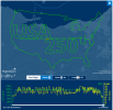
Impressive flight track!
- Thread starter Charlie Golf
- Start date

sourdough44
En-Route
I’d think that took some serious planning, if real & all.

Sac Arrow
Touchdown! Greaser!
- Joined
- May 11, 2010
- Messages
- 21,565
- Location
- Charlotte, NC
- Display Name
- Snorting his way across the USA
I'm thinking no.
EDIT: Maybe yes. Hard to say. A for effort, F for practicality.
EDIT: Maybe yes. Hard to say. A for effort, F for practicality.

luvflyin
Touchdown! Greaser!
- Joined
- May 8, 2015
- Messages
- 17,444
- Location
- Santa Barbara, CA
- Display Name
- Luvflyin
- Home Airfield
- KVUO
If real ?? It was C-182 and took 6 hrs 10 min.I’d think that took some serious planning, if real & all.


KE5BM
Pre-takeoff checklist
That's incredibly impressive! What I want to know is how he programmed that into the autopilot! When you replay the whole route, it's clear that he is an expert at Etch-A-Sketch.
KE5BM
Pre-takeoff checklist
As I write this, he's in the climb out of KMDW on his way to Virginia. It's a real plane with a real track...registered to an LLC.
luvflyin
Touchdown! Greaser!
- Joined
- May 8, 2015
- Messages
- 17,444
- Location
- Santa Barbara, CA
- Display Name
- Luvflyin
- Home Airfield
- KVUO
Rounding errorI heard it was 6 hrs 8 minutes

While I do think this is real (looking at the flight tracks and slight altitude inconsistencies) it's pretty easy nowadays to create an ADS-B transmitter that spoofs that flight track to be received by the nearest ADS-B ground station.
I suppose you could even program it to do that at 182 airspeeds and program in some altitude and speed variance to make it look real, too.
As for how he did it in flight, he likely created the graphic on the ground, got all of the waypoints and uploaded them to his navigator, and his autopilot just kept flying to the next waypoint until he was done.

- Joined
- Sep 11, 2019
- Messages
- 2,885
- Display Name
- Domenick
Warp time distortion. Depends on the location of the observer.Rounding error

RussR
Final Approach
While the non-flying world has been fawning over this flight track, I'm having a hard time describing whether I find it "impressive" or not.
I mean, it is neat, and attention-getting, and overall a pretty cool thing. No denying that.
But -
Piloting skill - very little needed. Clearly it's a preprogrammed route being flown on autopilot.
Planning skill - definitely needed some. I imagine there were some airspace issues, and ATC coordination had to happen. Good job there.
Programming skill - I'm not sure. Are there apps that will convert a drawing to coordinates? Then load them into Foreflight, and send the route to the panel. Or was there a lot of hand-planning done to determine turn points and such?
Obviously almost all of the work to make this happen occurred on the ground. Once in flight, autopilot on, and sit back. Although it does look like there may have been a few points where the turn needed to be pretty tight, so the autopilot may have been clicked off at those points.
If I am wrong about the level of effort in any part of this, I am completely willing to be wrong and be amazed.
Although I think the average person thinks this was done like skywriting, all stick and rudder flying, and just having to visualize the whole picture while flying it.
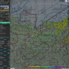
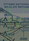
Maybe not. Looks like it was outside/above the Bravo, assuming the MDW-5A1 leg was not intended to be captured by adsbexchange. There is R-5502B, but that could have been a call on the ground.Planning skill - definitely needed some. I imagine there were some airspace issues, and ATC coordination had to happen. Good job there.
If it were me, I'd sketch the picture and then have AI return back a bunch of GPS coordinates representing the route. After verifying that data and/or iterating on the revisions, I'd then have AI generate a Python script that translated the file into something that could be imported into the GTN or whatever is in the panel. But that's just me.Programming skill - I'm not sure. Are there apps that will convert a drawing to coordinates? Then load them into Foreflight, and send the route to the panel. Or was there a lot of hand-planning done to determine turn points and such?
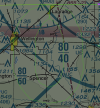
And yeah, I doubt it was the autopilot making these "Puget Sound" turns.
Last edited:


- Joined
- Mar 15, 2016
- Messages
- 5,585
- Display Name
- Ari
I wrote a program to convert .kml tracks to Garmin .fpl files. I ran it to make a track for my G3X autopilot to fly but I haven’t tried to fly the track yet. It does result in a ton of saved user waypoints in the panel, which annoys my OCD.
But the Etch-a-Sketch comment is spot on. Traveling salesmen probably rock at that thing.
But the Etch-a-Sketch comment is spot on. Traveling salesmen probably rock at that thing.

I don't care what y'all think, this is inspirational to me. When I finally get my plane in the air I want to draw all kinds of things. Admittedly inappropriate things. Way more fun than hamburger runs and bomber pattern touch and goes.

Jim_R
En-Route
- Joined
- Feb 17, 2010
- Messages
- 2,567
- Display Name
- Jim
At some point it becomes easier to just fly to the moon rather than hire Stanley Kubrick to make a movie that looks real enough to fool the world...While I do think this is real (looking at the flight tracks and slight altitude inconsistencies) it's pretty easy nowadays to create an ADS-B transmitter that spoofs that flight track to be received by the nearest ADS-B ground station.
I suppose you could even program it to do that at 182 airspeeds and program in some altitude and speed variance to make it look real, too.