Runway NOTAMs
Atlantic City NJ [ACY]: August NOTAM #64
Runway 4 HOLDING position sign for taxiway D not lighted August 30th, 2014 at 08:03 PM EDT (1408310003) - September 05th, 2014 at 07:00 PM EDT (1409052300)
Philadelphia PA [PHL]: September NOTAM #4
Runway 26 precision approach path indicator OUT of SERVICE August 31st, 2014 at 09:43 PM EDT (1409010143) - October 31st, 2014 at 06:00 AM EDT (1410311000)
Philadelphia PA [PHL]: May NOTAM #47
Runway 9L BLAST PAD NON - standard markings May 05th, 2014 at 11:00 PM EDT (1405060300) - September 30th, 2014 at 06:00 AM EDT (1409301000)
Philadelphia PA [PHL]: September NOTAM #25
Runway 9R runway visual range OUT of SERVICE September 03rd, 2014 at 08:00 AM EDT (1409031200) - September 03rd, 2014 at 12:00 PM EDT (1409031600)
Philadelphia PA [PHL]: July NOTAM #10
Runway 9L / 27R between taxiway K5 and taxiway T WORK in PROGRESS construction adjacent N EDGE barricades July 02nd, 2014 at 07:13 AM EDT (1407021113) - September 30th, 2014 at 06:00 AM EDT (1409301000)
Philadelphia PA [PHL]: September NOTAM #7
Runway 35 precision approach path indicator OUT of SERVICE September 01st, 2014 at 04:20 AM EDT (1409010820) - November 30th, 2014 at 06:00 AM EDT (1411301000)
Philadelphia PA [PHL]: August NOTAM #110
Runway 27R lead off light at taxiway K4 not standard August 13th, 2014 at 07:08 AM EDT (1408131108) - September 30th, 2014 at 06:00 AM EDT (1409301000)
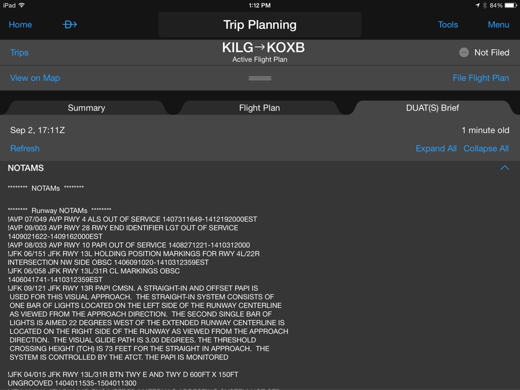
Wilkes-Barre/Scranton PA [AVP]: July NOTAM #49
Runway 4 approach lighting system OUT of SERVICE July 31st, 2014 at 12:49 PM EDT (1407311649) - 1412192000EST
Wilkes-Barre/Scranton PA [AVP]: August NOTAM #33
Runway 10 precision approach path indicator OUT of SERVICE August 27th, 2014 at 08:21 AM EDT (1408271221) - October 31st, 2014 at 04:00 PM EDT (1410312000)
Pedricktown NJ (Spitfire Aerodrome) [7N7]: April NOTAM #47 issued by Millville NJ [MIV]
Runway 25 precision approach path indicator OUT of SERVICE April 09th, 2014 at 04:12 PM EDT (1404092012) - 1410092359EST
Pedricktown NJ (Spitfire Aerodrome) [7N7]: April NOTAM #46 issued by Millville NJ [MIV]
Runway 7 runway end IDENTIFIER light OUT of SERVICE April 09th, 2014 at 04:10 PM EDT (1404092010) - 1410092359EST
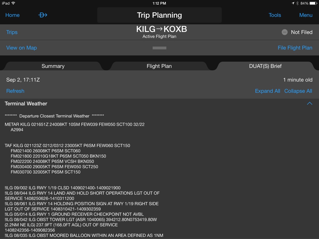
Wilmington DE (New Castle) [ILG]: September NOTAM #3
Runway 1/19 closed September 02nd, 2014 at 01:00 PM EDT (1409021700) - September 02nd, 2014 at 07:00 PM EDT (1409022300)
Wilmington DE (New Castle) [ILG]: August NOTAM #44
Runway 14 LAND and hold short operations light OUT of SERVICE August 25th, 2014 at 02:26 AM EDT (1408250626) - October 31st, 2014 at 08:00 AM EDT (1410311200)
Wilmington DE (New Castle) [ILG]: August NOTAM #61
Runway 14 HOLDING position sign at runway 1/19 right side light OUT of SERVICE August 31st, 2014 at 12:21 AM EDT (1408310421) - September 30th, 2014 at 07:59 PM EDT (1409302359)
Wilmington DE (New Castle) [ILG]: May NOTAM #14
Runway 1 ground receiver checkpoint not available
Churchville MD (Harford County) [0W3]: March NOTAM #206 issued by Washington DC [DCA]
Runway 10 precision approach path indicator OUT of SERVICE March 12th, 2014 at 08:49 AM EDT (1403121249) - 1404132359EST
Churchville MD (Harford County) [0W3]: March NOTAM #207 issued by Washington DC [DCA]
Runway 19 threshhold DISPLACED 205FT March 12th, 2014 at 08:56 AM EDT (1403121256) - 1409152359EST
Fallston MD [W42]: December NOTAM #379 issued by Washington DC [DCA]
Runway 4 threshhold DISPLACED 315FT not standard marking December 21st, 2013 at 05:16 PM EDT (1312212116) - {permanent, permission}
Fallston MD [W42]: March NOTAM #385 issued by Washington DC [DCA]
Runway 22 threshhold DISPLACED 220FT not standard marking March 25th, 2014 at 10:24 AM EDT (1403251424) - September 30th, 2014 at 08:00 AM EDT (1409301200)
Baltimore MD (Martin State) [MTN]: September NOTAM #2
Runway 15/33 closed September 03rd, 2014 at 10:00 PM EDT (1409040200) - September 04th, 2014 at 06:00 AM EDT (1409041000)
Aerodrome NOTAMs
Wilkes-Barre/Scranton PA [AVP]: August NOTAM #39
Aerodrome all SFC WIP grass CUTTING August 29th, 2014 at 05:11 PM EDT (1408292111) - September 02nd, 2014 at 07:59 PM EDT (1409022359)
Obstruction NOTAMs
Washington Center (Leesburg VA) [ZDC]: June NOTAM #118 issued by Washington DC [DCA]
Obstruction WIND turbine FARM WITHIN area DEFINED as 7NM RADIUS of 391319N0793004W (23.4 southeast CKB) 3900FT (250FT above ground level) not lighted June 09th, 2014 at 09:31 AM EDT (1406091331) - 1407152359EST
Atlantic City NJ [ACY]: June NOTAM #31
Obstruction pole 392707N0743415W (0.5NM ESE ACY) 165FT (100FT above ground level) not lighted June 23rd, 2014 at 09:18 AM EDT (1406231318) - September 19th, 2014 at 07:59 PM EDT (1409192359)
Wilkes-Barre/Scranton PA [AVP]: August NOTAM #35
Obstruction tower light (ASR 1026644) 412609.10N0754342.30W (5.9NM N AVP) 2411.7FT (342.8FT above ground level) OUT of SERVICE August 28th, 2014 at 04:47 AM EDT (1408280847) - September 12th, 2014 at 04:47 AM EDT (1409120847)
Essington PA (Philadelphia) [9N2]: August NOTAM #168 issued by Williamsport PA [IPT]
Obstruction tower light (ASR 1037841) 395130.00N0752335.00W (4.3NM W 9N2) 255.2FT (215.2FT above ground level) OUT of SERVICE August 20th, 2014 at 08:59 AM EDT (1408201259) - September 04th, 2014 at 08:59 AM EDT (1409041259)
Pedricktown NJ (Spitfire Aerodrome) [7N7]: June NOTAM #100 issued by Millville NJ [MIV]
Obstruction stack light 394729.9N0752429.8W (3.4 N 7N7) 447FT (430FT above ground level) OUT of SERVICE June 20th, 2014 at 06:30 AM EDT (1406201030) - 1406202300EST
Pedricktown NJ (Spitfire Aerodrome) [7N7]: August NOTAM #203 issued by Millville NJ [MIV]
Obstruction tower light (ASR 1280249) 394856.20N0753148.00W (7.7NM northwest 7N7) 862.2FT (495.1FT above ground level) OUT of SERVICE August 29th, 2014 at 04:18 PM EDT (1408292018) - September 13th, 2014 at 04:18 PM EDT (1409132018)
West Chester PA (Brandywine) [OQN]: August NOTAM #273 issued by Williamsport PA [IPT]
Obstruction tower light (ASR 1056385) 400250.40N0753509.70W (3.5NM N OQN) 877.0FT (480.0FT above ground level) OUT of SERVICE August 27th, 2014 at 10:23 PM EDT (1408280223) - September 11th, 2014 at 10:23 PM EDT (1409120223)
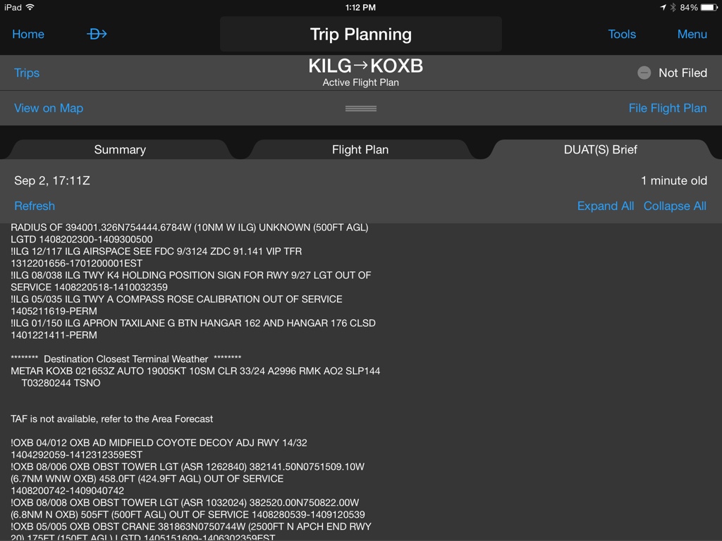
Wilmington DE (New Castle) [ILG]: August NOTAM #42
Obstruction tower light (ASR 1040065) 394212.80N0753419.80W (2.2NM northeast ILG) 237.9FT (168.0FT above ground level) OUT of SERVICE August 24th, 2014 at 07:56 PM EDT (1408242356) - September 08th, 2014 at 07:56 PM EDT (1409082356)
Wilmington DE (New Castle) [ILG]: August NOTAM #35
Obstruction moored balloon WITHIN AN area DEFINED as 1NM RADIUS of 394001.326N754444.6784W (10NM W ILG) UNKNOWN (500FT above ground level) lighted August 20th, 2014 at 07:00 PM EDT (1408202300) - September 30th, 2014 at 01:00 AM EDT (1409300500)
Toughkenamon PA (New Garden) [N57]: September NOTAM #5 issued by Williamsport PA [IPT]
Obstruction tower light (ASR UNKNOWN) 395139.03N754051.08 (5.15 ENE N57) 545FT (201FT above ground level) OUT of SERVICE September 01st, 2014 at 07:35 PM EDT (1409012335) - September 16th, 2014 at 07:35 PM EDT (1409162335)
Coatesville PA (Chester County G O Carlson) [MQS]: August NOTAM #216 issued by Williamsport PA [IPT]
Obstruction tower light (ASR 1037833) 400126.30N0754846.50W (3.7NM northeast MQS) 936.7FT (358.9FT above ground level) OUT of SERVICE August 23rd, 2014 at 02:24 AM EDT (1408230624) - September 07th, 2014 at 02:24 AM EDT (1409070624)
Coatesville PA (Chester County G O Carlson) [MQS]: August NOTAM #212 issued by Williamsport PA [IPT]
Obstruction tower light (ASR 1221221) 395326.90N0755518.90W (6.0NM SSW MQS) 746.7FT (155.8FT above ground level) OUT of SERVICE August 22nd, 2014 at 02:45 AM EDT (1408220645) - September 06th, 2014 at 02:45 AM EDT (1409060645)
Elkton MD (Cecil County) [58M]: August NOTAM #320 issued by Washington DC [DCA]
Obstruction tower light (ASR 1062403) 393201.00N0754911.00W (3.3NM southeast 58M) 363.8FT (315.0FT above ground level) OUT of SERVICE August 19th, 2014 at 08:17 AM EDT (1408191217) - September 03rd, 2014 at 08:17 AM EDT (1409031217)
Elkton MD (Cecil County) [58M]: August NOTAM #386 issued by Washington DC [DCA]
Obstruction tower light (ASR 1043512) 393341.80N0755546.80W (2.9NM WSW 58M) 579.7FT (280.8FT above ground level) OUT of SERVICE August 22nd, 2014 at 03:10 PM EDT (1408221910) - September 06th, 2014 at 03:10 PM EDT (1409061910)
Massey MD (Massey Aerodrome) [MD1]: August NOTAM #398 issued by Washington DC [DCA]
Obstruction tower light (ASR 1037376) 391220.00N0755642.20W (8.9NM southwest MD1) 483.6FT (405.8FT above ground level) OUT of SERVICE August 23rd, 2014 at 06:55 AM EDT (1408231055) - September 07th, 2014 at 06:55 AM EDT (1409071055)
Havre De Grace MD [M06]: September NOTAM #36 issued by Washington DC [DCA]
Obstruction tower light (ASR 1044113) 393714.00N0755921.10W (6.1NM northeast M06) 574.1FT (240.2FT above ground level) OUT of SERVICE September 02nd, 2014 at 01:36 PM EDT (1409021736) - September 17th, 2014 at 12:00 AM EDT (1409170400)
Havre De Grace MD [M06]: August NOTAM #488 issued by Washington DC [DCA]
Obstruction tower light (ASR 1035692) 393352.00N0760605.70W (2.0NM northwest M06) 749.0FT (525.9FT above ground level) OUT of SERVICE August 29th, 2014 at 03:11 AM EDT (1408290711) - September 13th, 2014 at 03:11 AM EDT (1409130711)
Brogue PA (Baublitz Commercial) [9W8]: August NOTAM #236 issued by Williamsport PA [IPT]
Obstruction stack 394530N/0761600W (11.0NM S 9W8) 773FT (492FT above ground level) not lighted August 25th, 2014 at 05:43 PM EDT (1408252143) - September 09th, 2014 at 05:30 PM EDT (1409092130)
Fallston MD [W42]: September NOTAM #23 issued by Washington DC [DCA]
Obstruction tower light (ASR 1027628) 392604.40N0762030.60W (5.1NM southeast W42) 429.8FT (272.0FT above ground level) OUT of SERVICE September 02nd, 2014 at 04:24 AM EDT (1409020824) - September 17th, 2014 at 04:24 AM EDT (1409170824)
Fallston MD [W42]: August NOTAM #373 issued by Washington DC [DCA]
Obstruction tower light (ASR 1035848) 393449.60N0762050.50W (5.7NM NNE W42) 791.0FT (321.9FT above ground level) OUT of SERVICE August 21st, 2014 at 10:19 PM EDT (1408220219) - September 05th, 2014 at 10:19 PM EDT (1409060219)
Baltimore MD (Pier 7) [4MD]: September NOTAM #17 issued by Washington DC [DCA]
Obstruction tower light (ASR 1022765) 391953.30N0763926.80W (5.3NM northwest 4MD) 805.1FT (399.9FT above ground level) OUT of SERVICE September 01st, 2014 at 08:27 PM EDT (1409020027) - September 16th, 2014 at 08:27 PM EDT (1409170027)
Baltimore MD (Pier 7) [4MD]: August NOTAM #406 issued by Washington DC [DCA]
Obstruction tower light (ASR 1029766) 391926.40N0763254.80W (3.3NM NNE 4MD) 675.5FT (561.7FT above ground level) OUT of SERVICE August 24th, 2014 at 03:04 AM EDT (1408240704) - September 08th, 2014 at 03:04 AM EDT (1409080704)
Westminster [EMI VOR]: August NOTAM #87 issued by Washington DC [DCA]
Obstruction moored balloon WITHIN AN area DEFINED as 1NM RADIUS of 394911N0771405W (23NM NNW EMI) 831FT (300FT above ground level) not lighted daily 1000 - 0100 August 06th, 2014 at 06:00 AM EDT (1408061000) - December 01st, 2014 at 09:00 PM EDT (1412020100)
Navigation NOTAMs
Atlantic City NJ [ACY]: July NOTAM #23
Navigation runway 4 ILS EXPERIMENTAL only for FAA TEST aircraft only July 10th, 2014 at 02:17 PM EDT (1407101817) - {permanent, permission}
Atlantic City NJ [ACY]: August NOTAM #50
Navigation ILS runway 31 {local, localizer, location} / glide path OUT of SERVICE August 25th, 2014 at 08:00 AM EDT (1408251200) - November 03rd, 2014 at 04:00 PM EDT (1411032000)
Philadelphia PA [PHL]: September NOTAM #26
Navigation ILS runway 9R category 3 not authorized September 03rd, 2014 at 08:00 AM EDT (1409031200) - September 03rd, 2014 at 12:00 PM EDT (1409031600)
Dupont [DQO VOR]: September NOTAM #1 issued by Millville NJ [MIV]
Navigation VORTAC OUT of SERVICE September 04th, 2014 at 08:00 AM EDT (1409041200) - September 04th, 2014 at 03:00 PM EDT (1409041900)
Coatesville PA (Chester County G O Carlson) [MQS]: November NOTAM #33 issued by Williamsport PA [IPT]
Navigation ILS runway 29 outer marker (OM) decommissioned
Communication NOTAMs
Washington Center (Leesburg VA) [ZDC]: July NOTAM #220 issued by Washington DC [DCA]
Communications remote transmitter/receiver QXC COMISSIONING DELAYED 272.75 REMAIN in use
Washington Center (Leesburg VA) [ZDC]: January NOTAM #53 issued by Washington DC [DCA]
Communications REMOTE TRANSMITTER / receiver 269.375 insead of 317.70 effective from January 05th, 2011 at 08:01 PM EDT (1101060001)
Dupont [DQO VOR]: September NOTAM #11 issued by Millville NJ [MIV]
Communications VOR voice 122.1 OUT of SERVICE September 02nd, 2014 at 11:00 PM EDT (1409030300) - September 03rd, 2014 at 06:00 AM EDT (1409031000)
Airspace NOTAMs
Washington Center (Leesburg VA) [ZDC]: August NOTAM #518 issued by Washington DC [DCA]
Airspace parachute jumping exercise WITHIN AN area DEFINED as 10NM RADIUS of 17 nautical miles on the 005° radial of Gordonsville [GVE VOR] (7NM northwest OMH) SFC - 12000FT September 02nd, 2014 at 06:00 PM EDT (1409022200) - September 02nd, 2014 at 10:00 PM EDT (1409030200)
Washington Center (Leesburg VA) [ZDC]: September NOTAM #7 issued by Sua East OA [SUAE]
Airspace R6602B active 4000FT - 10999FT September 02nd, 2014 at 12:00 AM EDT (1409020400) - September 02nd, 2014 at 11:59 PM EDT (1409030359)
Washington Center (Leesburg VA) [ZDC]: September NOTAM #78 issued by Sua East OA [SUAE]
Airspace R6611A active SFC - 10000FT September 03rd, 2014 at 05:01 PM EDT (1409032101) - September 03rd, 2014 at 07:00 PM EDT (1409032300)
Washington Center (Leesburg VA) [ZDC]: September NOTAM #32 issued by Sua East OA [SUAE]
Airspace R5303A active SFC - 6999FT September 02nd, 2014 at 06:01 PM EDT (1409022201) - September 03rd, 2014 at 12:00 AM EDT (1409030400)
Washington Center (Leesburg VA) [ZDC]: September NOTAM #31 issued by Sua East OA [SUAE]
Airspace R5304A active SFC - 6999FT September 02nd, 2014 at 06:01 PM EDT (1409022201) - September 03rd, 2014 at 12:00 AM EDT (1409030400)
Washington Center (Leesburg VA) [ZDC]: January NOTAM #141 issued by Washington DC [DCA]
Airspace unmanned aircraft WITHIN AN area DEFINED as .75NM RADIUS of 25 nautical miles on the 068° radial of Wilmington [ILM VOR] 1200 / below 0.75 SFC - 1200FT contact CAMP LEJUNE RANGE CONTROL DUTY OFFICER 119.5/233.8 and 910 - 451 - 3064 EXTION 4449 CALL sign BLACKBURN January 06th, 2014 at 04:37 PM EDT (1401062037) - 1501062359EST
Washington Center (Leesburg VA) [ZDC]: September NOTAM #51 issued by Sua East OA [SUAE]
Airspace R5304A active SFC - 6999FT September 03rd, 2014 at 12:01 AM EDT (1409030401) - September 03rd, 2014 at 05:59 AM EDT (1409030959)
Washington Center (Leesburg VA) [ZDC]: September NOTAM #46 issued by Sua East OA [SUAE]
Airspace R5303A active SFC - 6999FT September 03rd, 2014 at 12:01 AM EDT (1409030401) - September 03rd, 2014 at 05:59 AM EDT (1409030959)
Washington Center (Leesburg VA) [ZDC]: September NOTAM #47 issued by Sua East OA [SUAE]
Airspace R4001A active SFC - unlimited September 03rd, 2014 at 12:01 AM EDT (1409030401) - September 03rd, 2014 at 06:59 AM EDT (1409031059)
Washington Center (Leesburg VA) [ZDC]: September NOTAM #44 issued by Sua East OA [SUAE]
Airspace R6602A active SFC - 3999FT September 03rd, 2014 at 12:00 AM EDT (1409030400) - September 03rd, 2014 at 11:59 PM EDT (1409040359)
Washington Center (Leesburg VA) [ZDC]: September NOTAM #45 issued by Sua East OA [SUAE]
Airspace R6602B active 4000FT - 10999FT September 03rd, 2014 at 12:00 AM EDT (1409030400) - September 03rd, 2014 at 11:59 PM EDT (1409040359)
Washington Center (Leesburg VA) [ZDC]: January NOTAM #422 issued by Washington DC [DCA]
Airspace unmanned aircraft WITHIN AN area DEFINED as 362757N0761343W 362803N0761007W 362613N0761008W 362605N0761051W 362605N0761149W 362603N0761340W to POINT of ORIGIN SFC - 500FT above ground level January 24th, 2014 at 08:00 AM EDT (1401241200) - 1407020200EST
Washington Center (Leesburg VA) [ZDC]: September NOTAM #91 issued by Sua East OA [SUAE]
Airspace SEYMOUR JOHNSON ECHO Military Operations Area (MOA) active 7000FT up to BUT not INCLUDING FL180 September 02nd, 2014 at 08:01 PM EDT (1409030001) - September 02nd, 2014 at 11:30 PM EDT (1409030330)
Washington Center (Leesburg VA) [ZDC]: September NOTAM #79 issued by Sua East OA [SUAE]
Airspace R6612 active SFC - 7000FT September 03rd, 2014 at 05:01 PM EDT (1409032101) - September 03rd, 2014 at 07:00 PM EDT (1409032300)
Washington Center (Leesburg VA) [ZDC]: August NOTAM #109 issued by Washington DC [DCA]
Airspace unmanned aircraft WITHIN AN area DEFINED as 2NM RADIUS of 12 nautical miles on the 354° radial of Elizabeth City [ECG VOR] (NC61) SFC - 1500FT August 06th, 2014 at 10:29 AM EDT (1408061429) - January 01st, 2015 at 07:30 PM EDT (1501012330)
Washington Center (Leesburg VA) [ZDC]: September NOTAM #8 issued by Sua East OA [SUAE]
Airspace R6602A active SFC - 3999FT September 02nd, 2014 at 12:00 AM EDT (1409020400) - September 02nd, 2014 at 11:59 PM EDT (1409030359)
Washington Center (Leesburg VA) [ZDC]: August NOTAM #513 issued by Washington DC [DCA]
Airspace unmanned aircraft WITHIN AN area DEFINED as 10NM RADIUS of NKT SFC - 10000FT daily 1000 - 0359 September 02nd, 2014 at 06:00 AM EDT (1409021000) - September 30th, 2014 at 11:59 PM EDT (1410010359)
Washington Center (Leesburg VA) [ZDC]: September NOTAM #77 issued by Sua East OA [SUAE]
Airspace R6613A active SFC - 10000FT September 03rd, 2014 at 05:01 PM EDT (1409032101) - September 03rd, 2014 at 07:00 PM EDT (1409032300)
Washington Center (Leesburg VA) [ZDC]: September NOTAM #75 issued by Sua East OA [SUAE]
Airspace R6612 active SFC - 7000FT September 02nd, 2014 at 05:01 PM EDT (1409022101) - September 02nd, 2014 at 07:00 PM EDT (1409022300)
Washington Center (Leesburg VA) [ZDC]: September NOTAM #76 issued by Sua East OA [SUAE]
Airspace R6613A active SFC - 10000FT September 02nd, 2014 at 05:01 PM EDT (1409022101) - September 02nd, 2014 at 07:00 PM EDT (1409022300)
Washington Center (Leesburg VA) [ZDC]: September NOTAM #74 issued by Sua East OA [SUAE]
Airspace R6611A active SFC - 10000FT September 02nd, 2014 at 05:01 PM EDT (1409022101) - September 02nd, 2014 at 07:00 PM EDT (1409022300)
Washington Center (Leesburg VA) [ZDC]: September NOTAM #34 issued by Washington DC [DCA]
Airspace unmanned aircraft WITHIN AN area DEFINED as 1.5NM RADIUS of 15 nautical miles on the 157° radial of Norfolk [ORF VOR] (VA42) SFC - 700FT September 03rd, 2014 at 09:00 AM EDT (1409031300) - September 03rd, 2014 at 05:00 PM EDT (1409032100)
New York Center (Ronkonkoma NY) [ZNY]: September NOTAM #13 issued by Sua East OA [SUAE]
Airspace R5802B active SFC - 13000FT September 03rd, 2014 at 07:00 AM EDT (1409031100) - September 03rd, 2014 at 07:59 AM EDT (1409031159)
New York Center (Ronkonkoma NY) [ZNY]: September NOTAM #73 issued by Sua East OA [SUAE]
Airspace R5206 active SFC - 5000FT September 04th, 2014 at 08:30 AM EDT (1409041230) - September 04th, 2014 at 04:30 PM EDT (1409042030)
New York Center (Ronkonkoma NY) [ZNY]: August NOTAM #165 issued by New York NY [ISP]
Airspace unmanned aircraft WITHIN AN area DEFINED as 1NM RADIUS of 395852N754010W (4NM W OQN) SFC - 400FT daily 1200 - 2000 September 03rd, 2014 at 08:00 AM EDT (1409031200) - December 02nd, 2014 at 04:00 PM EDT (1412022000)
New York Center (Ronkonkoma NY) [ZNY]: September NOTAM #19 issued by Sua East OA [SUAE]
Airspace R5206 active SFC - 5000FT September 03rd, 2014 at 08:30 AM EDT (1409031230) - September 03rd, 2014 at 04:30 PM EDT (1409032030)
West Chester PA (Brandywine) [OQN]: August NOTAM #296 issued by Williamsport PA [IPT]
Airspace see ZNY 08/165 unmanned aircraft daily 1200 - 2000 September 03rd, 2014 at 08:00 AM EDT (1409031200) - December 04th, 2014 at 04:00 PM EDT (1412042000)
Wilmington DE (New Castle) [ILG]: December NOTAM #117
Airspace see flight data center 9/3124 ZDC 91.141 VIP temporary flight restriction December 20th, 2013 at 12:56 PM EDT (1312201656) - 1701200001EST
Havre De Grace MD [M06]: December NOTAM #346 issued by Washington DC [DCA]
Airspace see flight data center 1/1155 ZDC 99.7 temporary flight restriction December 21st, 2013 at 12:38 PM EDT (1312211638) - 1412312359EST
Churchville MD (Harford County) [0W3]: December NOTAM #364 issued by Washington DC [DCA]
Airspace see flight data center 1/1155 ZDC 99.7 temporary flight restriction December 21st, 2013 at 01:14 PM EDT (1312211714) - 1412312359EST
Churchville MD (Harford County) [0W3]: March NOTAM #314 issued by Washington DC [DCA]
Airspace see PPM 03/313 parachute jumping exercise daily sunrise - sunset March 19th, 2014 at 07:00 AM EDT (1403191100) - December 31st, 2014 at 07:59 PM EDT (1412312359)
Phillips [PPM VOR]: March NOTAM #313 issued by Washington DC [DCA]
Airspace parachute jumping exercise WITHIN area DEFINED as 5NM RADIUS 6 nautical miles on the 355° radial of Phillips [PPM VOR] (0W3 airport) SFC - 10000FT daily sunrise - sunset March 19th, 2014 at 07:00 AM EDT (1403191100) - December 31st, 2014 at 07:59 PM EDT (1412312359)
Edgewood Arsenal MD (Weide Ahp (Aberdeen Proving Ground)) [EDG]: December NOTAM #366 issued by Washington DC [DCA]
Airspace see flight data center 1/1155 ZDC 99.7 temporary flight restriction December 21st, 2013 at 01:22 PM EDT (1312211722) - 1412312359EST
Fallston MD [W42]: December NOTAM #359 issued by Washington DC [DCA]
Airspace see flight data center 1/1155 ZDC 99.7 temporary flight restriction December 21st, 2013 at 01:07 PM EDT (1312211707) - 1412312359EST
Baltimore MD (Martin State) [MTN]: December NOTAM #13
Airspace see flight data center 1/1155 ZDC 99.7 temporary flight restriction December 21st, 2013 at 01:11 PM EDT (1312211711) - 1412312359EST
Baltimore MD (Essex Skypark) [W48]: December NOTAM #357 issued by Washington DC [DCA]
Airspace see flight data center 1/1155 ZDC 99.7 temporary flight restriction December 21st, 2013 at 01:01 PM EDT (1312211701) - 1412312359EST
Taxiway NOTAMs
Atlantic City NJ [ACY]: July NOTAM #94
Taxiway K safety area west EDGE adjacent to taxiway EDGE 4IN LIP July 29th, 2014 at 11:33 AM EDT (1407291533) - 1410301300EST
Atlantic City NJ [ACY]: September NOTAM #2
Taxiway L between taxiway M and taxiway N closed September 01st, 2014 at 04:46 AM EDT (1409010846) - September 05th, 2014 at 07:59 PM EDT (1409052359)
Philadelphia PA [PHL]: August NOTAM #235
Taxiway K EDGE light between taxiway Y and taxiway Z OUT of SERVICE August 27th, 2014 at 06:47 AM EDT (1408271047) - October 15th, 2014 at 06:00 AM EDT (1410151000)
Philadelphia PA [PHL]: April NOTAM #20
Taxiway E at taxiway K ROUGH pavement / RUTTING April 05th, 2014 at 12:14 AM EDT (1404050414) - October 31st, 2014 at 07:00 AM EDT (1410311100)
Philadelphia PA [PHL]: May NOTAM #41
Taxiway J between taxiway Z and taxiway K5 WORK in PROGRESS construction daily 0300 - 1000 May 04th, 2014 at 11:00 PM EDT (1405050300) - September 30th, 2014 at 06:00 AM EDT (1409301000)
Philadelphia PA [PHL]: August NOTAM #213
Taxiway J EDGE light between taxiway Z and taxiway Y OUT of SERVICE August 25th, 2014 at 11:00 PM EDT (1408260300) - October 01st, 2014 at 06:00 AM EDT (1410011000)
Philadelphia PA [PHL]: August NOTAM #255
Taxiway J1 closed except TOW in only August 28th, 2014 at 08:05 PM EDT (1408290005) - October 15th, 2014 at 06:00 AM EDT (1410151000)
Philadelphia PA [PHL]: August NOTAM #160
Taxiway T centerline lighting (CL) light for runway 9L / 27R not standard August 19th, 2014 at 06:42 AM EDT (1408191042) - September 30th, 2014 at 06:00 AM EDT (1409301000)
Philadelphia PA [PHL]: August NOTAM #219
Taxiway W SURFACE PAINTED HOLDING position SIGNS north side for approach end runway 9L REMOVED August 26th, 2014 at 06:00 AM EDT (1408261000) - October 31st, 2014 at 06:00 AM EDT (1410311000)
Philadelphia PA [PHL]: July NOTAM #277
Taxiway K5 CHANGED to taxiway K6 July 31st, 2014 at 07:41 AM EDT (1407311141) - September 18th, 2014 at 12:00 AM EDT (1409180400)
Philadelphia PA [PHL]: September NOTAM #17
Taxiway K3 / M DIRECTIONAL sign not lighted for runway 9L / 27R September 02nd, 2014 at 07:10 AM EDT (1409021110) - October 31st, 2014 at 06:00 AM EDT (1410311000)
Philadelphia PA [PHL]: August NOTAM #230
Taxiway K COMMISSIONED between taxiway Y and taxiway Z concrete lighted August 27th, 2014 at 02:00 AM EDT (1408270600) - {permanent, permission}
Philadelphia PA [PHL]: September NOTAM #16
Taxiway W centerline lighting (CL) LIGHTS NON standard north and south for runway 9L / 27R September 02nd, 2014 at 07:08 AM EDT (1409021108) - October 31st, 2014 at 06:00 AM EDT (1410311000)
Philadelphia PA [PHL]: August NOTAM #228
Taxiway J centerline lighting (CL) light between taxiway Y and taxiway Z OUT of SERVICE August 27th, 2014 at 02:00 AM EDT (1408270600) - October 15th, 2014 at 06:00 AM EDT (1410151000)
Philadelphia PA [PHL]: April NOTAM #18
Taxiway J between taxiway J1 and taxiway Z WORK in PROGRESS construction adjacent south EDGE daily sunrise - sunset April 05th, 2014 at 12:07 AM EDT (1404050407) - October 31st, 2014 at 04:00 PM EDT (1410312000)
Philadelphia PA [PHL]: August NOTAM #226
Taxiway K7, K8 closed August 27th, 2014 at 02:00 AM EDT (1408270600) - October 15th, 2014 at 06:00 AM EDT (1410151000)
Philadelphia PA [PHL]: August NOTAM #254
Taxiway J between taxiway Y and taxiway Z closed August 28th, 2014 at 08:05 PM EDT (1408290005) - October 15th, 2014 at 06:00 AM EDT (1410151000)
Philadelphia PA [PHL]: July NOTAM #276
Taxiway K6 CHANGED to taxiway W July 31st, 2014 at 07:40 AM EDT (1407311140) - September 18th, 2014 at 12:00 AM EDT (1409180400)
Philadelphia PA [PHL]: July NOTAM #271
Taxiway K5 new TAXIWAY K5 COMMISSIONED July 31st, 2014 at 05:26 AM EDT (1407310926) - September 18th, 2014 at 12:00 AM EDT (1409180400)
Philadelphia PA [PHL]: September NOTAM #3
Taxiway Z centerline lighting (CL) light between taxiway J and taxiway S OUT of SERVICE August 31st, 2014 at 09:40 PM EDT (1409010140) - October 31st, 2014 at 06:00 AM EDT (1410311000)
Philadelphia PA [PHL]: September NOTAM #1
Taxiway H HOLDING position sign SOUTHEAST side for runway 17/35 not lighted August 31st, 2014 at 09:33 PM EDT (1409010133) - October 31st, 2014 at 06:00 AM EDT (1410311000)
Wilkes-Barre/Scranton PA [AVP]: September NOTAM #2
Taxiway C between taxiway B and TERM APRON closed lighted and BARRICADED September 02nd, 2014 at 11:41 AM EDT (1409021541) - September 02nd, 2014 at 04:00 PM EDT (1409022000)
Wilmington DE (New Castle) [ILG]: August NOTAM #38
Taxiway K4 HOLDING position sign for runway 9/27 light OUT of SERVICE August 22nd, 2014 at 01:18 AM EDT (1408220518) - October 03rd, 2014 at 07:59 PM EDT (1410032359)
Wilmington DE (New Castle) [ILG]: May NOTAM #35
Taxiway A COMPASS ROSE CALIBRATION OUT of SERVICE May 21st, 2014 at 12:19 PM EDT (1405211619) - {permanent, permission}
Service NOTAMs
Atlantic City NJ [ACY]: March NOTAM #61
Service(s) automatic terminal information service (ATIS) 125.725 insead of 108.6 March 07th, 2014 at 11:20 AM EDT (1403071520) - {permanent, permission}
Philadelphia PA [PHL]: August NOTAM #273
Service(s) terminal area SURVEILLANCE radar / SECONDARY SURVEILLANCE radar OUT of SERVICE August 31st, 2014 at 07:54 PM EDT (1408312354) - 1409032000EST
Philadelphia PA [PHL]: September NOTAM #24
Service(s) traffic MANAGEMENT PROGRAM ALERT see Air Traffic Control Systems Command Center message September 02nd, 2014 at 01:00 PM EDT (1409021700) - September 02nd, 2014 at 10:59 PM EDT (1409030259)
Wilkes-Barre/Scranton PA [AVP]: September NOTAM #4
Service(s) terminal area SURVEILLANCE radar / SECONDARY SURVEILLANCE radar OUT of SERVICE September 03rd, 2014 at 08:00 AM EDT (1409031200) - September 03rd, 2014 at 10:00 AM EDT (1409031400)
Coatesville PA (Chester County G O Carlson) [MQS]: August NOTAM #286 issued by Williamsport PA [IPT]
Service(s) AUTOMATED WEATHER broadcast system dewpoint temperature unreliable August 29th, 2014 at 01:50 PM EDT (1408291750) - 1409042000EST
Coatesville PA (Chester County G O Carlson) [MQS]: September NOTAM #6 issued by Williamsport PA [IPT]
Service(s) AUTOMATED WEATHER broadcast system OUT of SERVICE September 02nd, 2014 at 02:00 PM EDT (1409021800) - September 02nd, 2014 at 04:00 PM EDT (1409022000)
Coatesville PA (Chester County G O Carlson) [MQS]: August NOTAM #220 issued by Williamsport PA [IPT]
Service(s) automatic WEATHER broadcast system T / dewpoint temperature unreliable August 23rd, 2014 at 03:17 PM EDT (1408231917) - 1409061916EST
Unverified Aeronautic Information NOTAMs
Other NOTAMs
NOTAMs without keywords
ODP FDC NOTAMs
!FDC 4/0671 58M ODP CECIL COUNTY, ELKTON, MD.
TAKEOFF MINIMUMS AND (OBSTACLE) DEPARTURE PROCEDURES ORIG...
RWY 31, 600-2 OR STD WITH MIN CLIMB OF 360 PER NM TO 900. ALL
OTHER DATA REMAINS AS PUBLISHED.
1408061856-1502061856EST
SID FDC NOTAMs
STAR FDC NOTAMs
!FDC 4/0387 PHL STAR PHILADELPHIA INTERNATIONAL, PHILADELPHIA,
PA.
BUNTS ONE ARRIVAL...
UNUSABLE
1) BELOW 5000FT MSL BETWEEN PSB AND HAR
2) BELOW 4000FT MSL BETWEEN HAR AND BOUHN
1403261400-PERM
!FDC 1/4811 PHL FI/T STAR PHILADELPHIA INTL, PHILADELPHIA, PA., CEDAR
LAKE 8 ARRIVAL - MINIMUM ENROUTE ALTITUDE (MEA) IS REVISED BETWEEN
ROUTE SEGMENTS. THE MEA BETWEEN BRIGS INTERSECTION AND CEDAR LAKE VOR
(VCN) AND BETWEEN VCN AND WOODSTOWN VOR (OOD) IS REVISED FROM 1900
FEET MSL TO 2100 FEET MSL.
!FDC 4/0374 ILG STAR NEWCASTLE, WILMINGTON, DE.
BUNTS ONE ARRIVAL...
UNUSABLE
1) BELOW 5000FT MSL BETWEEN PSB AND HAR
2) BELOW 4000FT MSL BETWEEN HAR AND BOUHN
1403261400-PERM
!FDC 1/4809 ILG FI/T STAR NEW CASTLE, WILMINGTON, DE., CEDAR LAKE 8
ARRIVAL MINIMUM ENROUTE ALTITUDE (MEA) IS REVISED BETWEEN ROUTE
SEGMENTS. THE MEA BETWEEN BRIGS INTERSECTION AND CEDAR LAKE VOR (VCN)
AND BETWEEN VCN AND WOODSTOWN VOR (OOD) IS REVISED FROM 1900 FEET
MSL TO 2100 FEET MSL.
!FDC 4/9270 MQS STAR CHESTER COUNTY, COATESVILLE, PA.
CEDAR LAKE 8 ARRIVAL...
MINIMUM ENROUTE ALTITUDE (MEA) IS REVISED BETWEEN ROUTE
SEGMENTS. THE MEA BETWEEN BRIGS INTERSECTION AND CEDAR LAKE VOR
(VCN) AND BETWEEN VCN AND WOODSTOWN VOR (OOD) IS REVISED FROM
1900 FEET MSL TO 2100 FEET MSL.
1403211538-1603211400
!FDC 4/0366 MQS STAR CHESTER COUNTY, COATESVILLE, PA.
BUNTS ONE ARRIVAL...
UNUSABLE
1) BELOW 5000FT MSL BETWEEN PSB AND HAR
2) BELOW 4000FT MSL BETWEEN HAR AND BOUHN
1403261400-PERM
CHART FDC NOTAMs
DATA FDC NOTAMs
IAP FDC NOTAMs
!FDC 4/3851 ACY IAP ATLANTIC CITY INTL, ATLANTIC CITY, NJ.
VOR/DME RWY 22, AMDT 6B...
MSA FROM ACY VORTAC 2100.
THIS IS VOR/DME RWY 22, AMDT 6C.
1408141517-PERM
!FDC 4/3850 ACY IAP ATLANTIC CITY INTL, ATLANTIC CITY, NJ.
VOR RWY 31, AMDT 1A...
MSA FROM ACY VORTAC 2100.
THIS IS VOR RWY 31, AMDT 1B.
1408141517-PERM
!FDC 4/3849 ACY IAP ATLANTIC CITY INTL, ATLANTIC CITY, NJ.
VOR RWY 4, AMDT 15A...
MSA FROM ACY VORTAC 2100.
THIS IS VOR RWY 4, AMDT 15B.
1408141517-PERM
!FDC 4/3847 ACY IAP ATLANTIC CITY INTL, ATLANTIC CITY, NJ.
ILS OR LOC/DME RWY 31, ORIG-B...
MSA FROM ACY VORTAC 2100.
THIS IS ILS OR LOC/DME RWY 31, ORIG-C.
1408141517-PERM
!FDC 4/3845 ACY IAP ATLANTIC CITY INTL, ATLANTIC CITY, NJ.
VOR RWY 13, AMDT 4A...
MSA FROM ACY VORTAC 2100.
THIS IS VOR RWY 13, AMDT 4B.
1408141517-PERM
!FDC 4/5690 PHL IAP PHILADELPHIA INTL, PHILADELPHIA, PA.
RNAV (GPS) RWY 35, AMDT 3...
DESCENT ANGLE 3.00//TCH 40 NA.
1404181848-1410181848EST
!FDC 4/1350 PHL IAP PHILADELPHIA INTL, PHILADELPHIA, PA.
ILS OR LOC RWY 27L, AMDT 12B...
CHART NOTE: SIMULTANEOUS APPROACH AUTHORIZED WITH RWY 26.
THIS IS ILS OR LOC RWY 27L, AMDT 12C.
1408072016-PERM
!FDC 4/1349 PHL IAP PHILADELPHIA INTL, PHILADELPHIA, PA.
RNAV (GPS) RWY 27L, AMDT 1A...
CHART NOTE: SIMULTANEOUS APPROACH AUTHORIZED WITH RWY 26.
CHART NOTE: LNAV PROCEDURE NA DURING SIMULTANEOUS OPERATIONS.
CHART NOTE: USE OF FD OR AP PROVIDING RNAV TRACK GUIDANCE
REQUIRED DURING SIMULTANEOUS OPERATIONS.
THIS IS RNAV (GPS) RWY 27L, AMDT 1B.
1408072016-PERM
!FDC 4/1345 PHL IAP PHILADELPHIA INTL, PHILADELPHIA, PA.
ILS OR LOC RWY 26, AMDT 4A...
CHART NOTE: SIMULTANEOUS APPROACH AUTHORIZED WITH RWY 27L.
CHANGE HELICOPTER NOTE TO READ: HELICOPTER VISIBILITY REDUCTION
BELOW RVR 4000 NOT AUTHORIZED.
THIS IS ILS OR LOC RWY 26, AMDT 4B.
1408072016-PERM
!FDC 4/1344 PHL IAP PHILADELPHIA INTL, PHILADELPHIA, PA.
RNAV (GPS) RWY 26, AMDT 1A...
CHART NOTE: SIMULTANEOUS APPROACH AUTHORIZED WITH RWY 27L.
CHART NOTE: LNAV PROCEDURE NA DURING SIMULTANEOUS OPERATIONS.
CHART NOTE: USE OF FD OR AP PROVIDING RNAV TRACK GUIDANCE
REQUIRED DURING SIMULTANEOUS OPERATIONS.
CHANGE HELICOPTER NOTE TO READ: HELICOPTER VISIBILITY REDUCTION
BELOW RVR 4000 NOT AUTHORIZED.
THIS IS RNAV (GPS) RWY 26, AMDT 1B.
1408072016-PERM
!FDC 4/1316 PHL IAP PHILADELPHIA INTL, PHILADELPHIA, PA.
RNAV (GPS) RWY 35, AMDT 3...
LP MDA 460/HATH 447 ALL CATS. VIS CAT C/D 1 3/8. LNAV MDA
480/HATH 467 ALL CATS. VIS CAT C/D 1 3/8.
1406101735-1412101735EST
!FDC 4/9379 OQN IAP BRANDYWINE, WEST CHESTER, PA.
RNAV (GPS) RWY 9, ORIG-B...
DESCENT ANGLE 3.03/TCH 45 NA.
1407111350-1501111350EST
!FDC 4/6786 ILG IAP NEW CASTLE, WILMINGTON, DE.
VOR RWY 27, AMDT 4...
CHANGE THRE 72 TO TDZE 72.
THIS IS VOR RWY 27, AMDT 4A.
1404221820-PERM
!FDC 4/6784 ILG IAP NEW CASTLE, WILMINGTON, DE.
VOR RWY 9, AMDT 7...
CHANGE THRE 80 TO TDZE 80.
THIS IS VOR RWY 9, AMDT 7A.
1404221820-PERM
!FDC 4/6783 ILG IAP NEW CASTLE, WILMINGTON, DE.
ILS OR LOC RWY 1, AMDT 23A...
S-ILS 1 DA 276.
S-LOC 1 HAT 504 ALL CATS.
CASTL FIX MINIMUMS S-LOC 1 HAT 344 ALL CATS.
CHART TDZE 76 DELETE THRE 75.
THIS IS ILS OR LOC RWY 1, AMDT 23B.
1404221820-PERM
!FDC 4/4087 ILG IAP NEW CASTLE, WILMINGTON, DE.
VOR RWY 27, AMDT 4...
HOLD E LIEDR, LT, 260.95 INBOUND, 2100 FT IN LIEU OF PT (IAF).
1408151224-1409191224EST
!FDC 4/2397 ILG IAP NEW CASTLE, WILMINGTON, DE.
RNAV (GPS) RWY 9, ORIG...
LNAV/VNAV DA 521/HAT 441 ALL CATS, VISIBILITY 1 1/2 ALL CATS.
CHART NOTE: HELICOPTER VISIBILITY REDUCTION BELOW 3/4 MILE NOT
AUTHORIZED.
DELETE NOTE: VISIBILITY REDUCTION BY HELICOPTERS NA.
THIS IS RNAV (GPS) RWY 9, ORIG-A.
1407181723-PERM
!FDC 4/2362 ILG IAP NEW CASTLE, WILMINGTON, DE.
RNAV (GPS) RWY 27, ORIG...
LNAV/VNAV DA 530/HAT 458 ALL CATS.
CHANGE VISIBILITY REDUCTION BY HELICOPTERS NA NOTE TO READ:
HELICOPTER VISIBILITY REDUCTION BELOW 3/4 SM NOT AUTHORIZED.
CHANGE LOCAL ALTIMETER NOTE TO READ: WHEN LOCAL ALTIMETER
SETTING NOT RECEIVED, USE PHILADELPHIA INTL ALTIMETER SETTING:
INCREASE LPV DA TO 480, LNAV/VNAV DA TO 584, AND ALL MDA 60
FEET; INCREASE LNAV/VNAV ALL CATS AND LNAV CAT D VISIBILITY 1/4
MILE.
THIS IS RNAV (GPS) RWY 27, ORIG-A.
1407181611-PERM
!FDC 4/7927 EVY IAP SUMMIT, MIDDLETOWN, DE.
RNAV (GPS) RWY 35, AMDT 1...
TERMINAL ROUTE FROM TACKS (IAF) TO WENDS (IF) NA.
1405281732-1411281732EST
!FDC 4/4264 EVY IAP SUMMIT, MIDDLETOWN, DE.
NDB A, AMDT 8...
PROCEDURE NA AT NIGHT.
1405201513-1411201513EST
!FDC 4/7053 58M IAP CECIL COUNTY, ELKTON, MD.
RNAV (GPS) RWY 31, ORIG-C...
DESCENT ANGLE 3.01/TCH 40 NA.
1403142041-1409142041EST
!FDC 4/7052 58M IAP CECIL COUNTY, ELKTON, MD.
RNAV (GPS) RWY 13, ORIG-B...
DESCENT ANGLE 3.00/TCH 40 NA.
1403142041-1409142041EST
!FDC 4/6396 58M IAP CECIL COUNTY, ELKTON, MD.
RNAV (GPS) RWY 31, ORIG-C...
RNAV (GPS) RWY 13, ORIG-B...
LNAV MDA NA.
1407031257-1501031257EST
!FDC 4/1075 58M IAP CECIL COUNTY, ELKTON, MD.
VOR/DME RWY 31, ORIG-C...
PROCEDURE NA.
1408071338-1502071338EST
!FDC 4/9521 APG IAP PHILLIPS AAF, ABERDEEN PROVING
GROUNDS(ABERDEEN), MD.
RNAV (GPS) RWY 22, AMDT 1A...
DESCENT ANGLE 3.04/TCH 59 NA.
1406091907-1412091907EST
VFP FDC NOTAMs
ROUTE FDC NOTAMs
!FDC 4/9608 ZDC NC..ROUTE ZDC.
V139 WILMINGTON (ILM) VORTAC, NC TO NEW BERN (EWN) VOR/DME, NC
NA.
1408291351-1502281351EST
!FDC 4/9601 ZDC NC..ROUTE ZDC.
V56 WALLO, NC TO FONPO, NC NA.
1408291353-1502281353EST
!FDC 4/6753 ZDC VA..ROUTE ZDC.
V123-V445 MITCH, MD TO SWANN, MD MEA 7000. DCA VOR/DME, MD R-074
UNUSABLE BEYOND 20 NM BELOW 7000.
1405141214-1411141214EST
!FDC 4/2732 ZDC ROUTE ZDC ZHU ZTL.
Q22 CATLN, AL TO BEARI, VA NA.
1404021957-1410021957EST
!FDC 4/2312 ZDC NC..ROUTE ZDC.
V139 WILMINGTON (ILM) VORTAC, NC TO NEW BERN (EWN) VOR/DME, NC
NA.
1402261729-1408261729EST
!FDC 4/2311 ZDC ROUTE ZDC.
V56 WALLO, NC TO FONPO, NC NA.
1402261726-1408261726EST
!FDC 4/1849 ZDC NC..ROUTE ZDC.
V296 WILMINGTON (ILM) VORTAC R-315 UNUSABLE BYD 5NM BELOW 17500.
1407171410-1501171410EST
AIRSPACE / TFR FDC NOTAMs
!FDC 9/3124 ZDC DE.. FLIGHT RESTRICTION
GREENVILLE/WILIMNGTON, DE.
PURSUANT TO 49 USC 40103(B), THE FEDERAL AVIATION ADMINISTRATION
(FAA) CLASSIFIES THE AIRSPACE DEFINED IN THIS NOTAM AS 'NATIONAL
DEFENSE AIRSPACE'. ANY PERSON WHO KNOWINGLY OR WILLFULLY VIOLATES
THE RULES CONCERNING OPERATIONS IN THIS AIRSPACE MAY BE SUBJECT TO
CERTAIN CRIMINAL PENALTIES UNDER 49 USC 46307. PILOTS WHO DO NOT
ADHERE TO THE FOLLOWING PROCEDURES MAY BE INTERCEPTED, DETAINED AND
INTERVIEWED BY LAW ENFORCEMENT/SECURITY PERSONNEL. PURSUANT TO TITLE
14, SECTION 91.141 OF THE CODE OF FEDERAL REGULATIONS, AIRCRAFT
FLIGHT OPERATIONS ARE PROHIBITED WITHIN THE FOLLOWING AREA(S) UNLESS
OTHERWISE AUTHORIZED BY ATC WITHIN A 1 NMR OF 394605N/0753704W OR THE
DQO005005.4 UP TO AND INCLUDING 1500 FT AGL EFFECTIVE IMMEDIATELY
UNTIL FURTHER NOTICE.
!FDC 4/9152 ZDC PART 1 OF 8 DC..AIRSPACE WASHINGTON, DC..FLIGHT
RESTRICTION
EFFECTIVE 1406150401 UTC UNTIL 1606150359. THIS NOTICE REPLACES NOTAM
1/6386 DUE TO CLARIFICATION OF PROCEDURES. PURSUANT TO 49 USC
40103(B), THE FEDERAL AVIATION ADMINISTRATION (FAA) CLASSIFIES THE
AIRSPACE DEFINED IN THIS NOTAM AND IN 14 CFR SECTION 93.339 AS
'NATIONAL DEFENSE AIRSPACE'. PILOTS WHO DO NOT ADHERE TO THE
FOLLOWING PROCEDURES MAY BE INTERCEPTED, DETAINED AND INTERVIEWED BY
LAW ENFORCEMENT/SECURITY PERSONNEL. ANY OF THE FOLLOWING ADDITIONAL
ACTIONS MAY ALSO BE TAKEN AGAINST A PILOT WHO DOES NOT COMPLY WITH
THE REQUIREMENTS OR ANY SPECIAL INSTRUCTIONS OR PROCEDURES ANNOUNCED
IN THIS NOTAM:
A) THE FAA MAY TAKE ADMINISTRATIVE ACTION, INCLUDING IMPOSING CIVIL
PENALTIES AND THE SUSPENSION OR REVOCATION OF AIRMEN CERTIFICATES; OR
B) THE UNITED STATES GOVERNMENT MAY PURSUE CRIMINAL CHARGES,
INCLUDING CHARGES UNDER TITLE 49 OF THE UNITED STATES CODE, SECTION
46307; OR
C) THE UNITED STATES GOVERNMENT MAY USE DEADLY FORCE AGAINST THE
1406150401-1606150359EST
END PART 1 OF 8
!FDC 4/9152 ZDC PART 2 OF 8 DC..AIRSPACE
AIRBORNE AIRCRAFT, IF IT IS DETERMINED THAT THE AIRCRAFT POSES AN
IMMINENT SECURITY THREAT.
PURSUANT TO 14 CFR SECTIONS 99.7, SPECIAL SECURITY INSTRUCTIONS AND
91.139, EMERGENCY AIR TRAFFIC RULES, FLIGHT OPERATIONS ARE
PROHIBITED: WITHIN THE LEESBURG MANEUVERING AREA EXCEPT AS SPECIFIED
BELOW, AND/OR UNLESS AUTHORIZED BY THE AIR TRAFFIC SECURITY
COORDINATOR AT THE NATIONAL CAPITAL REGION COORDINATION CENTER
(NCRCC).
PART I. OVERVIEW.
A. THE PROCEDURES AS DESCRIBED BELOW ARE SUPPLEMENTAL TO 14 CFR PART
93 AND THE CORRESPONDING SUPPLEMENTAL NOTAM ISSUED FOR OPERATIONS
WITHIN THE WASHINGTON DC SPECIAL FLIGHT RULES AREA (DC SFRA). THEY DO
NOT AUTHORIZE AIRCRAFT TO CONDUCT ANY OTHER FLIGHT OPERATIONS
OUTSIDE OF THE LEESBURG MANEUVERING AREA (LMA). ALL AIRCRAFT
OPERATING OUTSIDE OF THE LMA, WITHIN THE DC SFRA, MUST COMPLY WITH
ALL THE PROCEDURES PRESCRIBED WITHIN 14 CFR PART 93 AND THE
SUPPLEMENTAL NOTAM FOR THE DC SFRA.
1406150401-1606150359EST
END PART 2 OF 8
!FDC 4/9152 ZDC PART 3 OF 8 DC..AIRSPACE
B. THE LEESBURG MANEUVERING AREA IS THE AREA DEFINED AS WITHIN THE DC
SFRA AND IS THE AIRSPACE AROUND THE LEESBURG EXECUTIVE AIRPORT (JYO)
BOUNDED BY A LINE BEGINNING AT THE WASHINGTON /DCA/ VOR/DME 299
DEGREE RADIAL AT 30 NM 390139.1N/0773826.7W, THENCE CLOCKWISE ALONG
THE DCA 30 NM ARC TO THE 391242N/0772930W OR THE ARMEL /AML/ VORTAC
004 DEGREE RADIAL AT 16.6 NM, THENCE SOUTH VIA A LINE DRAWN TO THE
390303N/0772837W OR THE ARMEL /AML/ VORTAC 004 DEGREE RADIAL AT 7NM,
THENCE COUNTERCLOCKWISE ALONG THE AML 7 NM ARC TO THE AML 331 DEGREE
RADIAL AT 7 NM 390139.3N/0773325.5W, THENCE WEST VIA A LINE DRAWN TO
THE POINT OF BEGINNING.
PART II. OPERATING REQUIREMENTS IN THE LEESBURG MANEUVERING AREA:
A. FLIGHT OPERATIONS, INCLUDING ULTRA LIGHT VEHICLES AND UNMANNED
AIRCRAFT SYSTEMS (UAS), EACH AIRCRAFT MUST:
1. BE EQUIPPED WITH AT LEAST ONE OPERABLE TWO-WAY RADIO CAPABLE OF
COMMUNICATING WITH POTOMAC TRACON (PCT) ON APPROPRIATE RADIO
FREQUENCIES.
2. BE EQUIPPED WITH AN OPERATING TRANSPONDER WITH AUTOMATIC ALTITUDE
1406150401-1606150359EST
END PART 3 OF 8
!FDC 4/9152 ZDC PART 4 OF 8 DC..AIRSPACE
REPORTING CAPABILITY AS SPECIFIED UNDER 14 CFR SECTION 91.215.
3. MONITOR VHF GUARD 121.5 OR UHF GUARD 243.0, IF ABLE.
4. SQUAWK THE ATC ASSIGNED TRANSPONDER CODE OR APPROPRIATE LMA
BEACON CODE AT ALL TIMES. CODE 1200 IS NOT PERMITTED AT ANY TIME
WITHIN THE LMA OR DC SFRA.
B. EXCEPT FOR FAA APPROVED DOD, FAA APPROVED LAW ENFORCEMENT, AND
WAIVERED LIFEGUARD/AIR AMBULANCE OPERATIONS FLIGHTS, ALL AIRCRAFT
OPERATING UNDER VISUAL FLIGHT RULES ARE RESTRICTED TO AN INDICATED
AIRSPEED OF 180 KNOTS OR LESS. IF UNABLE, THE PILOT MUST CONTACT
POTOMAC TRACON (PCT) AND ADVISE THEM OF THE AIRCRAFT'S OPERATIONAL
LIMITATIONS PRIOR TO ENTERING THE LMA OR SFRA.
PART III. VFR DC SFRA OPERATIONS AT JYO.
A. EGRESS/ INGRESS PROCEDURES FOR JYO.
1. PILOTS MUST SQUAWK TRANSPONDER CODE 1226
2. DEPARTING AIRCRAFT, PILOTS MUST ANNOUNCE THE AIRCRAFT CALL SIGN,
AIRCRAFT TYPE AND INTENDED DEPARTURE RUNWAY ON THE PUBLISHED CTAF
PRIOR TO DEPARTURE. PILOTS MUST EXIT THE LEESBURG MANEUVERING AREA
1406150401-1606150359EST
END PART 4 OF 8
!FDC 4/9152 ZDC PART 5 OF 8 DC..AIRSPACE
VIA THE MOST DIRECT LATERAL ROUTE AND AVOID THE SFRA.
3. ARRIVING AIRCRAFT, PRIOR TO ENTERING THE LMA, PILOTS MUST
ANNOUNCE THE AIRCRAFT CALL SIGN, AIRCRAFT TYPE AND RUNWAY OF INTENDED
LANDING ON THE PUBLISHED CTAF. PILOTS MUST ENTER THE LEESBURG
MANEUVERING AREA VIA THE MOST DIRECT ROUTE AND AVOID THE DC SFRA.
4. PILOTS ARE NOT REQUIRED TO CONTACT POTOMAC TRACON (PCT) UNLESS
OTHERWISE DIRECTED.
B. TRAFFIC PATTERN OPERATIONS AT JYO.
1. PILOTS WISHING TO CONDUCT TRAFFIC PATTERN OPERATIONS AT JYO MUST:
1) FILE A DC SFRA FLIGHT PLAN. 2) OBTAIN AND SQUAWK THE ASSIGNED
TRANSPONDER CODE FROM POTOMAC TRACON (PCT). 3) ESTABLISH AND MAINTAIN
TWO-WAY RADIO COMMUNICATIONS ON THE PUBLISHED CTAF FREQUENCY. 4)
OBTAIN ATC AUTHORIZATION TO PERFORM PRACTICE APPROACHES FROM POTOMAC
TRACON (PCT); AUTHORIZATIONS WILL BE WORKLOAD PERMITTING.
PART IV. RADIO OR TRANSPONDER FAILURE:
1. ANY PERSON OPERATING AN AIRCRAFT UNDER VFR WITHIN THE DC SFRA WHO
BECOMES AWARE OF AN INABILITY TO COMPLY WITH THE REQUIREMENT TO
1406150401-1606150359EST
END PART 5 OF 8
!FDC 4/9152 ZDC PART 6 OF 8 DC..AIRSPACE
MAINTAIN RADIO CONTACT WITH ATC SHALL IMMEDIATELY CHANGE THE
TRANSPONDER CODE TO 7600 AND EXIT THE DC SFRA BY THE MOST DIRECT
LATERAL ROUTE OR IF THE AIRCRAFT DEPARTURE POINT IS CLOSER, RETURN TO
THE DEPARTURE POINT BY THE MOST DIRECT ROUTE. THESE PROCEDURES DO
NOT AUTHORIZE PENETRATION OF RESTRICTED OR PROHIBITED AIRSPACE.
2. ANY PERSON OPERATING AN AIRCRAFT UNDER IFR WITHIN THE DC SFRA WHO
BECOMES AWARE OF AN INABILITY TO COMPLY WITH THE REQUIREMENT TO
MAINTAIN RADIO CONTACT WITH ATC SHALL CONTINUE THE FLIGHT VIA THE
TWO-WAY RADIO COMMUNICATIONS FAILURE PROCEDURES FOUND IN THE FAA
AERONAUTICAL INFORMATION MANUAL. THESE PROCEDURES DO NOT AUTHORIZE
PENETRATION OF RESTRICTED OR PROHIBITED AIRSPACE.
3. ANY PERSON OPERATING AN AIRCRAFT WITHIN THE DC SFRA WHO BECOMES
AWARE OF AN INABILITY TO COMPLY WITH THE REQUIREMENT TO CONTINUOUSLY
SQUAWK THE ATC ASSIGNED TRANSPONDER CODE MUST IMMEDIATELY ADVISE ATC
AND COMPLY WITH ALL INSTRUCTIONS FROM ATC. IF UNABLE TO CONTACT ATC,
PILOTS SHALL FOLLOW THE PROCEDURES LISTED IN PART IV PARAGRAPH 1 AND
2 ABOVE. THESE PROCEDURES DO NOT AUTHORIZE PENETRATION OF RESTRICTED
1406150401-1606150359EST
END PART 6 OF 8
!FDC 4/9152 ZDC PART 7 OF 8 DC..AIRSPACE
AREAS OR PROHIBITED AREAS.
PART V. DEFINITION: FOR PURPOSES OF THIS NOTAM, A DC SFRA FLIGHT PLAN
IS DEFINED IN 14 CFR PART 93.335.
PART VI. INFORMATION:
1. DIRECT ANY QUESTIONS ON THE LEESBURG MANEUVERING AREA OR DC SFRA
TO THE FAA REPRESENTATIVE AT THE NATIONAL CAPITAL REGION
COORDINATION CENTER (NCRCC), TELEPHONE 866-598-9522.
2. INFORMATION ABOUT WAIVER APPLICATIONS AND TSA SECURITY
AUTHORIZATIONS CAN BE FOUND AT
HTTP://WWW.TSA.GOV/STAKEHOLDERS/AIRSPACE-WAIVERS-0. OR BY CONTACTING
TSA AT (571) 227-2071. INDIVIDUALS MAY SUBMIT A REQUEST FOR A FAA
WAIVER AT
HTTPS://WAIVERS.FAA.GOV.
3. THE TRANSPONDER REQUIREMENTS DESCRIBED IN THIS NOTICE ARE SOLELY
FOR SECURITY TRACKING PURPOSES AND DO NOT IMPLY ATC RADAR SERVICES,
UNLESS ATC SERVICES ARE REQUESTED AND APPROVED.
4. THE COMMUNICATIONS REQUIREMENTS DESCRIBED IN THIS NOTICE ARE FOR
MAINTAINING THE ABILITY TO IMMEDIATELY COMMUNICATE SECURITY-BASED
1406150401-1606150359EST
END PART 7 OF 8
!FDC 4/9152 ZDC PART 8 OF 8 DC..AIRSPACE
INSTRUCTIONS, NOT FOR ATC SERVICES, UNLESS ATC SERVICES ARE REQUESTED
AND APPROVED.
5. SPECIAL AWARENESS TRAINING FOR THE WASHINGTON DC METROPOLITAN
AREA IS MANDATORY FOR ALL PILOTS THAT FLY UNDER VFR WITHIN 60 NM OF
THE DCA VOR/DME (14 CFR PARTS 61 AND 91, EFFECTIVE FEBRUARY 9, 2009).
THIS TRAINING IS AVAILABLE IN THE AVIATION LEARNING CENTER AT
HTTP://WWW.FAASAFETY.GOV. IT IS STRONGLY RECOMMENDED THAT ALL PILOTS
FLYING UNDER VISUAL FLIGHT RULES (VFR) WITHIN 100 NM OF THE DCA
VOR/DME ALSO COMPLETE THIS TRAINING.
1406150401-1606150359EST
END PART 8 OF 8
!FDC 1/1155 ZDC DC .. FLIGHT RESTRICTIONS, WASHINGTON, DC.
EFFECTIVE 1101102040 UTC UNTIL FURTHER NOTICE.
THIS NOTICE WILL REPLACE NOTAM 0/9463 DUE TO TECHNICAL ERROR, NO
CHANGES IN RESTRICTIONS.
PURSUANT TO TITLE 14 CFR SECTION 99.7, SPECIAL SECURITY INSTRUCTIONS.
A. EXCEPT FOR FAA APPROVED DOD, LAW ENFORCEMENT, AND WAIVERED
LIFEGUARD/AIR AMBULANCE FLIGHTS, ALL VFR AIRCRAFT OPERATIONS
WITHIN 30NM OF 385134N/0770211W OR THE WASHINGTON /DCA/ VOR/DME,
FROM THE SURFACE UP TO BUT NOT INCLUDING FL180, ARE RESTRICTED
TO AN INDICATED AIRSPEED OF 180 KNOTS OR LESS, IF CAPABLE. IF
UNABLE, THE PILOT MUST CONTACT THE APPROPRIATE ATC FACILITY AND
ADVISE THEM OF THE AIRCRAFT'S OPERATIONAL LIMITATIONS.
B. ALL VFR AIRCRAFT OPERATIONS WITHIN THE AIRSPACE BETWEEN 30 NMR
AND 60 NMR OF 385134N/0770211W OR THE WASHINGTON /DCA/ VOR/DME,
FROM THE SURFACE UP TO BUT NOT INCLUDING FL180, ARE RESTRICTED TO
AN INDICATED AIRSPEED OF 230 KNOTS OR LESS, IF CAPABLE. IF UNABLE
THE PILOT MUST CONTACT THE APPROPRIATE ATC FACILITY AND ADVISE
THEM OF THE AIRCRAFT'S OPERATIONAL LIMITATIONS PRIOR TO ENTERING
THE 60 NMR OF THE WASHINGTON /DCA/ VOR/DME.
!FDC 0/8326 ZDC PART 1 OF 10 FLIGHT RESTRICTIONS, WASHINGTON, DC,
EFFECTIVE
1012010401 UTC UNTIL FURTHER NOTICE. THIS NOTICE WILL REPLACE NOTAM
0/9477 DUE TO A CHANGE IN RESTRICTIONS. THIS NOTAM AND A NOTAM FOR
THE LEESBURG MANEUVERING AREA SUPPLEMENT SUBPART V, 14 CFR PART 93
FOR THE WASHINGTON, D.C. SPECIAL FLIGHT RULES AREA (DC SFRA).
PURSUANT TO 49 USC 40103(B), THE FAA HAS ESTABLISHED THE DC SFRA AREA
AS 'NATIONAL DEFENSE AIRSPACE. ANY PERSON WHO DOES NOT COMPLY WITH
THE REQUIREMENTS APPLICABLE TO THE DC SFRA MAY BE INTERCEPTED,
DETAINED AND INTERVIEWED BY LAW ENFORCEMENT/SECURITY PERSONNEL. ANY
OF THE FOLLOWING ADDITIONAL ACTIONS MAY ALSO BE TAKEN AGAINST A PILOT
WHO DOES NOT COMPLY WITH THE REQUIREMENTS OR ANY SPECIAL
INSTRUCTIONS OR PROCEDURES ANNOUNCED IN THIS NOTAM: A) THE FAA MAY
TAKE ADMINISTRATIVE ACTION, INCLUDING IMPOSING CIVIL PENALTIES AND
THE SUSPENSION OR REVOCATION OF AIRMEN CERTIFICATES; B) THE UNITED
STATES GOVERNMENT MAY PURSUE CRIMINAL CHARGES, INCLUDING CHARGES
UNDER TITLE 49 OF THE UNITED STATES CODE, SECTION 46307; C) THE
UNITED STATES GOVERNMENT MAY USE DEADLY FORCE AGAINST THE AIRBORNE
AIRCRAFT, IF IT IS DETERMINED THAT THE AIRCRAFT POSES AN IMMINENT
SECURITY THREAT. 1. THIS NOTICE SUPPLEMENTS THE DC SFRA WITH
ADDITIONAL GUIDANCE AND INFORMATION. 2. APPLICATION OF DEFINITIONS IN
SUBPART V, 14 CFR SECTION 93.335: A. THE DC FLIGHT RESTRICTED ZONE
END PART 1 OF 10
!FDC 0/8326 ZDC PART 2 OF 10 FLIGHT RESTRICTIONS, WASHINGTON, DC,
EFFECTIVE
(DC FRZ) FLIGHT PLAN FULFILLS THE REQUIREMENT FOR A DC SFRA FLIGHT
PLAN. A DC FRZ FLIGHT PLAN MUST BE FILED WITH FLIGHT SERVICE AT
866-225-7410. THE INITIATOR/PILOT MUST IDENTIFY THEMSELF AND USE THE
CONFIDENTIAL PILOT IDENTIFICATION CODE OR THEIR WAIVER NUMBER. B. A
DC SFRA FLIGHT PLAN DOES NOT FULFILL THE REQUIREMENTS FOR VISUAL
FLIGHT RULES (VFR) OPERATIONS IN THE DC FRZ. A DC FRZ FLIGHT PLAN IS
REQUIRED FOR VFR OPERATIONS IN THE DC FRZ. C. PILOTS MAY NOT FILE A
DC FRZ FLIGHT PLAN WHILE AIRBORNE. 3. ADDITIONS TO OPERATING IN THE
DC SFRA 14 CFR SECTION 93.339: A. AIRCRAFT OPERATING IN THE DC SFRA
MUST BE EQUIPPED WITH AN OPERABLE TWO WAY RADIO CAPABLE OF
COMMUNICATING WITH ATC ON APPROPRIATE RADIO FREQUENCIES OR UNICOM. IT
IS HIGHLY RECOMMENDED THAT A PILOT CONTINUOUSLY MONITOR VHF
FREQUENCY 121.5 OR UHF FREQUENCY 243.0 FOR EMERGENCY INSTRUCTIONS
WHEN OPERATING AN AIRCRAFT IN THE DC SFRA, EITHER IN AN AIRCRAFT THAT
IS SUITABLY EQUIPPED, OR BY USE OF PORTABLE EQUIPMENT. B. ANY PERSON
OPERATING AN AIRBORNE AIRCRAFT UNDER VFR WITHIN OR TRANSITING THE DC
SFRA/FRZ WHO IS AWARE OF AN INABILITY TO COMPLY WITH THE REQUIREMENT
TO MAINTAIN RADIO CONTACT WITH ATC MUST IMMEDIATELY SQUAWK 7600 AND
EXIT THE DC SFRA/FRZ BY THE MOST DIRECT LATERAL ROUTE UNLESS; 1) THE
DEPARTURE POINT IS WITHIN THE SFRA AND THE DEPARTURE POINT IS CLOSER
END PART 2 OF 10
!FDC 0/8326 ZDC PART 3 OF 10 FLIGHT RESTRICTIONS, WASHINGTON, DC,
EFFECTIVE
THAN THE SFRA BOUNDARY, THE PILOT MAY RETURN TO THE DEPARTURE POINT
BY THE MOST DIRECT ROUTE. 2) IF THE DEPARTURE POINT IS WITHIN THE FRZ
AND THE AIRCRAFT IS WITHIN 5 NM OF THE DEPARTURE POINT, THE PILOT
MAY RETURN TO THE DEPARTURE POINT BY THE MOST DIRECT ROUTE.
OTHERWISE, THE PILOT MUST EXIT THE FRZ VIA THE MOST DIRECT ROUTE. C.
ANY PERSON OPERATING AN AIRBORNE AIRCRAFT UNDER INSTRUMENT FLIGHT
RULES (IFR) WITHIN OR TRANSITING THE DC SFRA/FRZ WHO IS AWARE OF AN
INABILITY TO COMPLY WITH THE REQUIREMENT TO MAINTAIN RADIO CONTACT
WITH ATC MUST CONTINUE THE FLIGHT VIA THE TWO-WAY RADIO
COMMUNICATIONS FAILURE PROCEDURES FOUND IN THE FAA AERONAUTICAL
INFORMATION MANUAL (AIM) OR APPLICABLE FEDERAL AVIATION REGULATIONS
(FAR). D. AIRCRAFT DEPARTING AIRPORTS WITHIN THE SFRA WITH LIMITED
TWO-WAY RADIO COMMUNICATIONS MUST ESTABLISH TWO-WAY COMMUNICATIONS AS
SOON AS FEASIBLE, NORMALLY WITHIN 2NM OF THE DEPARTURE POINT. E.
PATTERN WORK OPERATIONS AT NON-CONTROLLED TOWER AIRPORTS WITHIN THE
SFRA (BUT NOT WITHIN THE DC FRZ) MUST BE CONDUCTED IN ACCORDANCE WITH
14 CFR SECTION 93.339 (C) AND THE PROCEDURES SPECIFIED IN THE MOST
CURRENT POTOMAC TRACON LETTER TO AIRMEN ON THE SUBJECT. THE LETTER
CAN BE FOUND AT:
END PART 3 OF 10
!FDC 0/8326 ZDC PART 4 OF 10 FLIGHT RESTRICTIONS, WASHINGTON, DC,
EFFECTIVE
HTTP://WWW.FAA.GOV/ABOUT/OFFICE_ORG/HEADQUARTERS_OFFICES/ATO/TRACON/P
CT/
4. ADDITIONS TO OPERATING IN THE DC FRZ 14 CFR SECTION 93.341. ALL
OPERATIONS ARE PROHIBITED WITHIN THE FRZ (INCLUDING TRANSIT) UNLESS
OUTLINED BELOW: A. THE FOLLOWING OPERATIONS ARE NOT AUTHORIZED WITHIN
THE DC FRZ: FLIGHT TRAINING, AEROBATIC FLIGHT, PRACTICE INSTRUMENT
APPROACHES, GLIDER OPERATIONS, PARACHUTE OPERATIONS, ULTRA LIGHT,
HANG GLIDING, BALLOON OPERATIONS, TETHERED BALLOONS, AGRICULTURE/CROP
DUSTING, ANIMAL POPULATION CONTROL FLIGHT OPERATIONS, BANNER TOWING
OPERATIONS, MAINTENANCE TEST FLIGHTS, MODEL AIRCRAFT OPERATIONS,
MODEL ROCKETRY, FLOAT PLANE OPERATIONS, UNMANNED AIRCRAFT SYSTEMS
(UAS) AND AIRCRAFT/HELICOPTERS OPERATING FROM A SHIP OR
PRIVATE/CORPORATE YACHT. B. IT IS HIGHLY RECOMMENDED THAT A PILOT
CONTINUOUSLY MONITOR VHF FREQUENCY 121.5 OR UHF FREQUENCY 243.0 FOR
EMERGENCY INSTRUCTIONS WHEN OPERATING AN AIRCRAFT IN THE DC FRZ,
EITHER IN AN AIRCRAFT THAT IS SUITABLY EQUIPPED, OR BY USE OF
PORTABLE EQUIPMENT. C. ALL AIR AMBULANCE FLIGHTS MUST OBTAIN AND
COMPLY WITH AN FAA/TSA WAIVER FOR OPERATIONS WITHIN THE FRZ. D. ALL
END PART 4 OF 10
!FDC 0/8326 ZDC PART 5 OF 10 FLIGHT RESTRICTIONS, WASHINGTON, DC,
EFFECTIVE
U.S. STATE AND LOCAL LAW ENFORCEMENT AIRCRAFT MUST OBTAIN AND COMPLY
WITH AN FAA/TSA WAIVER FOR OPERATIONS WITHIN THE FRZ. E. DOD
OPERATORS CONDUCTING VFR, ROTARY WING FLIGHTS WITHIN THE FRZ MUST
CONTACT THE NCRCC AT 866-598-9525 PRIOR TO ENTERING THE FRZ. F.
APPROVED DOD, LAW ENFORCEMENT, AND LIFEGUARD/AIR AMBULANCE OPERATORS
MAY CONDUCT TRAINING/MAINTENANCE FLIGHTS WITHIN THE DC FRZ WITH PRIOR
APPROVAL AND COORDINATION WITH THE TSA NCRCC AT 866-598-9520. THESE
OPERATIONS ARE TO BE KEPT TO A MINIMUM CONSISTENT WITH FLIGHT SAFETY
AND PILOT PROFICIENCY. G. THE FAA OFFICE OF SYSTEM OPERATIONS
SECURITY MAY EXEMPT OPERATORS FROM RESTRICTIONS BASED ON SAFETY,
CRITICALITY AND TIMELINESS OF THE MISSION REQUIREMENTS BEING
PERFORMED. 5. ADDITIONS TO OPERATING IN THE DC FRZ 14 CFR SECTION
93.341, OPERATIONS AT RONALD REAGAN WASHINGTON NATIONAL AIRPORT
(DCA): A. PART 121 AND 129 REGULARLY SCHEDULED AIR CARRIER FLIGHTS
WITH TSA APPROVED AIRCRAFT OPERATOR STANDARD SECURITY PROGRAM, FULL
ALL CARGO AIRCRAFT OPERATOR STANDARD SECURITY PROGRAM OR MODEL
SECURITY PROGRAM (MSP) AND HAVE SPECIFIC AUTHORIZATION FROM THE
DEPARTMENT OF TRANSPORTATION (DOT), MAY LAND AND DEPART RONALD REAGAN
WASHINGTON NATIONAL AIRPORT (DCA) HEREIN REFERRED TO AS DCA APPROVED
CARRIERS. B. DCA APPROVED AIR CARRIERS, OPERATING UNSCHEDULED,
END PART 5 OF 10
!FDC 0/8326 ZDC PART 6 OF 10 FLIGHT RESTRICTIONS, WASHINGTON, DC,
EFFECTIVE
CHARTER OR ADDITIONAL SECTIONS MAY OPERATE WITHOUT A WAIVER UNDER THE
FOLLOWING CONDITIONS: 1) ALL OPERATIONS MUST BE CONDUCTED IN
ACCORDANCE WITH THEIR TSA AIRCRAFT OPERATORS STANDARD SECURITY
PROGRAM (AOSSP) AND MUST DEPART A TSA OR EQUIVALENT SCREENED TERMINAL
GATE. 2) THE TSA NCRCC MUST BE NOTIFIED BY TELEPHONE AT LEAST ONE
HOUR PRIOR TO DEPARTURE AT 866-598-9520. 3) UNSCHEDULED OPERATIONS AT
DCA REQUIRE A SLOT RESERVATION PER 14 CFR PART 93, SUBPART K.
ADDITIONAL INFORMATION MAY BE OBTAINED IN ADVISORY CIRCULAR (AC)
93-1. C. ALL OTHER FLIGHTS MUST OBTAIN AN FAA/TSA WAIVER OR DCA
ACCESS STANDARD SECURITY PROGRAM (DASSP) SECURITY AUTHORIZATION.
ELIGIBLE OPERATIONS FOR A FAA/TSA WAIVER ARE LIMITED TO: U.S.
GOVERNMENT OPERATIONS (GOV), ELECTED OFFICIALS (ELO), SPECIAL
OPERATIONS (SPO), DOD, LAW ENFORCEMENT, AIR AMBULANCE FLIGHTS OR TSA
AIRCRAFT OPERATORS STANDARD SECURITY PROGRAM (AOSSP). UNSCHEDULED
OPERATIONS AT DCA REQUIRE A SLOT RESERVATION PER 14 CFR PART 93,
SUBPART K. ADDITIONAL INFORMATION MAY BE OBTAINED IN ADVISORY
CIRCULAR (AC) 93-1. D. DOD AND FEDERALLY OWNED AND OPERATED AIRCRAFT
ON AN OPERATIONAL MISSION, WITH PRIOR FAA APPROVAL, MAY LAND AND
DEPART DCA WITHOUT A WAIVER. APPROVAL FROM THE FAA NCRCC MUST BE
OBTAINED AT LEAST ONE HOUR PRIOR TO DEPARTURE VIA TELEPHONE AT
END PART 6 OF 10
!FDC 0/8326 ZDC PART 7 OF 10 FLIGHT RESTRICTIONS, WASHINGTON, DC,
EFFECTIVE
866-598-9522. D. DOD AND FEDERALLY OWNED AND OPERATED AIRCRAFT ON A
TRAINING OR FERRY FLIGHT MAY NOT LAND OR DEPART DCA UNLESS THE
OPERATOR HAS APPLIED AND RECEIVED AN FAA/TSA WAIVER. E. FOREIGN STATE
OR DIPLOMATIC AIRCRAFT ARE NOT AUTHORIZED TO LAND OR DEPART AT DCA.
6. ADDITIONS TO OPERATING IN THE DC FRZ 14 CFR SECTION 93.341,
OPERATIONS AT ANDREWS AFB (ADW) AND DAVISON ARMY AIRFIELD (DAA): A.
DOD OWNED AND OPERATED AIRCRAFT MAY OPERATE AT ADW OR DAA WITHOUT AN
FAA/TSA WAIVER AND ARE RESPONSIBLE FOR THE SECURITY OF THEIR
AIRCRAFT, CREW AND PASSENGERS. B. FEDERALLY OWNED AND OPERATED
AIRCRAFT MAY OPERATE AT ADW OR DAA WITHOUT AN FAA/TSA WAIVER. THESE
APPROVED GOVERNMENT OPERATORS ARE RESPONSIBLE FOR THE SECURITY OF
THEIR AIRCRAFT, CREW AND PASSENGERS AND ARE REQUIRED TO NOTIFY THE
FAA NCRCC ONE HOUR PRIOR TO DEPARTURE AT 866-598-9522. C. DCA
APPROVED CARRIERS, OPERATING UNSCHEDULED OR CHARTER FLIGHTS INTO ADW
OR DAA, IN SUPPORT OF U.S. GOVERNMENT OPERATIONS MAY OPERATE WITHOUT
A WAIVER UNDER THE FOLLOWING CONDITIONS: 1) ALL OPERATIONS MUST BE
CONDUCTED IN ACCORDANCE WITH THEIR TSA AIRCRAFT OPERATORS STANDARD
SECURITY PROGRAM (AOSSP), INCLUDING DEPARTING FROM A TSA OR
EQUIVALENT SCREENED TERMINAL. 2) NOTIFICATION TO THE TSA NCRCC VIA
TELEPHONE AT 866-598-9520 IS REQUIRED AT LEAST ONE HOUR PRIOR TO
END PART 7 OF 10
!FDC 0/8326 ZDC PART 8 OF 10 FLIGHT RESTRICTIONS, WASHINGTON, DC,
EFFECTIVE
DEPARTURE. D. AN FAA/TSA WAIVER IS REQUIRED FOR ALL STATE, LOCAL
GOVERNMENT AIRCRAFT, DOD CONTRACT (INCLUDING CONTRACT AIRCRAFT USING
MILITARY CALL SIGNS), ON DEMAND PASSENGER OR CARGO OPERATIONS
INCLUDING ALL PART 121, 125, 129, 135 FLIGHTS LANDING AND DEPARTING
ADW OR DAA NOT LISTED AS A DCA APPROVED CARRIER. NOTIFICATION TO THE
TSA NCRCC VIA TELEPHONE AT 866-598-9520 IS REQUIRED AT LEAST ONE HOUR
BEFORE DEPARTURE. E. 14 CFR SECTION 93.341 (C)(4) STATES THAT PRIOR
PERMISSION MAY BE REQUIRED TO LAND OR DEPART ANDREWS AIR FORCE BASE,
MD (ADW) OR DAVISON ARMY AIRFIELD (DAA). A PRIOR PERMISSION REQUIRED
(PPR) APPROVAL DOES NOT AUTHORIZE ENTRY INTO THE FRZ OR SUPERSEDE THE
REQUIREMENTS OF THIS NOTAM. F. FOREIGN OPERATED MILITARY OR FOREIGN
STATE AIRCRAFT OPERATIONS WITH A U.S. STATE DEPARTMENT DIPLOMATIC
CLEARANCE, AND A PPR, MAY LAND AND DEPART ONLY AT ADW WITHIN THE DC
FRZ. DAA IS NOT AUTHORIZED FOR ARRIVAL OR DEPARTURE OF FOREIGN
DIPLOMATIC FLIGHTS. 7. IN SUBPART V, 14 CFR SECTION 93.343 (A)(2) A
DC SFRA FLIGHT PLAN WILL NOT FULFILL THE REQUIREMENTS OF A DC FRZ
FLIGHT PLAN. 8. RESOURCES: A. THE CODE OF FEDERAL REGULATIONS CAN BE
FOUND ON THE GOVERNMENT PRINTING OFFICE WEBSITE AT A.
HTTP://WWW.GPOACCESS.GOV/CFR/INDEX.HTML. B. DIRECT ANY PILOT
PROCEDURAL QUESTIONS ON THE DC SFRA OR FRZ TO FAA SYSTEM OPERATIONS
END PART 8 OF 10
!FDC 0/8326 ZDC PART 9 OF 10 FLIGHT RESTRICTIONS, WASHINGTON, DC,
EFFECTIVE
SECURITY AT
9-AWA-ATS-NCRCC@FAA.GOV. C. FOR THOSE WAIVERS AND
SECTIONS THAT REQUIRE NOTIFICATION TO THE TSA NCRCC CALL
866-598-9520. D. FOR THOSE SECTIONS THAT REQUIRE NOTIFICATION TO THE
FAA NCRCC CALL 866-598-9522. E. THE LATEST POTOMAC TRACON LETTER TO
AIRMEN CAN BE FOUND AT:
HTTP://WWW.FAA.GOV/ABOUT/OFFICE_ORG/HEADQUARTERS_OFFICES/ATO/TRACON/P
CT/
F. INFORMATION ABOUT WAIVER APPLICATIONS AND TSA SECURITY
AUTHORIZATIONS CAN BE FOUND AT
HTTP://WWW.TSA.GOV/WHAT_WE_DO/TSNM/GENERAL_AVIATION/AIRSPACE_WAIVERS.
SHTM
(CASE SENSITIVE USE LOWER CASE ONLY) OR BY CONTACTING TSA AT (571)
227-2071. INDIVIDUALS MAY SUBMIT A REQUEST FOR A FAA WAIVER AT
HTTPS://WAIVER.C3.FAA.GOV. G. AFTER NORMAL BUSINESS HOURS, FOR
END PART 9 OF 10
!FDC 0/8326 ZDC PART 10 OF 10 FLIGHT RESTRICTIONS, WASHINGTON, DC,
EFFECTIVE
EMERGENCY OR SHORT NOTICE REQUESTS, CONTACT TSA NCRCC AT
866-598-9520. H. FOR OPERATIONS IN THE DC FRZ PILOTS WITH A WAIVER OR
CONFIDENTIAL PILOT IDENTIFICATION CODE, MUST CALL FLIGHT SERVICE AT
866-225-7410 TO FILE A DC FRZ FLIGHT PLAN. I. INFORMATION ON U.S.
DIPLOMATIC CLEARANCE AND LANDING AUTHORIZATION PROCEDURES CAN BE
FOUND AT
HTTP://USEG.ORG/USEG.HTML. 9. IT IS STRONGLY RECOMMENDED
THAT ALL PILOTS FLYING UNDER VISUAL FLIGHT RULES (VFR) WITHIN 100 NM
OF THE DCA VOR/DME COMPLETE SPECIAL AWARENESS TRAINING FOR THE
WASHINGTON DC METROPOLITAN AREA, THIS TRAINING IS MANDATORY FOR ALL
PILOTS THAT FLY UNDER VFR WITHIN 60 NM OF THE DCA VOR/DME (14 CFR
PARTS 61 AND 91, EFFECTIVE FEBRUARY 9, 2009). THIS TRAINING IS
AVAILABLE IN THE AVIATION LEARNING CENTER AT
HTTP://WWW.FAASAFETY.GOV.
END PART 10 OF 10
SPECIAL FDC NOTAMs
!FDC 7/4003 ZDC SPECIAL NOTICE...
EFFECTIVE IMMEDIATELY UNTIL FURTHER NOTICE
IFR TURBOJET AIRCRAFT FILED AT OR ABOVE FL240 DEPARTING FROM
MONTREAL, TORONTO, CLEVELAND, AND BOSTON CENTERS TO JACKSONVILLE AND
MIAMI CENTERS AS WELL AS CARIBBEAN DESTINATIONS BETWEEN THE HOURS OF
1200Z AND 2000Z (1100Z AND 1900Z DURING DAYLIGHT SAVINGS TIME), SHALL
NOT ENTER WASHINGTON CENTER AIRSPACE BETWEEN J53 AND J61 ON DIRECT
ROUTES SOUTHBOUND. PILOTS SHALL NOT FILE VIA DIRECT
ILM/DIW/CLB/RDU/CAE/CHS/FLO OR IN THE VICINITY OF THESE NAVAIDS ON
DIRECT ROUTING BETWEEN THESE AIRWAYS. PLEASE FILE VIA THE FOLLOWING
ROUTES: FROM CZY: .. EWC J53 PSK CAE. .. PSB J61 EDDYS J174 DIW. ..
PSB J61 HUBBS J193 WEAVR J121 CHS. FROM CZU: .. JFK J79 SBY J209 ORF
J174 DIW. .. JFK J79 SBY J209 ORF J121 CHS. .. PSB J61 OTT J61 EDDYS
J174 DIW. .. PSB J61 OTT J61 HUBBS J193 WEAVR J121 CHS. FROM ZBW: ..
HTO J174 SWL J121 CHS. .. HTO J174 DIW. .. CMK J75 CAE. .. PSB J61
OTT J61 EDDYS J174 DIW. PSB J61 OTT J61 HUBBS J193 WEAVR J121 CHS
FROM/THRU ZOB (TO ATLANTIC ROUTES): .. CXR J146 ETG PSB J61 EDDYS
J174 DIW PLEASE DIRECT ANY QUESTIONS TO WASHINGTON ARTCC AT
703-771-3443 OR 703-779-3787
!FDC 4/6318 08MD SPECIAL ST JOSEPH HOSPITAL, TOWSON, MD.
(SPECIAL)
COPTER RNAV (GPS) 269, ORIG...
PROCEDURE NA.
1403121705-1409121705EST
SECURITY FDC NOTAMs
Other FDC NOTAMs
FDC NOTAMs without keywords

 Re-education is a bitter pill.


