FAA "Flight Check" pilot - ask me anything

Do y’all have duty limits? For example, on the E-3 we had a 14-hr duty day waiverable to 16, 90hrs/30day look back limit, and 360 (I think, maybe a little less) over 90 days. Standard 12/8 crew rest.

If you broke any if them it was a admin grounding until the hours fell off. I only broke that once, early during OEF and we’d had our 90 day look back waived to 400hrs. I hit that mark about 2.5 months in and got sat down for about two weeks. I didn’t realize how beat I was until after the first week of that grounding had passed.
We follow Part 135 rules. 14 hour duty day, 10 hours of flying in 24 hours, with some options for extensions.

But we don't (normally) come anywhere close to that. 6 hours of flying is a normal day, 8 would be a lot. Most of our flying is low altitude with a lot going on, so it can be exhausting, especially mentally.

Also maximum limits per quarter, etc., but I don't know any of us who have gotten remotely close to those.
 
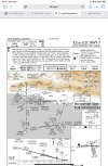
We just had a new RNAV(GPS) approach published for our airport. We put in the request with the FAA about 8 years ago, had to go through a justification process, and finally got it. The FAA funded the flight check and published the approach all on their dime. The only hiccup is there is no record of our runway edge lighting ever being officially flight checked and commissioned, so the new approach is NA at night until we can setup the reimbursement agreement and funding for that flight check. Yes the airport is having to pay @RussR to fly his King Air here and fly down the runway to make sure the runway lights are properly functioning.
Soooo....how much?
 
Hey @RussR what aircraft do you all use to flight check copter approaches?
Depends. I've flown a couple in the King Air. Not all copter approaches require copter "abilities" to fly, especially since of course we're flying them in VMC and not needing to actually land.

However, most copter approaches are private approaches developed by a third party. In many of these cases, we have a helicopter pilot on staff who travels to the location (say, a hospital) and flies in one of the proponent's helicopters with their helicopter pilot and conducts the inspection that way.
Yeah I think we use Hughes for our approaches and fly them around for the FC. I was just curious about DOD / FAA ones.
 
Russ, this question is a combo question including your past as a TERPSTER. I came back from the beach last Friday to KUZA. The winds favored runway 20 by 5 Kts, but it was below circling minimums to use RWY 2, CTL 20. I requested the RNAV 20, knowing it was highly unlikely going to be available due to conflict with KCLT traffic. Charlotte TRACON only offered the approaches from the south as being available, so I chose the RNAV 2 with LPV minimums. The 5 Kt tail wind was still within my comfort range, but it would have been nicer if I could have flown the RNAV 20. I think I have gotten it maybe once in the last 20+ years. I doubt it is of any practical use and wonder why it hasn't been cancelled. My question is if there are any adjustments that could be made to make this procedure usable, for example not aligning either the IF leg or FAC with the runway, even if it results in a higher DA/MDA. If I understand the TERPS correctly, there can be a maximum 3 degree angle for alignment with the runway CTL and a maximum of 15 degree turn angle between the IF leg to the FAC at the PFAF. The flight test question, do you have to make special arrangements to flight test the RNAV 20 procedure?
 
Russ, this question is a combo question including your past as a TERPSTER. I came back from the beach last Friday to KUZA. The winds favored runway 20 by 5 Kts, but it was below circling minimums to use RWY 2, CTL 20. I requested the RNAV 20, knowing it was highly unlikely going to be available due to conflict with KCLT traffic. Charlotte TRACON only offered the approaches from the south as being available, so I chose the RNAV 2 with LPV minimums. The 5 Kt tail wind was still within my comfort range, but it would have been nicer if I could have flown the RNAV 20. I think I have gotten it maybe once in the last 20+ years. I doubt it is of any practical use and wonder why it hasn't been cancelled. My question is if there are any adjustments that could be made to make this procedure usable, for example not aligning either the IF leg or FAC with the runway, even if it results in a higher DA/MDA. If I understand the TERPS correctly, there can be a maximum 3 degree angle for alignment with the runway CTL and a maximum of 15 degree turn angle between the IF leg to the FAC at the PFAF. The flight test question, do you have to make special arrangements to flight test the RNAV 20 procedure?
Easy answer first - I wouldn't anticipate any special arrangements with ATC to flight check it. They know we are coming, we show up on their daily briefing and schedule, and they work us in. Nothing real out of the norm compared to other things we do at a major airport, and they know the quicker they get us in, the quicker we're done and out of their way.

As far as why it still exists, the simple answer I imagine (not having any direct knowledge of this procedure) is that nobody has requested it to be canceled. There is no automated analysis of how many times a procedure is flown that goes into determining which procedures to cancel. I imagine that nobody at ATC is particularly keyed-up to request it be canceled, because if they don't normally want anybody to fly it, they just don't issue it - problem "solved" from a day-to-day basis. In other words, the existence of the RNAV (GPS) RWY 20 has no effect on ATC if they don't issue it.

You are right about the 3 degree offset that's allowed for LPV - with a minimum HAT of 250, but that's already the HAT on this procedure, so no impact there. The 15 degree course change at the PFAF is what was historically allowed, now the 8260.58x has the provision for a "capture fix" which changes this math some. However, I left TERPS before they were implementing that so I haven't ever worked through that math. Also, it is my understanding that the implementation of the capture fix has been problematic in certain scenarios, so it has been delayed. But my understanding on that could be completely wrong or dated, as that's well out of my part of the organization.

Whether such adjustments would be sufficient or not, hard to say without getting ATC involved. I will say KRVS has an almost-identical situation with the RNAV (GPS) RWY 19R and the proximity of KTUL, the problem there was solved with a straight-in final but a 20 deg offset intermediate (the bane of many instrument checkrides I'm sure). Because of that offset it is limited to LP and LNAV minimums only. But that could be an option for UZA.

As with any approach procedure changes, nothing gets going until a proponent makes a request. So either nobody has formally requested such a change at UZA, or they have but for various reasons it was denied. I have no actual information on UZA - maybe the airport manager would be a good point of contact.

 
What is FLC83 doing so far off shore and so low? (Its 1850 Eastern time on 8/11/25)

I don't have access to the schedule right now, but if I had to guess, it would be a shipboard TACAN inspection. Which is something we do, but I've never done (being based in OK kind of limits that kind of work).
 
I don't have access to the schedule right now, but if I had to guess, it would be a shipboard TACAN inspection. Which is something we do, but I've never done (being based in OK kind of limits that kind of work).

That would make sense, they were off shore near the Bath Iron Works.

Thanks.
 
I don't have access to the schedule right now, but if I had to guess, it would be a shipboard TACAN inspection. Which is something we do, but I've never done (being based in OK kind of limits that kind of work).
Does the boat have to be still to do that?
 
What about flyability. How often does everything meet criteria, but you won’t authorize something because it just don’t look good?
 
What about flyability. How often does everything meet criteria, but you won’t authorize something because it just don’t look good?

Yes, this happens and is one of the things we are specifically checking.

I remember years ago when I was designing the procedures, working on the VOR into OGD (now it's the VOR-A, but it was the VOR RWY 7 when I was working on it). I came up with a design that worked, but was right on the edge of all the criteria. The hold-in-lieu was at the VOR (the FAF), offset 30 degrees to final. So it had a 30-degree left turn at the FAF, then a 3.x nm final, then another 30-deg left turn to line up with the runway. The design was intended to fit a holding pattern in at the VOR and not require DME.

It met all criteria.

Flight check flew it and said "whoa, that's impossible to actually fly, redesign it". And I have no doubt they were right. So I did, but the only to redesign it was to require DME, essentially how it is now. This was a little bigger deal back then than it is now, but there was no way around it.
 
OK here is my stump everybody question.
Mitchell Stadium at West Point sits at 375 feet above the Hudson River.
A stadium TFR is from ground level to 3000 ft AGL (3375 ft in this case) and 3nm diameter.
In the case of Mitchell Stadium it puts the edge of the airspace a mile out into the Hudson River at 375 ft above the river.
Question:
Can you legally fly under the TFR? No opinions, prove it show chapter and verse.
To dream the impossible dream
To fight the unbeatable foe
To quote the unreadable FAR
This is my quest…………
 
Our most typical pass/fail would be something like an ILS. For both the Localizer and Glideslope, we are measuring various parameters - signal strength, modulation, course width, symmetry, signal "structure", etc. Each of these has tolerances the signal has to meet. If it doesn't, a technician on the ground (there during our inspections) makes an adjustment and we re-fly it as necessary until it's back in tolerance.

This is reasonably common on an ILS, for signals to drift as components age and such. They adjust it and now it passes.

Very occasionally, they can't fix it on the spot, and need more engineering study or parts or something. In that case the system is NOTAMed OTS and we come back later once they have (hopefully) fixed it.

The “technician” mentioned, how many of them are there? I saw a bunch of blue trucks at my airport one day, years later saw a bunch of them at my hotel. They acted hush hush, would not acknowledge what they did. US govt plates.
 
A stadium TFR is from ground level to 3000 ft AGL (3375 ft in this case) and 3nm diameter.
I like the premise of the idea... a fun thought exercise to explore loop-holes

but practically speaking, I think you're reaching to suggest that the floor of the TFR is limited to the height of the center point.

An airport's controlled airspace isn't limited down to say for example the published field elevation. It's down to the surface, right?...and not just the surface within the fence boundary, or some other arbitrary point until you get all the way out to the lateral boundary
Because unless the published airport elevation is the bottom of the pothole that's at the field's lowest point, then there is uncontrolled airspace under the airport's area. That doesn't make any practical sense to me.
I see the floor as undulating to the surface contours within the specified radius
 
To dream the impossible dream
To fight the unbeatable foe
To quote the unreadable FAR
This is my quest…………
I fly under the TFR "airspace" regularly.
When I'm out over the river in the J-3 I'm rarely higher than 25' above the water.
 
The TFR states that is from 3000 ft agl to the surface within that area. The stadium is only used to define the center point of the radius. I think you would have a better argument that you could fly at 2800’ over the river and not be violating the TFR. Personally, I wouldn’t mess with either.
 
I fly under the TFR "airspace" regularly.
When I'm out over the river in the J-3 I'm rarely higher than 25' above the water.
Confession may be good for the soul, but here may not be a good place to do it. Some swimmer or boater may take exception to your 25 foot sightseeing. TFR got nothing to do with it
 
The “technician” mentioned, how many of them are there? I saw a bunch of blue trucks at my airport one day, years later saw a bunch of them at my hotel. They acted hush hush, would not acknowledge what they did. US govt plates.

How many ground techs? I really have no idea. Busier metro areas will have dedicated techs for their airports, while in other areas the techs will handle multiple airports.

When we're working with them, there may be just one on site, or there may be several, depends on the nature of the work I suppose. We typically only get to talk to them on the radio, since we don't often need to land and shut down there. Although sometimes it's also our fuel/lunch stop, and sometimes they'll come meet with us at the FBO, or go to lunch with us, which is always a great opportunity for us to pick each other's brains.

If the people you saw were these types of folks, I have no idea why they were being secretive.
 
Depends. I've flown a couple in the King Air. Not all copter approaches require copter "abilities" to fly, especially since of course we're flying them in VMC and not needing to actually land.

However, most copter approaches are private approaches developed by a third party. In many of these cases, we have a helicopter pilot on staff who travels to the location (say, a hospital) and flies in one of the proponent's helicopters with their helicopter pilot and conducts the inspection that way.
Does the FC pilot bring along any gadgets, or just use the avionics in the chopper to evaluate? It kinda seems like about all he could do is look out the window and say that looks close enough to me. Or do you have personnel on the ground/roof with gadgets?
 
Sorta-related question: Why is it so expensive for the FAA to maintain a VOR (that they're being shut down - MON, etc.), but (apparently not) DME ? [Asking this since there are a number of former VOR/DME sites now reverted to only DME.]
 
Some of the vacumn tubes are no longer available. Some get so far out they can't be recalibrated. They take up a lot of space and require a lot of maintenance. They have standby generators that require lots of maintenance.
 
Does the FC pilot bring along any gadgets, or just use the avionics in the chopper to evaluate? It kinda seems like about all he could do is look out the window and say that looks close enough to me. Or do you have personnel on the ground/roof with gadgets?

I honestly don't know. Helicopter flight inspection is a niche field within a niche field. I'll try to ask him (yes, there's pretty much just one guy who does them in our office) and see what he says.
 
Sorta-related question: Why is it so expensive for the FAA to maintain a VOR (that they're being shut down - MON, etc.), but (apparently not) DME ? [Asking this since there are a number of former VOR/DME sites now reverted to only DME.]

I'm not an expert on the maintenance of such a facility. But a VOR is a whole structure, with multiple antennas, antenna cables, wires, just a bunch of "hardware" stuff. Which ages and goes out of tune and adjustment and gets eaten by rats and all that. Whereas, physical component-wise, a DME is (I think) much simpler. Just a transmitter, receiver, some processing, and antenna.
 
So, on August 7th, got a new approach at SSF; the RNAV 28. There is also a NOTAM that RNAV 28 is NA at night. There is also the ‘legacy’ RNAV 32. The RNAV 32 is available at night, to include circling, except to RWY 10 which is NA at night.
28de6675c96a0e34d23bffd3dff88bcb.jpg


Any reason a brand new approach would near instantly be NA’d at night?

Same thing happened here, still working on resolution.

The issue here is the Runway Edge lighting was never officially flight checked and commissioned. All existing approaches are grandfathered and not affected, but a new approach must now have the lights commissioned. So our new GPS approach is NA at Night until we can work through the agreement between the airport authority and flight check to pay for the flight check.

I will say it is slightly silly, given Flight Check flies the approach on their dime, but looking at the runway lights is on the airport's dime. It would also seem a little cheaper and easier to check the runway lights from the ground versus paying flight time on a King Air, but that's the FAA for you.
 
So, on August 7th, got a new approach at SSF; the RNAV 28. There is also a NOTAM that RNAV 28 is NA at night. There is also the ‘legacy’ RNAV 32. The RNAV 32 is available at night, to include circling, except to RWY 10 which is NA at night.
28de6675c96a0e34d23bffd3dff88bcb.jpg


Any reason a brand new approach would near instantly be NA’d at night?

There are a few reasons it could be, but I suspect it's probably the same or a similar reason as @midwestpa24 mentions. IIRC, this is the first time this runway has had an instrument approach, correct? In that case it needs a night evaluation. A night eval isn't just making sure all the lights work, it's about making sure the lights are easily visible against other nearby lighting, there is no potential confusion with streetlights, parking lots, etc., no visual illusions that could be a concern, that kind of thing.

One example is KCOS runway 17L. There have been pilot complaints that a traffic signal interferes visually with the approach lights. If you look at the aerial imagery, you can see that there is indeed a traffic signal almost perfectly in line with the RAILs, right at the beginning of them. Is this a problem? No idea, but pilots have asserted that it is. So one of our crews will take a look, at night. It was actually on my itinerary for last week, but we couldn't get it done (due mostly to the timing of other work, duty day limitations, and it doesn't get dark until real late (or early) this time of year).

I remember reading about a Cessna 340 accident years ago (and there are other examples) where the pilot was on approach in low vis, saw the approach lights and descended for landing, except they weren't the approach lights, it was a Walmart parking lot or something like that.

The purpose of the night eval is to try to identify issues like that.
 
There are a few reasons it could be, but I suspect it's probably the same or a similar reason as @midwestpa24 mentions. IIRC, this is the first time this runway has had an instrument approach, correct? In that case it needs a night evaluation. ….

Thanks, yes, it’s the first IAP for this runway. 10 will never get an approach due to SKF proximity and I doubt 14 (primary) will, either due to SAT.

At least with the existing RNAV 32 we can land straight in or CTL at night to 14 and 28, which is the least used runway. I’ve used it for takeoff or landing less than five times in the last five years.

SSF is dang hard to see at night, if 14 is active most folks point to the VOR and turn north just to get eyes on the airfield.
 
Sorta-related question: Why is it so expensive for the FAA to maintain a VOR (that they're being shut down - MON, etc.), but (apparently not) DME ? [Asking this since there are a number of former VOR/DME sites now reverted to only DME.]
Were they VOR/DME, or were they VORTAC?

If they were VORTAC, I would assume that the reason there's still DME is that the VOR got shut down, but the TACAN didn't, thus we can still use the DME component of the TACAN.
 
Posted about landing at 30 degrees to the centerline to be into a gusting to 60 wind. I had to add power at the center line to keep moving.

Could I have asked for a clearance to land on a taxiway that was into the wind, and expected permission?

Late at night, I was the only plane on the tower frequency, and flying a Cessna 172.
I don't think ATC can give you a normal clearance for that, but I expect what you would have been able to get is "cleared to land at your own risk on taxiway X" once they ensured there were no aircraft or vehicles there.
 
More of a TERPS question than Flight Check, but. Is publishing True Course on Charts going to be a new thing?

1756732639583.png
 
Back
Top