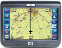
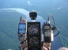
Anywhere Map & ipaq

Let'sgoflying!

Touchdown! Greaser!
Joined
Feb 23, 2005
Messages
21,872
Location
west Texas
Display Name
Dave Taylor
Home Airfield
KMRF
I dug mine out and plan to trash out even tho it starts and responds fine.
I can’t figure out why the AM app is missing; just curious.
It was a good program, got me into Canada & Mexico, around a lot of the US.
 
I dug mine out and plan to trash out even tho it starts and responds fine.
I can’t figure out why the AM app is missing; just curious.
It was a good program, got me into Canada & Mexico, around a lot of the US.
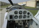
That combo (lower left panel) was my introduction to GA moving maps. I loved the software but wasn't crazy about the iPAQ. We've come a loooooong way. :)

old panel.jpg

(as I look at this picture I realize almost nothing in the pic is still in the airplane with the exception of the firewall, cheeks, and some (but not all) of the structure...oh, and the mechanical accelerometer :cool: )

Nauga,
no longer steaming
 
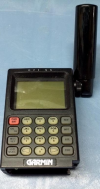
So I bought an ATC (Anywhere Map Travel Companion) at Osh in 2008. I still have it but no idea if it will turn on or not. FWIW I also have a my first GPS (non-moving map) which is a Garmin 55AVD that I bought circa 1991.
1769523863889.png
1769536031652.png
 
Last edited:
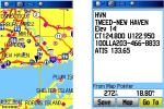
In 2008 I was using a Garmin 60CSx which was mainly aimed at the hiking/hunting market (though it did have glide slope information for the hang gliding crowd). After a lot of work getting it to display sectional charts I realized the screen was way too small for them to be legible so I created a simpler airport database for it. Used it for a few years until Avare on a phone supplanted it.

1769531521542.png

Of course my navigation needs were simple back then...

1769531568927.jpeg
 
A friend of mine had one. Used it on a mountain flight with me in 2003. Really nice. for it's time.

I don't know how long he kept it, but he was the first person I knew who used Foreflight on an iPad. That was about a year before me, so it was the first year it existed. Whether he was using the iPhone version even earlier, I don't know, but my guess would be he was.

Me, my first foray was CoPilot for the Palm Pilot, then an AirMap 100.
 
I wish I had kept my first GPS from 1997 - the Magellan GPS 2000. It was sold as a hunting/hiking GPS. The lat/lon waypoints had to be typed into it manually, and I think it had room for a dozen waypoints. I remember putting in the coordinates, and being fascinated by how it pointed me to the airports I was flying to. How times have changed!
 
Doesn't @EdFred have a similar device that is considered halal under the Butlerian jihad? :biggrin:
 
The iPAQ, that was a trip down memory lane. How many of you dorks wore it in a hip holster?
I finally tossed mine and all the accessories a handful of years ago. Some still going for $100+ accessories on eBay.
 
To answer your question why the AWM is lost, ipaq memory was volatile and required battery backup or it was lost.

AWM pro on the Windows tablet had an emergency mode which painted an arched line in front of the aircraft based on forward speed, rate of descent and terrain elevation in the area. It was magical. I could cut power at 10 miles out and 10k agl and as long as I keep the arc on a runway I could nail the threshold every time. It was a tremendous safety aid for me.
 
I wish I had kept my first GPS from 1997 - the Magellan GPS 2000. It was sold as a hunting/hiking GPS.
I had one of those. Used it a lot for hiking and hunting. I may even still have it somewhere, though I'm pretty sure it doesn't work any more.
 
Oh wow, that's a blast from the past. I had one on an HP handheld around 2004. The only part of it that I still have remaining is the bag it all came in. That was my first moving map experience, with XM weather, too! I think the app came on a CDROM if you still have it.
 
I had one. I think it’s still in my aviation junk box. It was pretty good back when they first came out
 
Back
Top