In Foreflight, go direct to an airport (or enter a flight plan, or whatever). Now, go pull up approach charts for your destination airport. Many ways to do it, but all of them take at least several taps, as you have to tell Foreflight which airport you want to bring up approach charts for.
I never go to the Plates tab anymore. Just keep the route (or drop it down with the FPL button) up on top, tap the airport, and Show Plate. It also works for taxi at the beginning of the flight plan to overlay the taxi diagram if you like that overlaid...
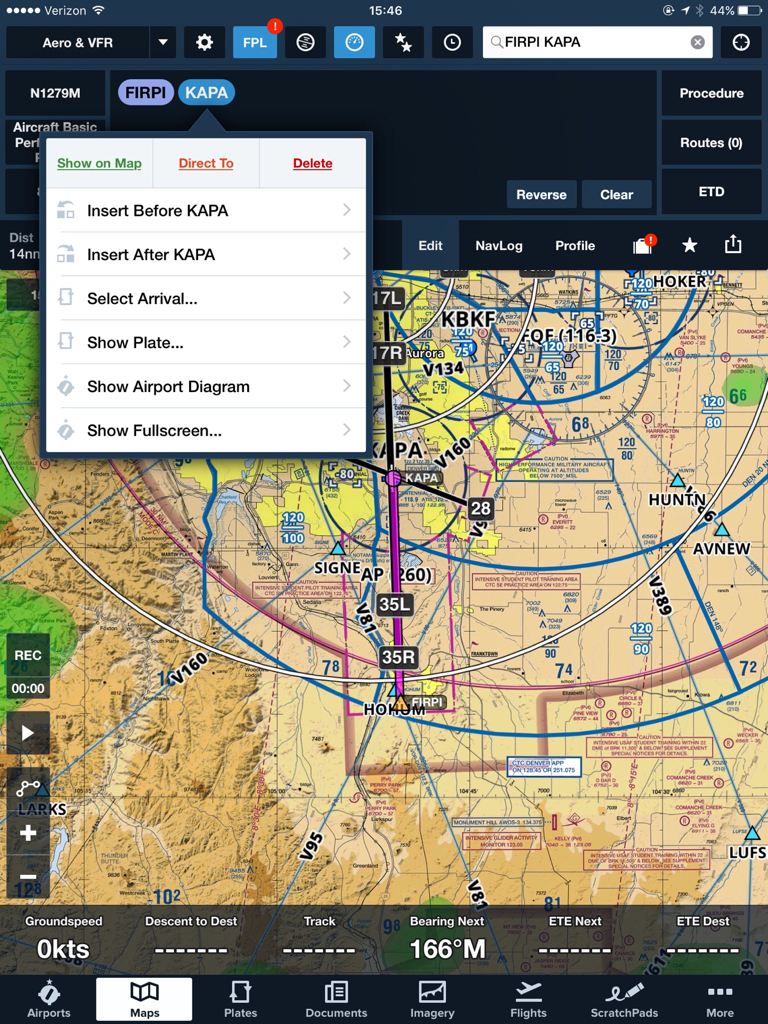
If you're a fan of "Direct To" to an airport, it works with that also, since your flight plan will be wiped and you'll have two waypoints, a lat/long waypoint where you hit Direct To, and the airport. Just tap the airport bubble in the flight plan, and Show Plate... done.
To go "Direct To" an airport and overlay the plate on whatever chart you're looking at is five fairly obvious taps if you go this route, and no page switching -- which really slows Foreflight down badly on older devices.
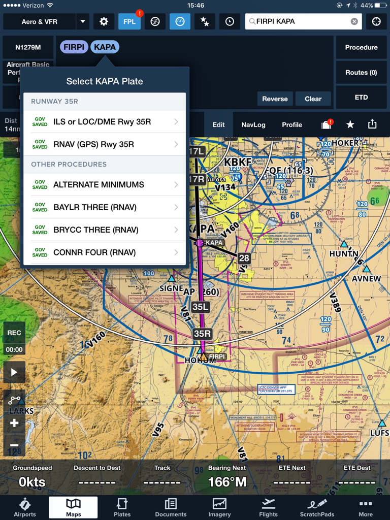
Airport tap, Direct To. [If Flight Plan not visible, tap FPL.] Tap Airport identifier/waypoint bubble in flight plan, Show Plate, pick the plate.
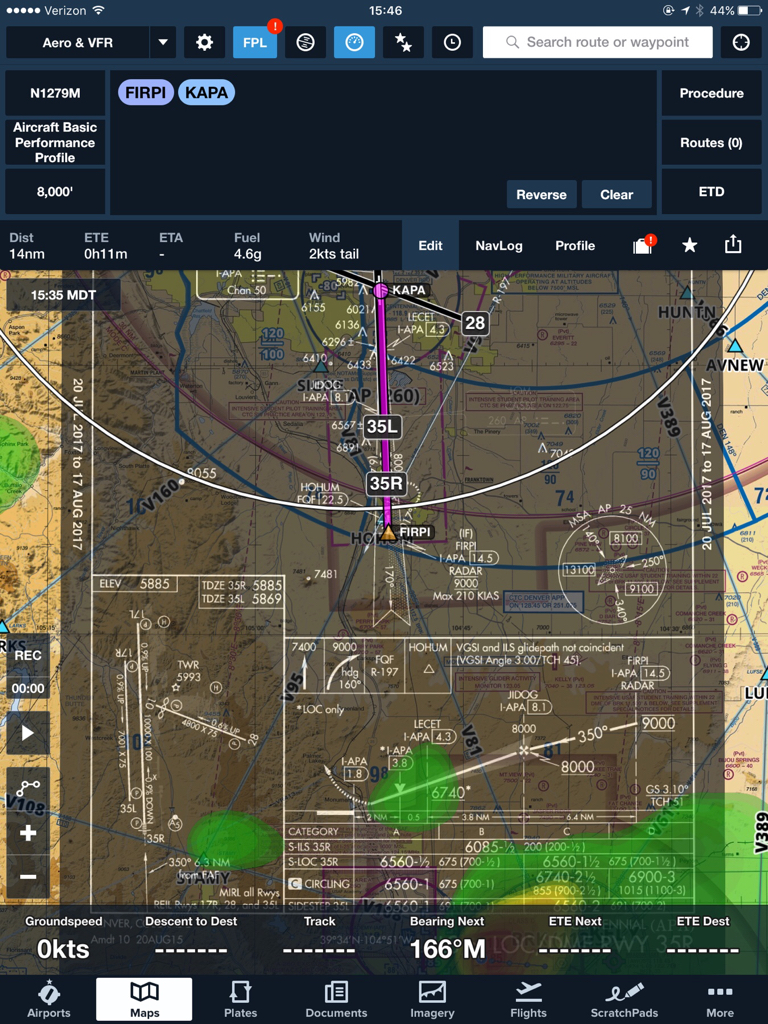
Once you have anything overlaid, seeing it as just a plate is easy, too... tap somewhere on the plate, and the top buttons are "Hide Plate" and "View Fullscreen"... as well as that menu lets you make a fast change of plate if the controller changes approach plans on you.
This UI variant was added in August 2013, but I still see old-timers using the Plates button... or having local plates for specific airports in folders in there, which was the fastest way to it prior to four years ago. Old habits die hard. The eyeballs get drawn to the Plates button in the UI, but it's mostly there for backward brain compatibility from the old days without overlaid plates.
Side-note: I like "Invert Plate Colors" for overlaid plates over charts, makes it easier to read for me, and I allow a little more of the underlying chart to show through with the opacity slider. Looks way better to me than a black on white plate slapped over a color chart. The reverse looks more like an opaque "HUD" like display to me.
The other cool thing you can do from there if you're planning a SID or STAR, is tap the overlaid plate and scroll to the SID or STAR. Since those aren't georeferenced at all, it'll take you straight to the Plates page with the SID or STAR loaded on it. Now you can review the SID or STAR there, and toggle between that and the map/overlaid plate, just by going back and forth between Maps and Plates.
And of course, talking about STARs... many people don't realize that even though the STARs aren't georeferenced, the ones that can be done with simple waypoints ARE coded in such a way that the same oval Airport press menu also has "Select Arrival" in it... you select the arrival and transition and foreflight will insert the transition waypoint and further waypoints into the FPL giving you the magic magenta line for those... but watch out on them... many arrivals aren't "plotable" that way, so always check the actual STAR before relying on what got inserted.
")