cowman
Final Approach
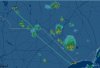
Been seeing lots of mostly VFR days in an area I'm trying to fly into where there are isolate/scattered storms around. Could have made the flight probably 2 or 3 times already if I was a little more willing to head out and be ready to land early or go around the cells if need be.
How do you develop personal minimums go/no go decisions for this? Say you're making a ~300mi flight that's expected to take just over 2.5hrs. Skies are clear all the way to the destination now but there are a bunch of scattered cells on the radar about 40-60mi away from your destination point and moving in that general direction. Would you go and just have a safe alternate airport in mind if you can't make it to the intended point?
I was in a situation like that a couple weeks ago and ultimately canceled... the larger deciding factor was a bunch of pireps along the route showing turbulence and I didn't really need to go that day anyway. I have a stratus so I'd have radar info plus with the clear skies I thought I'd be able to see anything and turn away before it became a problem but I've never flown in those conditions before. Seemed like a safe enough plan, like I said the thought of being bounced around roughly for nearly 3 hours was probably the bigger decision factor.
But what about weather that isn't so clear? What if I've got say scattered 10,000 most of the way in then in the last >100mi or so it's scattered or broken 3000... or even 2000. Would I be able to see the storm and avoid it? Am I walking right into something that will the next accident case study? Or am I being overly cautious?
Not having any first hand experience with this, but not wanting to be grounded when scattered t-storms are in the forecast almost every day for weeks as they have been.... how do I make these decisions with a healthy safety margin?


 ).
).