The Grand Adventure

flyingcheesehead

Touchdown! Greaser!
Joined
Feb 23, 2005
Messages
24,256
Location
UQACY, WI
Display Name

Display name:
iMooniac
The Grand Adventure, Day 1.

Ahem... Well... I suppose I should start with The Grand Adventure, "Day Zero." I was originally going to leave on Tuesday, Aug. 12th and get to maybe Mitchell, SD as I'd originally planned to get to West Yellowstone (MT) by the 13th.

Well, best laid plans of mice and men and all that... I spent a good chunk of the day running around doing last-minute stuff, and when I finally got to the airport and loaded the plane, my preflight discovered a pair of issues: One, the GPS database was out of date by two cycles :mad:, and the ELT antenna (which I'd squawked a week earlier) was broken. So, I called the MX officer and vented, and he promised to update the database first thing Wednesday morning and get Avionics to put a new antenna on. I grabbed my flight bag and went back home and began adjusting my plans.

And now... On to The Grand Adventure, Day 1.

Well, I started with another false start. I'd left the plane loaded Tuesday night, and after I got the call that the plane was ready, I headed out to the airport. As I was about to punch my code into the lock, I realized that I'd been carrying a lot more than just my laptop when I left last night... Remember how I took my flight bag home to adjust my plans? Yeah... Left it there. Doh! So I turned around and drove back home for it.

Three-quarters of the way home, I realized that I should have just hopped in the plane and flown to C29, thus turning the hour-long round trip driving into ten minutes of driving and six minutes of flying. Doh! again!

Finally, I made it back to the airport with all of my stuff, got situated, and fired up the engine at 2:47 PM. I'd originally filed for a 1:30 PM departure, so at least my flight plan was still in the system.

I was a little shocked at my clearance. My first stop, Blaine (KANE) is on the north side of the Twin Cities, and coming from the southeast I expected to get a STAR, or something added to what I filed (Direct). But, it went like this:

"Madison Clearance, Skylane 271G, IFR to Blaine."
"Skylane 271G, cleared to the Anoka-Blaine airport as filed, climb and maintain 5,000, expect 6,000 ten minutes after departure, squawk six two seven zero."

Well, OK... Works for me! I read it back, taxied to the north end of the ramp, did my runup, called for taxi clearance, taxied to 21, double-checked all the checklists, and it was go time.

"Madison Tower, Skylane 271G short of 21 ready for departure."
"Skylane 71G, hold short, traffic on a mile and a half final is a Cherokee."

Sheesh... I can get out before a Cherokee gets a mile and a half... But I'm in no rush. Turns out it was the Archer belonging to another club we're hoping to merge with soon.

The voice on the radio changed - Previously one of the veteran male controllers, now one of the veteran female controllers (I'm pretty sure there's two of 'em anyway!)

"Skylane 271G, climb and maintain 3,000, fly heading 270, Runway 21, Cleared for takeoff."
"Climb three thousand, Two seven zero, cleared for takeoff runway 21, 271G."
"Tower, Eagle Flight 688, ready to go, 18."
"Eagle Flight 688, Hold short for about one minute, traffic departing 21."

I normally fly runway heading to 400 AGL as that's standard IFR procedure and that's a habit I want to keep. However, weather at the airport was VMC and my favorite bird happily jumped off the runway with an excellent rate of climb, so when I hit 200 AGL and looked westward and saw that an early turn would not only put me in line with a large grassy field should the engine quit, it'd also keep me pretty close to the north shore of Lake Mendota, I went ahead and made the turn. That also meant that I crossed over runway 18 pretty quickly.

"Eagle Flight 688, runway 18, cleared for takeoff."
"Cleared for takeoff, Eagle Flight 188."
"Skylane 71G, thanks for the early turn, contact departure, have a good day."
"Contact departure, 71G, g'day."

Departure cleared me to turn on course and subsequently cleared me to 6,000, I punched through a cloud, and climbed into the cool, clear air above. Finally, after all the planning, all of the second-guessing over whether I should take this trip with no current source of income, the false starts, I was back at my second home in the sky!

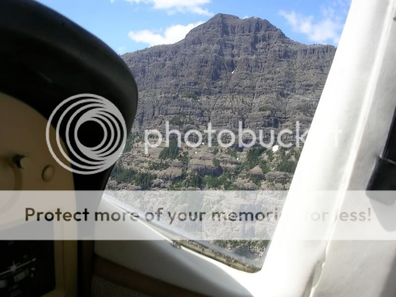
I was handed off to Volk Approach. My route paralleled the edge of the Volk South and Falls 1 MOA's, and the only thing hot today was R-6901A. The frequency was relatively quiet, and I spent a lot of time enjoying the view - I was above some scattered cumulus clouds, and the vast expanse of green fields and trees with all the white puffy clouds above was beautiful - I'm sure I'm in for a lot more of nature's beauty on this trip, but for now the lush green-ness of my home state is still exciting.

Eventually, I was handed off to Minneapolis Center. I heard another club member in one of our Archers who was en route from KONA to KISP. I heard another plane call in 8 miles north of KLSE, which was not too far from my position, but I never saw him (I think there was a cloud in between us).

There was some weather up near the Minneapolis area. I was watching it on the 496, and I began seeing it out the window as well. At one point the controller asked if I had on-board weather. I told him I had datalink and that I was watching the storms out the window as well. There was a small cell south of KLUM that was just north of my route, and then a big mass of thunderstorms off to the west. The controller said that several planes had deviated north of the first cell, but I elected to stay on course which put me south of it. As it turned out, I went south of the first cell and north of the big mass and stayed on my direct course the entire time. In fact, the north end of the mass looked a lot better out the window than it did on the NEXRAD.

I loaded the ILS 27 into KANE just in case. It paid off too, but not in the usual way - After being handed off to Minneapolis Approach, the controller cleared me direct to BOKYA, the FAF on that approach. Having the approach already loaded saved me from having to ask what the spelling of the fix was, and from having to twist a bunch of knobs to put it in the GPS - Push, twist, push, push, and Otto turned about 3 degrees right. Prior to reaching the final approach course, I called field in sight and was cleared for the visual to 27, contact tower, g'day.

I was on my game today - It seems that when the start of a trip is bad for me, the rest of it turns out really well! I contacted tower and was cleared to land a couple minutes later. I zoomed down the final approach course. I didn't keep it fast as close in as possible, just did a more leisurely slow-down and ended up with a great landing.

The folks at Cirrus Flight Operations, the FBO I went to, were excellent. I was feeling kind of hungry when I got there, and Ashley at the front desk said that Jimmy John's could deliver in less than 10 minutes (I was trying to minimize ground time today). There was apparently a new person working at JJ's, and she said they wouldn't deliver to the airport. Ashley ended up calling them back three times, and finally the delivery driver (who had been to Cirrus before) fixed the mix-up. Helpful, friendly, and very reasonable fuel prices - $4.79, and this in a major metro area (under class B). I know where to go next time I'm up there.

It rained for a bit while I was on the ground at KANE, and I left after it stopped. I left behind a nice airplane-shaped dry spot on the ramp:
657.jpg


With the late start, my originally-planned fuel stop was going to be closed by the time I got there. So, I looked at airnav for a bit, and chose 14Y as my next stop. It was listed as self-serve, but when I got there, the pump was locked and there was no credit card reader and nobody around. I called the number listed inside for the manager, and got a pleasant surprise from small-town America - Inside the unlocked terminal building (which has bathrooms, couch, TV, and a really odd soda machine), there's a key hidden that opens a door behind which lies another key with a clipboard. Write your name, tail number, address, number of gallons you pumped and the price and they'll send you a bill. Cool!

Well, once I was tanked up again, I figured that since I was much farther north than I'd originally planned, I would go ahead and make a landing in North Dakota just because. In fact, I found TWO airports near the southeast corner of ND that hadn't been claimed for the ConUS challenge, so I drew a quick line on the chart and off I went.

Yes, that's right. A line on the chart. Yeah, so I have a 430W, a two-axis autopilot, and a 496 sitting on the yoke... But that's no excuse to not exercise the grand old skill of pilotage now and then. I left the gadgets out this time. Oh, they were on just in case of an emergency (NRST is a wonderful thing, even when you are looking at the chart) but the 430 was zoomed way in so the screen was just black, the 496 was on the terrain page and zoomed way in, and the autopilot was off.

Okay, I should be over the end of this little peninsula in this lake, and the edge of that lake, and I can see these lakes lining up nicely, now here's the road I want to follow for a bit, here's the tracks that I'll parallel to the airport. Whee! I spotted the field quite a ways out and landed on runway 33 at KBWP, Wahpeton, ND. And I hope "Wahpeton" is pronounced just like the computer voice on the AWOS says it. :yes:

Wahpeton has a small terminal building with a locked door on it and a 1-5 combo lock. It won't take pilots too many tries to figure out the combo. :D Inside there's a couch, flight planning room, soda machine, and bathrooms. Pretty standard.

What wasn't standard was the Air Tractor that landed not long after me. (Traffic Pattern Altitude: Heavy aircraft 1500', Light aircraft 1000', crop dusters 100'. :D) There's an ag operation based at KBWP, and they have an interesting setup - Their hangars have doors on both sides, so they taxi in the back door, leave the engine running, refill, taxi out the front door and head back out to the field. I followed the yellow Air Tractor out, and a blue-winged one landed right afterwards. I followed the yellow one to his field, and from a couple thousand feet up and a couple miles away, videotaped him doing a couple of passes down the field. Cool. :yes:

Crop duster hangar:
658.jpg


Next, I headed toward Lidgerwood, 4N4. This is a grass field with nothing present - Just a grass strip with a grass "ramp" off to one side on one end of it, with a gravel road along the edge of the ramp and perpendicular to the runway. It must be a duster strip, it'd be perfect for them but not much use to the rest of us. I did a low pass and made the decision not to land - Major ruts, bumps, and standing water in several areas. Not safe to land. :( I had already programmed 6V4, my next planned stop, into the 430.

However, with the late start, I was not going to be able to make it to WYS as I'd originally hoped tonight, and so I had no hotel room reserved. The sun was setting and I had about 240nm to go, and I don't know how big of a town Wall, SD really is. I started looking for larger towns along the route. I saw the beacon for Britton, SD nearby, but I noticed that Aberdeen was right along the route a bit further up. Kate stayed in Aberdeen on her Ercoupe adventure and she had offered to tell me info about lodging and transportation if I ended up there, so it was pretty much a no-brainer.

Two things added to the adventure after I was on the ground. The first was a Columbia 400 that came in shortly after me. He landed on runway 17, then taxied up near the ramp. Then, he took a right onto runway 13, calling it 12 on the radio. He taxied most of the way down the runway, (despite the parallel taxiway), then turned around and once again taxied back to where the runways meet. He got on a taxiway once again, and finally found the GA ramp (I'd found it by following the yellow "GA RAMP" sign near where the runways meet, figuring that I wasn't supposed to go to the building with the jetways...). Just after he finally parked, an SUV drove onto the ramp and over to his airplane. It was someone from Aberdeen Flying Service who had gotten a call from Minneapolis Center wondering what happened to the Columbia. There had also been a Mesaba Saab 340 holding somewhere waiting for him to cancel IFR the entire time! (I heard them a while earlier asking if the Columbia could hear them.) As it turns out, the pilot has only had the Columbia for a week, moving up from an A36 Bonanza.

Both of us were looking for a hotel, and the FBO guy dropped us off at the Ramada Inn. After we'd grabbed all of our bags and such, we went inside, only to find that the Ramada was completely booked! Who knew Aberdeen was such a hoppin' place? As it turns out, the county fair is in town. They knew of another place that had a room available, and took us over there with a stop at the Taco Bell drive-through along the way.

Here's the second extra adventure on the ground: The Innkeeper Motel.
659.jpg


It's, well, very old. I had a good laugh when I got into my bathroom, though... One of the towels says "Hampton Inn and Suites" on it! :rofl: But, it has a bed, air conditioning, and wireless internet so I can live with it. :yes:
660.jpg


Stats so far:
484 nautical miles
5.3 hours
5 airports touched (KMSN, KANE, 14Y, KBWP, KABR)
6 ATC facilities talked to (KMSNx2, ZAU, ZMP, KMSP, KANE)
3 airports claimed for the ConUS Challenge (KANE, 14Y, KBWP)
39 gallons of Avgas

Tomorrow, the adventure continues. :)
 
Last edited:
Cool Writeup, Kent.... is anyone else (for people who know Kent) not suprised the he left late???

:D:D:D
 
Kent, you're making me wish I didn't have a job!

As jealous as it will make me (and probably the rest as well), please keep the updates coming.
 
Kent;

Wow your adventure really brings back memories of ferrying planes. Great write up and keep the story coming.

John J
 
What everybody else said. And no, I'm not surprised about his leaving late. Of course, I don't think I've left on a trip flight on time in my life!:no:
 
Kent when you stop for the night let me know if you figured out the OX? Just set the ball to your altitude and it takes over from there.

Dan
 
What, no picture of the really odd soda machine?

Excellent write-up, as usual, Kent.
 
Kent when you stop for the night let me know if you figured out the OX? Just set the ball to your altitude and it takes over from there.

Yup. Used it for the first time today, worked GREAT. Looking at my pulse ox, it seems like I'm at about 96 on the ground, goes down to 92 up at 6,000 or 6,500. Up at 10,500 today I was down to about 87. Put on the O2, and went right back to 96. :)
 
What, no picture of the really odd soda machine?

I really should have taken one. It was sitting on the floor and was maybe 3 feet high. You open the top, manually move the can you want to the end of its row and then along the edge, and then when you put your 50 cents in a little flap lifts up and lets you take it out. There are metal pieces that prevent you from removing it anywhere else.

It's kind of like a puzzle. :)
 
Sounds like fun Kent, I'm super jealous! Take me with you next time! :D
 
The Grand Adventure, Day 2

Well, after staying up super-late last night writing, planning, etc. I got a fairly late start today. Checked out of the motel at 11... Well, a bit after 11 because there was nobody behind the desk and ringing the buzzer and dialing 15 like it said to do for assistance on the sign didn't bring anyone.

Next, it was a ride in the Aberdeen Taxi which was a 1980's vintage station wagon with a 1930's vintage driver. Once at the airport, I decided to borrow the courtesy SUV and head to Wal-Mart for a bit of breakfast and to get some cash. I had the FBO top off the airplane, and I took advantage of their free ice to fill my cooler, and then I added two quarts of oil, and I got about the longest briefing in the history of the world (that's what I get for throwing an 11-airport flight at one of the new guys at FSS). And and and... I didn't get off the ground until 1:30.

It was a quick taxi to runway 35, and after a runup I pulled out and slowly fed the power in. The airplane seemed as eager to get out of the hot muggy air at the surface as I did, and we vaulted skyward and I made a turn to the southwest. Green fields still dominated, but it wasn't quite the same green seen in Wisconsin and Minnesota - It was a bit more muted, not quite as bright. These plants don't have the luxury of seemingly unlimited water.

Once again, I decided to practice pilotage skills. It's a lot more difficult when you get out where there aren't lakes all over the place! You really have to keep better track of your position on a consistent basis because otherwise all the roads and such blend together. But, there's nothing like the Missouri River to get you back on track... And is that... Yes, it looks like... Terrain!

685.jpg


Not long after, I was onto the Cheyenne sectional and out of the green area (Surface elevations above 2000). Wall, SD was fairly easy to pick out even from 20 miles away. I curved a bit left and followed the interstate to a straight-in for runway 30. I noted the position of Wall Drug relative to the airport, and it looked like a fairly easy walk. Winds were pretty strong out of the north, but my landing was OK anyway.

I liked Wall. By the time I got out of the airplane, an older gentleman came over and we chatted for a bit. He even lent me his motorcycle to get to Wall Drug. There was a nice Bonanza in his hangar.

Wall Drug is a trip. It seems like the whole town is built around it. The main drag where Wall Drug and every other shop in town is located has parking right down the middle of the street, and it's been that way at least since the 50's:

http://www.mytransponder.com/uploads_user/1000/212/686.jpg

Wall drug is like the entire business district of a small city in itself. There were two "streets" with fake storefronts INSIDE the main building, and not all of the various mini-stores were on one of these streets. It's a labyrinth of places selling boots, books, signs, crafts, food, and various trinkets. The food was actually quite good, probably better than you'll get within walking distance of any other airport in South Dakota. :yes: I also got my free ice water and my free "Where the heck is Wall Drug" bumper sticker as well as an old sign (had to buy SOMETHING ya know).

It began drizzling while I was at Wall Drug. I wiped the seat of the courtesy motorcycle off and headed back. Note to self: Make sure you're current in motorcycles next time. I was kind of glad the speed limit was only 20 MPH for the 7-block trip from the airport to the store! But, I was starting to get the hang of it again when I got back. I unchained the airplane and prepared to leave.

Oh yeah, that reminds me. Usually on these long cross countries, you learn something in the air. This time, I learned something on the ground. Prior to the previous night at KABR, I had never chained down an airplane - It's always been rope. So I can tie the knot, but the guy at Wall showed me a trick to using chains: The hook on the end is generally fairly weak and easy to come apart from things, so instead, after pulling the chain through the tiedown ring, you just feed a link of the chain through a link that's opposite the tiedown ring (this is kind of hard to describe, hope it makes sense!), and then feed a third link through that link, and add maybe a fourth and fifth as well. Then, the last link doesn't need to be very strong for it to hold.

So, I fired up the engine and took off. It seemed like I got to 6500 feet a lot quicker than normal - Well, I guess I did. I'm not used to starting from 2800! I headed towards Mount Rushmore, watching I-90 weave its way across the landscape and off to the north. I also discovered why they're called the Black Hills:

687.jpg


The picture doesn't really do the effect justice, but it seems like the trees are only on the hills and they're so much darker than the surrounding vegetation that they look black from a distance. Very shortly thereafter, I spotted Mount Rushmore, and made some turns to allow me to get good video and still shots.

688.jpg


Then, it was time to climb. Mount Rushmore is at 5725 feet and there's a 7242-foot peak in between it and Crazy Horse. So, I hopped over the top and headed back down to check out Crazy Horse. This is the one I'd never seen from the ground, and frankly it's rather disappointing. 60 years after starting, I don't even think they're half done. (I bet La Sagrada Familia gets done faster!) I think it actually would have been better without the big "chalk mark" where the horse's head will be:

689.jpg


Next, I headed to Upton, WY. Not straight, but in a big curve to avoid weather. At one point on the big weather avoidance curve, I hadn't seen a town or really any other sign of humanity in over 50nm, and then I saw them - The majestic beasts that had seemed so mythical to me in the past were right below me - A pack of wild horses. There seemed to be some sort of altercation going on between a pair of them, they were fighting with the rest standing around watching. They paused momentarily as I flew over and then resumed the fight. I circled around and descended to get a closer look, but I guess I spooked them a bit. They broke into full stride, not running away but almost paralleling my track. It looked just like you might imagine - Thundering hooves, manes blowing in the wind, nostrils flared. What a neat thing to see!

Upton's gravel runway was better than I expected, but there's really nothing there except a couple of really run-down hangars with no airplanes. :dunno: Oh well, the real mission was just to make a ConUS claim in Wyoming, 'cuz Barb did most of them already. :yes:

After departing Upton, I turned north. I was looking at my line on the sectional that led to Devils Tower and thinking that there weren't nearly enough distinguishing landmarks along the way, but it really didn't matter - I spotted Devil's Tower by the time I hit pattern altitude at Upton! I set up the plane for a wide circle at about 7300 feet (over 2000 AGL, ya know) and ran the video camera most of the way around. As a result, my only still is this one, which isn't the best quality and was taken a fair way out:

690.jpg


Next, I pointed toward the Crazy Woman VOR, which took me right past Gillette, WY. I called the tower to transition their airspace at 6500, and they told me to report clear (boy, what a busy day they were having :no:). At this point, there was quite a bit of rain up ahead, and I wasn't sure I'd be able to maintain VFR, so I decided to prepare for a pop-up IFR clearance if I needed one, with the 180 back to Gillette as the backup. As it turns out, I didn't need IFR for the rain, but it was a good thing I'd looked...

Looking at the sectional, the highest peak near my route across the Big Horn Mountains was 8230 MSL, so I decided I'd climb a few miles after crossing Crazy Woman. Well, I guess you just don't want to cross Crazy Woman - She'll throw a bunch of clouds in front of you!

Faced with a wall of clouds and some rocks I couldn't see, the IFR charts came back out. My route was almost right on top of V324, and the Worland VOR, the next one west of Crazy Woman, was the IAF for some of the approaches in to KGEY, my next destination. Unfortunately, all of this stuff is right along the corner of L-11, L-12, and L-13 so it was kind of a pain in the butt to piece it together.

Finally, I felt like I had my act together enough to call for a popup IFR clearance. I was already climbing, and was through 9,000 before I called Denver Center. I ended up having to do a 180 to stay VFR while the controller figured things out, but that was OK because the MEA on V324 there is 12,000 feet so I had to continue climbing anyway. About the time I made it back to Crazy Woman, I reached 12,000 feet and got my clearance. Even that high, radar coverage was pretty spotty, but they did finally find me.

About 10 miles west of Crazy Woman, Denver Center handed me off to Salt Lake City Center, and in the handoff she asked me to give the next controller a position report (see "spotty radar coverage").

This is where I started to second-guess myself - I called up ZLC right about the same time I hit IMC, and after adjusting my altimeter I felt a bit chilly. I checked the OAT - It was sitting at about 28F. Hmmm. Uh oh. Pitot heat on. I think I scanned the struts between every single instrument, but there wasn't even any moisture accumulating. Figuring this might be one of those "dry clouds" I elected to keep going and continue to keep a close eye on the wings. I saw nothing.

As is one of my standard practices when there might be ice, I left my landing light on (it's in the left wing). After a little while, I started seeing precip in the beam - Only the lightest shade of green was showing on the 496, with no cells or even yellow anywhere around - And it looked like snow. (side note: Does the NEXRAD on the 496 get dual-polarity radar so it can show snow/ice as well as rain? I only got it after winter was over.) But, the precip wasn't sticking at all. So far, so good.

Then, a minute later, I saw it - Ice! (Yes, in August, in non-Oxygen altitudes - It happens, folks! I saw OAT's below freezing at 12,500 in July in Texas once!) It was hardly anything, maybe 1/32nd of an inch - It basically looked like someone had fogged the leading edge of the wing. There was a bit more on the front of the fuel vent tube, maybe 1/8th or 1/4".

I'll be honest - Ice scares the hell out of me. It has the potential to turn my airplane from my best friend into someone I don't even recognize. And here I am, already up at 12,000 feet and legally there's nowhere to go but up. But do I want to climb and potentially pick up a bunch more ice on the underside of the wing, when I don't know how far I'll have to climb, and climb performance is already somewhat limited? I know I have about 3500 feet of terrain clearance on the airway, but legally I can't go down unless it's a bona fide emergency. And am I past the highest terrain, or is it still climbing? Looking back at the track on the 496, I was just a hair from the top, but I didn't know that at the time. After a minute of considering what to ask for, I looked at the airspeed indicator and it had dropped 20 knots. GET ME OUT OF HERE! :hairraise:

"Center, Skylane 271G is picking up light rime at 12,000, request return to Crazy Woman, unless you have a tops report." Ah, the good ol' 180. The clouds were pretty light though, and I suspected I was near the top.
"71G, turn left and proceed to Crazy Woman."

I acknowledged and began the turn.

"Oh, uh, 71G, it looks like you're almost out of the weather if you just keep going."
"Ah, 71G will continue then... Thanks."

So, there's a nice squiggle on the brief radar track:

691.jpg


A moment later... "271G, report when you're clear of the weather."
"Wilco, 71G - I just caught a glimpse of blue sky." And about 5 seconds later - "Center 71G is in the clear." Then he was going to hand me off to another sector, but I simply cancelled IFR. I'd had enough of that crap for one day!

CPR UA /OV CZI 255020/TM 0105/FL120/TP C182/TA M03/IC LGT RIME/RM ZLC

Besides, VFR would allow me to cut a big corner and proceed pretty much direct to Greybull. So, the transponder went back to 1200 and I was on my own again, once again enjoying the pretty view.

693.jpg


But, the fun wasn't over yet...

KGEY 150153Z AUTO 33021G30KT 7SM BKN095 19/06 A3017 RMK AO2 PK WND 33030/0144 SLP193 T01940061

And, guess what... Runway 15/33 was NOTAMed closed, which meant landing on 25, making that 21G30 almost a direct crosswind. :hairraise: This was the end of a flight I wasn't very happy with, and added to that unhappiness - I should have gone around the first time. I just didn't feel very stable with it. But, I planted the plane on the runway. Not pretty, but I didn't break anything except my ego. Again. :vomit: Oh well, I taxied over to where there was a GA ramp with a welcome sign, and couldn't find the fuel pumps, so I decided to take a walk around.

There were a TON of big old bombers and transports at GEY. I wished I had Steve along to tell me what the heck they were. I recognized quite a few C-97 like planes, but there were some that had a pair of jet nacelles under the wings too. (I see now, thanks to Wikipedia, that those would be KC-97L's - I guess the B-36E wasn't the only "turnin' and burnin'" airplane.)

695.jpg


There was also a Consolidated Vultee PB4Y-2 out on the ramp:

694.jpg


That's the type that lost its wings a few years ago while doing firebombing work, and apparently all of this type have been grounded since. :( This one, though, looks like it's almost in flyable condition, and the fire extinguisher under the wing made me wonder if they started up an engine on it today. :dunno:

I finally found the fuel pumps, returned to the plane, taxied over, fueled, fired up, and took off. I was going to attempt to climb over some clouds west of the airport, so I kept it in a sustained Vy climb. However, after I got above the first layer (and I'm on oxygen by now), there was another, and another, and... Oh, look, off to the right... A friendly-looking little town. And there's a beacon up to the north of town. Kinda funny how those things have been telling me to quit for the day.

I lucked out big-time, too. There was a car parked next to the terminal with its headlights on, and the lights were on inside the terminal. I taxied into a parking spot and was greeted by another friendly fellow. As luck would have it, I ended up with the last room in town for the second night in a row! Plus, with someone just happening to be there to give me a free ride... Hey, this luck doesn't reduce my bag of flying luck, does it? :dunno:

Stats so far:
484+? nautical miles (Forgot to look at the 430 when I left the airport)
11.5 hours
9 airports touched (KMSN, KANE, 14Y, KBWP, KABR, 6V4, 83V, KGEY, KPOY)
9 ATC facilities talked to (KMSNx2, ZAU, ZMP, KMSP, KANE, KGCC, ZDV, ZLC)
5 airports claimed for the ConUS Challenge (KANE, 14Y, KBWP, KABR, 83V)
128.47 gallons of Avgas

Can't wait for tomorrow! :yes:
 
Last edited:
Wow, sounds like a fantastic trip. Since you posted your route, I went to Runway Finder (see sectionals, topo, google maps all overlayed here) to see where you've been.

I enjoy following your stories, keep them coming!
 

Attachments

  • Tracking.JPG
    Tracking.JPG
    122 KB · Views: 65
Ah, this is just incredible to read ("fly") along with you, Kent. Thanks for sharing the story and pictures... the view you had of the hills bathed in sunlight and capped with clouds after getting out of IFR with ZLC is amazing. And you're getting just over 11GPH in the 182? Amazing economy!
 
Thanks for a great story! And, welcome to my neighborhood!
 
I really should have taken one. It was sitting on the floor and was maybe 3 feet high. You open the top, manually move the can you want to the end of its row and then along the edge, and then when you put your 50 cents in a little flap lifts up and lets you take it out. There are metal pieces that prevent you from removing it anywhere else.

It's kind of like a puzzle. :)
KIDS! We had pop machines like that everywhere that locked in the Coke bottles. I think you can still buy those from places like Costco.
 
and if you had a bottle opener, a long straw and a pop machine that was unobservable, you could ... uh, well, ... youth and indiscretion ... the "newer" machines that held the bottles horizontal with the long skinny vertical door would relinquish most of their contents into a large cup in a similar fashion.

Not that I would know, I've just heard that, ya' know ... ?

and the chest coolers used to be a nickle for a grape Nehi soda, too! :)
 
Keep the reports coming. It's like being in the cockpit with you. Good writing.
 
Wow, sounds like a fantastic trip. Since you posted your route, I went to Runway Finder (see sectionals, topo, google maps all overlayed here) to see where you've been.

I enjoy following your stories, keep them coming!

Awesome! Now I don't have to. :D (Good thing, I've gotta get to bed earlier tonight! :eek:)

Ah, this is just incredible to read ("fly") along with you, Kent. Thanks for sharing the story and pictures... the view you had of the hills bathed in sunlight and capped with clouds after getting out of IFR with ZLC is amazing. And you're getting just over 11GPH in the 182? Amazing economy!

Well, remember that's Hobbs time and counts all of the taxiing at every stop. It also doesn't count the tank I left with, only what I've bought on the trip so far (no fancy-schmancy fuel totalizer here!) I forgot to look at the tach AGAIN tonight. I normally get 13GPH, but might be doing a bit better with all this up-high flying. :yes:
 
The Grand Adventure, Day 3

(updated with pictures)

Today presented an interesting dilemma - When I checked the weather in the morning, there was a broken layer at 4500 AGL (9600 MSL). No problem, if you're in Wisconsin. But in Powell, Wyoming headed westbound, there's some big rocks! The options went something like this:

1) VFR over the top (there were some pretty big holes by the time I got to the airport). FA forecast the tops to be around 16,000 feet though, and that means no VFR cruising altitude over the top, plus a loooooooong climb.

2) VFR scud run. Baaaaad idea - AIRMETs for mountain obscuration, and MEF just west of POY is 12,600 feet and I sure don't want to be too close to terrain anyway. The peaks resulting in that MEF were a fair distance south of the direct route, but Windy Mountain and Indian Peak were close, and stand 10,262 and 10,923 feet respectively.

3) IFR. Unfortunately, that means either climbing past the OROCA of 15,500 feet or taking a detour all the way up to Billings. To top it off, there is an airmet for icing above 12,000 (which is still below the MEF - That means icing all the way to the surface in the highest terrain!)

4) A roundabout VFR trip through some valleys. Not too comfortable with that just yet, mostly because I've never done it and I don't know exactly how winds and terrain are going to mix just yet. I did, however, spend some time on the phone with my mountain CFI discussing it, as I'll need to cross some terrain to get to her airport regardless. She told me a "trick" that I'd actually thought of myself already - Visualize it as if you were in a river with rapids, and that's what the air is doing.

With the ice, IFR really wasn't an option. So, I departed VFR and began climbing like crazy. I saw a VERY large bird soaring around while I was in the climb. I passed maybe 40 feet above him climbing through about 7,000, but the majestic brown creature was large enough that I'd give us about even odds in a collision! He even paused his patrol of the ground long enough to lift his head and look me right in the eye. Wow.

After a while, I realized that it was going to take forever to get on top even if I could make it, so I decided to go with option 4 - The roundabout valley trip. I descended back down to 8500 and noted that I still wasn't below the level of some of the clouds in front of me - Not good, since I would need to make it through Colter Pass at 8066 feet. I picked up the Yellowstone River and headed for the mouth of the valley. When I got there, I stayed above the level of the ridges and made a steep turn just to be sure I could get back out if I needed to. I completed it with room to spare, so in I went, still with a bit of apprehension.

DSCN3616.jpg


It couldn't have gone better. I trimmed for maneuvering speed and set power to maintain altitude. I flew on the downwind side of the valley (read: the UPdraft side - I still don't understand the terms leeward and windward!), sometimes only a hundred feet or so from rock walls, sometimes higher than the terrain to my left (the close side). There was a nice flat area at the bottom just in case, and to top it off, the clouds began lifting once I was inside.

DSCN3618.jpg


The variety of scenery was incredible. Sometimes I was next to a sandstone-colored rock wall, sometimes flying over trees on an extreme slope and seeing them closer than I could by any other means, sometimes seeing a thick carpet of trees on a flatter area below, and sometimes the trees had been consumed by fire and were lying down scattered in all directions. There were gentle slopes, cliffs, grass, snow, and even a private airstrip. All the while, the Clarks Fork of the Yellowstone River meandered beneath, and after a while was joined by a small road. The air was smooth, I was getting excellent groundspeeds (not sure if that was just a tailwind or if being on the "updraft" side helped it along too), and the stark differences in my surroundings from one second to the next were simply awe-inspiring. Flying that close to the ground, whether it was vertical or horizontal or somewhere in between, gave me a "Super Cub moment" where I felt the grand aura of true flying, just going where my wings took me and enjoying "low and slow" of an entirely different variety.

DSCN3619.jpg

DSCN3620.jpg


The valley widened considerably prior to Colter Pass. I saw and heard motorcycles a few hundred feet below on the road just before I got there. It wasn't much of a "pass" in the sense that I think of when I'm ground-pounding - Just a slightly narrower high point before the road started down, certainly not as bad as it had looked to me on the sectional earlier in the morning.

DSCN3621.jpg


I felt better than ever after making it through the pass - The weather was getting better and better, the plane was quite happily performing where I was putting it, with no unexpected downdrafts. In fact, the air had helped me climb despite my level attitude, so after the road beneath went downhill, I had some pretty good terrain clearance and elected to take a shortcut over a fairly high but fairly flat area. This area was completely covered with trees except for the walls of the narrow canyon below. I believe I was just east of Mount Washburn.

And boy, what a stroke of luck that shortcut was. Up ahead, I saw the river I was following once again disappear into some terrain, with both sandy-colored and reddish hues on the canyon walls.

DSCN3622.jpg

DSCN3623.jpg


A couple minutes later, I saw it - A waterfall! (From what I can tell by Googling, it's called the Silver Cord Cascade.)

DSCN3625.jpg


Very cool. I circled over it to get another look and continued southward. Soon, Yellowstone Lake appeared behind a ridge and I knew that meant it was time to turn Northwest.

DSCN3626.jpg


I went pretty much directly to the West Yellowstone airport. It's already claimed for ConUS but I wanted to get it in my logbook because I've driven past it a couple of times and always wanted to land there! So, I did a touch and go there, flew through nearby Targhee Pass, and then landed at Henry's Lake airport, a grass strip which was still unclaimed. It looks like the perfect spot for a fly-in picnic, and has a picnic table ready and waiting for you. The grass was pretty tall, though!

After a short time there, I proceeded north-northwest along the Madison river valley, crossed over a couple of small ridges and Virginia City, and headed towards Twin Bridges.

DSCN3630.jpg


After making my first call on the CTAF, an automated advisory system came on the frequency and gave winds (which were strong and gusty, making me grateful for the advisory, however impersonal it was), altimeter, and a couple other things and advised to click the mic three times for more info, and four times for a radio check. Interesting. I landed, topped off the tanks, took a ConUS claim photo, and headed right back out - Time was running short to get to McCall before 5 PM.

No time to play around in the canyons on this flight, not to mention that there really aren't any navigable canyons or valleys anywhere near that route! So, I poured on the coals and turned westbound. I turned the oxygen on a few minutes after takeoff. Climb was decent at first, but began getting more sluggish. It was pretty turbulent down low, but there were only a couple of clouds left in the sky so I continued upwards. I was picking up some kind of a mountain wave effect, sometimes doing all I could to stay level and sometimes getting a nice lift of anywhere from 300-600 fpm. Climbing through 13,000 I finally saw my transponder light up and I called ZLC for flight following.

DSCN3634.jpg


Those two remaining clouds were at about 14,000 feet and after climbing through that the air was smooth. I finally reached 14,500 and asked ZLC if they had radar contact yet. That took them another minute or so. I was truing out at 123 knots, getting 140 over the ground and getting a whopping 15 inches of manifold pressure at full throttle.

I saw a couple of fires burning during this leg. One was pretty far off to the north of my route and looked pretty big. Another one was almost right underneath me, and actually it was several small fires in a small area, apparently with nobody fighting them.

DSCN3638.jpg


ZLC had asked me to report when I had the weather. I had it on the 496, but terrain prevented me from actually receiving it on the radio. I finally started hearing it about 23 miles out and reported such to ZLC. A minute or two later, they dropped me. I finally spotted the field visually clearing the last ridge, and knew I'd have to use the 182's excellent drag characteristics. :rofl: Power back, prop flat, and I was getting a nice 1700fpm descent. Slow down, flaps down, turn final, and land - The end of another great day.

Almost.

My reason for being in McCall is to get some instruction at McCall Mountain Canyon Flying. To start, Pete the A&P checked over the airplane. It was pretty much doing a half-hour preflight with an expert (and flashlights and mirrors and screwdrivers), and was very informative. He pointed out a few things that we'll want to fix at some point and fixed and adjusted some other minor things, but at the end he pronounced N271G to be very sound mechanically and ready to hit the backcountry strips tomorrow. Next, I met my instructor. We did some ground school inside, then I took her out to dinner where we continued over some excellent Chinese food. (Mmmm... General Tso's Chicken.) Finally, it was back to the airport and I walked across the street to my hotel. Tomorrow, we do some airwork, performance landings, and then head for some of the same backcountry strips that you've seen in Bob Bement's videos. I can't wait! :D

Stats so far:
1490 nautical miles
15.5 hours
13 airports touched (KMSN, KANE, 14Y, KBWP, KABR, 6V4, 83V, KGEY, KPOY, KWYS, U53, 7S1, KMYL)
9 ATC facilities talked to (KMSNx2, ZAU, ZMP, KMSP, KANE, KGCC, ZDV, ZLC)
7 airports claimed for the ConUS Challenge (KANE, 14Y, KBWP, KABR, 83V, U53, 7S1)
162.47 gallons of Avgas
6 Sectional charts (Chicago, Green Bay, Twin Cities, Cheyenne, Billings, Great Falls)
 
Last edited:
Wow. Cool flight so far! What's going on with the electrical problem? Did you point it out during your pre-flight? Have you already had it looked at?
 
Great flying adventure! Keep the stories coming.

Weird coincidence last night as I was driving the family up to our cabin. I was merrily (yet sleepily) cruising up to the lake listening to Podapalloza 2008 (for the third time) when I get the twitter update that you made it to McCall. It was about a second later that I saw the rotating beacon at the McCall airport! You are not only the voice inside of my head (podcast), but now you are here! We have a cabin on the west side of the lake. I'll be listening and looking out for you today. Have fun in the backcountry.

I claimed kmyl a few weeks ago so sorry about that. Burns may still be available on the way to Sun River. I forgot to take a picture when I was there on my student solo-xcountry a couple of months back. Fuel is self serve there at a reasonable price.

Jim
 
Well, Kent landed at S49 about 1:00 MT. After shaking hands and some small talk I asked him if he wanted to go flying with me or if he had had enough flying. He said never too much flying. So I pulled 9054N out and off we went I flew him down over the Owyhee Dam and up the lake to the Owyhee Res. State airstrip. We landed and taxied over to the Hotel. I had Kent sign the log book and he had to claim it for the USA challenge. Then we took off and I showed him another cow camp strip. We turned around on the upper end and took off down hill. When we hit a little dip in the runway I pulled back and up we went. We flew back to S49 and after landing had a nice visit, before he got in the 182 and took off for SunRiver. Bob :)

 
Last edited:
A very enviable trip so far, and excellent coverage! Thanks for taking us along!! :yes:
 
Great flying adventure! Keep the stories coming.

Wilco! :yes:

Weird coincidence last night as I was driving the family up to our cabin. I was merrily (yet sleepily) cruising up to the lake listening to Podapalloza 2008 (for the third time) when I get the twitter update that you made it to McCall. It was about a second later that I saw the rotating beacon at the McCall airport! You are not only the voice inside of my head (podcast), but now you are here! We have a cabin on the west side of the lake. I'll be listening and looking out for you today. Have fun in the backcountry.

Wow, awesome! Sure is beautiful in that area. Do you do any flying in the backcountry? I got just enough to be hopelessly addicted yet again to another form of flying. :D

I claimed kmyl a few weeks ago so sorry about that. Burns may still be available on the way to Sun River. I forgot to take a picture when I was there on my student solo-xcountry a couple of months back. Fuel is self serve there at a reasonable price.

Oh, I got my Idaho claim - Johnson Creek! That was the climax of the mountain flying.
 
Re: The Grand Adventure, Day 4

(updated with pictures)

There's only two things that will wake me up before sunrise: Money, and flying. And neither happens often. Today, though, was worth the exception - It was mountain flying day! :yes:

We began with some airwork up at 8,000 feet, mostly slow flight and stalls. For every flap setting (0, 10, 20, 40) we determined a power setting for stabilized slow flight, what indicated airspeed the stall horn started to sound, and what indicated airspeed the stall actually broke. Then, we did some configurations for cruise, slow cruise, canyon speed, initial descent, and final approach.

Next, we went to New Meadows (1U4) where the runway is grass, gravel, rock, and probably some other bad stuff too. It also has a major hump in the middle. Two landings there, and then we climbed up towards a nearby ridge to practice canyon turns and kind of combined it with ridge crossings.

You approach a ridge at a 45-degree angle, and towards lowering terrain if the ridge isn't level. You should be at or below Vfe (we picked a slow cruise number of 105 mph). If something happens where you need to turn away from the ridge, or if you're in a canyon you can't get out of, you immediately do a 45-degree bank towards lower terrain, add full power and full flaps, and unload the wing (your steep turn does not need to be level here, you're going towards lowering terrain).

Next, we went to Ski Valley, a more confined strip that isn't on the charts. (It's about where the 350 radial meets the outside of the VOR compass on the sectional, or 44.929549, -116.174304) Here, we circled above the field a few times, checking for animals, stuff on the runway, paths we could use to climb out (this one involves following the power lines :hairraise:), a good abort point on the runway for takeoff, trees on the upwind side of the runway that might cause squirrelly winds, and whatever other useful things we could find. Like most strips, we landed one way and took off the other way. Unlike others, you fly towards rising terrain after takeoff because there's a road in a small valley that you can follow out.

Next, we crossed back over McCall towards the rugged terrain to the east (Remember those ridges I had to clear on the way in yesterday?) and descended below the surrounding terrain when possible. This was a quickie navigation task, "find the strip." This one was pretty easy, maybe that's why it's called Landmark (0U0). We took a quick turn to scope it out, but then proceeded northward, descending a bit more into the valley.

We arrived at Johnson Creek (3U2) and began to scope it out. Not enough room to actually circle, so we basically flew the downwind a couple hundred feet high (about 800 above the strip, and <50 feet away from the rocks both horizontally and vertically). Then, a canyon turn at the end back to the south, and finally another canyon turn to enter the downwind leg at 600' AGL and even closer in to the runway - In fact, almost directly above it! I'd guess the downwind was offset from the runway less than 500 feet for the most part. It's also not much of a "leg" because you're making a bunch of turns to stay near the canyon wall.

The trick with this approach is that near abeam the north end of the runway, the canyon turns east momentarily and widens just a hair, so you turn a bit east to follow the east wall and then loop back around in a descending canyon turn which still puts you well past the runway centerline. You continue looping around in the turn until you're pointed back towards the centerline, then you line up and land.

Phew... I did it... WOW!!! The reward here is that you end up on the most beautiful little grass strip. It's the second-best grass runway I've ever landed on (behind Three Lakes) and it's got camp sites and facilities. What a great place to go relax! Looking towards either side of the runway, you're looking up over 45 degrees (maybe closer to 60) before the trees and rocks give way to blue sky (the surrounding terrain towers 4,000 feet above the field elevation.) Looking toward the ends of the runway, you see the terrain hinting that there might be a path out that way, if you'll only go around a few enticing curves.

DSCN3641.jpg


We stopped to take a quick break and I took a ConUS claim picture. When we climbed back in, I mounted the video camera to capture the takeoff and climbout. Unfortunately, since I had it aimed out the front window it really doesn't capture how close we flew to the terrain attempting to get lift. And we did get lift - A pseudo-cruise climb (faster airspeed, slower climb rate) was resulting in about 200-300 fpm climb rate, but at one point we were able to catch a nice boost off a ridge that briefly gave us 1400fpm!

As we meandered through the valleys, climbing the entire time, we paid very close attention to where we were going, using roads, headings, etc. in combination with the sectional. A very good lesson was learned here: Had we turned left one canyon too late at one point, we would have been in a box canyon. Another tidbit: Never fly down a canyon without active water in it - If there's no stream, it's probably a box canyon.

Finally, we had reached a high enough altitude to fly straight over the last ridge before McCall, and after we cleared it by 1-200 feet we had to start coming right back down to get down to McCall's field elevation.

I can't give high enough praise to Marti at McCall Mountain Canyon Flying - She was very accommodating of my constantly-changing arrival schedule as my flight path and weather and everything else changed. She managed to build me a "cram course" on short notice, and I learned a ton and had a lot of fun in the process (can you tell? :D). Folks, if you want a fun vacation, spend a few days here. It'll make you a better pilot and the experience is amazing. McCall is a resort town too, so there's stuff for the spouse and kids as well.

Unfortunately, all good things must come to and end, and it was time to go back to "normal" flying. (Bo-ring! :rofl:) I called Bob Bement and then pointed the airplane in his direction. After flying off 3.5 hours, I'd need fuel before too long. I landed briefly at S87 to see if they still had fuel, but their pump looks completely destroyed. I didn't even shut down, just finished off the flight to Vale.

Bob took me flying to a couple of strips that are TINY. Owyhee Reservoir claims to be 30 feet wide, but it looked more like about 12. (See the video!) Likewise for the other one. Bob's one heckuva pilot. :yes: Owyhee is the hilliest runway I've ever seen too. Thanks for the flight, Bob! :yes:

DSCN3649.jpg


I decided to put some fuel in at nearby Ontario, as there are basically no public airports along the route to Sunriver. I put in 20 gallons, and it turns out I didn't need it.

It was hot and bumpy, so I decided to go up high at first, but even 10,500 was a bit bumpy, and though it was a bit cooler, it wasn't enough. I put the oxygen on, and my pulse oximeter would blare at me from time to time, reminding me to take deeper breaths (difficult with only breathing through nose straws, at least for me). Then I had a stroke of genius - I turned the oxygen OFF and simply concentrated on taking large, deep, steady breaths and my pulse ox immediately improved to, and stablized at, 92 percent (which is roughly where it was at half the altitude with O2 on and poor breathing technique.

I was only getting 126 knots across the ground at 10,500, and I'd only gotten 130 down lower. I decided if it was going to be hot and bumpy, darn it, it should be hot, bumpy and FUN! So, I decided to use some of my newly acquired skills and knowledge and try to catch some ridge lift. Well, whadda ya know... Back to getting intimate with the terrain, I found plenty of lift which helped increase my groundspeed to 140 knots.

Soon, I arrived at Bend, OR and fueled again, topping off this time with "cheap" $4.89 100LL.

Finally, I hopped the last 19nm to Sunriver. There was a small rain shower off to my west that gave me one big bump on the way, but I did it! (I arrived at the family reunion in one piece. :yes:)

:goofy: :)

More to come, I hope to get my pics imported in the next couple of days. I probably won't be flying this week except maybe to McMinnville to see the Evergreen Air and Space Musceum.

Stats so far:
2230 nautical miles
24.8 hours (19.8 trip, 3.5 mountain, 1.5 flying around)
21 airports touched (KMSN, KANE, 14Y, KBWP, KABR, 6V4, 83V, KGEY, KPOY, KWYS, U53, 7S1, KMYL, 1U4, Ski Valley, 3U2, S87, S49, KONO, KBDN, S21)
9 ATC facilities talked to (KMSNx2, ZAU, ZMP, KMSP, KANE, KGCC, ZDV, ZLC)
10 airports claimed for the ConUS Challenge (KANE, 14Y, KBWP, KABR, 83V, U53, 7S1, 3U2, S49, KONO)
243.89 gallons of Avgas
7 Sectional charts (Chicago, Green Bay, Twin Cities, Cheyenne, Billings, Great Falls, Klamath Falls)

Falling asleep now! Zzzzz...
 
Last edited:
Kent,

:cheerswine: What a fantastic adventure you're having!! Doing some mountain training at McCall is (and has been) on my list of things to do, so hearing your experience is inspiring!

Have fun at Sunriver, and congratulations on completing the first part of your Grand Adventure! And THANKS for sharing it with us! Can't wait to see more pics and video.
 
Re: The Grand Adventure, Day 2

Whoops - Forgot a couple of things. I guess that's what I get for doing write-ups in the wee hours of the morning, trying to get it all down before I forget the details!

Next, I headed to Upton, WY. Not straight, but in a big curve to avoid weather. Upton's gravel runway was better than I expected,

And right there, I missed one of the coolest sights of the trip so far.

At one point on the big weather avoidance curve, I hadn't seen a town or really any other sign of humanity in over 50nm, and then I saw them - The majestic beasts that had seemed so mythical to me in the past were right below me - A pack of wild horses. There seemed to be some sort of altercation going on between a pair of them, they were fighting with the rest standing around watching. They paused momentarily as I flew over and then resumed the fight. I circled around and descended to get a closer look, but I guess I spooked them a bit. They broke into full stride, not running away but almost paralleling my track. It looked just like you might imagine - Thundering hooves, manes blowing in the wind, nostrils flared. What a neat thing to see!

I looked at the airspeed indicator and it had dropped 20 knots. GET ME OUT OF HERE!

This was the other thing I forgot to explain. When I saw I'd lost 20 knots, I thought maybe my prop was icing up. Well, it turned out that somehow my throttle friction lock had gotten a bit loose and the throttle had worked its way out a bit. When I pushed it back in, I got my 20 knots back. :redface: I suppose I'd have noticed that, if I wasn't spending too much time worrying about the ice! I also think that the ice must have stopped accumulating almost right away, but it's kind of hard to tell when the accumulation is so light. I never saw more than just the "fogging" on the leading edge of the wing and the 1/4 inch or so on the front of the fuel vent tube. Oddly enough, the strut never did ice up.
 
Kent, Pictures, Pictures, where are the pictures you promised us? Let us see some of those pictures that I know you have. Bob
 
Man Kent! Looks like you're having a fantastic trip! It's great to see the Rushmore/Crazy Horse/Devil's Tower portion as I just got back from doing that trip myself. Lovin it! Keep the write-ups comming man. I'm enjoying them! :cheerswine:
 
Kent,

Truly excellent commentary. I'm completely envious of the trip you are taking. :D I drove the Black Hills a couple of weeks ago and unintentionally ran into the Sturgis Rally. That many motorcycles on the ground is even noisier than a Cessna without a noise-canceling headset. I'd much prefer the roar of a Lycoming.

Looking forward to more of your adventures and the great accompanying pictures. Thank you for sharing the trip with all of us.
 
Back
Top