Planned dead reckoning segment allowed under IFR?

piedmonitor

Filing Flight Plan
Joined
Apr 8, 2026
Messages
1
Display Name
piedmonitor
Hello! Say you are flying something with no GPS on board (and also nothing like a ForeFlight EFB either, to avoid that nuance). Strict, old fashioned conventional radio navigation, VORs and NDBs only.

Would it be legal for the pilot of such an aircraft to file a flight plan that includes a leg between two VORs that is not part of an airway and that exceeds their service volumes, and thus will require dead reckoning after you lose the first VOR before you pick up the second VOR?

I am aware of MEA Gaps, but, as I understand them, that's only for a navigation gap on an airway. I am talking about just point-to-point between two VORs with a gap between them and nothing else to go by but dead reckoning.

Is that legal under IFR and, if so, is there a maximum distance for the gap in that scenario like there is with an MEA Gap? Or is it the same rule as the MEA Gap but instead of the MEA you'd have to use the OROCA?

Any insight appreciated -- thanks!
 
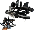
Just get an aircraft with celestial navigation window, a sextant and a Flight Navigator Certificate and you are set.

For the navigator certificate you need,
At least 200 hours of satisfactory flight navigation including celestial and radio navigation and dead reckoning, 500 hours of cross-country flight time, of which at least 100 hours were at night and be a graduate of a flight navigator course. Good luck finding one of those.
 
Last edited:
used to do something like this all the time in my previous /A airplane; and it was discussed a lot in the forums at the time

I filed valid victor airway routes, (huge arcing, wasteful tracks), and once airborne asked center for “requesting rv direct (vor near destination) and they always approved.

it was discussed here that as long as you could fly a reasonably straight line, they wouldn’t care. not sure how you’d do that well, ded reckoning on top however.(I had a handheld)
 
My joking aside, I don’t see anything other than careless that would prohibit dead rec IFR. The flight plan (91.153) only requires the proposed route.

Once upon a time dead rec appropriate for IFR was required training for the IR and prior to GPS is was rather common to depart outside the service volume of the first fix and pick up the VOR when able.
 
Back in the day when dinosaurs walked the earth we would fly WATRS routes with no direct navigation (ADF/VOR/DME). We would fly adf airways which in the summer months were difficult at best. We would use VOR stations on the coast to fix our position. Our only requirement was to be able to fix our position once per hour. So essentially DR.
 
Just get an aircraft with celestial navigation window, a sextant and a Flight Navigator Certificate and you are set.

For the navigator certificate you need,
At least 200 hours of satisfactory flight navigation including celestial and radio navigation and dead reckoning, 500 hours of cross-country flight time, of which at least 100 hours were at night and be a graduate of a flight navigator course. Good luck finding one of those.
1775750975929.png $93 on sale at Amazon
 
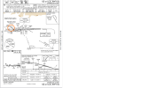
I think it is allowed since it appears on approach charts.example.png
 
I think it is allowed since it appears on approach charts.View attachment 151365
As noted in @midlifeflyer ’s article, “They all involve specific situations in which the course has been vetted for obstruction clearance on the assumption that wind conditions may blow us significantly off-course and yet still be safe for us to fly.”
 

Check out DAC01MA034. That was ded reckoning on the fly visual segment (didn't work out so well).​

 
Believe, but has been too long, that what OP proposed is legal so long as a radar vector is issued pointing at the second VOR until its signal is received. Likely neither legal nor workable in a non-radar environment. I think in the past there were some Western airways with defined switchover points where upon reaching, second signal was not yet received. Get vector ± climb to MEA if that's part of the leg.
 
ATC can only grant random routes when you're under radar coverage. No radar, no random routes, even if you have GPS.
 
ATC can only grant random routes when you're under radar coverage. No radar, no random routes, even if you have GPS.
What if you are IFR in uncontrolled airspace, you don’t even have a clearance and wonder around how ever you want.
 

Check out DAC01MA034. That was ded reckoning on the fly visual segment (didn't work out so well).​

It's 'dead,' as in 'not alive.' The story that the etymology derives from deduced is a bunch of hooey. The use of it as dead goes back to 16th century nautical navigation. The opposite (using landmarks or celestial observations) is called 'true reckoning.'
 
Your best bet might be... "Watchamacallit Center... N1234 Request." When they come back just tell them you are unable Direct XYZ, but any chance they could give you Radar Vectors to XYZ to shorten your fight?

If they approve it, at the end of giving them the Clearance Readback, you can add that you will advise when I'm receiving XYZ. And off you go.
 

Check out DAC01MA034. That was ded reckoning on the fly visual segment (didn't work out so well).​

Nothing in the report indicates they were dead reckoning. They were looking for landmarks to follow. The highway. That’s pilotage.
 
My opinion is a GPS in the plane is mandatory for IFR simple as that.
Ha! I took my instrument check ride in a 1960 C-310E. It had two King 170B NAV/COMs and one ADF. No DME. That setup would be rather limited in the IFR system today. Add DME and you could get by. I tried to find a picture of a similar panel but couldn't. They've all been upgraded!
 
ATC can only grant random routes when you're under radar coverage. No radar, no random routes, even if you have GPS.
Just making a guess here, but guessing that means that the ATC systems will track that plane that is out of radar coverage and ADSB with its own kind of dead reckoning. Meaning, it's moving a little dot on a map based on the filed speed. And that's why there may be mandatory reporting spots on an IFR flight that isn't under radar coverage. The ATC system keeps flights on those victor airways separated based on those times and speeds.

So for all intents and purposes, you could probably fly dead reckoning along an airway until you get to either a VOR or working GPS system when you're out of the GPS/VOR blind area...the expectation being that you're maintaining flight along the airway and won't drift off far enough to cross halfway into another victor airway's space.

Or in other words, you're flying an airway when you only have sporadic reception of either GPS or VOR. But rather than dead reckoning to a point, you're managing your airspeed and heading to maintain yourself on that airway as filed in your flight plan so as to be where you're supposed to be.

All kinda theoretical to me. Around here, up in the air, there's radar and radio. I do fly out of and into places that don't have either radar or ATC comm on the ground, but that's different and similar problem. Going out, file on the ground, pick up clearance in the air. Going in, get cleared for the approach when still in radio contact, cancel on the ground via phone.
 
Getting a vector to a NAVAID that is out of range is not dead reckoning, it's a radar vector.

Otherwise, it depends on the airspace that you are in. Non-radar random routings are common in most (except the busiest) oceanic airspace. Off airway directs are also used in some non-oceanic airspace with ATC using radial/distance reports to keep aircraft separated. Airspace has specific RNP requirements, many of which would preclude the use of dead reckoning, but it's not entirely depreciated (yet?).

The 767s I flew back in 2012-2013 still had the original FMS system which did not have GPS updating, just VOR/DME updating. They were good for up to six hours in the FMS dead reckoning mode, those FMSs were using the inputs from the three inertial navigation systems. I did an Atlantic crossing in one in 2012 but we had to go south of the Caribbean to Africa because it wasn't capable of the RNP required for the NATs (North Atlantic Tracks). You'll still see notes on procedures that say DME/DME/IRU not Authorized. That is for airplanes like those 767s.
 
Ha! I took my instrument check ride in a 1960 C-310E. It had two King 170B NAV/COMs and one ADF. No DME. That setup would be rather limited in the IFR system today. Add DME and you could get by. I tried to find a picture of a similar panel but couldn't. They've all been upgraded!

I flew IFR in a Cherokee 6 with no transponder and two Narco Mk12B's and an ADF (old coffee grinder style). And the heading indicator was the old drum style that turned opposite of the direction of the turn.

Also back in that time frame flew into airports with no radar, and approach control was all position reporting in and out.
 
Ha! I took my instrument check ride in a 1960 C-310E. It had two King 170B NAV/COMs and one ADF. No DME. That setup would be rather limited in the IFR system today. Add DME and you could get by. I tried to find a picture of a similar panel but couldn't. They've all been upgraded!
Did we train inn the same airplane? :D

On dead reckoning, I ultimately have to look at the regulatory requirement for "navigation equipment suitable for the route to be flown." I can easily see that a VOR is "suitable" for a victor airway or VOR-to-VOR navigation and that an RNAV1 box is "suitable" for RNAV SIDs and STARs (while VOR is not). But what's the PBN value for an E6B?
 
Last edited:
I flew IFR in a Cherokee 6 with no transponder and two Narco Mk12B's and an ADF (old coffee grinder style). And the heading indicator was the old drum style that turned opposite of the direction of the turn.

Also back in that time frame flew into airports with no radar, and approach control was all position reporting in and out.
The C-310 had that same style heading indicator. When I started to turn in the wrong direction, I just told my CFI that I was giving him the opportunity to clear in the direction of the turn.

The horizon was a solid black background with a single white horizon line. No pitch markings. The six-pack was in the old 1950s arrangement, too.

I'd see those corporate airplanes with the fancy King KNS-80 course-line computer RNAVs. Thought that was the ultimate!

Flew DC8s, in 1996/7, with VLF/Omega long range nav. DC9s, shortly after, with LORAN-C units that would lose signal as soon as you went into a cloud. Those were replaced, around 2000?, with Apollo GPS units that were terrible, but at least they knew where they were.

Did we train inn the same airplane?
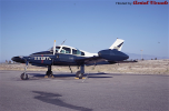
Maybe. N10875. It's been deregistered so don't know what eventually happened to it. This picture may be it (it came up with an search of the n-number) before it left the Air Force and entered the SPS Aero Club where I flew it. It had a red/black on white color scheme at that point. I can't find any pics of it with that paint scheme.

1775834291313.png
 
ATC can only grant random routes when you're under radar coverage. No radar, no random routes, even if you have GPS.
Aircraft that are GPS equipped may be on random Point to point routes that do not require radar monitoring (quote from 7110.65):

c. Random routes.
1. When not being radar monitored, GNSS-equipped RNAV aircraft on random RNAV routes must be
cleared via or reported to be established on a point−to−point route.
(a) The points must be published NAVAIDs, waypoints, fixes or airports recallable from the aircraft’s
navigation database. The points must be displayed on controller video maps or depicted on the controller chart
displayed at the control position. When applying nonradar separation the maximum distance between points
must not exceed 500 miles.
(b) Protect 4 miles either side of the route centerline.
(c) Assigned altitudes must be at or above the highest MIA along the projected route segment being
flown, including the protected airspace of that route segment.
 
Aircraft that are GPS equipped may be on random Point to point routes that do not require radar monitoring (quote from 7110.65):
Hmm. Having to be on fixed points in the database and displayed to the Controller kinda stretches the concept of ‘random.’
 
Believe, but has been too long, that what OP proposed is legal so long as a radar vector is issued pointing at the second VOR until its signal is received. Likely neither legal nor workable in a non-radar environment. I think in the past there were some Western airways with defined switchover points where upon reaching, second signal was not yet received. Get vector ± climb to MEA if that's part of the leg.
I don't think that a radar vector needs to be provided, but radar monitoring is required. The service volumes in the ATC guidance only match the original service volumes and don't reflect the expanded service volumes of VOR that are classified as VL or VH (70 NM 5000 ATH). Also many VOR have specific limitations on various radials and distances that are noted either in the Chart Supplement or in a NOTAM until the Chart Supplement is updated.
 
Hmm. Having to be on fixed points in the database and displayed to the Controller kinda stretches the concept of ‘random.’
There are two kinds of random routes defined in the ATC terminology, point to point random routes where the route is defined between points in the database, and random impromptu routes which are direct routes from the current position to a point in the database or a Nav facility. By being on a point to point random route, one has to be assigned an altitude that is above the MIA for the segment. With the impromptu random route they need to be above the MVA.
 
There are two kinds of random routes defined in the ATC terminology, point to point random routes where the route is defined between points in the database, and random impromptu routes which are direct routes from the current position to a point in the database or a Nav facility. By being on a point to point random route, one has to be assigned an altitude that is above the MIA for the segment. With the impromptu random route they need to be above the MVA.
Gotcha. Impromptu as a qualifier clears it up. I think that’s probably what @dmspilot meant when he started this.
 
Aircraft that are GPS equipped may be on random Point to point routes that do not require radar monitoring (quote from 7110.65):
That's domestic. Oceanic, we do random lat/long fixes, outside of the established routes, with spacing of 10 degrees latitude (longitude on north/south routes).

Here's an example from a recent JAL flight from HNL to NRT (Narita, Japan).

KEOLA3 PUPPI ECEDO 2900N/17000W 3100N/18000E 3300N/17000E 3400N/16000E 3500N/15000E SEALS OTR13 LAPIL Y811 BITEK Y811 POROT Y809 SUPOK
 
Maybe. N10875. It's been deregistered so don't know what eventually happened to it. This picture may be it (it came up with an search of the n-number) before it left the Air Force and entered the SPS Aero Club where I flew it. It had a red/black on white color scheme at that point. I can't find any pics of it with that paint scheme.
LOL! I'm joking. I'm sure it wasn't, I was in an old 172. But were similarly equipped when it came to avionics :D
 
The C-310 had that same style heading indicator. When I started to turn in the wrong direction, I just told my CFI that I was giving him the opportunity to clear in the direction of the turn.

The horizon was a solid black background with a single white horizon line. No pitch markings. The six-pack was in the old 1950s arrangement, too.

I'd see those corporate airplanes with the fancy King KNS-80 course-line computer RNAVs. Thought that was the ultimate!

Flew DC8s, in 1996/7, with VLF/Omega long range nav. DC9s, shortly after, with LORAN-C units that would lose signal as soon as you went into a cloud. Those were replaced, around 2000?, with Apollo GPS units that were terrible, but at least they knew where they were.

Yea, I flew 727's with Omega. We thought that was high tech!
 
Yea, I flew 727's with Omega. We thought that was high tech!
Did you have to put in lat/long's for the waypoints like we did in the Falcon 20's? 9 waypoints and one flight plan, the current one. We took it to Europe and back once in the late 80's. We had to tell ours where they were on startup.

My Dad flew 727's around the Pacific using twin dopplers and a loran. Later on, he started flying ones with INS's.
 
Back
Top