Need Advice Crossing Rocky Mountains in Winter

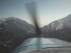
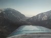
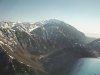
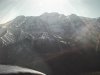
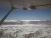
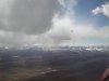
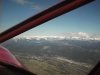
Probably, I haven't run the northern highways in several years, in that area everything looks the same.:lol: Personally this time of year I would head south and burn an extra tank of fuel, even kill an extra day or two than fly the north route in a plane I didn't have enough time with to be comfortable trusting the single engine. There is a lot of sparse badland up that part of the country.

Yup... Badlands are on I-90....
 
I am afraid of Rockies especially in winter weather.

Then don't go there.

Look at the sectional, Detroit direct to Cheyenne, via I-80.
to Herber City Ut. then down the canyon to Provo and I-15 to Vegas, and you are home.
 
There is a lot of sparse badland up that part of the country.

That's a really good point and the reason I suggest staying near the interstate. It's also the reason I had the 406 ELT installed.
 
things tend to get down right nasty west of Bozeman...and I lived in Butte not to mention the Wyoming like winds around Livingston

as for a pro pilot, not a bad idea but I'd be happy to shepherd him through WY - I'm not doing anything better and gas is getting cheap - I've got on board weather and have flown the route at least once ;) - he can follow on a mile trail and we'll all be happy campers

That will be awesome! Thanks for the thought.
What could be better than following a local good hearted pilot.
 
it's winter time the temps will be sub zero. DA will be below sea level.

Just remember Flagstaff is 7,011' up as is most of New Mexico. Rock Springs is near 7k too but you will be that high for much shorter distance.

WATCH THE WINDS in the winter the high country can howl . 65k is not uncommon.

Check the METARs. Not subzero at the surface. Not even close.

KGCN is 11 C at 6600 MSL right now.

And there ain't NO WAY you're getting below sea level DA at 10,500. Not even at the South Pole. You need -70C or so for that. Considering the ISA minimum is -56.5 -- and that's at 36000 feet -- it ain't happening.
 
Last edited:
Then don't go there.

Look at the sectional, Detroit direct to Cheyenne, via I-80.
to Herber City Ut. then down the canyon to Provo and I-15 to Vegas, and you are home.

Really good route - avoids the worst of the California Sierra...
 
That will be awesome! Thanks for the thought.
What could be better than following a local good hearted pilot.

Let me know what your plans are and we can work out the details. Ya gotta promise not to run over me...
 
That's a really good point and the reason I suggest staying near the interstate. It's also the reason I had the 406 ELT installed.

Yep, highways and a minimum of a 406 G/PLB are very good things to have. This time of year though the highway trick may not be that friendly either if the weather goes to hell on you enroute.
 
That will be awesome! Thanks for the thought.
What could be better than following a local good hearted pilot.

Be careful, if you buy him cheap beer he'll lead you into a box canyon his turbo can out climb and you can't...:yikes::lol:
 
Really good route - avoids the worst of the California Sierra...

And you'd have a major highway under you most of the way. Plus you can basically turn left at Rawlins, direct to Heber City. or the Hanksvill VOR then 70 across to I-15.

there isn't much over 5k' that way.
 
Then don't go there.

Look at the sectional, Detroit direct to Cheyenne, via I-80.
to Herber City Ut. then down the canyon to Provo and I-15 to Vegas, and you are home.


good! another good option
 

Attachments

  • Texas Trip 99 034.jpg
    Texas Trip 99 034.jpg
    150.1 KB · Views: 47
  • Texas Trip 99 035.jpg
    Texas Trip 99 035.jpg
    150.8 KB · Views: 39
  • Texas Trip 99 036.jpg
    Texas Trip 99 036.jpg
    164.7 KB · Views: 41
  • Texas Trip 99 037.jpg
    Texas Trip 99 037.jpg
    146.6 KB · Views: 40
Really good route - avoids the worst of the California Sierra...

Crossing at Tahoe isn't the big problem here. It can be done in calm winds at 8000. I prefer to do it at 9000 (that's still under 3000 AGL, so no worries about VFR cruising altitudes or IFR traffic). It's right around freezing at Tahoe now, so watch the DA. It's a bit warm.

With the Sierra, the problem is weather. It can be sucky, and there ain't no NA IFR there. In winter, it's icy, in summer, it has thunderstorms. Fortunately, there are some nice airports on the east side in the precipitation shadow.

I'd suggest flying from Detroit "I Follow Roads" I-94 to Chicago, then follow I-80 ALL the way home. Be prepared for weather delays and dress for weather on the ground. FILE A FLIGHT PLAN. You will not get flight following over your entire route, and a forced landing in the snow can be deadly even if the landing isn't. Bring an emergency kit sufficient for a night outdoors. Space blanket, means to start fire, means to purify water (or water -- but it's heavy), winter clothes, Leatherman, and signaling device, at a minimum. Wear it or it may not get out of the plane with you.
 
Last edited:
The fun crossing is I-70 with a high speed taxi through the Eisenhower tunnel.:D;)

When you do the north end around you'll be way north of 70 Which is the worst of the Rockies. There is a lot of aluminum laying on the rocks between the Denver and Grand Junction.
 
Let me know what your plans are and we can work out the details. Ya gotta promise not to run over me...


Cherokee 6 is not very fast any ways. What do you fly anyways? Promise no cheap beer
 
And you'd have a major highway under you most of the way. Plus you can basically turn left at Rawlins, direct to Heber City.

Maybe left a Ft. Bridger rather than Rawlins...
 
I'd suggest flying from Detroit "I Follow Roads" I-94 to Chicago, then follow I-80 ALL the way home.

I'd prefer to stay about 50 miles south of Chicago. and head for my first fuel stop in Iowa.
 
Yep, highways and a minimum of a 406 G/PLB are very good things to have. This time of year though the highway trick may not be that friendly either if the weather goes to hell on you enroute.[/QUOTE

My apologies for ignorance. What is 406 g/PLB?
 
Maybe left a Ft. Bridger rather than Rawlins...

Yep some where in between. its just low hills below the tree line from there all all the way to the Hanksvill VOR
 
Yep, highways and a minimum of a 406 G/PLB are very good things to have. This time of year though the highway trick may not be that friendly either if the weather goes to hell on you enroute.[/QUOTE

My apologies for ignorance. What is 406 g/PLB?

The New type ELT.
 
406g/plb is a personal locater beacon w/gps - it's what ya carry in your pocket to supplement or replace the 121.5 ELT beacon.

I've got a 406 ELT w/gps in the 'kota and carry a plb - surviving a crash in the mountains and having folks not find me doesn't sound like much fun so I try to keep the odds in my favor
 
Here's the landscape most of UT.
 

Attachments

  • Texas Trip 99 031.jpg
    Texas Trip 99 031.jpg
    145.9 KB · Views: 31
  • Texas Trip 99 042.jpg
    Texas Trip 99 042.jpg
    166.7 KB · Views: 27
  • Texas Trip 99 043.jpg
    Texas Trip 99 043.jpg
    182.8 KB · Views: 30
  • Texas Trip 99 044.jpg
    Texas Trip 99 044.jpg
    160.8 KB · Views: 27
  • The Big Red One 043.jpg
    The Big Red One 043.jpg
    145.6 KB · Views: 24
  • The Big Red One 047.jpg
    The Big Red One 047.jpg
    166 KB · Views: 26
  • The Big Red One 049.jpg
    The Big Red One 049.jpg
    136.7 KB · Views: 22
  • The Big Red One 009.jpg
    The Big Red One 009.jpg
    159.9 KB · Views: 23
Last edited:
This is awesome to know. I plan on carrying a portable oxygen cylinder. Thanks

When I had my turbo STCd Travelair it had a placard that said, "This aircraft has not been evaluated for operations above 25,000'" I asked one of the FSDO guys from next door if that was a limitation and he basically said, "No, it just means they didn't develop the data for higher, you can fly as high as ATC will give or or the plane quits climbing, just remember Vne is a TAS number so you can't use the red line in IAS at altitude."
 
You're at RHV. Look up Coby Sena and ask to see hers. A few doors from the pilot shop, away from the baseball diamond.

Great tip!
Coby is my tie-down neighbor. I will try to see her. I know she went to Bahamas this year.

Thanks
 
Cherokee 6 is not very fast any ways. What do you fly anyways? Promise no cheap beer

I have a turbo Dakota with a few STC'd modifications. Generally the Cherokee 6's are about 10 knots faster unless I'm up above 16,000. I've watched them run away from me down at sea level.
 
That leaves me out.. I am ALOT slower then you....:redface::redface::redface::(

Hey, if you want the western half that's fine by me. I'm sure RHV would be delighted to see your 801. Heck, I'd like to see it.
 
When do you want to leave Detroit?

I have some family business to take care of before I take off. Also a lot of IFR area just below MI.

I will post in as soon as the plan is clear, it will probably be in next 1-2 weeks.

You guys are so helpful. I intend to post as I move along the route as a thank you note to all of you.
 
Back
Top