Navigating by Pilotage

More seriously, "cheating" is a dangerous word. A number of years ago, a student on his commercial cross country and his passenger died when they got way off course flying. they stopped at my home airport to refuel, then somehow got their heading off — I think the compass in the rental plane (a C152?) was unreliable — and instead of flying southwest to Toronto, they flew West towards the huge unlit area that's Algonquin Park as night fell and it got harder to see visual references. they eventually called for help on 121.5 and got an airliner to relay, but they were below radar coverage and the VOR in the plane was also off by 30°, so ATC couldn't determine their position and they couldn't find an airport. They eventually ran out of fuel and crashed.

Lots of mistakes here, of course and we can discuss them forever but here's the kicker: according to the TSB report, both pilots had smartphones in their pockets with GPS's, and the one of them had an aviation application on it — they both still had charge and were working after the crash. They could easily have made it to several nearby airports. but in the stress and tunnel vision of an emergency, the pilot focused only on what he had practiced before, and since his instructor had presumably drilled it into him that using a GPS was cheating, it never occurred to his overtaxed brain that he could simply pull his phone out of his pocket and see where he was.

The crash wasn't his instructor's fault, but I still think the instructor has a lot to answer for. Instructors need to work with their students to practice "cheating" so that they know how to do it effectively in an emergency.
 
Flying the Cub(s), none of which have particularly good compasses:
In my part of the Northeast, it's not hard to get lost. I do it all the time because I'm always sightseeing and not paying attention to where I'm going.
But, you have to try really, really hard to stay lost, especially if you are from this part of the Northeast. This is a landmark rich environment if there ever was one.
That being said, I'm occasionally gobsmacked by people who are so clueless that they don't know they can take out their phone, crank up Google Maps, then push the walking man icon, type in a destination, and follow the directions.
 
The crash wasn't his instructor's fault, but I still think the instructor has a lot to answer for. Instructors need to work with their students to practice "cheating" so that they know how to do it effectively in an emergency.
Instructors need to work with their students to practice lots of things that aren’t “on the test”. Unfortunately time and money often become overriding factors.

IMO, it was a much healthier environment for learning when people gathered socially at the airport. I can remember a time when I learned more from offhand comments by experienced pilots than I did flying. Of course, the fact that I flew for maybe half an hour or an hour out of the 5 hours I spent at the airport meant there was far more opportunity to learn that way.
 
More seriously, "cheating" is a dangerous word. A number of years ago, a student on his commercial cross country and his passenger died when they got way off course flying. they stopped at my home airport to refuel, then somehow got their heading off...
In his book 'Flying from the Black Hole: The B-52 Navigator-Bombardiers of Vietnam' Robert Harder has a story about a training flight from Mather AFB (Navigator School at the time) in which the lead navigator on the flight accidentally plugged in the reciprocal heading causing the entire formation to travel west (over the Pacific) rather than east (over the mountains) and his trying to balance necessity (informing the other navigators) with military etiquette (not showing up a ranking officer).
 
More seriously, "cheating" is a dangerous word. A number of years ago, a student on his commercial cross country and his passenger died when they got way off course flying. they stopped at my home airport to refuel, then somehow got their heading off — I think the compass in the rental plane (a C152?) was unreliable — and instead of flying southwest to Toronto, they flew West towards the huge unlit area that's Algonquin Park as night fell and it got harder to see visual references. they eventually called for help on 121.5 and got an airliner to relay, but they were below radar coverage and the VOR in the plane was also off by 30°, so ATC couldn't determine their position and they couldn't find an airport. They eventually ran out of fuel and crashed.

Lots of mistakes here, of course and we can discuss them forever but here's the kicker: according to the TSB report, both pilots had smartphones in their pockets with GPS's, and the one of them had an aviation application on it — they both still had charge and were working after the crash. They could easily have made it to several nearby airports. but in the stress and tunnel vision of an emergency, the pilot focused only on what he had practiced before, and since his instructor had presumably drilled it into him that using a GPS was cheating, it never occurred to his overtaxed brain that he could simply pull his phone out of his pocket and see where he was.

The crash wasn't his instructor's fault, but I still think the instructor has a lot to answer for. Instructors need to work with their students to practice "cheating" so that they know how to do it effectively in an emergency.

I agree wholeheartedly that using the GPS is not cheating unless you're competing to fly without it or something, but I'm curious as to how you knew that the instructor had said or conveyed to this student that using GPS is cheating. Granted, I didn't train several years ago, but every instructor I've met has encouraged the use of GPS on cross countries, even if it's just running as a situational awareness map, including the ones who have been instructing for a few decades.
 
I agree wholeheartedly that using the GPS is not cheating unless you're competing to fly without it or something, but I'm curious as to how you knew that the instructor had said or conveyed to this student that using GPS is cheating. Granted, I didn't train several years ago, but every instructor I've met has encouraged the use of GPS on cross countries, even if it's just running as a situational awareness map, including the ones who have been instructing for a few decades.
That's fair. As I mentioned, I just assumed it from the fact that the pilot seems never to have considered pulling the phone out of his pocket. It's a common attitude in flight training — using many of the tools you'll be using every flight after you get your license (and really need to learn to use safely) isn't quite cricket, as the English used to say.

Glad your experience has been different.
 
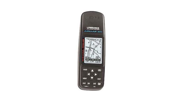
Sounds like my first Garmin GPS:

iu

Looks like it was a "touch" newer than my first Garmin (a 45). :)
 
Looks like it was a "touch" newer than my first Garmin (a 45). :)
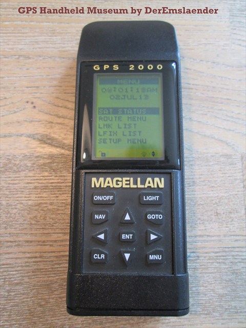
I had an old Magellan GPS with a tiny display and a set of open-data aviation waypoints (airports and navaids) that I hacked together. What an improvement when I finally splurged on a Garmin 196 a couple of years later.
 
I had serial #9 of the Garmin 195. Bought it when it was released at Oshkosh back around 1996 or so.

My first Oshkosh (92) I flew up holding an early Trimble handheld and flew back using a Garmin 100 (handy when you've got the editor of IFR and Aviation Consumer in the right seat. Lots of toys).
 
Mine was this. I've still got it too...near mint condition with the case and all accessories. Anyone need it for a museum?
section-SC398-020-large.jpg
 
Brad, does that Lowrance still work?

Nearly bought one, partners preferred the original IFR certified handheld. It has died. They quit issuing data updates many years ago, but it would be useful for reference when flying. Took it on airliners for years after database went out of date.
Also used it on my boat.
 
Just this week I had to take a step back in time as I was testing my newly installed Trio autopilot. It needed NMEA information and for some reason my iFly won't supply it (working on that with Adventure Pilot) so I had to pull out the trusty 20 year old Garmin 196:

iu

Still works as advertised and supplies the NMEA info to drive the A/P like a charm but it's archaic with all the button pushing required ...
 
When I bought my Starduster a 196 came with it but I quickly realized that it was so far behind a modern phone or tablet with Avare or other software that I put it on ebay before everybody else figures that out.
 
My first, not for flying:

a7060999-1526-4053-98f3-f1772b4156a4_l.jpg

That was my first also. I had two of them. I gave the first one to a friend to help him with constantly getting lost.

I dropped the second one and broke the display. Magellan took it back and sent me the newer model as a replacement. I still have that one.
 
Peachtree Dekalb (PDK) - Anniston (ANB) - Montgomery (MGM) - PDK. About 350nm.

If the visibility is decent that’s not a bad loop. I stopped at ANB on my second solo XC; RYY - AUO - ANB- RYY. There was a FSS there at the time and they invited me in to look around and see what they do.

We did RYY - HSV on a day trip as the GPS wasn’t picking up the signal. Pretty easy with good visibility as the Tennessee River makes it straight forward.

I started only 16 years ago, so almost all of the planes had a GPS in them.
 
It took two attempts to make that loop. On the first attempt, I turned back about 20 minutes past FTY. Cloud cover was a bit more than forecast. And none of the planes had GPS. There was a Loran in the Warrior I was flying but it was so intermittent that it was a waste of time to even try and use it.

One of my XC's was to Huntsville. Seemed like I spend more time taxiing than I did flying there.
 
Back
Top