vontresc
En-Route
Well I was planning on flying our new diamond some more tomorrow, but decided to check the weather after hearing that we were supposed to have major winds tomorrow.
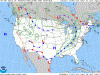
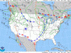
Looking at the progs I noticed that there was a massive Low pressure system developing over western Ontario.

I haven't seen such a large low in a long time, and I was wondering how these things develop? BTW 961 millibar is equal to 28.38" of Hg
Looking at the progs I noticed that there was a massive Low pressure system developing over western Ontario.
I haven't seen such a large low in a long time, and I was wondering how these things develop? BTW 961 millibar is equal to 28.38" of Hg