LVK to MRY

What is Harris Ranch and why would someone want to go there?

It's the world's largest pile of cow ****, and also a source for very good steaks, with a small VFR airstrip next to it.

It's the world's only olfactory instrument approach. Fly direct to the stink, then heading 180.

It's right next to I-5, and is notorious among drivers between LA and San Francisco, as the spot where you either roll your windows up or you puke.
 
It's the world's largest pile of cow ****

One of my still faviote quotes I believe from you...don't forget to lean for the cow farts!

If MRY, STS, WVI or HAF are outta the question tomorrow for food...eat lunch early and just stick with a Bay Tour...much more interesting as a sight seeing trip (at least to me newbies I have had in the plane) than a flight through the Central Valley.

You could always land a RHV and Uber to Chipotle!

TAFs for SNS and MRY are not looking at that stellar. Be willing to bet you could get into KWVI but MRY is gonna be iffy. Didn't significantly burn off down there today and forecast similar for tomorrow.
 
Last edited:
The trip is for Saturday, and not Friday. But either way, I'm completely okay with not going there. However, I checked the weather, and it may seem that I'm going to get lucky.

On leaving Monterey (assuming I make it there), are there any pitfalls to climbing above the sfo bravo and giving the passengers a 10k+ view of the city on the way back to Livermore? Assuming, of course that there is only a marine layer, and sfo has the same?
 
I've crossed over the SFO B at 10500 before, and even got cleared through it for a VFR descent. The only pitfall is it takes a LONG time to get up there even in a 182. And the B is real big up there.

Shawn is right. The view is better at 3500, and you'll still be well above the marine layer at that altitude.
 
...yeah...spent most of the day thinking it was Friday. oops.

The 3500' view is much better.

I've crossed over the SFO B at 10500 before, and even got cleared through it for a VFR descent. The only pitfall is it takes a LONG time to get up there even in a 182. And the B is real big up there.

Shawn is right. The view is better at 3500, and you'll still be well above the marine layer at that altitude.

So, if I were to depart MRY, climb to 3500', heading north towards the SQL/PAO area and request a Bravo transition for a Bay Tour from NorCal, they would oblige?

Firstly, is that even the correct thing to ask for? Not in terms of phraseology, but in terms of what I actually want to get done. And secondly, what path would that request most likely take me through?

Again, this is all assuming the marine layer is low, correct?
 
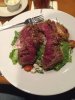
IMG_2742.JPG
Since you just had to ask about Harris Ranch, and why one would fly down there, it's for the steaks! This was my skirt steak salad at a meetup with a couple PB members. Aside from that it's boring as fk.
 
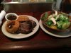
IMG_2743.JPG

And if you do go to Sac Executive, you can eat at the airport if you want, but you aren't that far away from downtown and REAL food. Like Jamie's. 5th and Broadway. This is a "brisket sandwich" sans the bun. It's the only place around that seems to know how to do brisket. Tender. Cut it with a fork. Lots of it. Damn, I'm getting hungry now. I might have to take a jaunt up the Valley.
 
So, if I were to depart MRY, climb to 3500', heading north towards the SQL/PAO area and request a Bravo transition for a Bay Tour from NorCal, they would oblige?

Firstly, is that even the correct thing to ask for? Not in terms of phraseology, but in terms of what I actually want to get done. And secondly, what path would that request most likely take me through?

Again, this is all assuming the marine layer is low, correct?

If you're west of the mountains, they will want you a little higher for radar coverage. East of the mountains, 3500 works.

If tops are higher than about 2500, it's not marine layer. You CAN get mountain obscuration higher than that.
 
If you're west of the mountains, they will want you a little higher for radar coverage. East of the mountains, 3500 works.

If tops are higher than about 2500, it's not marine layer. You CAN get mountain obscuration higher than that.

So, in my previous post, if I were to follow that "planned" route, I should be okay at 3500'? And just coordinate with NorCal about getting me through the bravo portions of the airspace? Obviously the controllers cant see the marine layer...assuming there are clouds in the direction they're telling me to go, can I just tell them I'm unable to do so because of VFR requirements?

I know there's a lot of hypotheticals in here, but I'm just trying to plan for the word, while hoping for the best.

Thanks for all your clarifications and inputs.

Yes. But also bear in mind that in class B airspace, the requirement is clear of clouds, not 1-5-2.
 
Yes. But also bear in mind that in class B airspace, the requirement is clear of clouds, not 1-5-2.
Very well aware....but my point being that if I proceed flying the way they tell me to fly, I will eventually hit the cloud. Then, I'm not a happy camper.
 
Very well aware....but my point being that if I proceed flying the way they tell me to fly, I will eventually hit the cloud. Then, I'm not a happy camper.

As a practical matter, 3,500 feet should be no problem, and if it is, you'll be able to see that well before you get to Bravo airspace.
 
Back to MRY real quick, is the 1500' piston TPA published anywhere other than this page: http://montereyairport.com/general-aviation/noise-abatement ? I checked the AFD and couldn't find a reference (although it does reference the moneteryaiport site for noise abatement and arrival procedures). It seems odd to not have the TPA listed in the remarks if it's non-standard.
 
Back to MRY real quick, is the 1500' piston TPA published anywhere other than this page: http://montereyairport.com/general-aviation/noise-abatement ? I checked the AFD and couldn't find a reference (although it does reference the moneteryaiport site for noise abatement and arrival procedures). It seems odd to not have the TPA listed in the remarks if it's non-standard.
Huh?

It's in the AFD, on the second line. TPA 1757(1500).
 
So, if I were to depart MRY, climb to 3500', heading north towards the SQL/PAO area and request a Bravo transition for a Bay Tour from NorCal, they would oblige?

Usually, yes, but always have a plan B, in case they can't give you a bravo transition for some reason.

Firstly, is that even the correct thing to ask for? Not in terms of phraseology, but in terms of what I actually want to get done.

That depends on what you want to get done, but personally, I find the view from 3500' to be quite nice.

And secondly, what path would that request most likely take me through?

I don't remember the exact instructions, but when I've done it, I flew along the general vicinity of Interstate 280.

Again, this is all assuming the marine layer is low, correct?

I don't understand the question.

By the way, just to be clear, the thing that's most likely to be inaccurate about the MRY forecast is the time at which the clouds move in.
 
Obviously the controllers cant see the marine layer...assuming there are clouds in the direction they're telling me to go, can I just tell them I'm unable to do so because of VFR requirements?
Since, as you say, they can't see the clouds, you also need to tell them what you can do. For example, "Cessna xyz needs to climb to x to remain clear of clouds."
 
So, if I were to depart MRY, climb to 3500', heading north towards the SQL/PAO area and request a Bravo transition for a Bay Tour from NorCal, they would oblige?

Firstly, is that even the correct thing to ask for? Not in terms of phraseology, but in terms of what I actually want to get done. And secondly, what path would that request most likely take me through?

Again, this is all assuming the marine layer is low, correct?


It really is easy peasy.

3500' out of MRY on your route will be plenty. You may want to climb a bit for comfort over the hill to SJC but 3500' will get you over the hill with plenty of altitude crossing near WVI (watch out for jump zone) or over Highway 17 near Santa Cruz.

Pick up FF and as you head up the peninsula all you gotta say is "Norcal, Cessna 12345 request Bravo Transition for Bay Tour up the Peninsula" That will tell them what direction you wanna head vs out around Oakland which is also common. You do not need to request that till around the SJC area controllers. Remember, once you are on FF, the walls of C & D disappear...they will let ya know how to navigate that space if they want you somewhere else.

You will get remain South and West of either 280 or 101 at either 2500' or 3500'. Some days I get 280...last trip I got 101 and 3500'. Even though there is a lot of blue, there is only a small ring of Bravo that you actually pass through at 3500 over SFO. Once you are outta Bravo on the north side you are free to drop down and fly around the Bay as you wish. Just know where those B rings are and OAK C is.

My Bay Tour last week was fogged over just as we are talking about...well, the city, Golden Gate and Alcatraz was fogged over but SFO was still clear so they had no problem issuing a Bravo Clearance to VFR. When SFO gets a ceiling, then they limit VFR traffic. ATC was even asking for Pireps of visibility so they could let others know as it was a busy Bay Tour day up flying. 3500' You will be above any marine layer if there is one...if not, just let them know you can not maintain VFR at assigned altitude or heading. Flying through LAX Bravo I was about to hit some clouds...let them know and they approved me to climb higher without any problems.
 
Last edited:
If you're west of the mountains, they will want you a little higher for radar coverage. East of the mountains, 3500 works.

Up towards HAF and south of MRY that is certainly true on the coast, but most of the Monterey Bay they can easily get ya well before 3500'
 
Last edited:
What a great flight!! Due to time constraints, we couldn't go up the peninsula to take a bay tour. Instead, we flew LVK-RHV-E16-SNS-MRY, then the reverse back to Livermore. Only thing in our way was a tiny cloud or two. Stopped at Del Monte, took the courtesy car to the wharf, got some gas, and headed back home. Both the father and the uncle enjoyed the trip thoroughly!

Thanks for all the helpful hints guys! Much appreciated.
 
Glad it worked out!
 
Nice...I actually woke up this morning, looked out my window to blue skies for the first time in quite a while and thought "no problem on him making it to Monterey today!"
 
I spent the day in the outer Sunset. I think the ceiling got up to 50 AGL around lunch, but that's it. I drove by KHAF later, and it was way below minima. And perfectly clear everywhere south of Pigeon Point.
 
I spent the day in the outer Sunset. I think the ceiling got up to 50 AGL around lunch, but that's it. I drove by KHAF later, and it was way below minima. And perfectly clear everywhere south of Pigeon Point.

I lived in the outer sunset for about 15 years. 50ft is quite generous on some days. Only place worse is on hwy 35 between Lake Merced and Pacifica/Daly City.
 
Hey party people... I'm going to be making a cross country burn-in run on my engine... so I'm probably going to be heading up to KMRY this week. Figured the central coast route is better than the coastal route since I have 3 new cylinders. Any pireps on the local weather lately? Looks like it's getting a late in the season for the marine layer to persist unlike a couple weeks ago.
 
Been waking up to sunny skies and just got home tonight and could see clear across the bay to Monterey which is rare. Any marine layer has been burning off super early. Things change day by day but the June gloom is starting to subside. Probably will be a great weekend to head up.

Fly up the 101 corridor via SBA...you still get some coast line and little better views. A LOT more airport options all the way up should you have an issue. Up the central valley you are putting down in a field! Hwy 101 is usually my nighttime NorCal to SoCal route if safety is on your mind....plus flying the central valley is about as exciting as driving I-5.
 
I'm 2 miles from SMX. It's been really nice here with no marine layer for a couple of nights now.


Sent from my iPhone using Tapatalk
 
Been waking up to sunny skies and just got home tonight and could see clear across the bay to Monterey which is rare. Any marine layer has been burning off super early. Things change day by day but the June gloom is starting to subside. Probably will be a great weekend to head up.

Fly up the 101 corridor via SBA...you still get some coast line and little better views. A LOT more airport options all the way up should you have an issue. Up the central valley you are putting down in a field! Hwy 101 is usually my nighttime NorCal to SoCal route if safety is on your mind....plus flying the central valley is about as exciting as driving I-5.

I was thinking once you get up past SBP, you're pretty limited along the coastline with emergency landing spots... not to mention the MOA. I'm gonna have to stay low and fuel rich as part of the burn in, so I figured SBP would be a midway stop.
 
Yup, most of the way up the coastline you are ditching if you have a problem at low altitudes. Highway 101 however is dotted with airports all the way up and mostly flat terrain.

Never once has any MOA in that area ever been a factor for me on countless trips up and down the state. I am always on FF (or IFR) and will avoid if hot...I would not give the MOA's a second though. There are a few R airspaces however to keep an eye on.
 
Thanks! I'll be on flight following the whole way as long as the ATC gods are smiling on me. Figure I'll go into Salinas instead since gas is way cheaper and it's a turnaround.
 
I was thinking once you get up past SBP, you're pretty limited along the coastline with emergency landing spots... not to mention the MOA. I'm gonna have to stay low and fuel rich as part of the burn in, so I figured SBP would be a midway stop.
You can go to SMX instead and check out the pink centerline.

CalFire operates a DC10 out of there, and it seems it leaks.

Or perhaps Oceano. Look out for meat bombs.
 
I have no idea where that is but time to do research tomorrow.
It's only slightly further. But if the marine layer is gone, you simply will not beat Half Moon Bay for a $100 burger. There are several amazing restaurants just southeast of the field, around the harbor.

Salinas has a restaurant, too, but it's closed Sundays.
 
Is the Salinas restaurant any good? A friend who used to live there sounded like she wasn't impressed, but that was a few years ago.
 
I picked SBP as the fuel stop since I'm familiar with them. Been there a couple of times. Unfortunately that's the furthest north I've been to date. But KWVI doesn't have a tower. What kind of uncultured heathens operate out of non-towered airfields? That just isn't civilized. ;D

And my trip is mostly business, as this is just an excuse to put 6 on the hobbs to break in the engine.
 
Back
Top