3393RP
En-Route
- Joined
- Oct 8, 2012
- Messages
- 4,720
- Display Name
- 3393RP
Ugh, this is horrible!
A recently published photo near the accident time.
I’m really wondering if this is another CFIT accident...
View attachment 82271
I'm not.

Ugh, this is horrible!
A recently published photo near the accident time.
I’m really wondering if this is another CFIT accident...
View attachment 82271

What is in that circled area? Camarillo is further west of there.This is where they were going. Maybe there was indeed an emergency onboard. View attachment 82275

The circled area was the destination, apparently a basketball camp in Thousand Oaks.

I saw that too. It's right next to Griffith Park. Maybe they were looking at the Hollywood sign. That said, it was a pretty lousy day to be out sightseeing. Low viz and low clouds.This is odd...

This is where they were going. Maybe there was indeed an emergency onboard...

Agree.Or simply a failed turn back attempt if the local visibility immediately ahead was driving them down? The track suggests they were below the deck, following the highway, navigating visually.

If they had another parent and child on board, they may have done some sightseeing for their entertainment. Not many people get to ride on a helicopter.I saw that too. It's right next to Griffith Park. Maybe they were looking at the Hollywood sign. That said, it was a pretty lousy day to be out sightseeing. Low viz and low clouds.
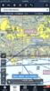
According to Flightaware this morning’s flight originated at SNA (N72EX).
View attachment 82269 View attachment 82270


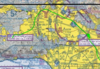

This is odd...
That's the boundary of the Burbank Class C surface area.I saw that too. It's right next to Griffith Park. Maybe they were looking at the Hollywood sign. That said, it was a pretty lousy day to be out sightseeing. Low viz and low clouds.


Here is 2EX at Burbank (BUR) https://archive-server.liveatc.net/kbur/KBUR3-Gnd-Twr-App-Jan-26-2020-1730Z.mp3
until 5:10 then they go to Van Nuys (VNY) at 5:33 we don't hear the helo only the tower
https://archive-server.liveatc.net/kvny/KVNY-Jan-26-2020-1730Z.mp3
At around 30:00 it sounds like the tower clears a SAR in SVFR

No approach to the destination is my guess.It’s obviously apparent that they were not on a IFR flight plan and was flying low in hilly terrain.
Can any helo pilots explain why the pilot wouldn’t want to file IFR?

This.No approach to the destination is my guess.

This is where they were going. Maybe there was indeed an emergency onboard. View attachment 82275

I appreciate this but I’m confused. Those who know the area maybe can help. Why does it look like the pilot turned towards the higher terrain? Is there any lower terrain the pilot could have turned to? If he was starting the approach, wouldn’t he be starting it below the minimum safe altitude in the area?
Rising terrain on the original heading, peaks are 3k+, flying svfr, no approach, vis extremely low.
Sent from my SM-G960U1 using Tapatalk