KAEG ILS RW 22 question

It's still not really a waypoint exactly. The route from LIYIR is a DR segment. A dead reckoning segment where you simply fly a heading (112) with no course guidance until you intercept the localizer. An FMS can't really do that, so a CNF is positioned at the point where a 112 COURSE would intercept the localizer, giving it something to fly "to". And not that it really matters, but I guess the "official" way to fly one of these is still just to fly a heading, not a course, although in reality a course is exactly what's going to be flown when using any kind of FMS.
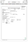
I’m going to have to do this in two posts because I can’t figure out how to get two screen shots in one. Ok, the WP box is not checked, it’s the CNF box.

1788348195852.png
 
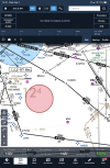
It's still not really a waypoint exactly. The route from LIYIR is a DR segment. A dead reckoning segment where you simply fly a heading (112) with no course guidance until you intercept the localizer. An FMS can't really do that, so a CNF is positioned at the point where a 112 COURSE would intercept the localizer, giving it something to fly "to". And not that it really matters, but I guess the "official" way to fly one of these is still just to fly a heading, not a course, although in reality a course is exactly what's going to be flown when using any kind of FMS.
1788348258494.png
 
Thanks. That kind of explains why it’s listed in the sequence in this case. Yeah, that’s why I put “waypoint” in quotes.

Edit: but it does raise a question. Not charting, but database. What drives the decision about whether to list it as part of the NAV sequence as in the SAF example, but not list it as part of the sequence as in the AEG example? In both cases, the FMS is using it, but in only one case the pilot sees it being used.

Unfortunately I didn't work that closely with that part of the criteria, so I do not know the FMS coding side of it very well.

I can’t find any now, but I’ve seen them before where hdg is not printed, just the course. Refresh my memory, what is the angle of airspace that’s being protected, it’s usually 4.5 degrees, but on DR segments it’s about 6 ??

The DR segment protected airspace is huge - 6 nm either side of centerline, expanding at 15 deg (on both sides of centerline) until intercepting the inbound course.
 
Yeah, that one got a name change, as starting maybe 12-15 years ago it was determined that CNFs had to start with "CF". Before that, they could be any combination of letters. I did try to pick an unpronounceable sequence of consonants for my CNFs, since they would never actually be spoken. I remember I had named a CNF "ZZZZZ" which I thought was pretty fun. It was later changed. I believe it was at Portland PDX.

EDIT - yes, PDX ILS OR LOC 10L. It's the LOC MAP which is now CFBGC. I remember this project pretty well, since that Loc also passed close enough to the approach end of VUO to call it an LDA into VUO, with the same fixes on final. It was one of those fun geometric situations that happen occasionally.

I also think I remember why the LOC MAP needed to be a CNF instead of just a DME fix like the rest of the fixes on the procedure. Looking at the chart, the VDG DME antenna is not at the localizer (at the far end of the runway) like is optimal. From the chart it appears it's at the opposite end localizer (at the approach end), which is not uncommon either, the opposite direction ILSes sharing the same DME antenna. But IIRC, in this particular example, the DME antenna isn't actually at that end's localizer either, it's off to the side some, for some reason I assume of geography or wiring or obstructions or whatever.

For a DME to be used for a fix, the antenna has to be within 23 degrees of the course at that fix. If it's too far off to the side, the DME distance is not usable. This one is usable for all the fixes up until the last one (the LOC MAP), where it exceeds 23 degrees and therefore could not be used. Notice this procedure has a timing table as well, which would be needed for the loc final even if you had DME (and didn't have GPS obviously), which is a pretty rare situation that has fortunately been overcome by technology.

 
Last edited:
Yeah, that one got a name change, as starting maybe 12-15 years ago it was determined that CNFs had to start with "CF". Before that, they could be any combination of letters. I did try to pick an unpronounceable sequence of consonants for my CNFs, since they would never actually be spoken. I remember I had named a CNF "ZZZZZ" which I thought was pretty fun. It was later changed. I believe it was at Portland PDX.

EDIT - yes, PDX ILS OR LOC 10L. It's the LOC MAP which is now CFBGC. I remember this project pretty well, since that Loc also passed close enough to the approach end of VUO to call it an LDA into VUO, with the same fixes on final. It was one of those fun geometric situations that happen occasionally.

I also think I remember why the LOC MAP needed to be a CNF instead of just a DME fix like the rest of the fixes on the procedure. Looking at the chart, the VDG DME antenna is not at the localizer (at the far end of the runway) like is optimal. From the chart it appears it's at the opposite end localizer (at the approach end), which is not uncommon either, the opposite direction ILSes sharing the same DME antenna. But IIRC, in this particular example, the DME antenna isn't actually at that end's localizer either, it's off to the side some, for some reason I assume of geography or wiring or obstructions or whatever.

For a DME to be used for a fix, the antenna has to be within 23 degrees of the course at that fix. If it's too far off to the side, the DME distance is not usable. This one is usable for all the fixes up until the last one (the LOC MAP), where it exceeds 23 degrees and therefore could not be used. Notice this procedure has a timing table as well, which would be needed for the loc final even if you had DME (and didn't have GPS obviously), which is a pretty rare situation that has fortunately been overcome by technology.
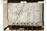
It looks like Airway CNF’s start with CA, but if so, why the CFLMZ down in the lower left?

1788388702822.png
 
It looks like Airway CNF’s start with CA, but if so, why the CFLMZ down in the lower left?

View attachment 154741

I wasn't aware of the existence of CA CNFs, but it makes sense if, for example they ran out of CFxxx fixes (17,576 possibilities, minus some for such reasons as obscenities).

Or, it's possible that fix CABUS was created before the CF rule came into effect.

EDIT - oh yeah, that's an old one. CABUS was established in 1997. Well before any rules on CNF naming.

Those airway CNFs are a perfect example of CNF use, though. In each case you're following one radial until the intersection with another radial of another facility and then following that. Easy and straightforward to do with basic VOR navigation skills. But an FMS needs something to navigate to, so a CNF is placed at that intersection.
 
Last edited:
Yeah, that one got a name change, as starting maybe 12-15 years ago it was determined that CNFs had to start with "CF". Before that, they could be any combination of letters. I did try to pick an unpronounceable sequence of consonants for my CNFs, since they would never actually be spoken. I remember I had named a CNF "ZZZZZ" which I thought was pretty fun. It was later changed. I believe it was at Portland PDX.

EDIT - yes, PDX ILS OR LOC 10L. It's the LOC MAP which is now CFBGC. I remember this project pretty well, since that Loc also passed close enough to the approach end of VUO to call it an LDA into VUO, with the same fixes on final. It was one of those fun geometric situations that happen occasionally.

I also think I remember why the LOC MAP needed to be a CNF instead of just a DME fix like the rest of the fixes on the procedure. Looking at the chart, the VDG DME antenna is not at the localizer (at the far end of the runway) like is optimal. From the chart it appears it's at the opposite end localizer (at the approach end), which is not uncommon either, the opposite direction ILSes sharing the same DME antenna. But IIRC, in this particular example, the DME antenna isn't actually at that end's localizer either, it's off to the side some, for some reason I assume of geography or wiring or obstructions or whatever.

For a DME to be used for a fix, the antenna has to be within 23 degrees of the course at that fix. If it's too far off to the side, the DME distance is not usable. This one is usable for all the fixes up until the last one (the LOC MAP), where it exceeds 23 degrees and therefore could not be used. Notice this procedure has a timing table as well, which would be needed for the loc final even if you had DME (and didn't have GPS obviously), which is a pretty rare situation that has fortunately been overcome by technology.
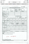
VUO was my last home airport. That Approach was hard to get, Portland Approach hated it, you could expect long delays if you insisted. We would use the VOR-A at PDX to get underneath and then cancel. The LDA-A got cancelled recently and there is now the RNAV (GPS)-B to VUO. Anyway, I went digging around and found my old Jepp Binder from back in 1980. It was the LDA (BACK CRS) Rwy 8 Approach then. It used the PDX 28R Localizer I-IAP. I’m trying to take and post a pic of it but it’s not working. Interesting line of minimums. It has a STRAIGHT-IN LANDING RWY 8 with MDA 540 visibility 1. And CIRCLE-TO-LAND 940- 1 1/4. Were you there to decommission this one and do the original LDA-A?

EDIT: Ah Ha

1788435742528.png
 
Last edited:
VUO was my last home airport. That Approach was hard to get, Portland Approach hated it, you could expect long delays if you insisted. We would use the VOR-A at PDX to get underneath and then cancel. The LDA-A got cancelled recently and there is now the RNAV (GPS)-B to VUO. Anyway, I went digging around and found my old Jepp Binder from back in 1980. It was the LDA (BACK CRS) Rwy 8 Approach then. It used the PDX 28R Localizer I-IAP. I’m trying to take and post a pic of it but it’s not working. Interesting line of minimums. It has a STRAIGHT-IN LANDING RWY 8 with MDA 540 visibility 1. And CIRCLE-TO-LAND 940- 1 1/4. Were you there to decommission this one and do the original LDA-A?

EDIT: Ah Ha

View attachment 154744

I did not know about that! That's even more amazing than my example of it being an LDA. An LDA Back Course straight-in to a different airport, that had to have been the only one of its kind.
 
I did not know about that! That's even more amazing than my example of it being an LDA. An LDA Back Course straight-in to a different airport, that had to have been the only one of its kind.
VUO has a history of being unique. It once was a Class D Surface Area but did not have a Tower.
 
Back
Top