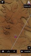
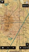
I'll switch between Sectional and the VFR map (and I like that GP distinguishes between a "chart" and a "map"!) for planning, but I fly exclusively with the VFR map. Once I took the time to set it up properly, the dynamic display (or culling) of information is truly excellent. I like that when I'm low to the ground, I get full display of obstacles, but those drop off the map once I climb out. Similarly, airspaces, terrain, and ADSB aircraft are displayed/highlighted only when they are plausibly relevant.
I don't think you would want to fly via pure pilotage with the VFR map, as the Sectional does a better job of showing landmarks. Region is also a factor. Flying Colorado's front range 20 years ago, the Sectional was a thing of beauty, showing detail without being cluttered. The modern DC SFRA region chart, on the other hand, is a nightmare of crowded information. My hat is off to the folks who figure out how to cram it all in, but deciphering that visual clutter is best done on a table with a cup of coffee, rather than in the cockpit.