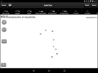
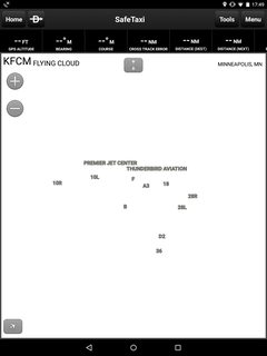
Yes, this happens to me all the time. To me it SEEMS like when I first start GP, say at home for flight planning, and check out the safe taxi chart, it works fine.
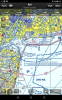
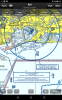
In flight, after flying for say 3 hours, collecting weather data via XM the whole time, etc. when I get to my unfamiliar destination, THAT's when the Safe Taxi is almost always blank, just like the images you posted.
Not sure if it's related to the length of time GP has been running (and/or memory usage storing all the weather data, track log, etc. during that time)? Or if it's just that I happen to notice it more after a flight to an unfamiliar airport when I really want the chart, and I just don't notice as much if I get the blank chart sitting on my couch at home?
It's gotten to the point where I don't even use SafeTaxi anymore. I just use the "Airport Diagram" pdf and give up the georeferencing. I wish they would just show your position on the FAA Airport Diagram chart like competing products do, since the Safe Taxi charts do not work well. (In fact, even when they do work, I would prefer the FAA charts - often the taxiway designators do not display and I have to zoom in/out a while to get everything to display on the SafeTaxi chart.)
![Screenshot_2015-04-29-17-39-36[1].png](/community/data/attachments/32/32221-b61afb37314c3d7ae495cb4873be7b28.jpg)
![Screenshot_2015-04-29-17-40-27[1].png](/community/data/attachments/32/32222-8ea772e0f493b9bdbe5b8821fb9ca2ff.jpg)
")

