G1000 VNAV ATD offset from airport

RussR

En-Route
Joined
Jan 12, 2011
Messages
4,050
Location
Oklahoma City, OK
Display Name

Display name:
Russ
I fly a G1000-equipped PA-46 (if it matters) fairly regularly. I like the VNAV planning feature for descent to the airport, and usually set an ATD offset of about 1500 ft AGL 5 nm prior to the airport, as shown below.

But if ATC amends my routing, as they did today, when I enter in the new fix (in this case CDS), it wipes out the ATD and I have to re-enter it. It does this whether or not the new routing is going to "interfere" with the descent or not.

To word it a different way, if in the example below I was given another re-route and had to enter "ABC" in between CDS and "KRQO -5nm", it would remove the "KRQO -5nm", thereby removing the ATD offset and therefore the VNAV functionality.

It seems like it would be pretty easy for it to automatically calculate a new TOD with the new route, since regardless of the new routing I still want to hit 3000 at 5nm before KRQO.

We're not talking loading an approach procedure here, that I get, because they would have different altitude constraints than I selected.

Is this normal behavior for the G1000, or am I doing something wrong? (I did try looking in the manual, but couldn't find this case.)

Thanks!

XTKI3jSldCKBhxqwcr6GHXbs6lJ55Erz5I8KQ_-GHkom91Tlo9mG4nDtdwGb4rNg9jxjkYHYxM8qrC_7VhEWGT6wn7HBYuxQSh2LgrRuGuGLK-hR56SyEMLxmWi9z2SlVG3JoYd4NNlc0NQAmus1ed_GuFcTBOIHHKj6VWrfK59106rj8WC_JZCjQ-Hw1ozNYVftyobheWbceD3626DIcJVxUiiMi8cfkLoLo-jc5D84ZN2EPRCJTjOdonbIx4hRa8h2ipI-SzS9kyWzFIjGQGuHmANY-3tGSW8crjLLkYchWDpz9MIhM7A1YFHRfmDL8B5g4rIF8TdLPbB9HvqHHTPVReH5CMb_hZPq5IOlvDjjaMlmQy_68EjNkpB-W6TtrUdmmwFycd-F1VZcHX9G9LlS_9txyrKBkJ2T1k2n1wQ_Ysb5QimNNgbUBWXzqzv2U0tmeJ-zlS4eA2xkmPPDNCmWox-1q_jFIoZVBW_28p5M0TzIn9TnrXGwaJtyLfVFlUgx-1g2kWVpOiWYeUsABUCveigHAkYeg7nazkFWaxgSgSCEcDDZzLPzM0YkL84ovmNFcys7pV8JcCiGNAbQdaIwOWpwQLu0ACPf999m-FRo-o_4SlVY4WIhqPUSzFz7sAOaZDituDkdjPapVHAj1YRzczhljJehldlPHu18f5k6voki4R6eNslePdGlXmvT2w_BHHcb7h1epYGcN7NE4CT8=w1476-h937-no
wgoXMVA6mlUXKLQ8pho8YyPz1rJwDo7h_8iKLcUeST-kaAFLllzunMgnOhdPLR52JMmyU0vB4jWiFpc8DtTSc6LV7t-06DKsA0KMiNeqKu2TnG51kEvG4gLrGXwdXx-S7sTJ1-ptHfGDgowzNhV7OVWfHM1A-hyV4W8g3VMouMFpiZcTikicEIGZxrZKXxzMIOAFTtILSInLEehK76T15f911HEMJxKVCRc-4A0K4M5c0F4g5xSxyffGRd4GIPszGCq-uO7duLj2j84WpQ5h0i-4-UDjRuLWtcjHL46yRKEDUyYJFH0-jWT0G7sXgOoNrVvkbd9IYcK7QkG2TwzxYd9xOehbiiVIPiNhxOwk3LQhhDk8R52zW4u07pM9oq6KVMd7jnPIoAZ97RDfhMD2_5qjcnqRr1-oSDnsVL3Wowjw_KHKJMmWhXDHk6zgxkljJ-PEfnMT_84zGa-emwUZf7h51d09YmuUG27y8nkEARWPkhsZ6H67lylGYNROnSOAs9nZPIixTiq73XeJI5JaNZkHu79CkkbXPCJaEVCqd_Y5G0IxtzabK5YzsZnrutSaTMdGCYL1ASrzzLqevM7uWbg_oFQpZ1FsTLXJsZzZegpaDqveZsVtCB_q77Ujjw1LWFL7k8_ynfGPqnR5qPW6xrxOVnDzI5nn0ABaTu-gJATJX8YAVHZbQnubrYgYL7Ivav-TxCApGio1qrDJS6qXYNlb=w1334-h848-no
 
Last edited:
Sorry, I haven't tried it in my flavor G1000 but inserting a waypoint before the offset waypoint does not remove the offset waypoint nor its altitude constraint in the GTN. Doesn't mean earlier models did it.
 
Last edited:
I suspect very few are so knowledgeable about the G1000 that they could comment. Of course, that has never impeded anyone before.

I read it as the software engineers must have had a reason for it, although perhaps not a well thought out one. I don’t know enough about the system to even hazard a guess as to what they were thinking or why.

I can hazard a guess. The Garmin ATD waypoint is a fixed location - a temporary user waypoint - based on your course to the waypoint when you created it. It doesn't float with course changes*. So, for example, if heading to KRQO on a 330 course, it will create the 5 mile ATD southeast of the airport at 150 degrees, 5 miles from KRQO. If for some reason you have to be routed northeast of the airport, the ATD waypoint will still be to the southeast. I can see the designers deciding that's probably not what you want to do (it can be confusing in some situations) so it gets deleted. Perhaps later designers are just allowing the pilot to decide whether or not to keep it.

(*the Avidyne does float - it's not a separate waypoint. Not better, just different)
 
Last edited:
I can hazard a guess. The Garmin ATD waypoint is a fixed location - a temporary user waypoint - based on your course to the waypoint when you created it. It doesn't float with course changes*. So, for example, if heading to KRQO on a 330 course, it will create the 5 mile ATD southeast of the airport at 150 degrees, 5 miles from KRQO. If for some reason you have to be routed northeast of the airport, the ATD waypoint will still be to the southeast. I can see the designers deciding that's probably not what you want to do (it can be confusing in some situations) so it gets deleted. Perhaps later designers are just allowing the pilot to decide whether or not to keep it.

(*the Avidyne does float - it's not a separate waypoint. Not better, just different)

I disagree. If your suspicions are correct, and I think they probably are, then the Avidyne solution is indeed far superior.

I mean, at least as far as I can tell, the whole purpose of an ATD waypoint is for descent (and sometimes climb) planning. I would consider the ATD point to be less of a "point" (as in having coordinates and such) and more of a circle around the waypoint. After all, that is how you specify it - a distance from a waypoint, not a bearing and distance. So if I want to cross 5nm from the airport (or some fix) at some altitude I don't care which direction I'm coming from, or what the preceding waypoint is.

A related issue I'm not sure of, and may be able to test today, is whether if I deviate off the direct course, but then "re"direct it, if the ATD fix moves too, or if it puts a kink in the route. That will be easy for me to test, if I remember...
 
I disagree. If your suspicions are correct, and I think they probably are, then the Avidyne solution is indeed far superior.
Like most of the differences I found when doing my COVID project, it depends what you want to do. A flip side example is an instruction to hold 20 west of a waypoint. In Garmin, you can create the 20 west ATD and, since it's a static waypoint, hold there (assuming your version of the G1000 creates holds). In Avidyne, since it's not a static waypoint, you can't. You have the create the user waypoint independently. Funny, when I saw this behavior with the hold, I thought, "well here's something Garmin definitely does better." And here yo are saying the exact opposite about the same thing.

BTW, yes, in the G1000 I get the same thing - the ATD gets deleted. But that's not necessarily the case with later software upgrades or the most recent series.
 
A related issue I'm not sure of, and may be able to test today, is whether if I deviate off the direct course, but then "re"direct it, if the ATD fix moves too, or if it puts a kink in the route. That will be easy for me to test, if I remember...
The ATD fix does not move. If I understand what you are asking, Direct to it will create a course from wherever you are direct to that waypoint.
 
So, does it get removed on the G1000 because it's no longer on the track? Best guess....
 
Well I just got back from a flight.

1) I had an ATD fix set 5nm prior to my destination airport. I was taken off course by ATC. When I went direct to the airport again, using "Direct-Enter-Enter", it did indeed move my ATD fix to align with my new inbound course. This is the behavior I would expect, and I was glad to see it.

2) BUT, what I discovered is that (apparently, unless I'm doing it wrong), when you go Direct-Enter-Enter to your destination, it resets the vertical profile to 3 degrees (note this is NOT using the VNAV Direct function, though I use that and like it). I would have the vertical profile set for a 500 fpm descent. If I got taken off course for a bit then cleared direct, it would reset that vertical profile, causing me to have to re-enter the desired vertical speed. I didn't like this functionality. Now, a 3 degree descent may seem reasonable, but at 180-220 kts GS, it's about 1000 fpm, and this is an unpressurized aircraft - so that's a little fast for comfort.

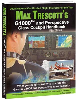
I'm flying this airplane 7-8 hours a week, so maybe I should just get Max's book to learn the ins and outs. Anybody know if it covers things to this level of detail?

512EDMDf2TL._SX308_BO1,204,203,200_.jpg
I'm not sure any single reference contains everything. I thin that's true of all the units because of software updates changing functionality. But it's especially true of the G1000 because configuration and some functionality is OEM-specific. Even the set up of the MFD in a Cessna G1000 is different than in a Diamond G1000.
 
Last edited:
Anybody know if it covers things to this level of detail? (Max Trescott book)

Yes. It is a VERY detailed book. It's about 300 pages long and the information is extremely dense. It may be the best G1000 book out there, but it doesn't cover every possible thing you want to do. For example, there's no ATD, but there is an extensive discussion about Along Track Offset waypoints. You might be able to piece it together from the level of detail there.
 
Back
Top