tawood
En-Route
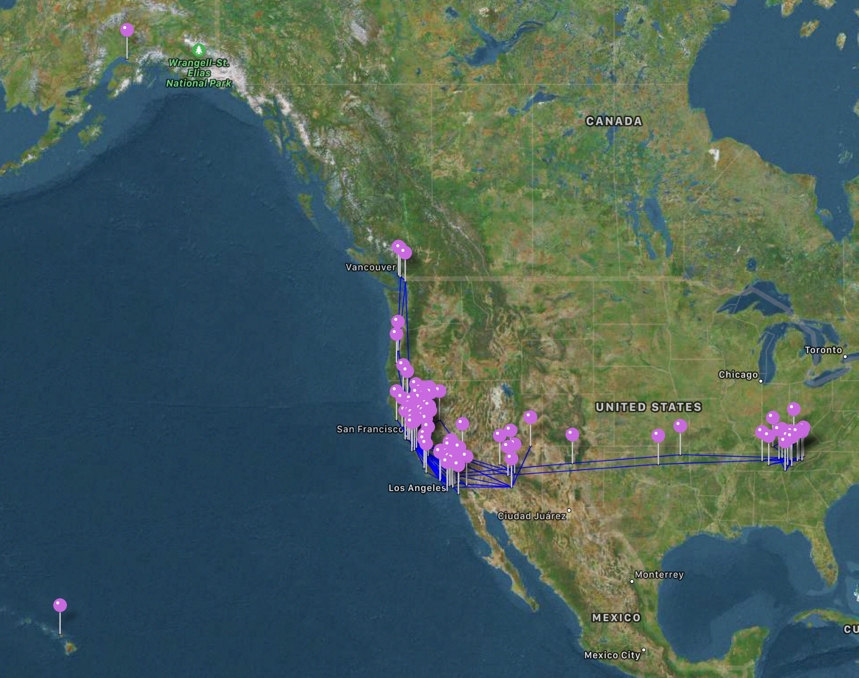
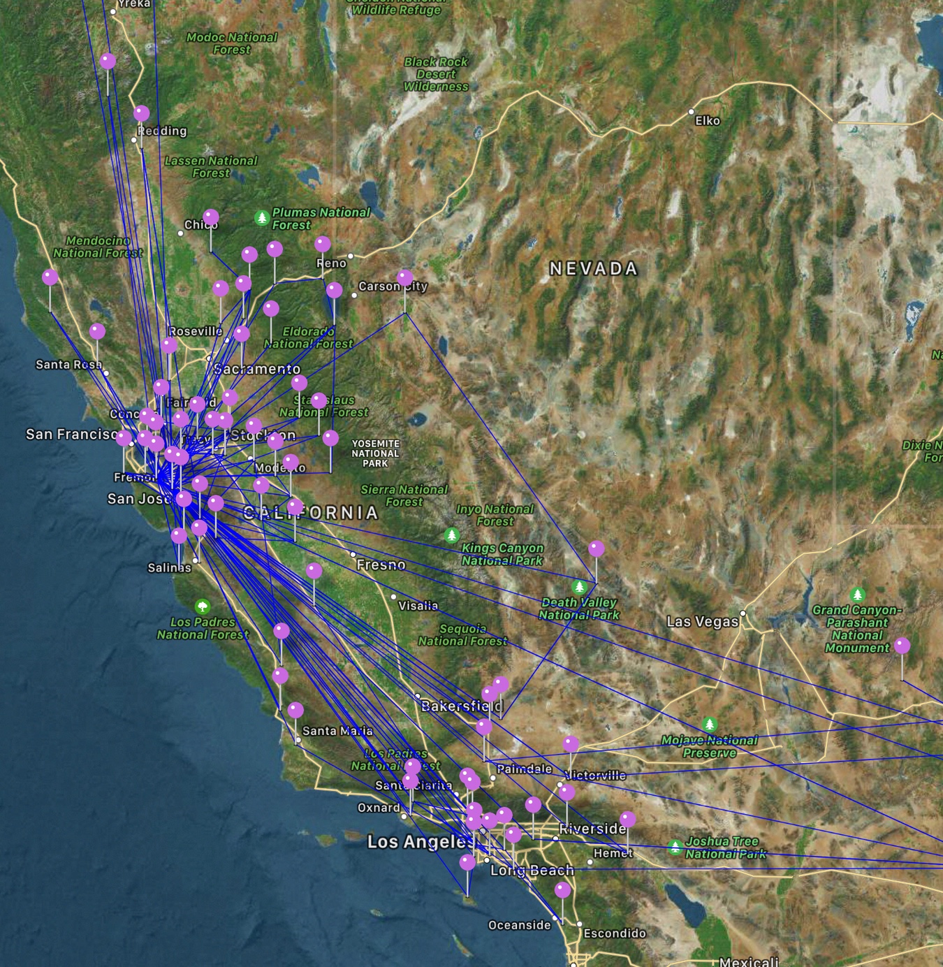
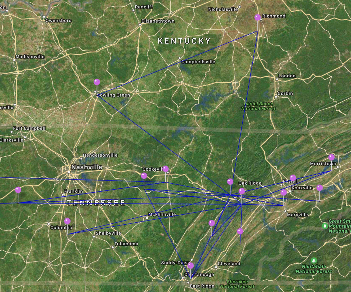
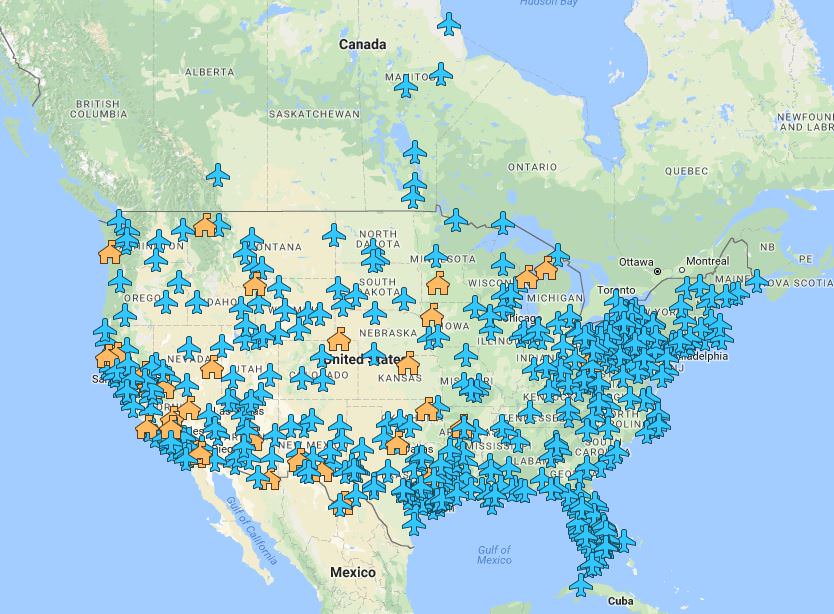
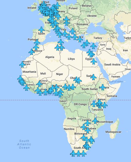
I was given the idea from POA member @GMascelli to make a map of every airport I've made at least one landing...it took me awhile, and it was quite surprising for me: Even though I've only made maybe 5 trips beyond 300nm, I was surprised at the total number of airports I've visited. This actually isn't a complete list because several are no longer in operation, and my log didn't have enough detail to figure out what now-closed airport I was once flying out of.
Its easy, if you want to make one yourself. Just Youtube search "custom google map"...lots of tutorials.
https://drive.google.com/open?id=1ZgZQA_UA_zZjp49-N3kjuUB_4U8EVzW9&usp=sharing
Its easy, if you want to make one yourself. Just Youtube search "custom google map"...lots of tutorials.
https://drive.google.com/open?id=1ZgZQA_UA_zZjp49-N3kjuUB_4U8EVzW9&usp=sharing
")