Best bang for buck EFB?

cocolos

Pre-takeoff checklist
Joined
Jul 4, 2012
Messages
468
Location
Davis, CA
Display Name

Display name:
cocolos
I'm getting back into it again after a year of not flying, but I need an affordable EFB. I used to use foreflight but last I checked it was around $150/yr. I am planning on starting my instrument training in the far so ifr charts will be a requirement.

Anyone have pireps on garmin or wings?


Sent from my iPhone using Tapatalk

I use Garmin Pilot with a GDL-39-3D that works nicely. All of them cost about the same, Garmin has the only international charting.
 
Flightplan.com has a mobile app that is free. Moving map GPS, VFR sectionals and approach plates. I have foreflight now, but I won't renew.
 
Foreflight and WingX are both $75/yr for VFR and IFR charts. The additional cost is optional and only is you want fancy, shmansy to see your airplane on the ground or on an approach.
 
I use Garmin Pilot with a GDL-39-3D that works nicely. All of them cost about the same, Garmin has the only international charting.

Except Foreflight is the only one to offer Central America and Caribbean on the basic subscription though, right? That's a substantial discount over GP Global if as far as you'll ever go is Panama and the Caribbean.

Don't get me wrong, based on my disdain for iCrap I'll probably end up going the GP Android route and just get paper charts for my Caribbean one-off bucket list flying needs.

Flightplan.com has a mobile app that is free. Moving map GPS, VFR sectionals and approach plates. I have foreflight now, but I won't renew.

What made you decide not to renew? Better options out there?
 
Except Foreflight is the only one to offer Central America and Caribbean on the basic subscription though, right? That's a substantial discount over GP Global if as far as you'll ever go is Panama and the Caribbean.

Don't get me wrong, based on my disdain for iCrap I'll probably end up going the GP Android route and just get paper charts for my Caribbean one-off bucket list flying needs.


What made you decide not to renew? Better options out there?

I am a VFR day, fair weather flyer, I don't need bells and whistles and fltpln.go does everything I need. Moving map GPS, sectional, i can download a flight plan to it. Checklist, Af/d, weather ( although that is only on the ground) scratchpad. That's more than I need really. And it's free.
 
Android + Avare.

Free sectionals, AFD, IFR enroute hi/lo, geo ref approach plates and taxi diagrams, weather, ads-b. All free.


The end.
 
Android + Avare.

Free sectionals, AFD, IFR enroute hi/lo, geo ref approach plates and taxi diagrams, weather, ads-b. All free.


The end.

^^^^^This. :yes: it's free. Charts, plates, sectionals, all free, as many as you have memory to store. Give it ten minutes or so to update. Don't know about international plates, I don't go there.
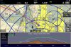
I run it on an old Samsung Galaxy tablet, but have heard there is an iApp available now.
 
I'm going to try fltplan. You can't be free. How do they make any money?


Sent from my iPhone using Tapatalk
 
I'm going to try fltplan. You can't be free. How do they make any money?

Honestly... fltplan is garbage, buggy, and slow.

Avare is free because the author wants it to be. It is constantly being updated and improved.
 
Except Foreflight is the only one to offer Central America and Caribbean on the basic subscription though, right? That's a substantial discount over GP Global if as far as you'll ever go is Panama and the Caribbean.

Don't get me wrong, based on my disdain for iCrap I'll probably end up going the GP Android route and just get paper charts for my Caribbean one-off bucket list flying needs.

What made you decide not to renew? Better options out there?

I use Garmin Pilot. It seems to work well in the cockpit (esp. if you're Garmin friendly) and runs pretty equally well on both Android and IOS. Foreflight also seems to work well and I have one friend that likes WingX. I guess it's all really preference.
 
I've tried/subscribed to every one of them. Any will meet your needs. ForeFlight simply works best for me. The cost is the smallest item in my annual flying budget and well worth it. 35 years ago I spent twice (really four times in current dollars) that amount for my IFR charts covering a dozen states....no VFR, no A/FD. EFBs have been an absolute godsend for aviation, especially GA.
 
Last edited:
How do the weather functionalities compare


Sent from my iPhone using Tapatalk
 
I'm a Foreflight fan, but from what I've seen of Garmin and WingX, they both look pretty good, too. If you're IFR, make sure to have a backup!!! I fly with two iPads.
 
I might give garmin. I don't like how wingx looks


Sent from my iPhone using Tapatalk
 
The interface design


Sent from my iPhone using Tapatalk
 
The interface design

I assume you're talking about the buttons being plain, because the UI function is fairly similar to ForeFlight. The EFB functionality is the same on both as well, you can look up publications, charts, ect.

My advice is you'll get what you pay for... so pick Garmin, WingX or ForeFlight and go with it. I use WingX and prefer it over the other two.


+ 1 for WingX. FF makes excellent use of the iOS API but the downside of that, what my wife calls " pretty" interface, is that they make great use of new iOS API feature with each iOS release, which tradionally will slow older iPads, causing you to purchase a newer gen iPad to get the horse power to make full benefit of all those "pretty" new features.

FF and Garmin requires ios8 as a min, WingX is ios7.
 
Last edited:
I'm a Foreflight fan, but from what I've seen of Garmin and WingX, they both look pretty good, too. If you're IFR, make sure to have a backup!!! I fly with two iPads.

You do realize that any unapproved system (ALL tablets are unapproved, except as a source for charts) IS your backup, right? Please don't fly with ForeFlight, Garmin Pilot, etc, running as your "portable, primary navigation system"!!

That goes for VFR and IFR.
 
You do realize that any unapproved system (ALL tablets are unapproved, except as a source for charts) IS your backup, right? Please don't fly with ForeFlight, Garmin Pilot, etc, running as your "portable, primary navigation system"!!

That goes for VFR and IFR.

Well said. Batteries die , tablets freeze just when you need them most. I still carry paper and keep it close by.
 
If you can get past the design it really is a wonderful product.


You're right I watched a bunch of their videos on their YouTube channel. They have a lot of neat features for half the price of foreflight.


Sent from my iPhone using Tapatalk
 
The title is best bang for the buck and, that being said, the three year deal for WingX is hard to beat. The basic sub for WX contains the features that require pro subs elsewhere.
 
Is there a pro and a standard version for wingx?


Sent from my iPhone using Tapatalk
 
Is there a pro and a standard version for wingx?


Sent from my iPhone using Tapatalk

Sort of... every version is WingX Pro... that's the base version and then you can add on Fuel pretty cheap. Their upgraded version is called Advance IFR which has the main feature of Geo-referenced plates and routing.

Most people start with Foreflight and use it because their CFI and their CFIs CFI used this. Foreflight has done a great job marketing their product and as an early adapter got it out to market. I used it for three months but because of their agreement to support Stratus ADS-B only I had to find another solution after my Navworx installation. I tried Garmin and couldn't get it to pick up my ADS-B traffic and weather. Messed around with it for a bit, seemed familiar enough but then tried WingX.

My reaction was probably like most peoples in that it looked very clunky... big buttons, no diffused colors. Even the startup icon looks like it was made in MS Paint. However as I loaded it up I figured out I could get it to work on my home Flight Simulator. So I was doing fake flights using a real EFB. That really gave me a chance to run it through the paces and get used to it. The two main features I liked were the route planning, which I found extremely intuitive and easy to work through, modify ect. And the split window function.. so I could have a map up and notes, or a map and chart (Which I didn't know how to read yet). Once I got in the plane with it, I knew how to use it and it connected and worked like a champ. They've added timers, re sizable windows and some other features that work nice. I'm past the chunkiness of it, and when it's bumpy out I don't mind the big clear icons.

I have since been working on my Instrument Rating and bought the Advanced IFR upgrade. Geo reference charts are great for situational awareness. I can pull up charts, go back and forth between views and now they have timers built in. The flight planning is still easy as ever. Also have a backup on my phone which I've done a few flights with.. so I don't need a backup Ipad...
 
Is there a pro and a standard version for wingx?


Sent from my iPhone using Tapatalk

Standard version is full featured and includes geo referenced airport diagrams, SV plus 'Replay' that records track, speed etc, all without extra hardware ( see attachment) and works with various ADB-S in units.

You don't pay for extra features when they are introduced

An addition IFR subscription adds geo ref approach plates.
 

Attachments

  • image.jpg
    image.jpg
    258.8 KB · Views: 46
Last edited:
What were you flying to get a climb and descend profile like that? Helicopter?
 
That makes more sense... I don't use the profile view because Oklahoma is pretty flat.

Its not profile view per say, but that is also included in the base product, but the replay function is far more than showing you speed/Altitude over the terrain profile, it can replay the complete flight on top of the WFR/IFR charts, allowing you to match you actual course (yellow line on my image) to your planned course. Can also export to Google earth and I believe the flight history used by replay is very compact, so its not chewing up your ipad memory.
 
You do realize that any unapproved system (ALL tablets are unapproved, except as a source for charts) IS your backup, right? Please don't fly with ForeFlight, Garmin Pilot, etc, running as your "portable, primary navigation system"!!

That goes for VFR and IFR.
Russ is a smart guy - I think he knows that.

He was referring to charts. That is kind what an Electronic Flight Bag is. It replaces the 20 lb flight bag I used to carry for IFR.
 
Ahh it's the blackbox feature. I used that when they first put it in. Then I never used it again. Maybe I'll mess with it next flight.
 
Ahh it's the blackbox feature. I used that when they first put it in. Then I never used it again. Maybe I'll mess with it next flight.

I use it all the time, its great for giving first time passengers a quick review of where we flew, dump it to GE and send them the KML file.

Plus it highlights that the best planned trips still have ATC induced course changes !!! :)

Always wondered why Hilton refers to it as both "BlackBox" and "Replay" - pick one and stick with it !!
 
I used to GP but switched to FF. It's the little things. Extended center lines, show weather first, etc.

They all have essentially the same functionality. The differences are cost, interface and "the little things". Just my personal opinion but FF seems to win in 2 out of 3 areas.
 
Back
Top