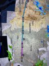
Altitude over I-70

David Loftus

Pre-takeoff checklist
Joined
Jan 1, 2021
Messages
111
Location
Johns Creek, GA
Display Name

Display name:
dmloftus
Looking for a new route for my annual trip from Atlanta to Vegas in my non-turbo DA40. In a single, I try to stick close to interstates near higher elevations and rough terrain to have an out in emergencies. I’ve flown the I-10 southern border route through El Paso and Tuscon, the I-40 route across Amarillo and Albuquerque, and the I-80 route through southern Wyoming and down thru Provo Pass. I’m considering whether my plane has the performance to fly I-70 west of Denver and the continental divide. Seems I would need to be at least 14,500 to safely traverse over the Eisenhower Tunnel. But there are some tight twists and turns west of the tunnel due to some of the higher peaks. I’ve had this aircraft up to 15,500 but it is pretty sluggish above 14,000 and very little margin for error. Anyone care to share their experience flying the I-70 route in a non-turbo aircraft? Thanks!
 
Last edited:
I don’t know - too much bad juju to fly over I-70 there for me. I take Rollins pass about 10nm north of there.
 
If you want to survive, I recommend you get some mountain flying insturction before you attempt this.

You do know that I-70 doesn't go over the mountain? It crosses the continental divide via the Eisenhower TUNNEL. US-6 which roughly parallels I-70 does cross over the divide at Loveland Pass which would be a foolhardy way to attempt to cross the mountains in a DA-40. It's elevation is 12,000. There are better passes to use are things like Corona pass. That could even be done without O2 (you only need to be above 12,5 for a short time. Still, I'd like oxygen as a flatlander (things were a little different when I learned to fly at BJC).

If you're bent on following interstates, you might try I-10 or I-90. Both have relatively bening mountain crossings or even I-40 (which will take you to Vegas.
 
I plugged in Atlanta to Las Vegas in foreflight and the direct route is not going anywhere close to Denver / I-70. Do you have a reason for going that way?

I would go via I-84 via Santa Fe KSAF. Quick look and the highest point this way seems to be around 8212’ and that’s the mountains on the side of the highway so technically you can be below this point. I picked a random Atlanta airport to Vegas and the direct to route is 1504nm and my suggested route makes it 1510nm so you aren’t really losing time / distance.

I wouldn’t plan something where you are forced to go to 15k feet. Remember that your ceiling is based on DA, not above sea level. I’ve had times where my bird was struggling at 8k and throw in a mountain wave you are getting downdrafts and updrafts putting you at 7k and then suddenly at 9k and back. There is no assurance nor performance in a NA at 8-10k much less at 15k if you suddenly got a downdraft and then had a peak to clear. From your initial message sounds like you’ve done this many times before? My first time I thought I had to be above the peaks but then I quickly learned to follow low altitude roads (other aircraft were doing the same) but I planned this in advance on foreflight, and only conducted the flight in good VFR days.
 
Out near Denver and the mountains, 400 pounds of passengers and full fuel. Cessna 172 with 160 hp engine. At 12,500 feet, ran into a 500 plus rate of descent and went to full throttle, leaned to max rpm, max rate of climb air speed and still had more than a 200 fpm descent. This continued for 2,000 feet, and gradually faded.

On the east side of the mountains, following I 70, this is likely to happen to you from the mountain above the Eisenhower tunnel, and continue until you pass over the top.


The good news, if you do get over, there will be a nice updraft on the other side!

My same trip, took off from Colorado Springs at 7 AM in September, to get a better density altitude, and turned east. The high terrain is to the west, but the terrain to the east is rising too. I was "counting jack rabbits" much longer than I liked, but used cruise climb speeds, full throttle, and leaned. No mountains around to produce down drafts, and thermals developing to ride up.

Up and down drafts of more than 1,000 fpm are common in the big mountain regions, and can last a long time.
 
In addition to what others have said, one thing I was taught: Never climb up a canyon.
 
I've known two expert pilots, both who should have known better that killed themselves in the Rockies. Twentyfive years or so ago, the Navion convention was in Grand Junction. When I read the information on routes into there they published, I told my wife with instructions like that, we'd be lucky we didn't lose someone. We did.

Mountain waves, density altitude, etc... are all unkind to pilots.
 
If you want to survive, I recommend you get some mountain flying insturction before you attempt this.

You do know that I-70 doesn't go over the mountain? It crosses the continental divide via the Eisenhower TUNNEL. US-6 which roughly parallels I-70 does cross over the divide at Loveland Pass which would be a foolhardy way to attempt to cross the mountains in a DA-40. It's elevation is 12,000. There are better passes to use are things like Corona pass. That could even be done without O2 (you only need to be above 12,5 for a short time. Still, I'd like oxygen as a flatlander (things were a little different when I learned to fly at BJC).

If you're bent on following interstates, you might try I-10 or I-90. Both have relatively bening mountain crossings or even I-40 (which will take you to Vegas.
I’ve had mountain flying instruction and significant experience. I used to live in Northern California and flew regularly to Tahoe, Truckee, and Yosemite. I understand there are other options with I-10,I-40, I-80, etc. If you reread my original message, I said I’ve flown those previously to KVGT. I’m looking for a new experience, so the idea of I-70 and visiting Rocky Mountain National Park for a day or two. Just looking for specific feedback from pilots who have flown the I-70 route and nearby alternatives.
 
Looking for a new route for my annual trip from Atlanta to Vegas in my non-turbo DA40. In a single, I try to stick close to interstates near higher elevations and rough terrain to have an out in emergencies. I’ve flown the I-10 southern border route through El Paso and Tuscon, the I-40 route across Amarillo and Albuquerque, and the I-80 route through southern Wyoming and down thru Provo Pass. I’m considering whether my plane has the performance to fly I-70 west of Denver and the continental divide. Seems I would need to be at least 14,500 to safely traverse over the Eisenhower Tunnel. But there are some tight twists and turns west of the tunnel due to some of the higher peaks. I’ve had this aircraft up to 15,500 but it is pretty sluggish above 14,000 and very little margin for error. Anyone care to share their experience flying the I-70 route in a non-turbo aircraft? Thanks!
By sticking to the freeways, you are missing out on some of the World's best aerial views. I thought DA40 was one of the safest planes, so curious why limit your flying to the freeways?
 
Going to need to be up around 14,000 feet to do that safely. Been planes lost going up that canyon including most of the Wichita state football team in a DC6. Downdrafts on that canyon could very easily exceed the minimal minimal climb performance of the DA40 at that altitude. So.... I wouldn't do it and I have many hundreds of hours of DA40 time in the Rockies. Wrong equipment for that mission. Could it be done? Maybe. I have always told my kids that words that send chills down my spine in aviation are probably, maybe, and I think. ;-)
 
By sticking to the freeways, you are missing out on some of the World's best aerial views. I thought DA40 was one of the safest planes, so curious why limit your flying to the freeways?
Only over the highest peaks and most difficult terrain when available. You’re correct, the DA40 is one of the safest aircraft. But it’s still a single piston with a normally aspirated IO360, and I want the option of a nice wide highway if I lose an engine without 10 miles of glide distance. In a twin, or even behind a single PT6, it might not be a requirement. But I try to stick to that personal minimum when available. Not always so conservative - over the years I’ve flown more than 25 passes over the Grand Canyon, flown down Yosemite and Zion Canyons, and buzzed Pacific coastlines at 200 msl. Sometimes you take the calculated risk for the scenic beauty, but I don’t constantly push my luck at high DA. Given the feedback on this forum and another, I’m likely to opt for one of my previous routes.
 
Last edited:
I've flown from KAPA to KGWS in the afternoon in the summer. While some days its quite nice, some days its not, you really have to look at the weather. The day I flew APA to GWS was early June, there was some weather along the way and I couldn't do direct, so I flew around the weather and picked up I-70 at Frisco. You don't need to be at 14,500 for that. I don't think I exceeded 12,500 on that route. I have also flown from roughly Canyon City to GWS as well, but had to land and park the plane for 4 days at Leadville then finish the trip to EGE, that was in the spring. I have flown many times from GWS to Minnesota and South Dakota, I cross a pass between Grand Lake and Estes Park, I've done that in the evening in the summer, mid day in the winter, and morning in the summer, probably a dozen times either way. It's predicated on weather. One trip in the spring, I was flying a Husky A1-C, my ground speed from GWS up to Grand Lake was in the mid 140's. At the pass, I thought I had really blown it, I could see the snow rolling off the cliffs on the east side, my ground speed went up to the 160's, I was at 13,700. I was ready to be inverted and thrashed, but it was only moderate turbulence. Once clear of the mountains, I dropped to 9,500 and had a wonderfully smooth flight all the way to STP with groundspeed of 172 at one point.
The day you want to fly, look at the weather at the airports along the way, as well as the remote reporting points, look at winds aloft, take all of it into consideration. Ask someone familiar with flying in the area. I've flown some wonderful days in the Colorado high country, it was my backyard for many years.
 
Please, feel free to fly the I-70 route over the tunnel. We (CAP Colorado) need more practice finding crashed aircraft near Loveland ski area. Haven’t had one yet, but it’s still early in the year.
 
Going to need to be up around 14,000 feet to do that safely.
Higher than that. While the low point of the pass is 11,900, there is high ground both north and south up toward 14,000'. No sane person crosses in a NA single at Loveland pass when there are lower passes not more than 30 miles away.
 
Higher than that. While the low point of the pass is 11,900, there is high ground both north and south up toward 14,000'. No sane person crosses in a NA single at Loveland pass when there are lower passes not more than 30 miles away.
Let's continue the reasons....there's NO reasonable place anywhere near the tunnel for an emergency landing. Granby is 25 nm north and you'll need to be at LEAST at 15K. East? turn around and hope you can make it to the flatlands. South? Forget it. West? Surely you jest. You're only option is to head NW on the west side of the tunnel and hope & pray you can make it to the valley between Silverthorne & Kremmling for a bit of flat-ish land and not run into the power lines. Following I-70 and hope to use that for landing doesn't work. On the east side, twisty little passages. On the west side, well, let me describe how I usually drive from the Tunnel to Silverthorne in the winter...shift into low, hold on, and hope I don't need to brake because the road is an ice rink - an incredibly steep ice rink.
 
I’ve had mountain flying instruction and significant experience. I used to live in Northern California and flew regularly to Tahoe, Truckee, and Yosemite. I understand there are other options with I-10,I-40, I-80, etc. If you reread my original message, I said I’ve flown those previously to KVGT. I’m looking for a new experience, so the idea of I-70 and visiting Rocky Mountain National Park for a day or two. Just looking for specific feedback from pilots who have flown the I-70 route and nearby alternatives.
No one willingly flys the I-70 route in a single. Not unless the single is a Pilatus or an F-16.
Mountain training and experience is radically different in the various areas. This is why Colorado Pilots Assoc and the New Mexico Pilots Assoc each have 2-day training programs. CPA emphasizes the middle to north part of the state, NM does northern NM and southern Colorado. The terrains, the winds, are different hence the training is very different in the two areas.
 
You can go north through Wyoming, then south through grand junction, but it will add 150 miles to your journey.
 
I would be wary of I-70, especially west bound with the headwinds that predominate up high. If I was going to try, I would suggest on the way back when the winds and updrafts/downdrafts are most likely will be in my favor. I fly the interstates as well out west, not just for the lower terrain and off airport landing safety, but also multiple airports along the interstates to spend a nite due to weather or emergency.
 
I’ll add another voice saying go around the I-70 corridor in a single, not over it.

Plenty of better options not that far north or south of it. Lower terrain and wider passes.

Rollins is generally good to the north and gives you plenty of warning if winds aloft aren’t as forecast that you shouldn’t be up there prior to the Eldora Ski Area where the saddle starts to narrow westbound. You should be turning around there and going back to Denver if you’re getting your ass kicked prior to Eldora.

I-70 valley has nearly no opportunity for weather warnings via turbulence nor enough room to turn around in. Even if you’re on the ridge line and not in the center, ready for a nose down course reversal.

Loveland Pass is not oriented well for flying thru with prevailing winds nor low enough for comfortable AGL numbers. The possible downdrafts in ALL of our flyable and not as flyable passes will exceed the climb performance of nearly any single and most light twins. But Loveland Pass is simply asking for it.

To cross it with reasonable AGL margins you’ll be on O2 and you’ll be circling quite a while way east of it to reach that altitude in a location where terrain doesn't prevent the circle. Which in winter is right about where the mountain wave turbulence is worst, most days.

Cheers.
 
I've known two expert pilots, both who should have known better that killed themselves in the Rockies. Twentyfive years or so ago, the Navion convention was in Grand Junction. When I read the information on routes into there they published, I told my wife with instructions like that, we'd be lucky we didn't lose someone. We did.

Mountain waves, density altitude, etc... are all unkind to pilots.
My AI is a Navion man who lost his parents in just such a situation. Mountain wind patterns can be tricky and powerful. Plan for safety first and use every advantage you can. The most powerful airplane in the world is still vulnerable to Mountain winds.
 
My AI is a Navion man who lost his parents in just such a situation. Mountain wind patterns can be tricky and powerful. Plan for safety first and use every advantage you can. The most powerful airplane in the world is still vulnerable to Mountain winds.
That would be Kevin Woodside's father Byron. This is the incident I was referring to. Byron was instrumental in helping me get started with Navions back in the early 90s. I still go to Kevin for my annuals.

An amusing story on Byron. One day I was flying from IAD down the HEF (yeah, I know that's kind of silly) to take my instrument written. I told the tower that I was going to Manassas Air Center and asked where I should park. They told me I could just leave my plane at the base of the tower if I wanted (closest walk). When I came out I found a piece of paper closed in the Navion canopy. Well, it was someone who knew how to open the canopy. Turns out it was a parking ticket written by Byron.

Byron and Nina had six kids, all who owned either Navions or Tripacers (or both).
 
Not sure why you would even be close to Denver I fly from Winona Mn to Henderson nv twice a year I stop in Dalhart , you have almost a straight flight to Henderson nv and less than 5 dollar fuel till west of the Albuquerque ill fly west in April or may I always have a good headwind going west but I can make it with one fuel stop not sure your range, have fun , I always enjoy the ride.
 

Attachments

  • IMG_9878.jpeg
    IMG_9878.jpeg
    3.6 MB · Views: 23
I have a covered shade hanger in KHND , that sits empty most of the time let me know your trip days and your welcome to use it you can text me it’s easier than email for me. 7022498867
 
I’ll add another voice saying go around the I-70 corridor in a single, not over it.

Plenty of better options not that far north or south of it. Lower terrain and wider passes.

Rollins is generally good to the north and gives you plenty of warning if winds aloft aren’t as forecast that you shouldn’t be up there prior to the Eldora Ski Area where the saddle starts to narrow westbound. You should be turning around there and going back to Denver if you’re getting your ass kicked prior to Eldora.

I-70 valley has nearly no opportunity for weather warnings via turbulence nor enough room to turn around in. Even if you’re on the ridge line and not in the center, ready for a nose down course reversal.

Loveland Pass is not oriented well for flying thru with prevailing winds nor low enough for comfortable AGL numbers. The possible downdrafts in ALL of our flyable and not as flyable passes will exceed the climb performance of nearly any single and most light twins. But Loveland Pass is simply asking for it.

To cross it with reasonable AGL margins you’ll be on O2 and you’ll be circling quite a while way east of it to reach that altitude in a location where terrain doesn't prevent the circle. Which in winter is right about where the mountain wave turbulence is worst, most days.

Cheers.

Thanks Nate. Any suggestions on a route to Grand Junction from Boulder utilizing Rollins Pass? I've taken mountain flying classes and flew a lot in northern California mountains when I lived in Silicon Valley. I've done a fair amount of flying in the mountain states, (Northern/Southern Coastal Ranges, Sierra Nevada, Wasatch, Taos, Tetons, etc) just never directly west of Denver. I have experienced challenging turbulence and significant up/downdrafts. I also have oxygen systems and almost always fly now with my Inogen oxygen generator anytime I'm over 10K MSL.
That being said, I'm not going to do something stupid. If I can find a route that provides sufficient ground clearance, AND I get fantastic weather with good DA's, AND the plane is flying well, I will consider it. If any of those factors don't pan out, I sit on the ground and do more sight-seeing until conditions improve or reroute north to I-80 across Wyoming/Utah and down thru Provo Pass, which I have also flown before. I definitely don't want to be the subject of an AOPA ASI (God rest Richard McSpadden) or YouTube pilotdebrief.com analysis.
Not sure why you would even be close to Denver I fly from Winona Mn to Henderson nv twice a year I stop in Dalhart , you have almost a straight flight to Henderson nv and less than 5 dollar fuel till west of the Albuquerque ill fly west in April or may I always have a good headwind going west but I can make it with one fuel stop not sure your range, have fun , I always enjoy the ride.

I've flown the southern routes several times and I'm considering different options. I'm not necessarily looking for the most direct route east to west. We buy and fly planes for the incredible experiences, not just point-to-point transportation. Usually I stop several places along the way to see national parks, etc, ie Grand Canyon, Sedona, Zion. I've never seen Rocky Mountain National Park so I'm considering Denver/Boulder area as a stopping point before proceeding west. It will probably add 400-500nm to the journey, but not a big deal to see some beautiful scenery.
BTW, the southern routes are no picnic in late spring/early summer when I plan to go. I've encountered severe turbulence across northern and southern Texas (especially across the dry line), New Mexico, and Arizona. I actually set down in Albuquerque for two extra days last year to wait out high winds and dust storms, >60kts. I pad my travel schedule by several days on the front and back end so there is no pressure to fight bad conditions.
 
Last edited:
I have a covered shade hanger in KHND , that sits empty most of the time let me know your trip days and your welcome to use it you can text me it’s easier than email for me. 7022498867
Wow, thanks Tom. That's fantastic. KHND and KVGT FBO overnite fees have definitely gone up over the past few years for a simple single engine tie-down. I'll be in Vegas the week before Memorial Day. I'll text you.
 
I agree on the rough ride I am retired so if there is turbulence I don’t go I have made this trip 40 to 50 times when I had a twin I would fly direct from Henderson to Alliance nb. But I don’t fly over the Rocky Mountains in a single engine plane anymore , I was involved in turbulence going to Eagle co. one time and I don’t ever want to do that again , but we all have our go no go list. Have fun on your trip. Tom
 
Ok text me I will be in Mn. Then you are welcome to it. It’s sunshade 1. space 2 the south side closest to runway I’ll send a picture. Have fun. Tom
 
Is Colorado Springs to Buena Vista then thru Tennessee pass to Minturn viable?

Kinda. Which pass you want to use?

La Veta has a habit of eating airplanes but mostly because it’s incredibly long even though it’s not as high as say, Rollins.

I’ve never figured it out completely. You are kinda committed once you’re way up in there but it’s still very wide. I think folks fly up the middle where you’re not supposed to be… and yeah the downdrafts in there can be impressive.

The wind absolutely screams through that pass out on to the plains with any pressure difference.

I do like the southerly routes better than the northerly ones for terrain you might survive a landing in.
Was thinking follow US 24 through Wilkerson Pass, then turn north at Buena Vista and follow the railroad. Seems pretty benign when I've driven that route. Tennessee Pass to Minturn would be hairy if you had a problem, but it's down valley.
 
Gentlebeings...the question was asked for reasonable routes thru the Rockies. Those of us who live here, and fly here all the time, have been responding with both personal and community knowledge. Please stop trying to find "loopholes" or alternatives to our recommendations. I'm not kidding when I say CAP gets called out far too often to do aerial & ground searches for missing aircraft. Altho we allow the cadets to train for ground ops, they are NOT allowed to go on actual missions for missing aircraft.

Example - last fall, a Colorado resident in a 172 who's flown 1V6-APA (Canon City to Centennial airport) frequently flew directly into the side Pikes Peak(take a look at the direct route) with passengers. I've flown the route repeatedly but never direct: 1V6-STANO-LUFSE-KAPA. This keeps me away from Colorado Springs big commercial traffic (always fun for my cherokee to be called traffic to the 737) and mostly away from the Academy traffic. The other route, and this might be what they planned to do, is 1V6-GORJE then dodge west of Pikes Peak then straight into KAPA. The Prelim NTSB report shows the crash north of Canon City on 300 heading while the route should have been further west to GORJE.

4 people in a souped-up 172, in May, daytime mid-morning.
 
Was thinking follow US 24 through Wilkerson Pass, then turn north at Buena Vista and follow the railroad. Seems pretty benign when I've driven that route. Tennessee Pass to Minturn would be hairy if you had a problem, but it's down valley.
Benign on the road. Consider same at 14K. Turn south at Buena Vista, to Salida then, cross at Marshall (NOT Monarch!) or a bit further to Poncha Pass.
 
Gentlebeings...the question was asked for reasonable routes thru the Rockies. Those of us who live here, and fly here all the time, have been responding with both personal and community knowledge. Please stop trying to find "loopholes" or alternatives to our recommendations. I'm not kidding when I say CAP gets called out far too often to do aerial & ground searches for missing aircraft. Altho we allow the cadets to train for ground ops, they are NOT allowed to go on actual missions for missing aircraft.

Example - last fall, a Colorado resident in a 172 who's flown 1V6-APA (Canon City to Centennial airport) frequently flew directly into the side Pikes Peak(take a look at the direct route) with passengers. I've flown the route repeatedly but never direct: 1V6-STANO-LUFSE-KAPA. This keeps me away from Colorado Springs big commercial traffic (always fun for my cherokee to be called traffic to the 737) and mostly away from the Academy traffic. The other route, and this might be what they planned to do, is 1V6-GORJE then dodge west of Pikes Peak then straight into KAPA. The Prelim NTSB report shows the crash north of Canon City on 300 heading while the route should have been further west to GORJE.

4 people in a souped-up 172, in May, daytime mid-morning.

I lived in Colorado for 35 years, the last 7 of which I was a pilot. First based out of EGE, then out of GWS, I also kept a 466 pound homebuilt on a ranch at 8000'. I flew back and forth from GWS or EGE to Minnesota several times, I also went to CLL and back in February of 2018. I did my instrument checkride in Cheyenne, and then flew down to APA to renew my medical, then over the mountains back to GWS. I flew to Idaho and back several times as well. A breakfast run was EGE to SBS, or Salida, or Buena Vista, or Leadville, of MTJ. I've flown to TEX 4 or 5 times. I did direct from EGE to GUC in the winter, highest I went was 14,700, smooth as silk even though the winds aloft forecast predicted 50kt winds.
My routes may not be approved by you, and my plane performs better than most. Loopholes as you call them, are perhaps pilots making their own decisions. While I understand giving out basic information to people unfamiliar with mountains with questionable aircraft is a good thing, there are pilots out there that can make their own decisions based on their own aircraft, knowledge and skill. I have seen it presented many times that if the winds at 12,000 are over 25kts, that you shouldn't fly a single piston over the mountains. If I held to that, I wouln't have flown very much. There is more to it than just wind speed, it matters which direction it comes from, it matters what the weather system is that is creating the wind. It also matters what direction you are going, approaching a ridge or pass from the leeward side suggests that you have your altitude long before you get to the pass, and requires you to be ready to turn around if needed.
Many times I would go direct, other times if I wasn't going far I would find a pass so I didn't have to go as high. My route to Minnesota from EGE was nearly direct, I did not cross at any specified pass. One time flying a Husky from STP to GWS, the winds on the ground at FNL were in the mid 30's, winds aloft forecast called for less than that, but I went around to the north coming back down over Walden and Rabbit Ears to EGE where the ATIS said I needed a special VFR.
Returning from CLL to EGE, I went over Canyon City, to Buena Vista, then up to Leadville. Leaving Buena Vista it was blowing 21kts straight across the runway, I got to LXV and parked it for 4 days, waiting for the continental divide to not be socked in. Left LXV with strong winds, went over Tennessee pass and down to EGE, normally I would have gone over Hagerman pass, but the divide was still looking very unfriendly.
There are many routes to fly across and in the mountains. Check the winds aloft forecast (I don't put much stock in them), check the winds on the ground at various places, check the remote sites for current weather. If on your selected route the turbulence gets bad or the conditions do not match the predicted weather, turn around.
 
I lived in Colorado for 35 years, the last 7 of which I was a pilot. First based out of EGE, then out of GWS, I also kept a 466 pound homebuilt on a ranch at 8000'. I flew back and forth from GWS or EGE to Minnesota several times, I also went to CLL and back in February of 2018. I did my instrument checkride in Cheye
I don't approve or disapprove anything. The OP asked for information. My comments are taken from the Colorado Pilots Association's Mountain Flying class. Each of the flying instructors and the developers of the course have been flying the mountains around here for decades, in various aircraft. I've personally known most of them for the past 20 years or so, flown with 3 of them. I trust their experience and knowledge.

You have extensive knowledge of the area, the terrain and local weather issues that the OP does not have. The OP asked for routes to transit the area, with a possible stop to visit Rocky Mtn Natl Park. There's a huge difference in mission and knowledge between the two of you.
 
Back
Top