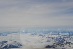
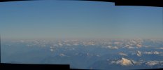
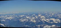
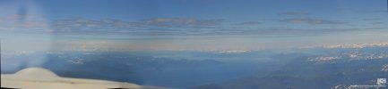
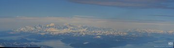
Alaska

Robert Young

Filing Flight Plan
Joined
Nov 11, 2018
Messages
26
Display Name
Just Bob
Home Airfield
Kbhb
Hello
I am planning to fly my 182 from Maine to Alaska in July of this year. I need to fly the coast because as I understand it Canada does not accept special issuance for medical. Any tips would be appreciated
 
Hello
I am planning to fly my 182 from Maine to Alaska in July of this year. I need to fly the coast because as I understand it Canada does not accept special issuance for medical. Any tips would be appreciated
Feel free to DM me, so we can talk on the phone.
I recommend you fly direct from KORS (they always have 100ll, but still check) to PAKT. We have done this twice in a 182 with 75 gal usable.
- File and activate VFR flight plan on the ground at KORS via 800-wxbrief and request a border-crossing squawk code
- Take off from KORS and contact Victoria Terminal on 120.8. They will clear you below 3500 along the outer islands
- They will then hand you off to Comox control, with whom you will cross the Straight of Georgia, after which they will hand you off to Vancouver center.
- Depending on your altitude, you may lose radio contact for ~1 hr, but then will get in touch with either Vancouver center or Prince Rupert radio.
- They will hand you off to Anchorage Center, who will be with you all the way to PAKT.
- Read the special VFR rules for PAKT, but it's super simple (the pattern is south of the runway).
Be prepared for the 100ll prices in Alaska - they are eye-watering.
Once you see the scenery, the costs will disappear.
 
I've done it in a 140kt airplane in 5 hours from KBVS to PAKT. Similar to going from KORS. We just filled IFR and went. But, 5 hours and if you had to stop in Canada, you will have all that to deal with, whatever your situation.
 
I could be wrong, but I don't think that's correct. A medical is a medical, once it's been issued. What Canada doesn't accept is Basicmed or sport pilot/no medical.
Thanks Dana
 
Canada does honor the Special issuance. And having done this I would suggest Edmonton, Prince George and the trench. It's beautiful and there are places to land if none other than the Alcan itself.
Thank you for your help
 
Feel free to DM me, so we can talk on the phone.
I recommend you fly direct from KORS (they always have 100ll, but still check) to PAKT. We have done this twice in a 182 with 75 gal usable.
- File and activate VFR flight plan on the ground at KORS via 800-wxbrief and request a border-crossing squawk code
- Take off from KORS and contact Victoria Terminal on 120.8. They will clear you below 3500 along the outer islands
- They will then hand you off to Comox control, with whom you will cross the Straight of Georgia, after which they will hand you off to Vancouver center.
- Depending on your altitude, you may lose radio contact for ~1 hr, but then will get in touch with either Vancouver center or Prince Rupert radio.
- They will hand you off to Anchorage Center, who will be with you all the way to PAKT.
- Read the special VFR rules for PAKT, but it's super simple (the pattern is south of the runway).
Be prepared for the 100ll prices in Alaska - they are eye-watering.
Once you see the scenery, the costs will disappear.
Thank you
Very helpful. I will be in touch
 
I've done it in a 140kt airplane in 5 hours from KBVS to PAKT. Similar to going from KORS. We just filled IFR and went. But, 5 hours and if you had to stop in Canada, you will have all that to deal with, whatever your situation.
What altitude did you file?
 
Feel free to DM me, so we can talk on the phone.
I recommend you fly direct from KORS (they always have 100ll, but still check) to PAKT. We have done this twice in a 182 with 75 gal usable.
- File and activate VFR flight plan on the ground at KORS via 800-wxbrief and request a border-crossing squawk code
- Take off from KORS and contact Victoria Terminal on 120.8. They will clear you below 3500 along the outer islands
- They will then hand you off to Comox control, with whom you will cross the Straight of Georgia, after which they will hand you off to Vancouver center.
- Depending on your altitude, you may lose radio contact for ~1 hr, but then will get in touch with either Vancouver center or Prince Rupert radio.
- They will hand you off to Anchorage Center, who will be with you all the way to PAKT.
- Read the special VFR rules for PAKT, but it's super simple (the pattern is south of the runway).
Be prepared for the 100ll prices in Alaska - they are eye-watering.
Once you see the scenery, the costs will disappear.
This would be a legal transit for a US pilot flying under basic med?
 
Canada does not accept special issuance for medical.
"Special issuance" (diabetes, etc.) or Basic Med? If you have a 1st, 2nd or 3rd Class Medical, even with a "special issuance" you should be fine in Canada. (Though don't trust me on that without confirming.)

I've only heard that the Basic Med is not allowed in Canada and a number of other countries, it's a US thing. But even if you usually fly on a Basic Med, if you can get a 3rd Class, do it to resolve so many potential issues (you can keep your Basic Med too and keep it current and let the 3rd Class lapse again). And even if you are not planning to land in Canada, be sure to take your passport (not the passport card) just in case you have no choice due to Wx or some other aircraft issue. Just don't say anything about your medical, hand them your passport and say "sorry" it was an emergency.

And on another note.... Have you seen that if you have a direct lineage to someone that was a Canadian Citizen, for a small fee you can become a dual citizen with Canada. It needs to be direct as in parents, grandparents, great grandparents, great great..., etc. It can't be a aunt or uncle, in-law, etc.
 
Can’t help you with the coastal route. Did the alcan,weather is usually better ,it’s an easy trip ,gas isn’t always available on week ends in Canada,should be no problem in a 182.
 
Bada$$ !!!!

Nothing useful to add but to say make sure you post lots of pictures and give us a full debrief !!! We are planning the inland route next summer in our 206 from MA.
 
I’ve done the coast route a few times in my Cub. In a recip, I’ve only over-flown Canada without stopping there once, when I had 8 hours of range with my fuel pod on. I did Ketchikan - Hood River, OR. I’ve done the Trench and Alcan as well. I would only recommend the coast if there isn’t low pressure in the gulf of Alaska or within 1000 miles of the Canadian West coast as it tends to generate extreme turbulence especially if it is a strong low. It tends to be the kind of turbulence even the flight levels won’t keep you of. The coast is either beautiful or terrifying.
 
I’ve done the coast route a few times in my Cub. In a recip, I’ve only over-flown Canada without stopping there once, when I had 8 hours of range with my fuel pod on. I did Ketchikan - Hood River, OR. I’ve done the Trench and Alcan as well. I would only recommend the coast if there isn’t low pressure in the gulf of Alaska or within 1000 miles of the Canadian West coast as it tends to generate extreme turbulence especially if it is a strong low. It tends to be the kind of turbulence even the flight levels won’t keep you of. The coast is either beautiful or terrifying.
Thanks for that information on the turbulence.
 
I did some flying in a rental Skyhawk a couple years ago out of PAMR, just a few months after getting my PPL.
Cordova is a fantastic stop I would highly recommend on the way up to Anchorage. I flew into the long paved strip (PACV) a little ways outside of town because I wasn't yet confident in my own short field performance in a Skyhawk, but in your 182 you should have no trouble with the 1800 foot gravel strip (CKU). CKU is a short walk from town where you can get delicious fresh halibut.
Then, make sure to fly over Kenai Fjords National Park, just West of Seward (PAWD)- the only other way to see it is on a boat tour! From there, there's a great canyon route from Seward to Anchorage over Kenai Lake; I can give you the details of it if you're interested. I'm sure you're going to have a blast.
 
Just for the heck of it I checked the 100LL price in Juneau, AK, $12.26. I know it would still be very enjoyable flying up. To mitigate costs you have lean of peak, catching your own food, camping out, do the ‘pregame’ from the grocery store. Don’t forget to fly the ‘Carson’s speed’. Fly safe.
 
Hello
I am planning to fly my 182 from Maine to Alaska in July of this year. I need to fly the coast because as I understand it Canada does not accept special issuance for medical. Any tips would be appreciated
I have flown this route 7-times in a RV-6. Once roundtrip in a Piper Cherokee 140 with LR Fuel. I love the coastal mountains, totally beautiful but nowhere to land unless a top of frozen lake.

BE SURE TO LOOK AT Alaska FAA WEBCAMS: https://weathercams.faa.gov/map/-152.13357,59.73607,-143.54775,62.12355

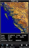
Can you make 800 miles on a tank? KORS to Petersburg, AK PAPG, is what I suggest. Ketchikan is a hassle, while the people at Petersburg are awesome. Fuel is cheaper at Petersburg, however it is 100-miles further for fuel than Ketchikan.
KORS-PAPG 6-27-21.jpg

I fly at 11,500 south and 12,500 north to stay above the view.

The last time I flew north a C182 left Friday Harbor, contacted Victoria control right after my call, he was flying the coast as well.

Use flight following to cross the border.

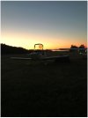
It is 758-miles from Orcas Island to Petersburg, my range is 880-miles. Orcas Island has camping tie downs in the grass, showers, all kinds of cool people to meet and talk with. Standard bus schedule into town, or bicycles available, nice hiking trail has you in town or the bike gets you there a little faster, might even have a courtesy car, but I use one of the bicycles. Orcas Island:
26JUN2021 KORS Camp.JPG

File a standard domestic flight plan. You are flying from USA to USA.

Leaving Orcas, have to call in to activate the flight plan to RCO Bellingham. At this I always request flight following. The International Border is 8.5-miles away. Don't climb above 8500', Victoria control will vector you at this height to the west, traffic avoidance. Once clear of the traffic, Usually near Comox, they will allow you to Navigate on your own. This is when I climb to 12,500ft, I have oxygen available. Usually start at 8500' because want clear head for the mountains getting ready to fly over.

You will fly through the Snowbird Training area, if it is active you need to deviate, flight following helps here.

Questions? Ask Away!

BTW-the C182 and I talked, it was interesting.

At first they asked me my altitude, told them 12,500. They asked about the winds at 10,500. That particular day was the fastest trip North. We had a really great tail wind, it was 10kts higher at 12,500 than 10,500', 10,500' was a solid 30kt, almost, direct tailwind, they left 8500 for 10,500'

In Canada you can't go above 13,500' without being IFR. The winds were better at higher elevations.

Off and on we talked, they were going to Ketchikan, didn't have the range to Petersburg.

Landed in Petersburg, easy 1-mile walk to town. Spent the night in hotels several times, the local people are fantastic. There is a food bus that has the best Mexican Food in Alaska, always walk in and eat lunch there.
Top off with Tempest Helicopters, 737 service the same airport, you need to be aware of jet blast when fueling. Pay attention to the taxi lines and pavement markings to be safe. Petersburg Airport:
PAPG 6-27-2021-.jpg

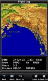
The next leg for me is 758 miles to Kenai, PAEN. VFR flight for me, so have to plan it around when PAPG ihas to be clear. Be cautious about weather. Super cautious on the coast, it can change fast into something they didn't see coming. Known to be marginal VFR minimums for days at a time.

Due to weather getting across Prince William Sound, decided to divert to PAGK, Gulkana, this added to my flight on June 27, 2021. From Orcas to Kenai, stop for an hour at Petersburg, my flight distance and time: 1558-miles/9.9 hours in a day.
PAPG-PAEN 6-27-21.jpg

After leaving Petersburg, at Yakutat, PAYA, made the call to FSS Juneau about the weather I was seeing over Prince William Sound, could see layer after layer, but looking north to Gulkana, could see blue sky, call and they verified what I was seeing. Changed the flight plan to Gulkana, PAYA was out of fuel and the coast was expecting nasty weather for at least 4-days. I happen to know Alaska very well, I flew Alaska National Guard Helicopter up here during the 1980's. Due to this I know what options to look for.

Soon after this call the C182 contacted me when I was crossing the Yahtse Glacier/ Bagley Ice Valley, they were leaving Juneau for a direct flight across Prince William, they had IFR capability. We talked a little, he was heading to Soldotna, PASX, city next to my destination Kenai. However he was staying overnight at a friends before heading to Skwentna.
DSC_0497.JPG

Mike
 
Last edited:
If you wanted a little more pad on the fuel and did not want to do it non stop from ORS, where would you recommend stopping for fuel along the way?

It looks like some of the airports in the Vancouver area only carry Jet A. Or is that just that FF isn't showing they have 100LL?
 
If you wanted a little more pad on the fuel and did not want to do it non stop from ORS, where would you recommend stopping for fuel along the way?

It looks like some of the airports in the Vancouver area only carry Jet A. Or is that just that FF isn't showing they have 100LL?
Top Off in the states. Fuel is expensive once you leave. Alaska isn't much cheaper than Canada, remember in Canada, price is by the liter, not gallon.

I've stopped at Williams lake in the Cherokee(1993). Overnight camping with my kids at the time. Prince George is a great fuel stop as well. Then flew Smithers, Terrace, Prince Rupert on the way to Ketchikan.

If you fly the coast, not sure where to stop. Prince Rupert at the far end possibly. Port Hardy might be a good option, near the mid way point is Bella Bella.
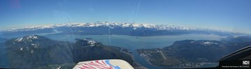
702-miles of this; Note-Almost every valley floor is seawater or lakes:
KORS-PAPG 6-27-2021.jpg
KORS-PAPG 6-27-2021-.jpg


Mike
 
Last edited:
Almost all of the photos I've posted so far have been stitched together from several photos, due to the aircraft speed, you can see black borders that are curved. Tried to crop most of these out, but sometimes they remove too much.

My first flight in 1993 was a lesson learned. At the time to fly at night in Canada you needed to be IFR rated. Okay no problem. Flying from Ketchikan to Bellingham at night means flying the coast. To beat some bad weather the next day, decided to fly at night. This was a huge mistake with a faulty aircraft. Did a position report at 2130 or 930pm to Port Hardy. By the time I reached Comox I had some serious issues happening with the Cherokee.

What I didn't know, was that nobody flies this route at night, so all the FSS, airports shutdown for the night. Nobody to talk too. A coast guard ship answered my calls finally. Coast Guard Ship called the Mallard is my favorite ship of any kind!

Make sure you know the emergency frequencies for Canada.

Leaving Petersburg, the Alaska Panhandle:
Islands 27JUN21.jpg
Islands 27JUN21-2.jpg

Reaching the mainland at Cape Spencer, Mt Crillion, Mt Fairweather has its top in the clouds, Highest point in Canada.
Mainland 27Jun21.jpg

Mike
 
Last edited:
Make sure you know the emergency frequencies for Canada.
You mean the WORLD WIDE Emergency Frequency of 121.5??? (It is no different in Canada.)

Or are you talking about 126.7 MHz, which is the standard en-route frequency for position reports in Class G. In some areas, someone may hear you quicker on 126.7. So it would not be a bad idea if you're already on that freq. to give a call before switching to 121.5. I might end with "switching now to 121.5" so anyone that heard me can continue monitoring and possibly relay info. But if you're saying to use some other frequency than 121.5, let's not confuse people on what the real/official Emergency Frequency is.

There is also 123.1 for SAR and other special uses, but it should not be considered as a go-to frequency, only if you're told to use it.
 
I have flown this route 7-times in a RV-6. Once roundtrip in a Piper Cherokee 140 with LR Fuel. I love the coastal mountains, totally beautiful but nowhere to land unless a top of frozen lake.

BE SURE TO LOOK AT Alaska FAA WEBCAMS: https://weathercams.faa.gov/map/-152.13357,59.73607,-143.54775,62.12355

Can you make 800 miles on a tank? KORS to Petersburg, AK PAPG, is what I suggest. Ketchikan is a hassle, while the people at Petersburg are awesome. Fuel is cheaper at Petersburg, however it is 100-miles further for fuel than Ketchikan.
View attachment 153348

I fly at 11,500 south and 12,500 north to stay above the view.

The last time I flew north a C182 left Friday Harbor, contacted Victoria control right after my call, he was flying the coast as well.

Use flight following to cross the border.

It is 758-miles from Orcas Island to Petersburg, my range is 880-miles. Orcas Island has camping tie downs in the grass, showers, all kinds of cool people to meet and talk with. Standard bus schedule into town, or bicycles available, nice hiking trail has you in town or the bike gets you there a little faster, might even have a courtesy car, but I use one of the bicycles. Orcas Island:
View attachment 153353

File a standard domestic flight plan. You are flying from USA to USA.

Leaving Orcas, have to call in to activate the flight plan to RCO Bellingham. At this I always request flight following. The International Border is 8.5-miles away. Don't climb above 8500', Victoria control will vector you at this height to the west, traffic avoidance. Once clear of the traffic, Usually near Comox, they will allow you to Navigate on your own. This is when I climb to 12,500ft, I have oxygen available. Usually start at 8500' because want clear head for the mountains getting ready to fly over.

You will fly through the Snowbird Training area, if it is active you need to deviate, flight following helps here.

Questions? Ask Away!

BTW-the C182 and I talked, it was interesting.

At first they asked me my altitude, told them 12,500. They asked about the winds at 10,500. That particular day was the fastest trip North. We had a really great tail wind, it was 10kts higher at 12,500 than 10,500', 10,500' was a solid 30kt, almost, direct tailwind, they left 8500 for 10,500'

In Canada you can't go above 13,500' without being IFR. The winds were better at higher elevations.

Off and on we talked, they were going to Ketchikan, didn't have the range to Petersburg.

Landed in Petersburg, easy 1-mile walk to town. Spent the night in hotels several times, the local people are fantastic. There is a food bus that has the best Mexican Food in Alaska, always walk in and eat lunch there.
Top off with Tempest Helicopters, 737 service the same airport, you need to be aware of jet blast when fueling. Pay attention to the taxi lines and pavement markings to be safe. Petersburg Airport:
View attachment 153350

The next leg for me is 758 miles to Kenai, PAEN. VFR flight for me, so have to plan it around when PAPG ihas to be clear. Be cautious about weather. Super cautious on the coast, it can change fast into something they didn't see coming. Known to be marginal VFR minimums for days at a time.

Due to weather getting across Prince William Sound, decided to divert to PAGK, Gulkana, this added to my flight on June 27, 2021. From Orcas to Kenai, stop for an hour at Petersburg, my flight distance and time: 1558-miles/9.9 hours in a day.
View attachment 153351

After leaving Petersburg, at Yakutat, PAYA, made the call to FSS Juneau about the weather I was seeing over Prince William Sound, could see layer after layer, but looking north to Gulkana, could see blue sky, call and they verified what I was seeing. Changed the flight plan to Gulkana, PAYA was out of fuel and the coast was expecting nasty weather for at least 4-days. I happen to know Alaska very well, I flew Alaska National Guard Helicopter up here during the 1980's. Due to this I know what options to look for.

Soon after this call the C182 contacted me when I was crossing the Yahtse Glacier/ Bagley Ice Valley, they were leaving Juneau for a direct flight across Prince William, they had IFR capability. We talked a little, he was heading to Soldotna, PASX, city next to my destination Kenai. However he was staying overnight at a friends before heading to Skwentna.
View attachment 153352

Mike

That a wealth of information. Thank you Sir!
 
You mean the WORLD WIDE Emergency Frequency of 121.5??? (It is no different in Canada.)

Or are you talking about 126.7 MHz, which is the standard en-route frequency for position reports in Class G. In some areas, someone may hear you quicker on 126.7. So it would not be a bad idea if you're already on that freq. to give a call before switching to 121.5. I might end with "switching now to 121.5" so anyone that heard me can continue monitoring and possibly relay info. But if you're saying to use some other frequency than 121.5, let's not confuse people on what the real/official Emergency Frequency is.

There is also 123.1 for SAR and other special uses, but it should not be considered as a go-to frequency, only if you're told to use it.
1993 flight, had the Canadian Book purchased from Sporty's. It listed an alternative frequency, I used both, that frequency and 121.5, the Coast Guard Ship Mallard answered on the alternative frequency, don't remember what is was.

Might have started with 13--- or a 14---.


Mike
 
Last edited:
the Coast Guard Ship Mallard answered on the alternative frequency, don't remember what is was.
On the marine band it would have been Ch 16, but guessing you don't have a marine radio in your plane. :D If it was some other frequency, it could not have been 14x.x since aviation radios stop at 136.975 (actually .992 in some cases).
By chance did you try 121.5 and they had you go to another frequency? Coast Guard ships (US & C) do monitor 121.5.
 
On the marine band it would have been Ch 16, but guessing you don't have a marine radio in your plane. :D If it was some other frequency, it could not have been 14x.x since aviation radios stop at 136.975 (actually .992 in some cases).

By chance did you try 121.5 and they had you go to another frequency? Coast Guard ships (US & C) do monitor 121.5.
Yes, I tried 121.5 as a second Frequency, after the first call.
I did not know if I was transmitting at all. I waited for a reply each time I made a call. Hoping for a reply, squelch, anything. Did not know if I could even receive anything at this stage.

I used the alternative freq first, why? Because thought I was still over Canada-allot of confusion trying to figure what to do. After finding the freq. in the book, immediately input into radio. Thinking it would work better for some reason.

My reason for the alternate Freq, first call, doesn't make sense, but that is how I did it.

you have to understand, reading by flash light, teeth clamp in use, the operators manual to try and troubleshoot, emergency steps for electrical, Canadian Book to find frquency's, while the mind is playing different scenario's, and trying to keep a compass heading is a high work load. Stress can be a distraction, but it is there 100%+. Had over two hours to read, fly, and freak out. I wanted to be back home in a nice warm bed.

I took a course in the Military that taught electronics/computers in 1981. Not knowing where the issue with the electrical was, no way to troubleshoot.

Suspected the alternator= bright lights then dim.

Hot wire smell, could be a short. On any of the circuits.

Once under the clouds and seeing street lights, began to relax a little. Began to think a little clearer, maybe.

Thought was to try the radio. But how to power? Use the alternator only, no, the bright lights/then dim suggest it might be the issue.
Okay, battery side. What happens if the electrical problem is on one of the other circuits? or even the radio?
Take a chance on the circuit breaker for the radio not being the issue, pull all the others.

Battery on. Radio on. Made my calls.

Yes, I fly with a handheld radio now at all times.

Mike
 
Last edited:
On the marine band it would have been Ch 16, but guessing you don't have a marine radio in your plane. :D If it was some other frequency, it could not have been 14x.x since aviation radios stop at 136.975 (actually .992 in some cases).

By chance did you try 121.5 and they had you go to another frequency? Coast Guard ships (US & C) do monitor 121.5.
Okay, you are were right to question my comment about the 121.5 freq. Thank you.

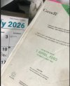
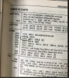
Went through some old banker boxes, found the Canadian 1993 Supplement to check what freq I used. I had circled it the next day, after trying to start it, we had to jump start with cables from a MP car. While waiting for one of the MP's to return with cables, I sat down and circled it, wanted to remember everything. Plus needed it to take off.
1993 Canada 1.jpg
The Coast Guard ship had me tune in the Tower Freq. for COMOX.126.2
1993 Canada 2.jpg

Now I have to figure why I said all this about a different frequency, my mind playing games on me?

Would you like to see a write up about my flight from Kenai, AK to Kitty Hawk, NC? Could do it on a new thread about Trip Reports. Some of the photos been posting are from that trip.

Mike
 
Last edited:
Would you like to see a write up about my flight from Kenai, AK to Kitty Hawk, NC?
Sounds like a great trip. Hope you stopped at lots of fun places along the way. We always try to find a different place to stop to see the sites when we do X-US trips.
 
Sounds like a great trip. Hope you stopped at lots of fun places along the way. We always try to find a different place to stop to see the sites when we do X-US trips.
When you headed this way?

The actual trip was done as quickly as possible. June 2021 was record hot everybody was saying. Due to weather delay left Alaska 3-weeks later than wanted too.

Tried in 2019 to do the trip. Engine delay repair issue had to return to Alaska to get back to work.

At 16,500ft crossing over the frozen lakes near Gannett and Fremont peaks in the wilderness areas of Wyoming. The temp was 44deg F. The lakes were half frozen, not frozen like everyone claims......

Mike
 
When you headed this way?
We've been thinking about it for the last couple of years, but stuff keeps getting in the way.

This year is still a slight maybe, but hopefully we'll get our act together for next year.
 
We've been thinking about it for the last couple of years, but stuff keeps getting in the way.

This year is still a slight maybe, but hopefully we'll get our act together for next year.
For the best weather, June is best usually. Early June over later. We get allot of rain here on the coast of Cook Inlet.

Mike
 
For the best weather, June is best usually. Early June over later.
Yea, I've heard that from multiple people. The way our Wx was in the PNW this year though was May is the new June.
 
Our weather this year is about 5-degrees cooler than the last few.

Checking the state for my next RV camping trip, weather is an issue. Delta Junction has the best weather forecast, South of the Alaska Range is rain, parts of the interior also show rain [next 10-days].

I look for airstrips with a campground close, within a short hiking distance.

You can usually camp at your plane, weather issues. Some pilot lounge or FBO have setups to help. At Gulkana they have a guest room (twin size cot), bathroom, no shower, and food in a fridge. Computer for flight planning. Fuel last week was $9.99 per gal.

I'm looking for campgrounds to setup actual camp site for 3-4 days.

Last week was Gulkana. Mile hike to the Dry Creek campground, 50lb rucksack. Creek might be dry, but the marsh surrounding the campsite isn't. Mosquitos by the hundreds. Updated out house style toilet, potable water cistern, campgrounds have fire grate, picnic tables, level RV and tent sites at each spot. Most campers only show up late in the day and are gone early the next morning. Still about a day drive from Anchorage if driving the ALCAN.

Make sure your Alaska survival kit has bug repellant, 100% deet. A head net with ring support to keep net away from skin, some are just a net, this style does not work.

These are the airstrips with campgrounds:
TOK, Alaska at the airport; commercial campsite for drivers reaching Alaska after driving through Canada. Alaskan Stoves Campground is the name-looks setup up for RV's not tents.
Delta Junction, State campground at the end of the runway, near Army airfield, has restricted airspace nearby-trying to find a way to leave today and get there. Several spots in passes that don't look good on the webcams, rain here-mostly sunny there for the next 10-days.
Talkeetna, commercial campground and boat launch about a mile hike
Seward, State campground 1-mile hike
Quartz Creek-south end of runway on Kenai Lake, nice big campground good gravel on runway
Willow-commercial campground 1 -1-1/2 mile hike Creekside is the name this one looks good, planning to call/reserve a spot once weather looks like a good stay.
Riley Campground-McKinley Park entrance campground-must adhere to many rules-can't reserve tent camping spots, you can reserve normal RV spots for tent camping, hiking trail from airport, bus terminal, visitor center all within hiking distance, grocery store (seasonal May-Sept.). Must be Bear aware here More than the other locations.

Mike
 
Seattle to Ketchikan is a fun route, fly along the coast, check the weather cameras before flying for conditions.
 
Back
Top