7-Day VFR Weather Planning CHALLENGE

William Pete Hodges

Line Up and Wait
PoA Supporter
Joined
Mar 6, 2020
Messages
852
Location
Virginia
Display Name
Petehdgs
Home Airfield
KCJR
A SIMPLE CHALLENGE:

Pick a XC flight that you have flown and start looking at the flight plan weather 7 days in advance. Write down if the prediction is GO or NO-GO. if you have Windy, take it out to 12 days. Make a table with a line for today's date across the top, and each added line is the next date for 24 days, 24 lines. Then make 7 columns down, the first column is today and each additional column is 1 day in advance. If you are using Windy then make 12 columns. Now check today's weather. Put down an X if it is NO-GO. put down a Y if it is GO, and leave it blank if it is maybe. Now analyze the weather along your route 7 days in advance, X or Y in each column as predicted. Do this again tomorrow and again each day for the next 24 days. I have done this and I think you will be surprised with the results.

Post your results on this thread. Let's see what you find out!

Try it. It is FREE and it can be fun!
 
In my 2013 article I laid the groundwork for 7-day VFR weather planning using the weather tools available back then. Windy takes that concept out to 12 days. There are a few key principles involved but the premise is it is relatively easy to identify bad VFR weather windows 1-2 weeks in advance, subject to adjustments as time approaches. That means good VFR windows can also be predicted allowing for leeway of about +/- 1 day or so. As the day of the flights approach fine tuning allows planning your VFR trips to keep away from unacceptable weather. I started this because our visits with family revolved around being able to fly home in good weather after spending several days away. I now I only fly if there is high probability of good weather coming back. In 20 years I have only missed my return window once. I have often ruled out flying in favor of driving because my return trip could not be completed VFR. This system predicts return VFR probability with a high degree of accuracy.

airfactsjournal.com
 
One problem. You could be successful in your experiment. You need multiple replicate experiments. Even one failure makes it a failed concept. Especially if that failure is of the sort that would have put you in an extreme situation.

Since you said long cross country, are you following a Dave Snowden “next best thing” or hitting adjacent possibles along the way so as to progress toward a destination not actually getting to the destination? Picking alternate routes to different intermediates and saying you are going? Branch plans are not a go of the original plan. They are their own form of no-go. Is your day-to-day continuum of yes, go actually a set of differing plans? And with it, how much time are you wasting planning?

From your article:
“3. Plan for flexibility into your departure and return dates and choose the day to fly based on the weather, not your schedule. After you have been using the 7-day tool for a while, you will realize that the forecast is usually 80% right, but not always right at the right time. Weather formations change and move over time. The 7-day forecast usually predicts these formations fairly well, but the timetable might be off by a day or so. If it is raining now, and good flying weather is predicted in two days, that good weather might take three days to appear, or it might show up a day early.
You must be able to adjust your flying schedule to meet the weather if you want to fly the trip and be safe. For a family trip that has only one hard date event, (like Thanksgiving) that is probably doable. If there are two or three hard date events, it might not be. We drive the car if there are multiple hard dates that must be met.”

Seems rather contradictory.
Using this concept does not relieve you of your responsibility of Aeronautical Decision Making on the day of your flight, it just gives you more information to use in planning for that flight either today or next week. When the day of the flight arrives you still have to decide if it is safe to fly right now.

Since I analyze the proposed flight plan or each day in advance, my first rule is can I make it from start to finish with Good VFR weather along my route for the entire trip? Y / N? or could I make the flight with a minor route change? y / n ? ( maybe )
or could I make the flight part way and sit out weather as it passes? That is a hard NO for this exercise. Alternative airport? NO. The idea is to make the flight as planned. Y / N?

The idea of 7-Day VFR Weather Planning is to adjust your flying days to meet the weather you want. Adjusting your schedule is part of it. It is not contradictory at all.

Within the last 12 months I had to go to New England 3 times for Funerals and memorials. (sad) My analysis indicated bad VFR weather on 2 of those 3 trips, so we drove the car in the rain. We flew to and from with no problems on the third trip. It is what it is.
 
Last edited:
VFR only for two flights
Since I analyze the proposed flight plan or each day in advance, my first rule is can I make it from start to finish with Good VFR weather along my route for the entire trip? Y / N? or could I make the flight with a minor route change? y / n ? ( maybe )
or could I make the flight part way and sit out weather as it passes? That is a hard NO for this exercise. Alternative airport? NO. The idea is to make the flight as planned. Y / N?

The idea of 7-Day VFR Weather Planning is to adjust your flying days to meet the weather you want. Adjusting your schedule is part of it. It is not contradictory at all.

It's not contradictory, but IMO a tough goal. A lot of factors come into play that vary depending upon the locations and distances of the desired flight. Such as seasons (and change of seasons), proximities to mountains and/or coastlines, etc. Around the east coast where we're sandwiched between the mountains and the Atlantic Ocean winter forecasts can, and do change by the day.

Two to three days out is often the maximum that could work out for needing to fly all VFR in the winter, or not. I don't bother locking in dates and worrying about weather until 3 days out, or even less in the winter.

Limiting the trip (out and back) to be flown in VFR conditions can really cut down the length of advanced planning in certain regions of the nation. Allowing some soft IFR is a big help. Or willingness to divert and rent a car, conduct an earlier departure, or arrive back later than planned. Seven days ahead can be a real pot luck stretch in certain locations, and seasons.
 
I'm currently 8 days out from a trip from south Louisiana (KOPL) to the Phoenix area (KDVT). I'm filing IFR for this trip but, if conditions are conducive, may fly VFR with advisories. I started looking at the 10 day forecast yesterday. It will be interesting to see how this plays out. I've done this a half dozen times or so, in the past several years, on flights of 700nm or greater. These long flights greatly increase the chance to cross weather systems with frontal boundaries. The general accuracy a week out is impressive and the precision of 36hrs and closer to the departure time, even more so. However, I always prepare myself for an out. The excersize you propose is always fun.
 
I constantly do this exercise. I’ve mostly moved to windy as a forecast visualization tool and look at the overall forecast over the times I’m looking to fly. 7 days out is just inside models being able to predict “reasonable “. Windy lets me explore predictions in frontal movement, winds, ceiling, freezing levels and more during the time I’m interested.

Last weekend I planned a trip with the kiddo to visit granddad. The flight was great! Now that it’s fall I keep a closer eye on freezing levels. But I always look at ceilings, tops and t storm forecasts too. I started watching closely 7 days out and adjusted from there
 
I've always thought it would be interesting to collect weather forecast data for a year or so, and then see how the actual weather turned out to see how accurate forecasts are for different timeframes prior to the flight and how it varies in different geographic areas.

Just not interesting enough to actually spend the time to write the system to do it. ;)
 
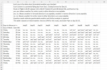
I did a similar chart exercise on POA a few years ago. The attached chart is my look at the weather for 15 days over the preferred route from CJR to 2MI8 and back. Read the legend. This chart is bidirectional. At the time I wanted to get the AVS to embrace the 7-day VFR weather concept and add it to their graphical weather forecast tool, which I liked at the time. The following year they redid the tool with poor results, so I dropped getting them to embrace the idea.

and Ed, thank you for the compliment!


1792499739740.png

1792498122483.png
 
Last edited:
I've always thought it would be interesting to collect weather forecast data for a year or so, and then see how the actual weather turned out to see how accurate forecasts are for different timeframes prior to the flight and how it varies in different geographic areas.

Just not interesting enough to actually spend the time to write the system to do it. ;)

And @1kashtanov

This is where I think that Jaffby guy should pivot; this is where I see opportunity. Let the computer do it. And also let the computer see if it finds patterns across and around topography.


“Ranges and proximity aren’t always the whole picture; terrain matters. You can have very close places with vastly differing weather while you can have some further apart that are very similar in condition. Can’t tell you how many times north side of the HRBT (KLFI-KNGU) would be foggy while south side clear. Similarly, if you look at KIZG, nearest TAF is KHIE but that is the other side of the mountains. KPWM is reasonably close but it is coastal while KIZG is still rugged and up. You can also have places with interesting “localized” phenomena. Maybe in the nozzle of a convergence. See Walker Pass near KIYK. Note KIYK itself can be pretty sheltered though the air overtop rather extreme. Then again I’ve seen forty knot wind shifts at KIYK. Or underneath the apex of a wave. KEDW as example, can have light winds out of the east while above and around are strong westerlies. KTSP closest KWJF TAF and that makes no sense. But KMHV and KBFL aren’t fits either. If you’re gonna have AI, you could start looking for where trends with where so as to realize better fitting TAFs to places rather than nearest as other stuff presently does. And spots that make for regular outliers in certain conditions. Matching (and contrasting) would be done in METAR to METAR so as to suspect which TAFs would more align as well as how some might skew.”
 
I've studied this long-range planning (VFR and IFR) quite extensively over the last 25+ years. Done over a thousand briefings with pilots making long cross country trips during that time. Beyond about 5 days, about the best you can tell is -- will the weather be fair or disturbed along your proposed route. There are some weather patterns that can be easier to decipher (e.g., under a major ridge) and some that are much more difficult. For example, an active jet stream can create errors on the order of 24 to 36 hours in the forecast. This means that if a front is forecast to be crossing the Mississippi River at the time of your proposed departure, it could be crossing the Appalachian Mountains or could be leaving the high plains based on that error. Of course, this gets worse beyond 7 days and much worse beyond 10 days. I wouldn't plan a picnic much less a flight at this time frame. That's why my app only allows for a 72 hour lead time.

Did a 1-on-1 online training session with a student of mine that was departing the Charlotte area on a Saturday for a VFR flight headed north. We were looking five days out (the previous Monday). Looked like if he would be able to easily make the flight early in the morning Saturday...late afternoon was questionable. Well, Hurricane Isaias made landfall earlier than expected which made that long-range forecast a bust. During our conversation, we talked about this error. So, he prepared to depart Friday afternoon making the assumption that earlier was going to be a better choice. As each day passed, it became clearer that this was a better solution. Because he had the flexibility (although it wasn't his preference), he was able to make the flight.
 
Because he had the flexibility (although it wasn't his preference), he was able to make the flight.
That is the key to making GA work. Flexibility - Both in timing and in routing. If you go 100nm off the direct course halfway through a 1000nm trip, you only have to fly 10nm further. And a day earlier/later, or an unintended stop along the way to wait for things to pass, makes a huge difference as well. Even having those tricks up your sleeve, IME it's pretty rare that I need to use them for a GA trip.
 
Today is Friday Oct 23. On Monday Oct 19 I put out a 7-Day VFR Weather Planning Challenge to check the weather 7 - 12 days in advance and put the results on a chart. See messages 1, 2, & 3. It is still early days but I was wondering if any adventuresome pilots or skeptics had started the challenge? Just curious...
 
I've always thought it would be interesting to collect weather forecast data for a year or so, and then see how the actual weather turned out to see how accurate forecasts are for different timeframes prior to the flight and how it varies in different geographic areas.

Just not interesting enough to actually spend the time to write the system to do it. ;)

That's basically how they validate the models in the first place, by running them on historical data
 
Back
Top