WingX for free for CFI's

This is pretty much the same story for me. I originally purchased a three month subscription to ForeFlight when I got my iPad. Near the end of my FF subscription WingX came out with the 30 free trial. When I tried the two programs head-to-head, WingX clearly had more bang for the buck features like their terrain database, split screen, georeferenced airport diagrams and the list goes on. Yes, FF had a neat way to drag the flight path line to add waypoints and it looked very nice sitting in my La-Z-Boy in the den, but in a bouncing airplane with less than optimum visibility, the FF fonts were much more difficult to read. As Henning said in his post it was also surprising to me too that more people didn't see how much further ahead WingX has been over FF. A couple of months ago a pilot friend of mine that uses FF and I compared the two programs side by side. He would keep saying over and over, 'I wish FF would do that' or 'I wish FF's weather overlay looked that nice.' If people would just take the time to watch the WingX videos on YouTube and spend a little time with the program I think they would love it too. Each to their own. I do think the competition between WingX, FF and Garmin makes us all winners because it pushes all three app providers to keep improving their program. Regardless of which program a person chooses to use, we all benefit from that competition.

:yes: 
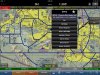
...and you can learn a lot at home before using it in flight, using the WingX built-in flight simulator or by linking your iPad to your PC sim like this...
Also an excellent way to familiarize yourself with all of the features of WingX Pro (shown here with P3D) or Foreflight. Both are compatable with X-Plane 10, FSX and P3D via wifi. Nice feature!:yesnod:
 
WingX looks like an impressive package, not as pretty as Foreflight, but nice features.

Still no vector maps though, it appears. Not sure I could give that up. That's a feature of Garmin Pilot I'd really miss.
 
Well, I've downloaded WingX with the 30-day trial. We'll see how it goes.

I've never been a huge fan of navigating on FF.
In which case you might like the WingX method. IMO, that's the real difference between the two - they have from the beginning (I looked at both in their early versions when I was making my initial purchase decision 3-4 years ago) taken a slightly different approach on how to accomplish the same task, which IMO accounts for most of the differences in UI and many of the differences in specific functions.
 
Still no vector maps though, it appears. Not sure I could give that up. That's a feature of Garmin Pilot I'd really miss.

Could you grab a screen capture from your iPad with a sample of the vector map you are referring to and post it for us to see? Thanks!
 
It's easy to see how someone can confuse the names. In fact, like Peggy, I couldn't remember them either.

Maybe one of them should have chosen a different name.

Yeah it's like Foreplay and Foreflight, so easy to confuse..:rofl:
 
Could you grab a screen capture from your iPad with a sample of the vector map you are referring to and post it for us to see? Thanks!
If I'm not mistaken, vector (or data-driven) maps allow such things as decluttering and rotating the entire map when track-up so that the lettering and labels are still right side up.

As I recall, only the Garmin and Jepp apps have it (since only those two can probably afford to do it).
 
If I'm not mistaken, vector (or data-driven) maps allow such things as decluttering and rotating the entire map when track-up so that the lettering and labels are still right side up.

As I recall, only the Garmin and Jepp apps have it (since only those two can probably afford to do it).

That's exactly why I asked. WingX was one of the first to offer track up and rotate the map accordingly. The overlayed text rotates as needed and declutters as you zoom out. I was wanting to see if Garmin really had something special or unique over what I am use to with WingX.
 
I've been playing around with Wing X trying to get a feel for it. Have a question though. In ForeFlight I can tap an airport on the sectional and get a dialog box. From there I can get more options including the full blown 'details' page. A useful feature I use is to just tap the airport thumbnail and it shows a sketch of the airport with labels and lines showing the location of all the FBOs on the field (usually with some gaps).

Is there any way to display details for the field like this? FBO locations, comm freqs and the like or is it just limited to the A/FD? Hopefully I'm just overlooking this as I'm afraid if the feature isn't there it might be a deal breaker for me.
 
When you click on the airport ID, a 7-item contextual menu shows.

One choice is "A/FD & NOTAMS".

That brings up all the airport info on the left, in one of two sizes.

Can do some screen shots if that helps.
 
I've been playing around with Wing X trying to get a feel for it. Have a question though. In ForeFlight I can tap an airport on the sectional and get a dialog box. From there I can get more options including the full blown 'details' page. A useful feature I use is to just tap the airport thumbnail and it shows a sketch of the airport with labels and lines showing the location of all the FBOs on the field (usually with some gaps).

Is there any way to display details for the field like this? FBO locations, comm freqs and the like or is it just limited to the A/FD? Hopefully I'm just overlooking this as I'm afraid if the feature isn't there it might be a deal breaker for me.

Just tap on the airport name and you should be presented with a submenu for options for diagram etc..
 

Attachments

  • image.jpg
    image.jpg
    329.3 KB · Views: 22
I don't need an airport diagram or A/FD. I need a way to know where the FBO is. Does Wing X have the equivalent of this feature found in ForeFlight?

IMG_0050.PNG
 
I don't need an airport diagram or A/FD. I need a way to know where the FBO is. Does Wing X have the equivalent of this feature found in ForeFlight?

IMG_0050.PNG

Not that I know of. ForeFlight didn't either when I dropped it in favor of WingX. I like the split screen feature.

But that's nice at a new airport.

John
 
I don't need an airport diagram or A/FD. I need a way to know where the FBO is. Does Wing X have the equivalent of this feature found in ForeFlight?

Do ForeFlight maps show where the self-serve pumps are at airports?
 
Do ForeFlight maps show where the self-serve pumps are at airports?

Don't know. Any airport where I'd use self serv is an airport where it'd be obvious. (1 runway and 1 building does an airport make)
 
>> But that's nice at a new airport.

Agree that's nice but I think FF generates them themselves , WingX uses the plain boring AOPA layouts - don't know about GP. I assume they are kept updated as FBO's come and go from airports - does it show an effective date ?
 
You have to understand, my day in day out job is to fly into small and often unfamiliar airports who may or may not answer the radio on an in range call. I need to know where to go after I land or I look absolutely retarded driving around the airport aimlessly with a passenger on board. People paying $5k an hour don't like their pilots looking lost.
 
So I recently got the synthetic vision for foreflight, and I've since deleted wingx.

It was a really cool offer for CFIs, maybe wingx timed it with the release of foreflights synthetic vision :dunno:

Ether way it seems like wingx is quite a ways behind foreflight, and even with their offer I'm not sure they will catch up.

YMMV.
 
Not nearly IMO.

You can keep digging and digging in foreflight, everything is very polished, from weight and balance, to NOTAM flaps, to how the briefing and cross country logs work.
 
So I recently got the synthetic vision for foreflight, and I've since deleted wingx.

It was a really cool offer for CFIs, maybe wingx timed it with the release of foreflights synthetic vision :dunno:

Ether way it seems like wingx is quite a ways behind foreflight, and even with their offer I'm not sure they will catch up.

YMMV.

WingX announced free synthetic vision for a year the day after ForeFlight announced their synthetic vision. I've updated but haven't had a chance to try it yet.

John
 
WingX announced free synthetic vision for a year the day after ForeFlight announced their synthetic vision. I've updated but haven't had a chance to try it yet.

John

On the red board Hilton indicated that including SV as part of the basis $75 a year renewal has long been in the works, so it's not just prompted by FF announcement. Maybe news of its release was.

It's not only free for a year, it is part of the basis subscription , the expiry date is only displayed as 12/31/2015 until the next WingX version.

So it is now part of the basis $75 a year renewal.
 
Last edited:
I sent them an email with my certificate. I haven't heard back from them yet. I am chalking it up to Christmas/new years for now. I will try resending in a few weeks.
 
I sent them an email with my certificate. I haven't heard back from them yet. I am chalking it up to Christmas/new years for now. I will try resending in a few weeks.

I sent mine just before Christmas and had a response in a couple days, so I suspect you'll be hearing from them shortly.
 
I also hate that the FF charts don't have the comm freq info that the regular charts provide.
 
I also hate that the FF charts don't have the comm freq info that the regular charts provide.

?? What do you mean? All the comm stuff is there on the FF charts.
 
?? What do you mean? All the comm stuff is there on the FF charts.

They're on the standard NOAA airport diagram included with the approach plates but that's not the diagram that FF automatically pops up after landing. For that they now use their own in-house developed "TrueTaxi" (or whatever they call them) diagrams for that and they contain no comm data.
 
They're on the standard NOAA airport diagram included with the approach plates but that's not the diagram that FF automatically pops up after landing. For that they now use their own in-house developed "TrueTaxi" (or whatever they call them) diagrams for that and they contain no comm data.

Oh, I've never turned on the pop up chart after landing. Sounds like a good idea, just never bothered to work it out and layer into my flow.


For comms here's my pro tip. Take it or leave it, no refunds. When I taxi out I have ground in comm 1 active, twr in comm 1 stdby, and departure in comm 2 active. That way it's all right there heads up and no looking down to find anything.

On arrival I have twr in comm 1 active, apch in comm 1 stdby (it was active a minute ago with twr in stdby), and ground in comm 2 active. Again...it's all right there heads up with no looking around or fumbling with a chart. Using comm 2 isn't to transmit, it's just to hold the freq so when I need it it's right there. The only one I don't load is a ground of 121.9 as I consider that standard. Anything else goes in during apch.
 
Last edited:
Oh, I've never turned on the pop up chart after landing. Sounds like a good idea, just never bothered to work it out and layer into my flow.

Yeah, I find it handy when landing at a new airport, so leave it on by default. I'm not sure what the benefit of recreating these on their own vs. just georeferencing the NOAA chart?
 
Yeah, I find it handy when landing at a new airport, so leave it on by default. I'm not sure what the benefit of recreating these on their own vs. just georeferencing the NOAA chart?

I guess so they can have the FBO labels? Sounds like they should either combine the info or let the user pick which chart pops up.
 
I guess so they can have the FBO labels? Sounds like they should either combine the info or let the user pick which chart pops up.

I forgot they're trying to sell ad placement. That would explain it. But they could at least include the frequencies!
 
I just got my free WingX subscription..........

How did you actually get (receive) it? I sent them the email as per the original instructions and never heard anything back from them.
 
How did you actually get (receive) it? I sent them the email as per the original instructions and never heard anything back from them.

I received an email with a user ID and password.
 
How did you actually get (receive) it? I sent them the email as per the original instructions and never heard anything back from them.

I am still waiting as well.
 
It took about a week before I got the email notification, was about to give up. Downloading it now.
 
I still don't have mine. I might resend it.
 
Back
Top