Techsan02
Filing Flight Plan
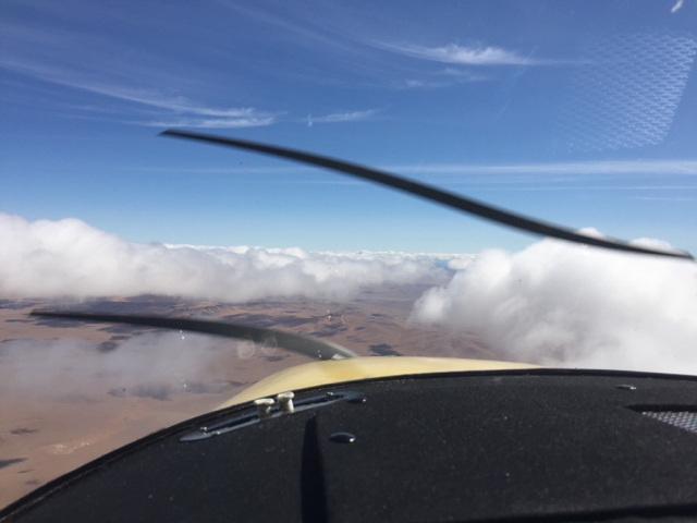
I've seen a few posts related to this but haven't seen a definitive answer, of course I guess it varies from pilot to pilot. I will attach a couple pictures of the kind of cloud layer I am talking about, and is it a good idea to go over the top. Also, is there anyway to tell when you may come into a solid layer before it's too late. I had someone tell me on my way back from my trip to fly over the clouds so I don't get beat up like I did on the way down. I didn't know if that was such a good idea. So, let the debate rage on...Forgive me if this topic has been beaten to death.


")