You are using an out of date browser. It may not display this or other websites correctly.
You should upgrade or use an alternative browser.
You should upgrade or use an alternative browser.
VFR chart quiz
- Thread starter jhoyt
- Start date
Brad Z
Final Approach
Flying Viking
Pre-takeoff checklist
Lizards.
SixPapaCharlie
May the force be with you
- Joined
- Aug 8, 2013
- Messages
- 16,030
- Display Name
Display name:
Sixer
mole people
SixPapaCharlie
May the force be with you
- Joined
- Aug 8, 2013
- Messages
- 16,030
- Display Name
Display name:
Sixer
or butts
eetrojan
Pattern Altitude
AggieMike88
Touchdown! Greaser!
- Joined
- Jan 13, 2010
- Messages
- 20,805
- Location
- Denton, TX
- Display Name
Display name:
The original "I don't know it all" of aviation.
I was going to say "alligators"
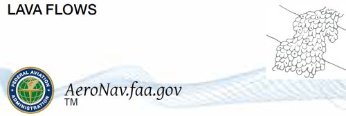
But seeing that your location is Yakima should have been a good clue for lava.
I traveled through that state park going west from the Bend, OR, region one time. Really trippy to suddenly go from Green Forest to Lava Moon Landscape
But seeing that your location is Yakima should have been a good clue for lava.
I traveled through that state park going west from the Bend, OR, region one time. Really trippy to suddenly go from Green Forest to Lava Moon Landscape
Last edited:
eetrojan
Pattern Altitude
But seeing that your location is Yakima should have been a good clue for lava.
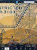
The OP's chart, however, is from the center of the Big Island in Hawaii. The Kilauea volcano is sneakily just off screen, near the bottom. :wink2:
DrPappy
Pre-takeoff checklist
I was going to guess a nature preserve for beakless, eyeless penguins. That's what I'm telling my little boy.
MAKG1
Touchdown! Greaser!
- Joined
- Jun 19, 2012
- Messages
- 13,411
- Location
- California central coast
- Display Name
Display name:
MAKG
Lava it is. Vacation in kona via Alaska Air, not Cirrhus.....glub..glub...
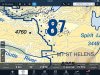
Living near Mt. St. Helens thought I'd see similar lava on map but they call it "Debris". Interesting stuff as I study for PPL.
There aren't many lava flows around Mt. St. Helens, but the 1980 mudflows are very obvious.
FastEddieB
Touchdown! Greaser!
- Joined
- Oct 14, 2013
- Messages
- 11,421
- Location
- Lenoir City, TN/Mineral Bluff, GA
- Display Name
Display name:
Fast Eddie B
Always new stuff to learn!
Lindberg
Final Approach
"Here be dragons."
Richard
Final Approach
- Joined
- Feb 27, 2005
- Messages
- 9,076
- Location
- West Coast Resistance
- Display Name
Display name:
Ack...city life
Aviators. Recent travels brought me to this quadrant. Hadn't seen these honeycomb terrain markings prior. Any thoughts?
Go south to South Cape to check out the old fishing villages on the east side.
overdrive148
En-Route
- Joined
- Apr 17, 2013
- Messages
- 3,903
- Location
- Fort Worth, Texas
- Display Name
Display name:
overdrive148
My wife had a question for me once. She points at this gray circle on the chart asks what it is. Had me going for a minute.
"LANDPLANE:
EMERGENCY
No facilities
PUBLIC USE (Soft surfaced runway or hard surfaced runway less than 1500' in length.) - Limited attendance or no service available"
So what looks like a short lakebed runway that could be used for emergency landings?
"LANDPLANE:
EMERGENCY
No facilities
Nope, that's not it. It is in fact not an aerodrome of any sort.
Let me give you a little more context.
There's a big hint in the middle of the Dolly Sods Wildlife Area.
Attachments
Last edited:
roncachamp
Final Approach
Nope, that's not it. It is in fact not an aerodrome of any sort.
It's an O.
Yep, it's the O in mountain. What makes it particularly bad is that the U and N are lost in the clutter of the windmills and such where they would be rendered.
overdrive148
En-Route
- Joined
- Apr 17, 2013
- Messages
- 3,903
- Location
- Fort Worth, Texas
- Display Name
Display name:
overdrive148

Pilawt
Final Approach
- Joined
- Sep 19, 2005
- Messages
- 9,480
- Display Name
Display name:
Pilawt
roncachamp
Final Approach
Here's the one I asked students about when I was instructing -- the black line oriented northeast/southwest, just south of the Squaw Valley VOR:
It's an I.
SIERRA
roncachamp
Final Approach
SIERRA
Aye..
Always reminds me of a scene from The Attack of the Killer Tomatoes that most people these days don't understand fully.
They're looking at a map and said this line is their point of furthest advancement, and these red x's are our machine gun emplacements.
What are these blue dots?
Those are Mobil stations.
They're looking at a map and said this line is their point of furthest advancement, and these red x's are our machine gun emplacements.
What are these blue dots?
Those are Mobil stations.
Brad Z
Final Approach
Yep, it's the O in mountain. What makes it particularly bad is that the U and N are lost in the clutter of the windmills and such where they would be rendered.
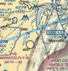
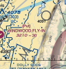
Yep, that got me once when I was planning a flight out to Windwood. Took me a bit to figure out it was a letter.
roncachamp
Final Approach
Yep, that got me once when I was planning a flight out to Windwood. Took me a bit to figure out it was a letter.
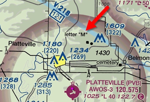
What do you make of this letter?
Pilawt
Final Approach
- Joined
- Sep 19, 2005
- Messages
- 9,480
- Display Name
Display name:
Pilawt
When I visited the campus of New Mexico State University in 1967 they told me that the letter 'A' on the hill east of campus was for the football players.
Next week, they said, they'll put up a 'B'.


Next week, they said, they'll put up a 'B'.
eetrojan
Pattern Altitude
BigBadLou
Final Approach
- Joined
- Aug 6, 2014
- Messages
- 5,166
- Location
- TX - the friendliest state
- Display Name
Display name:
Lou
What do you make of this letter?
The dot next to the label means that there is a landmark called 'letter M'.
If you switch to Satellite view (oh right, you can't, cuz Skyvector does not allow that
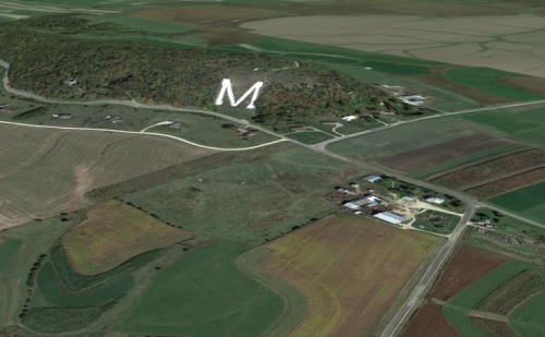
) ... okay, if you switch to VFRmap.com, look up KPVB and switch to Satellite, you will see that it really is an actual letter M on the ground.Or is it W?


EDIT: eetrojan beat me to it, and with a screenshot too.
Matthew
Touchdown! Greaser!
Or is it W?
Track up or North up?
roncachamp
Final Approach
The dot next to the label means that there is a landmark called 'letter M'.
If you switch to Satellite view (oh right, you can't, cuz Skyvector does not allow that
Or is it W?
It's an M, it's for the former Wisconsin Mining School, now the University of Wisconsin–Platteville. The letter is made of whitewashed stone about 240' by 210', built in 1937.
eetrojan
Pattern Altitude
It's an M, it's for the former Wisconsin Mining School, now the University of Wisconsin–Platteville. The letter is made of whitewashed stone about 240' by 210', built in 1937.
Here are some similar "LMU" letters for Loyola Marymount University that helpfully define the entry to the southbound "miniroute" over LAX, leaving Santa Monica's airspace.
However, I looked, and they're not on the chart.
 Probably just too crowded around there?
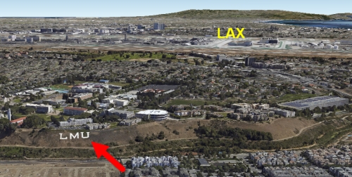
Ghery
Touchdown! Greaser!
- Joined
- Feb 25, 2005
- Messages
- 10,903
- Location
- Olympia, Washington
- Display Name
Display name:
Ghery Pettit
There aren't many lava flows around Mt. St. Helens, but the 1980 mudflows are very obvious.
They are, indeed.
roncachamp
Final Approach
Here are some similar "LMU" letters for Loyola Marymount University that helpfully define the entry to the southbound "miniroute" over LAX, leaving Santa Monica's airspace.
However, I looked, and they're not on the chart.
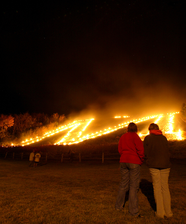
The Platteville "M" shows up pretty good at night as well.
Last edited:
eetrojan
Pattern Altitude
The Platteville "M" show up pretty good at night as well.
That's cool. Why so familiar with it? Did you go there?