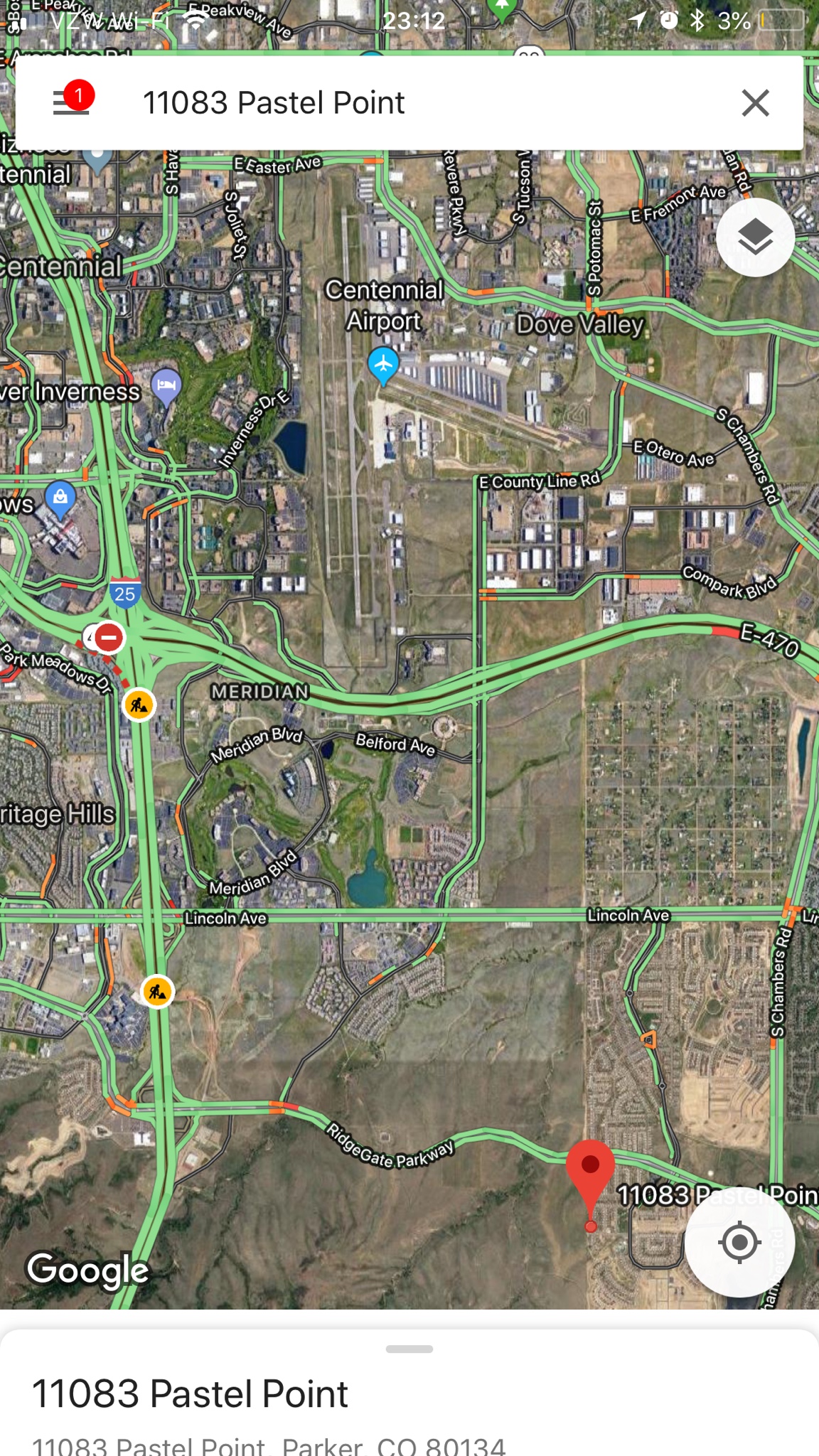
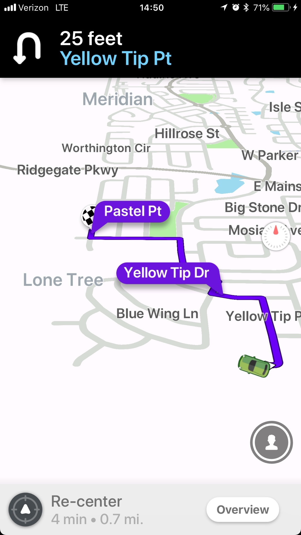
Looks like he turned left after takeoff, then LH downwind, then turned East across the approach path? That's what would appear to have concerned the controller with traffic on final?
Yep. He went right through the approach path.
He had an airplane with a rather capable AP, and the last thing he said was he wanted to come back to the airport... he may have had an engine problem. Wind was out of the northwest, he may have been trying to come back around to land on Runway 28.
In the end, he got high enough AGL to pull the handle...
Crashing going directly east at high speed still feels like CFIT to me, but there’s not going to be enough of that airplane left to know if it was an engine or control problem.
If the engine and controls were good, turning on the AP, setting a heading, and a higher altitude and asking for help, makes that a fine outcome.
Cloud bases were at pattern altitude according to the other Cirrus he cut across their ILS, who reported breaking out at 6800’. Probably ragged bases with lowering visibility... kinda like the commonly seen soupy junk in the Midwest.
Warm enough it’s unlikely icing was a factor, since the other Cirrus was doing laps on the approach as was the military aircraft. Basically one of our rare “reasonable practice” IMC days here where a pattern altitude ragged overcast and mist wasn’t convective and it wasn’t icing.
Lots of questions in my head now after seeing where his flight path took him and him only saying he wanted to come back to the airport.
The recording may have missed something there because I can’t imagine the controller asking him out of the blue for his intentions before he turned east like that unless he had said something else to them like he was running into IMC or similar. The scanner nature of the LiveATC recording may have hidden that.
He departed without an IFR clearance even though he had the rating and didn’t immediately ask for an IFR pop up which is also somewhat odd. Either he thought he could scud run the four miles back to the runway, or he was worried about not being current or something, perhaps.
We’ll probably never know.
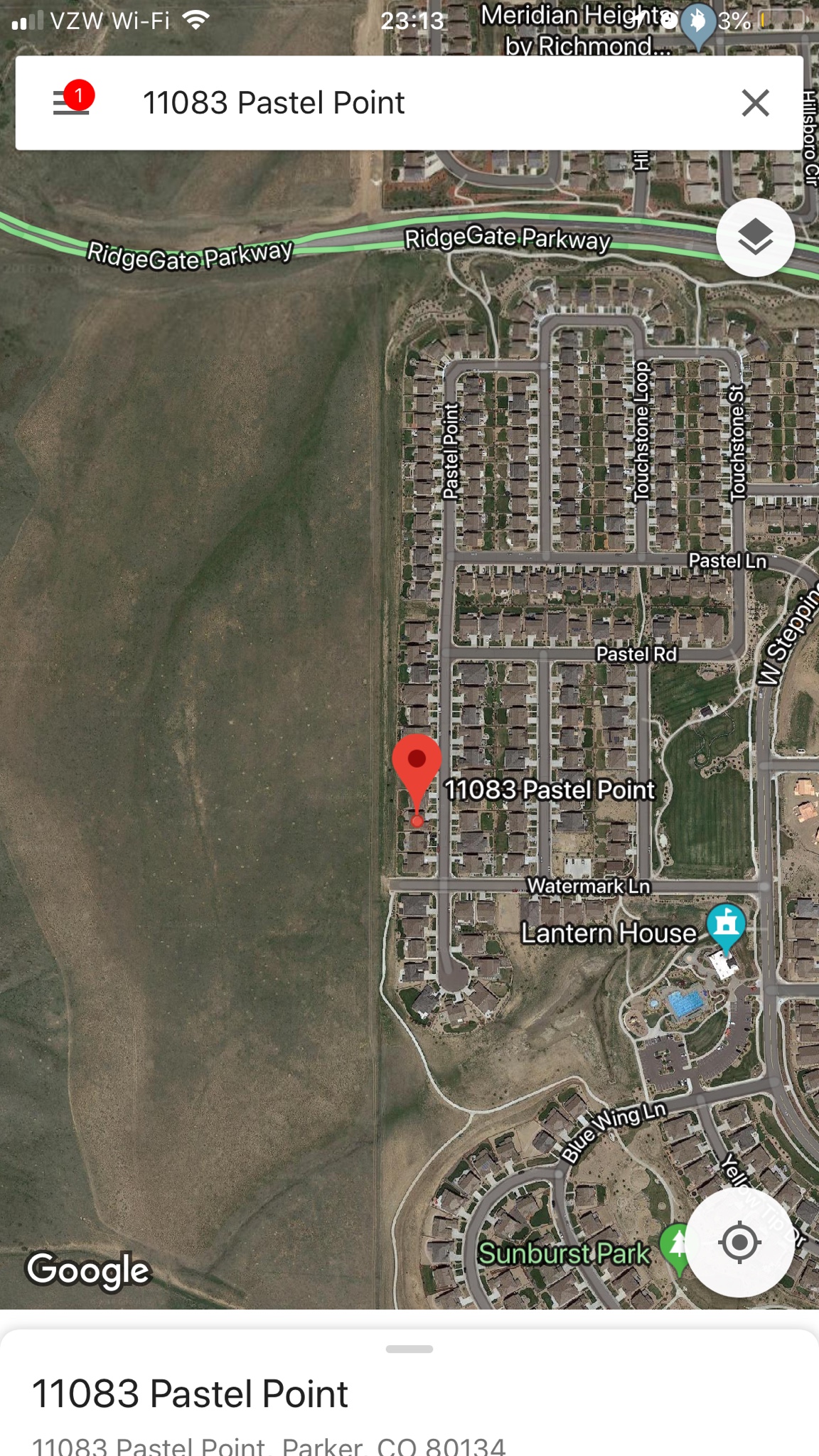
There’s high tension lines on that ridge line there at Lincoln Avenue in those screen shots. They’re below you on the ILS. Just south of where he is there’s also the KOA broadcast tower. Too much crap to hit besides the ridge line itself to be scud running south of the airport.
The other Cirrus when warned about him said they’d descend to 6000’ to go under him. They were VMC at that point. I wouldn’t go down to 6000’ to duck under anything there over the ridge unless I could see those power lines.
Very odd, and sad. I see a number of ways he could have taken an “out” including, of course, the parachute. Sigh.
")