SoonerAviator
Final Approach
- Joined
- Jul 21, 2014
- Messages
- 9,371
- Location
- Broken Arrow, OK
- Display Name
Display name:
SoonerAviator
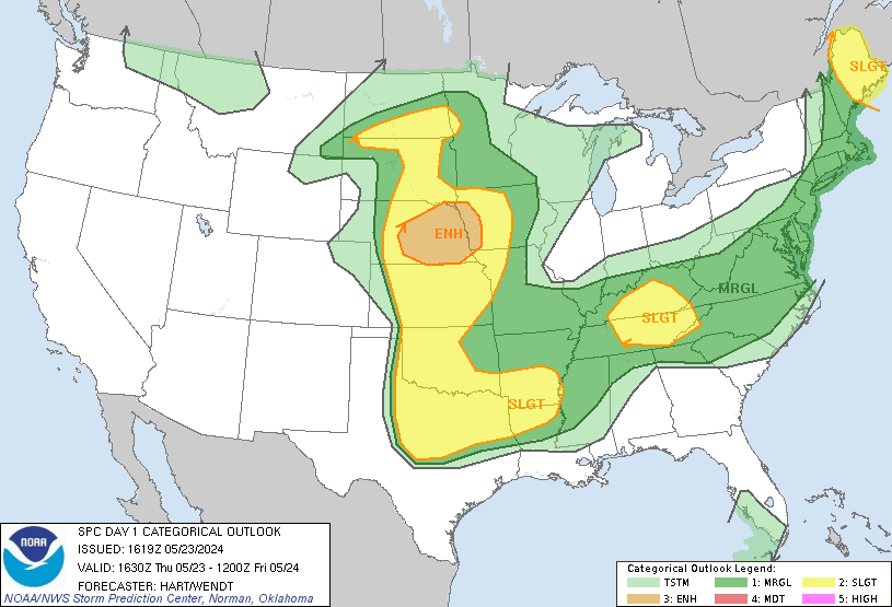
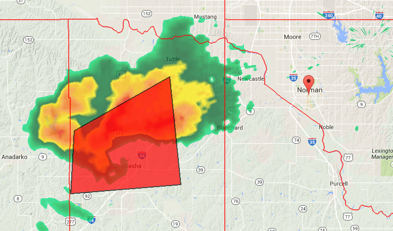
I think the geographic location of Moore just happens to coincide with where storms naturally reach the tornadic-activity level. The storms all spawn just east of the dry line in west Texas/Oklahoma and by the time they reach the southwest side of OKC they have fully matured and are ready to unleash the fury. There isn't a whole lot of topography to change much of anything in western OKC, so it seems as viable as any other explanation. Once the surface winds hit the hills and valleys in northeast Oklahoma, I think it makes the location of tornadoes a bit more sporadic.
 \
\ Some heavy rain planned for OKC but it looks like you guys are gonna get hit harder than us...