deyoung
Line Up and Wait
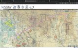
I'm looking at planning for a future trip from Tucson to Carrizozo, NM. Initially it looks like the thing to do is go to El Paso (roughly), and then there is a narrow corridor north between R5107 and R5103. I don't want to bust either of those; how practical is it to use that corridor?
Right now I have a GDL-39 connected to Garmin Pilot on a tablet. I am probably looking at installing a Garmin 355 GNC, but that's not done yet and I don't have a time frame for it yet (or really even a committed decision yet, though I'm getting there).
Alternatively I could go around the restricted areas, but going east first and then north has a lot of high terrain that I don't love (my model Cherokee has a 12k ceiling), and going north through Socorro is just a long way out of the way.
Thoughts? Thanks!