Mt Rainier scenic flight - local procedure?

Tinstafl

Pre-Flight
Joined
Oct 17, 2019
Messages
73
Display Name
Tinstafl
Anyone know if there are local practices for circumnavigating mt rainier? Like direction of flight or altitudes?

Also wondering if anyone has gotten cleared to take a single circuit while on an IFR flight plan? Say inbound and taking a circuit at the MVA before continuing? Is it a thing? Seems kinda unlikely with all the arrivals coming in over the mountains, but who knows? How’d you make it happen if so?

Thanks. Figured it might be a fun bonus on the trip.
 
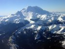
I live in this area and fly around Rainier several times a year just for fun. I've only done it VFR so I'm avoiding the Bravo too. A few tips:

If you are approaching from the NW, you're probably below the SEA B airspace so take care not to climb into as you approach. Also keep your eyes peeled because some of the SEA jet routes are nearby and they won't be much above you.

Make sure to get the winds in your briefing at 8k to 12k levels. If over 20 kts, better to fly it another day because you're in for a bumpy ride and may encounter downdrafts stronger than your airplane's max climb rate. Also watch out for "the hat" If you see lenticular clouds above Rainier, it's not a good day to fly around it.

Whether to fly around CW or CCW: depends on the wind direction - approach on the upwind side. This will facilitate your climb as you approach, and ensure you're higher on the downwind side, where there there will be downdrafts. Prevailing winds are from the SW.

Just E of Mt. Rainier is a sub-peak called "Little Tahoma", about 11,200' elevation. Watch out for that and go around the outside. The dip between Little Tahoma & Rainier may be tempting, but it tends to funnel and accelerate winds.

I usually fly around it at 10k to 12k feet. Bring a pulse oximeter and monitor your O2 levels. Pressure breathing is helpful and worth a good +5% on O2 level.

Around the S side is one of the most popular trails hikers use, so you may see a bunch of people.

There's a fun little airstrip NE of Mt. Rainier called Ranger Creek 21W. It's open June through Sep and you can fly in and camp. In summer temps the DA can get 5000' or so, so plan accordingly and ensure you're current with your high DA / mountain flying.

As you complete the circle and depart, if you're going NW back to the Seattle area, make sure to get below the Class B in time. This may require flying S turns or a big circle.

 
Anyone know if there are local practices for circumnavigating mt rainier? Like direction of flight or altitudes?

Also wondering if anyone has gotten cleared to take a single circuit while on an IFR flight plan? Say inbound and taking a circuit at the MVA before continuing? Is it a thing? Seems kinda unlikely with all the arrivals coming in over the mountains, but who knows? How’d you make it happen if so?

Thanks. Figured it might be a fun bonus on the trip.
I’ve flown over it a few times. I’ve never heard of some local procedure for doing it. Requesting VFR OTP could increase your chance of getting approval to do a ‘tour’ while IFR.
 
Anyone know if there are local practices for circumnavigating mt rainier? Like direction of flight or altitudes?
... I’ve never heard of some local procedure for doing it. ...
I've lived in this area for 15+ years and never heard of any local procedures, nor is anything printed in the charts or supplements. It's generally a good question to ask, though. Rainier is not like Denali, which has 10 pages of charts, routes and frequencies documented in the FAA Alaska Guide.
 
I've lived in this area for 15+ years and never heard of any local procedures, nor is anything printed in the charts or supplements. It's generally a good question to ask, though. Rainier is not like Denali, which has 10 pages of charts, routes and frequencies documented in the FAA Alaska Guide.
@Tinstafl
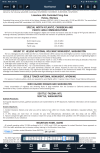
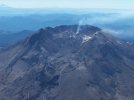
Turns out there is some recommended procedure for St Helens. Page 339 of the Northwest U. S. Chart Supplement.

1750095405528.png
 
I've always followed the procedure noted above for both Mt. St. Helens and Mt. Ranier. 2 rules of thumb: Don't fly close enough to any terrain that the hikers can read your tail number, and if there is a lenticular cloud cap, don't fly close at all.
 
The only guidance I can offer is the obvious one: stay above 2,000 ft AGL. There is hardly any traffic around Mt Rainer (close enough to it to be called a scenic flight).
 
There are two replies about Mt St Helens. Not sure why.
 
I've flown in the PNW for 25 years. I've never heard of a special way of flying around Mt. Rainier. Mt. St. Helens, yes. The general guidance given above is good. Keep high and keep your distance. And, yes, ATC is watching you. I remember years ago coming back from the east side VFR with FF. My passenger (CFI) wanted to get a closer look at the rock pile, so I turned towards it (from the SW). ATC came up on the frequency with "I know what you're doing!" I laughed and said we'd be back on our way to KOLM shortly. We were and never heard another word about it. Yes, they are watching.
 
Nothing special. I just took off and sent it. Circled Hood, Adams and Rainer a bunch since they were within radius for my experimental fly-off. I called Seattle center and/or Approach and got flight following especially over Ranier but radio coverage was a little spotty at times. They didn’t care, seemed routine for them. Obviously respect the regulatory minimum altitudes. I don’t remember seeing any other airplanes but there were definitely a bunch of climbers on Hood and Ranier.
 
Thanks for the replies. Coming in IFR we got a good enough view as it was and didn’t request the circumnav. I thought I’d remembered some local pilots giving clockwise and counterclockwise altitudes a while back. Sounds like nothing formalized.

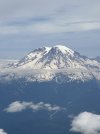
Beautiful peak regardless. I used to spend a lot of time there a few years back. Always fun to revisit from the air.
 

Attachments

  • IMG_3445.jpeg
    IMG_3445.jpeg
    806 KB · Views: 5
Back
Top