LR weather

Mahneuvers

Pattern Altitude
Joined
Nov 3, 2020
Messages
1,665
Display Name
Mahneuvers
The GFA Forecast is my primary weather tool as my XCs aren't that long and it's extremely rare for me to spend the night. I'm having trouble reconciling some of the weather comments in the RR thread made several days out. I've been watching the Medium Range Forecast and Windy's hour-by-hour Cloud Base map. What are people using for >=2 days out weather forecasts?
 
The GFA Forecast is my primary weather tool as my XCs aren't that long and it's extremely rare for me to spend the night. I'm having trouble reconciling some of the weather comments in the RR thread made several days out. I've been watching the Medium Range Forecast and Windy's hour-by-hour Cloud Base map. What are people using for >=2 days out weather forecasts?
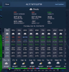
Windy and prog charts on GFA. @eman1200 just put me on to weather.gov and the hourly weather forecast.
https://forecast.weather.gov/MapCli...=-86.523&unit=0&lg=english&FcstType=graphical is for Rough River. Then

www.weather.gov
then select local under forecast
click on the map
(click on next map as well)
Scroll down to hourly weather forecast
Select time range.
 
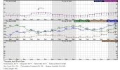
I have loved that meteogram for decades.
 
For multiple >3 days out I use the "DAILY" weather tab on ForeFlight.

I like it when software does the analytical portion for me that correlates a shifting of fronts and pressure systems into more concrete information I can use (expected cloud levels, visibility, wind speed/direction, precip). I prefer this over progs because there's no way my interpretation of a prog chart is going to beat theirs :)

Gives me a practical weather expectation:
1745423603526.png

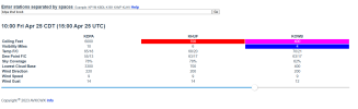
Closer in I use tools like this which I believe blend TAF/MOS (which incidentally for RR is why I'm leaving on Thursday instead of Friday!)
1745423660415.png
 
I use weather.gov, pinpoint forecast for a couple of different spots, and the hourly graphs that go out about 5 days I think. It's good but doesn't give ceilings. Then I compare that with the forecast discussion to get a rough idea of how certain the forecasters feel about the current forecast. Don't know how area dependent it is, but out of ALB they're pretty candid when the forecasts are kinda unknown.
 
I use weather.gov, pinpoint forecast for a couple of different spots, and the hourly graphs that go out about 5 days I think. It's good but doesn't give ceilings. Then I compare that with the forecast discussion to get a rough idea of how certain the forecasters feel about the current forecast. Don't know how area dependent it is, but out of ALB they're pretty candid when the forecasts are kinda unknown.

You sure it doesn’t give ceilings?

4dcc51efdbd9ad2cc32a3aa26fd30384.jpg
 
You sure it doesn’t give ceilings?

4dcc51efdbd9ad2cc32a3aa26fd30384.jpg
Here it doesn't. I'm officially jealous, and a little annoyed. That's just south of me, forecast out of ALB.
 

Attachments

  • chart-wx.jpg
    chart-wx.jpg
    126.1 KB · Views: 6
Maybe it depends on what weather reporting services are available at each location. I dunno.
I picked some different spots around the country, and some have fewer choices than here. It might be worth making a call to the local office. I was there on a tour when they opened up their new office, they were pretty friendly.
 
So I'm part of that RR discussion and I've been looking at weather semi-obsessively since this(wed) afternoon. First thing is I'm looking at 2I0 as I have to make a stop there on my way in as well as 2I3 second I'm trying to decide if we can stick to our plan of arriving around 6p or if we need to try to rearrange our schedules yet again and try to depart earlier in the morning which involves some difficulty. I'm instrument rated so I'm less concerned about ceilings than I am about convective activity.

Primarily for long range outlooks I'll use the Foreflight daily weather, an app I have on my phone called stormradar, and weatherunderground.com. Throughout the day I've been checking those 3 sources primarily and I've seen all 3 of them give times for precip several hours apart, chances of precip anywhere from 20-70% and the overall outlook shifting between mostly cloudy to showers to scattered/isolated t-storms to full on t-storms and back. Finally a TAF got issued for the OWB and PAH for 30% chance of thunderstorms with light rain between 1 and 7pm local. Putting this all together my read is there's probably going to be some precip in that area and there's a chance some of it may develop into scattered or isolated storms but they don't really know how widespread or exacty when/where it will be. Although they seem consistant on a 40-ish% chance of scattered storms at my initial destination around our planned arrival time because of course it is. :mad2: That said, experience has taught me not to assume anything because I've woken up many mornings seeing actual or forecast conditions for later in the day that are very different than my expectations.

Where it all gets frustrating is when you have to make decisions ahead of time that impact non-aviation things based on these sorts of might go either way conditions.
 
Back
Top