Now there's one to have with Google Glass!
Not available on android though...

Now there's one to have with Google Glass!
Doe the airport have an instrument approach? If so, fly it.
Holy crap, that is cool...
IF it works. If it uses GPS to determine attitude, it won't include WCA. And if it's anything like Google Sky Map, it will place stuff 10 deg off, probably bad enough to land at the wrong airport.
So hypothetical... possibly common scenario:
You are inbound for landing at an uncontrolled airport you've never been to before. You know what runway you want based on winds, the gps is telling you it's right in front of you 5 or 6 miles ahead. You know about where it should be in relation to nearby landmarks but your eyeballs just won't locate the runway so you can set up for a proper pattern entry and landing.
What's the ideal response to this?
Oh - something I didn't realize, but the compass in the iPhone 4s seems to work just fine oriented in all three axis and right side up or upside down.
Actually, that's a sign of BS from the phone. A real compass has two directions in 3D space where the measurement is poorly defined. It's very much like the zone of confusion for a VOR, except it's not zenith/nadir.
You are correct when the sensor senses on only 2 axis. However, according to net sources, the iPhone 4 uses the 3 axis AKM AK8975 hall effect chip:
http://www.akm.com/akm/en/product/datasheet1/?partno=AK8975
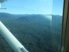
Some airports are just danged hard to see when you're coming in for the first time ever. Hidden by trees or hills. Buried in a mass of buildings, etc.
I too try to look at a new field on google maps or earth and get a feel for it. Just knowing which side of a small town a small airport is located is extremely helpful.
There's only one that I found repeatedly hard to find. Hartselle, AL (5M0)...which was a fuel stop when I was working in Georgia. A north/south runway completely hidden behind trees when coming in from the west. Many times I'd be right on top of it before seeing it.
That doesn't change basic geometric constraints that magnetic field lines are inherently one dimensional, and attitude is not determined orthogonal to that. There must be additional constraints. If they assume you're looking at the horizon, that's only going to work for distant airports.
Not sure the point of calling it a toy just because the accuracy isn't known - given the option of not having it at all, which is perfectly reasonable option. Since many pilots already fly for the enjoyment anyway, the whole bloody plane and all the stuff in the typical flight bag are "toys". I spend about a $90 for an hour of flying - a one time purchase of a $10 app isn't that big of a deal to me. I don't know that I'll ever find it helpful, but I do think it is neat and clever.And, as a toy, we don't know how accurately it can find the field direction, or if it has any knowlege of local distortion, which can be substantial.
It is true that Hall sensors will not exhibit any of the problems of a mechanical wet compass. They require power, but will have a great advantage during turns and turbulent conditions.What it does mean is that it can sense the dip angle, and should therefore not show the usual mag compass errors.
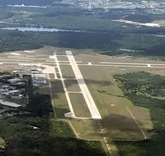
One of my most difficult situations was where I was inside PDX (Portland) airspace going to TTD (Troutdale) and they were keeping be "at or below 1,200 ft" for spacing to the heavy metal going into PDX and although I was only 2 miles away and had the airport on the GPS, I still had no visual on it 'till I was almost on top of it.
The slant angle to the airport on the nose, combined with the dense urban area around the airport made it very challenging. This was one situation where climbing to get a better overview of the terrain was not possible.
Not always possible; most approaches are GPS approaches, and not all aircraft are GPS equipped.
Not always desired, as instrument approaches can take you miles out of your way, and put you in front of much faster aircraft.
If you're on the radio with ATC already, just say "negative contact on the field, could I get a vector and range please?"
If you were inside the PDX Class C at 1200, there is an enormous river and a major interstate leading the way to TTD.
Sometimes we get so enamored with gadgets that we forget to look out the window.
Oh yeah, versions of that were said many times. Tower were telling me it was 12:00 3-4 miles but I just couldn't see it. Problem was really the slant angle, you just couldn't see the wood for the trees at that altitude....
Get on it! When you do a cross-country, note every airport within 20 miles of your courseline, and use them as checkpoints. Like everything else, you get better with practice. Picking out airports gets easier as you do it more and more.Maybe I will get up the nerve to find a decent CFI and try again.
As a student pilot, I find it encouraging to know even experienced pilots can find it challenging to locate their desired airport/runway. My instructor made me feel like a miserable, hopeless failure when I failed to spot a small airport on the outskirts of our metro area. I was almost on top of it before I recognized it, altho I knew it had to be nearby.
This experience shook me so badly I quit flying. What kind of pilot can't find his runway, for goodness sake?
Maybe I will get up the nerve to find a decent CFI and try again.
I dunno - finding an airport is half the fun.
I especially like it at night, when you spot the beacon and start working your way to it, only to realize that's the beacon for the wrong airport. It's really fun when they happen to be lined up on your course and you are looking at the far beacon and miss the one right under your nose.

Been there done that....
.As a student pilot, I find it encouraging to know even experienced pilots can find it challenging to locate their desired airport/runway. My instructor made me feel like a miserable, hopeless failure when I failed to spot a small airport on the outskirts of our metro area. I was almost on top of it before I recognized it, altho I knew it had to be nearby.
This experience shook me so badly I quit flying. What kind of pilot can't find his runway, for goodness sake?
Maybe I will get up the nerve to find a decent CFI and try again.
Heck, there's a local airport near here that I never did spot from the air until I saw it from the ground. Airport environment? No, just a cut in the trees.