NordicDave
En-Route
I just upgraded to Foreflight Performance Plus today because of the new 3D feature they have been promoting.
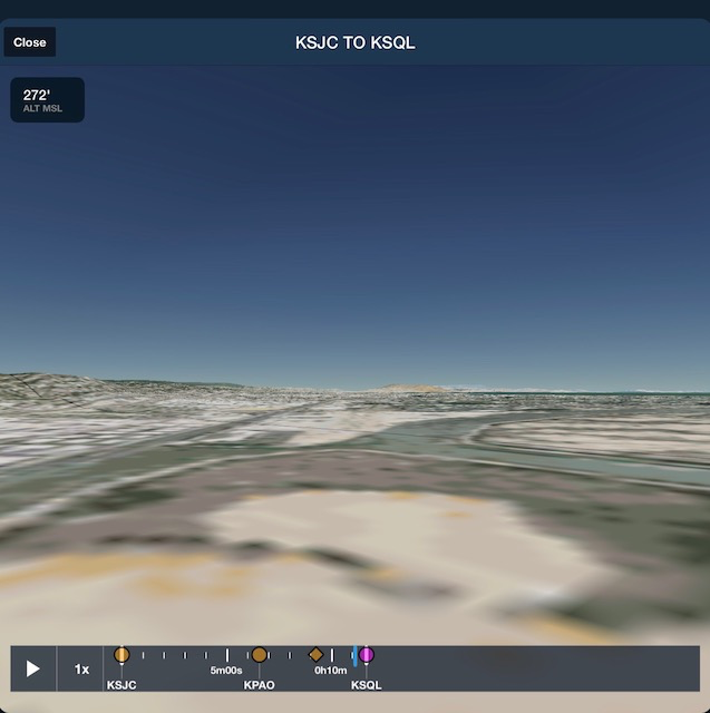
Here's an example of the approach to San Carlos KSQL rwy 30. KSQL has a couple of prominent visual checkpoints like the Cement plant and the Diamond lake. Neither of those is visible in Foreflight, but are present in google maps from the same perspective. The examples below don't include these landmarks to adjust the size constraints for posting. However from those examples you can clearly see the difference in usability.
Foreflight 3D:
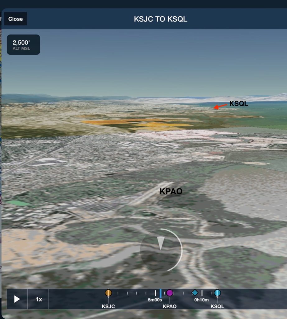
They tout the advantage is to help pilots find new to them airports. Maybe "where's Waldo" can find this one.
Google Maps:
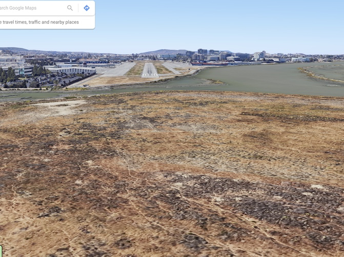
Even the Slough around the edge of the airport is not represented correctly.
If this is the prime feature of the ForeFlight Pro upgrade, I don't think t's worth the extra $100 a year. I expected more than the lowest level terrain we see on a cheap flight SIM.
-David
Here's an example of the approach to San Carlos KSQL rwy 30. KSQL has a couple of prominent visual checkpoints like the Cement plant and the Diamond lake. Neither of those is visible in Foreflight, but are present in google maps from the same perspective. The examples below don't include these landmarks to adjust the size constraints for posting. However from those examples you can clearly see the difference in usability.
Foreflight 3D:
They tout the advantage is to help pilots find new to them airports. Maybe "where's Waldo" can find this one.
Google Maps:
Even the Slough around the edge of the airport is not represented correctly.
If this is the prime feature of the ForeFlight Pro upgrade, I don't think t's worth the extra $100 a year. I expected more than the lowest level terrain we see on a cheap flight SIM.
-David
Last edited:


")
