TangoWhiskey
Touchdown! Greaser!
I hope to do a lot more flying than I did in the past 24 months. Today, May 1st (the anniversary of my PP checkride in 1998), I got signed off on my Flight Review (I guess it's not technically called a "BFR" anymore).
It's been 25 months (April 2008) since I last flew as PIC, and 30 months since my last BFR. Way too long. Time, finances, kids going to college--all added up to flying getting reluctantly pushed to the back burner.
Earlier this week, I renewed my renter's insurance with an effective date of May 1st, and scheduled my flight review out of NW Regional (52F) with Gilbert Barth at MarcAir Aviation, in their G1000 C172 with the GFC700 autopilot. All week long, thunderstorms were forecast for today, and I was worried the flight would get scrubbed. We've also been dealing with really strong westerly gusty winds all week. Just to show how fickle weather can be, today dawned with 7000' ceilings, light and variable winds, and cooler temps--and all convective activity off to the east. The scare of thunderstorms must have held many pilots at bay, though, as the airport and skies were quiet.
I have to say that Gilbert gave me what was, by far, the most enjoyable and instructive flight review I've experienced to date. We spent 1.2 hours on the ground, and 1.9 hours in the air--more than the minimum, but time well spent. Knowing I'm instrument rated and fly the G1000 a lot, and have done little with VFR in a long time, Gilbert suggested we "get back to basics"... what fun that was!
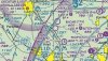
After the typical oral review of basic part 91 regulations, we pulled out paper and pen, the POH, and he had me do a weight and balance for today's flight (no issue), then we turned to the charts hanging on the wall behind me for airspace review. We did scenario based questions about a possible cross-country flight from 52F to Amarillo, TX, about 260 nm to the west-northwest.
At the end of that exercise, he had me do a quick-and-dirty flight plan for that trip: he wanted some checkpoints, headings corrected for winds aloft and magnetic variation, fuel burned, and fuel remaining.
We then got in the airplane, and after refueling, we departed 52F and started off on that trip much like you would on a PP checkride, climbing westbound out from under the shelves of DFW's class B airspace. Our target altitude for the trip was 6500 (though we never got that high), and I had to watch my altitude under each ring before climbing. He made it fun (really!), by zooming in the GPS so I couldn't use it to see when I was passing each ring of airspace. No DME, so it was "refer to the chart" in my lap, figure out where I was based on what was on the ground, and when it was safe to continue my climb.
He asked for my estimate of when I'd hit my first checkpoint (the north end of Lake Bridgeport), and that's when I realized I'd forgotten to note my departure time as we took the runway--Lesson #1. He showed me how the Aux 2 page of the G1000 has that information. Using the departure time from that page, plus my nav log, I estimated we'd hit that checkpoint at :47 after the hour. And, we did.
He then asked for a diversion to Stephenville, and asked me to use the GPS to accomplish that one, and to take up that course and let him know how far it was, when we'd get there, how much fuel it would take, and what our reserves would be when we got there.
That was easy. So now, headed southbound, he said "Change of plans... we want to go to Oklahoma City instead. Do that one, and provide me with the same information, without using the GPS." This was fun--OKC is on the same sectional, but on the other side of the page. He also had told me on the ground he likes to see the pilot get the plane going in the correct direction early and give the answers to the questions in not more than a minute or two.
I did some quick figuring and estimated a heading of due north to get there, and turned left to 360. Quick counting of quadrangles (30 nm each) gave me a figure of 127 nm to OKC, and I estimated 1:15 minutes (we now had a headwind with the change of direction) and 12.5 gallons of fuel would be used. He cranked the MFD over to the flight plan page, did Direct KOKC, and it said the course would be 001, 1:14 minutes, and 12.3 gallons of fuel, so I passed. It was fun to do it "the hard way".
We then did the normal steep turns, power on and power off stall series, and then an emergency landing (lost the engine at 4500' over Bridgeport KXBP). I ran through my flow, briefed him for the emergency landing, and circled down over a key position abeam the downwind/final turn, and made the runway. Although I'd done really well with checklist usage up to this point, I learned during the post-flight debrief that I'd have gotten my engine back if I'd had used that extra time descending from 4500' to pull out and do the checklist... I'd left the "aux fuel pump ON" off my flow! Lesson #2. During debrief, he said he suggests, when time allows, that the emergency engine failure checklist be ran three times; first as a flow, then again with the checklist to be sure you didn't miss something, then if the engine doesn't start, a third time, this final time as a "secure the engine" checklist, turning things OFF instead of ON. Lesson #3.
We did short and soft field takeoffs and landings, with the short field landings to a designated touchdown spot (accuracy landing), then headed back towards 52F. On the way, we dialed up the Bowie VOR so I could hear HIWAS (I mentioned during the oral that I knew what HIWAS was and how to get it, but had never seen a VOR that had it). He knew that Bowie is the only local VOR with it, so we made a point to listen to it. Lesson #4.
Then, on the way back, he briefed me on all the modes of the GFC700 autopilot, and we tried each of them, including VS and FLC altitude change modes and using CWS (control wheel steering) to set pitch or rate of climb.
Two more landings back at 52F, one full flaps and one sans flaps, and the flight was done.
A good debrief, where he went over the "lessons" above from the notes he'd taken during the flight. He said I'd had good instructors, and for 25 months of rust, flew quite well. I was pleased with my performance too, but more so with Gilbert's instruction techniques, and how he used the BFR to bring me back to basics and help me remember some of the stuff that can be so easily forgotten.
Man, it felt good to be back in the air!
It's been 25 months (April 2008) since I last flew as PIC, and 30 months since my last BFR. Way too long. Time, finances, kids going to college--all added up to flying getting reluctantly pushed to the back burner.
Earlier this week, I renewed my renter's insurance with an effective date of May 1st, and scheduled my flight review out of NW Regional (52F) with Gilbert Barth at MarcAir Aviation, in their G1000 C172 with the GFC700 autopilot. All week long, thunderstorms were forecast for today, and I was worried the flight would get scrubbed. We've also been dealing with really strong westerly gusty winds all week. Just to show how fickle weather can be, today dawned with 7000' ceilings, light and variable winds, and cooler temps--and all convective activity off to the east. The scare of thunderstorms must have held many pilots at bay, though, as the airport and skies were quiet.
I have to say that Gilbert gave me what was, by far, the most enjoyable and instructive flight review I've experienced to date. We spent 1.2 hours on the ground, and 1.9 hours in the air--more than the minimum, but time well spent. Knowing I'm instrument rated and fly the G1000 a lot, and have done little with VFR in a long time, Gilbert suggested we "get back to basics"... what fun that was!
After the typical oral review of basic part 91 regulations, we pulled out paper and pen, the POH, and he had me do a weight and balance for today's flight (no issue), then we turned to the charts hanging on the wall behind me for airspace review. We did scenario based questions about a possible cross-country flight from 52F to Amarillo, TX, about 260 nm to the west-northwest.
At the end of that exercise, he had me do a quick-and-dirty flight plan for that trip: he wanted some checkpoints, headings corrected for winds aloft and magnetic variation, fuel burned, and fuel remaining.
We then got in the airplane, and after refueling, we departed 52F and started off on that trip much like you would on a PP checkride, climbing westbound out from under the shelves of DFW's class B airspace. Our target altitude for the trip was 6500 (though we never got that high), and I had to watch my altitude under each ring before climbing. He made it fun (really!), by zooming in the GPS so I couldn't use it to see when I was passing each ring of airspace. No DME, so it was "refer to the chart" in my lap, figure out where I was based on what was on the ground, and when it was safe to continue my climb.
He asked for my estimate of when I'd hit my first checkpoint (the north end of Lake Bridgeport), and that's when I realized I'd forgotten to note my departure time as we took the runway--Lesson #1. He showed me how the Aux 2 page of the G1000 has that information. Using the departure time from that page, plus my nav log, I estimated we'd hit that checkpoint at :47 after the hour. And, we did.
He then asked for a diversion to Stephenville, and asked me to use the GPS to accomplish that one, and to take up that course and let him know how far it was, when we'd get there, how much fuel it would take, and what our reserves would be when we got there.
That was easy. So now, headed southbound, he said "Change of plans... we want to go to Oklahoma City instead. Do that one, and provide me with the same information, without using the GPS." This was fun--OKC is on the same sectional, but on the other side of the page. He also had told me on the ground he likes to see the pilot get the plane going in the correct direction early and give the answers to the questions in not more than a minute or two.
I did some quick figuring and estimated a heading of due north to get there, and turned left to 360. Quick counting of quadrangles (30 nm each) gave me a figure of 127 nm to OKC, and I estimated 1:15 minutes (we now had a headwind with the change of direction) and 12.5 gallons of fuel would be used. He cranked the MFD over to the flight plan page, did Direct KOKC, and it said the course would be 001, 1:14 minutes, and 12.3 gallons of fuel, so I passed. It was fun to do it "the hard way".
We then did the normal steep turns, power on and power off stall series, and then an emergency landing (lost the engine at 4500' over Bridgeport KXBP). I ran through my flow, briefed him for the emergency landing, and circled down over a key position abeam the downwind/final turn, and made the runway. Although I'd done really well with checklist usage up to this point, I learned during the post-flight debrief that I'd have gotten my engine back if I'd had used that extra time descending from 4500' to pull out and do the checklist... I'd left the "aux fuel pump ON" off my flow! Lesson #2. During debrief, he said he suggests, when time allows, that the emergency engine failure checklist be ran three times; first as a flow, then again with the checklist to be sure you didn't miss something, then if the engine doesn't start, a third time, this final time as a "secure the engine" checklist, turning things OFF instead of ON. Lesson #3.
We did short and soft field takeoffs and landings, with the short field landings to a designated touchdown spot (accuracy landing), then headed back towards 52F. On the way, we dialed up the Bowie VOR so I could hear HIWAS (I mentioned during the oral that I knew what HIWAS was and how to get it, but had never seen a VOR that had it). He knew that Bowie is the only local VOR with it, so we made a point to listen to it. Lesson #4.
Then, on the way back, he briefed me on all the modes of the GFC700 autopilot, and we tried each of them, including VS and FLC altitude change modes and using CWS (control wheel steering) to set pitch or rate of climb.
Two more landings back at 52F, one full flaps and one sans flaps, and the flight was done.
A good debrief, where he went over the "lessons" above from the notes he'd taken during the flight. He said I'd had good instructors, and for 25 months of rust, flew quite well. I was pleased with my performance too, but more so with Gilbert's instruction techniques, and how he used the BFR to bring me back to basics and help me remember some of the stuff that can be so easily forgotten.
Man, it felt good to be back in the air!


") ) As I was VFR at the time, I was very concerned about getting stuck on top. The CFI said "look ahead, UNDER the clouds... what do you see?"
) As I was VFR at the time, I was very concerned about getting stuck on top. The CFI said "look ahead, UNDER the clouds... what do you see?"