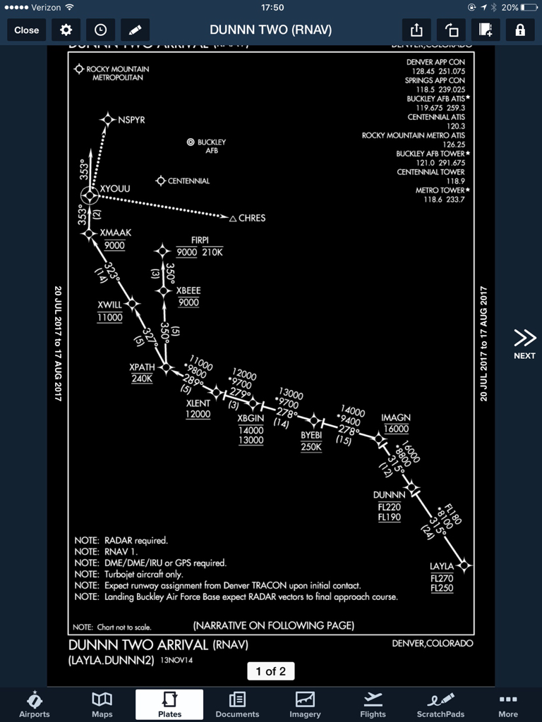
Could be, but then you'd leave off the 210 and want folks to go 200 to help alleviate that.
I see the 210 as a warning to slow up and simultaneously a "gotcha" if you don't look literally 1 second ahead of that on the VFR chart, which a lot of IFR pilots never really do...
It's a great "gotcha" question for an IFR ride too. Not that I've heard of any DPEs using it, but it wouldn't surprise me at all.
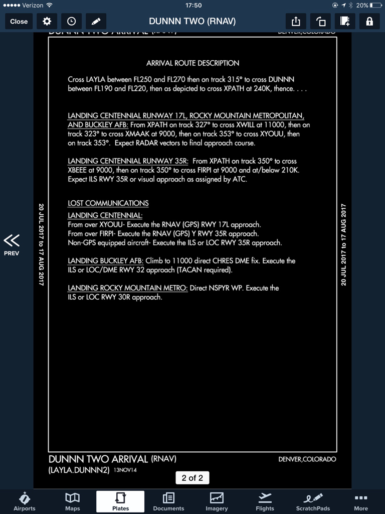
"You're now superpilot and someone handed you the keys to the Jet. You're planning the 35R ILS into KAPA. How fast can you be at FIRPI?"
See if the pilot really knows the next step in that game...
The only truly correct answer is, "210 is the limit on the plate, but I need to be at 200 as soon as I descend out of 9000 because it's underneath the Bravo."
Other fun games with that approach would be...
"You're flying back from the mountains on V95 and the last clearance you received was V95 to HOHUM, maintain 17 thousand, expect ILS 35R at Centennial. How and when do you descend?"
And wait for them to say the controller has to give a lower altitude...
"Okay, so they haven't. Where do you need to be asking for one if they forgot about you?"
And they figure that out... and the notice that a descent at 250 knots from STAMY to HOHUM is 2000 ft/min. ("Hey, is this thing I'm flying pressurized?"
")
Even slowed to 200 knots for 21 miles from 17K to 9000 is 1600 feet per minute. The passengers aren't going to like this much if we've been sucking O2 in an unpressurized cabin...)
"And as you call them there to ask for lower, you realize you've lost Comm with Denver. What next?"
There's all sorts of places you can do this sort of thing, of course, but this approach can be fun as a scenario generator.
Clark's catch on the NOTAM is a fun one too. That one will trip up nearly everyone. I believe it needs to say "as published" if they want you to turn left (or just say left turns).
With that NOTAM in place, your favorite "smart" GPS is going to try to prompt you to fly that with left turns if you don't get it out of the missed mode, too. And you might get suckered into it by comparing the published to the text of the NOTAM, because the only other difference is a 200' higher altitude. I bet lots of folks would choose to fly the magenta line. Punch OBS and CDI and go where no man has gone since the NOTAM was issued, once you reach the hold.
Someone sharp would say they'd ask Denver if they minded if they flew left turns at HOHUM vs what the NOTAM says, and Denver would likely be quite confused by the request. Because I think Clark's right. The NOTAM writer screwed that one up.