ForeFlight 5.3 out...neat new feature!

LDJones

Touchdown! Greaser!
Gone West
Joined
Sep 6, 2011
Messages
10,998
Location
Twin Cities, MN
Display Name

Display name:
Jonesy
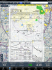
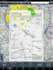
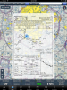
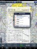
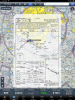
Just got notice 5.3 is released. Coolest feature: You can overlay your approach plate over your maps and adjust the transparency of the overlay. This makes the approach plate fixes "hot", allowing for easy Direct To's and adding them to your route. It also means your weather depictions are overlaid on your approach plate.

Very cool.

(Examples on their blog.... blog.foreflight.com)
 
Last edited:
Been playing with it (FF, lol) for the last half hour. Very cool! Glad to see the add of more windows in he HUD and the satellite view function too!
 
Been playing with it (FF, lol) for the last half hour. Very cool! Glad to see the add of more windows in he HUD and the satellite view function too!

I only see one more...am I missing something? I'd really like to see them make them a bit smaller and allow a few more...or even go the route of Garmin Pilot and make those scrollable left and right for more options.
 
They really thought this through.... you can touch and hold on an airport to get the pop-up. Choose the Info option. Scroll to the Procedures and when you find the approach you want there is a "Map >" button to instantly send the overlay to your chart.

Then you can long-press on a waypoint to get a direct-to or add it to your flight plan.

Well played!
 

Attachments

  • IMG_0573.PNG
    IMG_0573.PNG
    4.1 MB · Views: 82
  • IMG_0574.PNG
    IMG_0574.PNG
    6.1 MB · Views: 87
  • IMG_0575.PNG
    IMG_0575.PNG
    5.5 MB · Views: 77
  • IMG_0576.PNG
    IMG_0576.PNG
    6.1 MB · Views: 82
One thing I'm really liking about Hilton and Tyson (and their respective crews) is the quantity and quality of the updates this year.

Cheers to both!
 
One thing I'm really liking about Hilton and Tyson (and their respective crews) is the quantity and quality of the updates this year.

Cheers to both!

They recognize they have serious competition now - all of which are gunning for their customers - and they know the answer to holding their customers is to continue to release quality software consistently. Many of these competitors, I'm convinced, won't be able to stay in the fight long enough.
 
This sounds like what the Flightguide app had when I did the 30 day demo in 2011. Competition is good.

Do you know if this Foreflight feature requires the Pro subscription (since it basically gives you georeferenced approach plates)?

-Paul
 
This sounds like what the Flightguide app had when I did the 30 day demo in 2011. Competition is good.

Do you know if this Foreflight feature requires the Pro subscription (since it basically gives you georeferenced approach plates)?

-Paul

I tried to try it out on my non-Pro subscription and it reminds you to get the Pro.

So, no worky.

David
 
I tried to try it out on my non-Pro subscription and it reminds you to get the Pro.

So, no worky.

David

Yep, the geo-referenced plates is required, which makes since if you think about it. But for only $75 more it's a no-brainer for IFR flyers.
 
I'm just... Impressed. The Foreflight gang seems to keep the hits coming.

Makes me cry a few little tears for the Android thread folk, though. ;)
 
Hmm. Turning on the ILS 35R overlay on KAPA solidly locks up the graphics engine on iPhone 5.

That or it's a live satellite view and really really dark out. LOL

uqubu9u3.jpg


Hit main iPhone button, then tap FF App back open, splash screen and then a crash. Consistently.

Relaunch, map comes back to life. No overlay.
 
P.S. just noted that it also locks up the app so hard it thinks it has no GPS fix. (Bottom right corner.). GPS works right up until you attempt to overlay.
 
Just downloaded the update,looks great at first look.cant wait to try it in the aircraft.ff and stratus the way to go and if you rent you don't have to worry about their avionics.
 
I only see one more...am I missing something? I'd really like to see them make them a bit smaller and allow a few more...or even go the route of Garmin Pilot and make those scrollable left and right for more options.

You get the additionals if you rotate to landscape mode. 8 total.
 
I'm just... Impressed. The Foreflight gang seems to keep the hits coming.

Makes me cry a few little tears for the Android thread folk, though. ;)

Don't cry...love what Garmin Pilot is doing on my Android Phone and Nexus 7. Used both along with my iPad from MN to southern CA this past weekend. All did their job commendably well.

ForeFlight raising the bar is good for everyone. :yes:
 
Hmm. Turning on the ILS 35R overlay on KAPA solidly locks up the graphics engine on iPhone 5.

That or it's a live satellite view and really really dark out. LOL

uqubu9u3.jpg


Hit main iPhone button, then tap FF App back open, splash screen and then a crash. Consistently.

Relaunch, map comes back to life. No overlay.

I think that's as designed....trying to pick your way around on such an itty-bitty little screen is likely to make your entire world go black!

:D
 
You get the additionals if you rotate to landscape mode. 8 total.

Sweet. I still think they could be slightly smaller, allowing more in both orientations, but this is a step forward.
 
A nice feature is quick access to alternate approaches right from the map screen. We regularly shoot the VOR 12 into KLVN, do the published missed and hold, then do the ILS 30. Now a quick tap of the gear in the top left corner lets me choose the next approach.

In the examples attached, note the weather overlay. I like it.
 

Attachments

  • IMG_0580.PNG
    IMG_0580.PNG
    6 MB · Views: 56
  • IMG_0581.PNG
    IMG_0581.PNG
    6.1 MB · Views: 47
I guess I'm going to have to update my iPad, stll on Gen 1.

I did notice with the new update that the track data at the bottom of the page can no longer be scrolled out of view.

I'll go try that approach overlay function.

Edit: ok the approach overlay does work on Gen 1 iPad, and I found the touch switch to display or not display the track data, but how to change the transparency of the IAP overlay?
 
Last edited:
Elegant and beautiful. These guys are really something!
 
Next up will be STAR depiction on the chart? That would be wonderful for those of us who don't regularly fly them.

Last time I got one I spent a few minutes figuring out exactly what they wanted me to do. Of course a few minutes in the 'kota is pretty uneventful that far out...
 
I guess I'm going to have to update my iPad, stll on Gen 1.

I did notice with the new update that the track data at the bottom of the page can no longer be scrolled out of view.

I'll go try that approach overlay function.

Edit: ok the approach overlay does work on Gen 1 iPad, and I found the touch switch to display or not display the track data, but how to change the transparency of the IAP overlay?

Click the settings button (sprocket) at the top of he screen, then scroll down.
 
Next up will be STAR depiction on the chart? That would be wonderful for those of us who don't regularly fly them.

Last time I got one I spent a few minutes figuring out exactly what they wanted me to do. Of course a few minutes in the 'kota is pretty uneventful that far out...

You can add a STAR to your route now. How exactly do you intend for them to depict them in FF?
 
This starts to make the capabilities of Aspen's Connected Panel look really attractive.
 
Next up will be STAR depiction on the chart? That would be wonderful for those of us who don't regularly fly them.

STARs would be harder to make usable, since they aren't to scale - at all. To overlay one on a sectional, you'd have to stretch some parts out, and squish some parts together to make it work, and then you wouldn't be able to read them anyway. Look at most any STAR, you'll see that there are 5 nm legs where the line is just as long as 60 nm legs.

Plus, it CAN display the waypoints already, if you have the STAR in your flight plan - just not the altitudes and speeds and other info.

Exactly....the STARS aren't geo-referenced, but since you can easily add them to your flight plan I don't see that as a huge issue.
 
Click the settings button (sprocket) at the top of he screen, then scroll down.
Is that how transparency is accessed?

Been trying to figure that one out. I have an iPad1 so maybe it's not supported.
 
Hmm. Turning on the ILS 35R overlay on KAPA solidly locks up the graphics engine on iPhone 5.

That or it's a live satellite view and really really dark out. LOL

uqubu9u3.jpg


Hit main iPhone button, then tap FF App back open, splash screen and then a crash. Consistently.

Relaunch, map comes back to life. No overlay.

Looks like they fixed this with a patch today.
 
Is that how transparency is accessed?

Been trying to figure that one out. I have an iPad1 so maybe it's not supported.

No, the transparency of the overlay is controlled via the little gear symbol at the top left of your screen, immediately right of the map menu. You have to scroll down as it does not appear within the initial space. It's the last one, I believe.
 
I love overlaying a transparent approach plate over a VFR chart!

btw, it is interesting to discover some discrepancies in the vfr charts vs approach plates. Tower obstructions appear in both of them, but they can be misaligned by a mile or two, even when waypoints and navaids are spot on. That must be a fault of the govt mapmakers -- obstructions aren't mapped as precisely as nav stuff.
 
Last edited:
That must be a fault of the govt mapmakers -- obstructions aren't mapped as precisely as nav stuff.

"Fault" isn't the right word. With any cartography, there is always a certain amount of error induced for several reasons, the most mundane of which is simply readability. In fact, this situation is accepted as routine by cartographers, so much so that there are standards as to what is an allowable offset for each individual symbol.

For FAA charts, it's set by importance of the symbol. I don't know the exact details, since this was based on a conversation a few years ago, but the basic idea is that, say you have an airport and a tower that are next to each other and both need to be charted on a visual chart. If you put the symbols overlapping each other, you can't read them, so you have to offset one from its true location. On a visual chart, a difference of even up to a mile isn't going to make much difference, so maybe you move the tower symbol a little bit and leave the airport where it is.

For the cartographers, it's a constant game of weighing the value of certain symbols and making it all work out so it's readable. It's actually a pretty interesting puzzle. (Now, if I move the obstruction symbol over a little, it covers the edge of the VOR information box, so I need to move that a little, but now it covers the road a little, but I can remove that part of the road...)

In instances where the visual chart and the approach chart don't match up (as mentioned above), my guess is it's probably the visual chart that is less accurate.
 
Last edited:
I'm still not figuring out how to overlay the plate over the chart. I have pro subscription. Any help would be appreciated.
 
I'm still not figuring out how to overlay the plate over the chart. I have pro subscription. Any help would be appreciated.

In map view tap on an airport. Then tap on the little blue arrow to the right of the airport name. Scroll down to procedures, tap on approach. Pick an approach and tap on map on the right.
 
The other option is to open the approach plate itself, then click the envelope with arrow button at top and select "send to map".
 
Back
Top