Youtube's algorithm thought that I should watch this video...so like a puppet, I did
I just wish I had known about this 30 years ago when I was using sectional and low en-route charts! I feel like this might have been useful.
You are using an out of date browser. It may not display this or other websites correctly.
You should upgrade or use an alternative browser.
You should upgrade or use an alternative browser.
folding a sectional
- Thread starter Brad W
- Start date
I had several maps (not sectionals) that came like this. Pretty handy.
My paper chart method wasYoutube's algorithm thought that I should watch this video...so like a puppet, I did
I just wish I had known about this 30 years ago when I was using sectional and low en-route charts! I feel like this might have been useful.


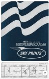
Howie and his wife were interesting people to talk to. I was a pretty big chart geek when I started in aviation and he would love to stand in the booth and talk about maps. His wife related him spreading out all the components all over the house (mostly the pool table) when putting together the first atlas.
Last edited:
Clip4
Final Approach
30 years ago you should have figured WAC charts (Air Charts did) were the way to go VFR and the Jeppesen for IFR was well worth the money for the paper quality aloneYoutube's algorithm thought that I should watch this video...so like a puppet, I did
I just wish I had known about this 30 years ago when I was using sectional and low en-route charts! I feel like this might have been useful.
MauleSkinner
Touchdown! Greaser!
35 years ago I figured out that WAC charts don’t allow the level of accuracy I need when navigating VFR.30 years ago you should have figured WAC charts (Air Charts did) were the way to go VFR and the Jeppesen for IFR was well worth the money for the paper quality alone
- Joined
- May 11, 2010
- Messages
- 20,469
- Location
- Charlotte, NC
- Display Name
Display name:
Snorting his way across the USA
That's interesting. We never learned that trick on DMA quad maps. We just folded them to the area we needed, and in the unlikely chance that we needed to operate outside that area, we just refolded them as needed.
We did, however, frequently cut maps and tape them together when our ops overlapped quads. The suckiest deal was when we were in a corner area, and we needed to slice up four maps.
We did, however, frequently cut maps and tape them together when our ops overlapped quads. The suckiest deal was when we were in a corner area, and we needed to slice up four maps.
Clip4
Final Approach
We’re the meridian and parallels wrong? The highways missed drawn and labeled? Rivers flowed the wrong direction?35 years ago I figured out that WAC charts don’t allow the level of accuracy I need when navigating VFR.
Air Charts books were WAC charts and they certainly had a large customer base that seemed to do just fine.
MauleSkinner
Touchdown! Greaser!
Too much stuff not on them.We’re the meridian and parallels wrong? The highways missed drawn and labeled? Rivers flowed the wrong direction?
Air Charts books were WAC charts and they certainly had a large customer base that seemed to do just fine.
I’m betting that the large customer base was included in the people I almost never saw at 600 AGL.
- Joined
- Jul 10, 2019
- Messages
- 1,093
- Display Name
Display name:
Initial Fix
I remember subscribing to Air Charts. Great product at the time. Once I went digital I dropped it.
I too was a sectional guy. I did like WAC's for planning though. Even had a wall of WAC with the string in my extra bedroom35 years ago I figured out that WAC charts don’t allow the level of accuracy I need when navigating VFR.
FastEddieB
Touchdown! Greaser!
- Joined
- Oct 14, 2013
- Messages
- 11,520
- Location
- Lenoir City, TN/Mineral Bluff, GA
- Display Name
Display name:
Fast Eddie B
Years ago I went to a Grumman American get together. They had games, like a “broken towbar“ race.
Another, for kids, was a chart folding competition. What made it interesting was folks were jostling the chairs they were seated in, plus others blew a fan on them, while someone else sprayed them with mist. And a fun time was had by all!
Another, for kids, was a chart folding competition. What made it interesting was folks were jostling the chairs they were seated in, plus others blew a fan on them, while someone else sprayed them with mist. And a fun time was had by all!
Clip4
Final Approach
If you flew a lot at 600 AGL, a topographical map may have been a better choice than a sectional because it shows all the hospitals and cemeteries.Too much stuff not on them.
I’m betting that the large customer base was included in the people I almost never saw at 600 AGL.
MauleSkinner
Touchdown! Greaser!
As long as I didn’t follow highways, the amateurs weren’t a hazard.If you flew a lot at 600 AGL, a topographical map may have been a better choice than a sectional because it shows all the hospitals and cemeteries.
pilotshashi
Ejection Handle Pulled
Seriously I carry my iPad just zoom zoom zoom
RIlls
Filing Flight Plan
- Joined
- Nov 6, 2011
- Messages
- 26
- Display Name
Display name:
RIlls
pilotshashi
Ejection Handle Pulled
I just got sneezed and the plane turn some degree, now I'm flipping the damn chart. Which heading should I go.
I dropped a lot of stuff when I went digitalI remember subscribing to Air Charts. Great product at the time. Once I went digital I dropped it.

MauleSkinner
Touchdown! Greaser!
Your planned heading.I just got sneezed and the plane turn some degree, now I'm flipping the damn chart. Which heading should I go.
Cartographic accuracy isn't an issue. A problem is that WACs were updated less frequently than sectionals and they didn't have midcycle notams to update them. They also omitted a lot of information useful to VFR pilots.We’re the meridian and parallels wrong? The highways missed drawn and labeled? Rivers flowed the wrong direction?
Air Charts books were WAC charts and they certainly had a large customer base that seemed to do just fine.
Howie used to put in the insets either from the TAC (for class Bs) or the sectional (for class C) in the WAC atlases.
Toward the end, he did do a two volume set of bound sectionals. I still have one of those kicking around here somewhere.
Howie's updating system for the books and plates was a bit strange, but technically legal (and really let error prone than what the old pre-Q service Jepp was).
Clip4
Final Approach
I feel confident you were diligently updating your sectional charts from the Chart Bulletins penciling in all the information.Cartographic accuracy isn't an issue. A problem is that WACs were updated less frequently than sectionals and they didn't have midcycle notams to update them. They also omitted a lot of information useful to VFR pilots.
Howie used to put in the insets either from the TAC (for class Bs) or the sectional (for class C) in the WAC atlases.
Toward the end, he did do a two volume set of bound sectionals. I still have one of those kicking around here somewhere.
Howie's updating system for the books and plates was a bit strange, but technically legal (and really let error prone than what the old pre-Q service Jepp was).