Star Keeper
Pre-takeoff checklist
- Joined
- Dec 20, 2021
- Messages
- 124
- Display Name
Display name:
Star Keeper
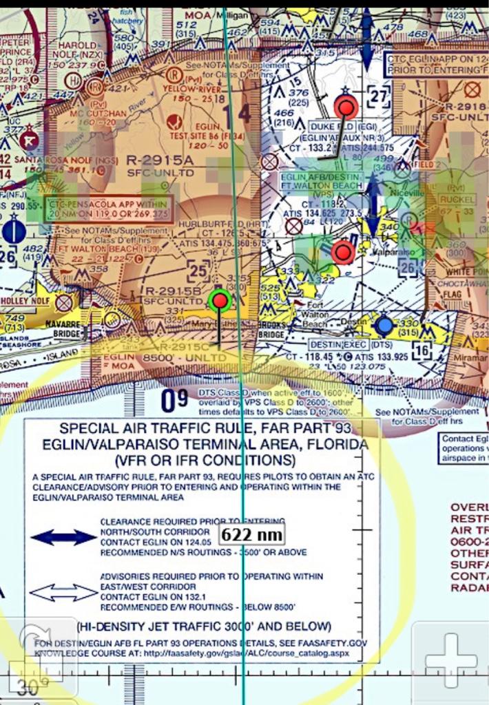
So I'm planning a trip from Central Florida around the coast to New Orleans. I'm planning around R2915 and I see the airspace restriction is continuous. If I'm not under Flight Following who would I contact to transition across that space. Specifically R2915B which is surface - unlimited continuous. I would prefer NOT to go out over the water if I can avoid it.
")
.jpg")


