Flying around Remnants of a Hurrican

Ryan2

Pre-Flight
Joined
May 21, 2019
Messages
53
Display Name

Display name:
Ryan2
Hi All -

In the Keys this weekend on vacation. Been watching TS Nicole which looks poised to hit FL on Thursday.

My return flight to the Northeast is planned for Saturday.

Obviously everything is very much in flux, but any general advice for flight planning around what seems like it will be the remnants of a tropical storm/hurricane?

My thoughts initially were to perhaps fly up the west coast of FL and plan a route staying west of the Appalachians back to the Northeast ....

If the weather situation permits, would I find better winds on the east side of the storm due to the counterclockwise spin?

Thanks
 
Stay west of the storm. You will have strong headwinds but cooler, drier air/minimal convection. These things will hook east, particularly this time of year, and you don't want to get caught on that side.
 
Thanks and noted.

They are, in fact, predicting it to hook east after making landfall in FL.

Will keep an eye on it as I have been, appreciate the advice.
 
By Saturday it should be in Maine.
 
By Saturday it should be in Maine.
That would be ideal, but it looks like its gonna be more widespread than that.

Looks like more NY than Maine....

upload_2022-11-8_11-59-40.png
 
My cousins house is almost repaired after the last storm. :eek:
 
Windy shows the rain being in Maine by Saturday.
 
By Saturday, Nicole will probably be somewhere around Connecticut. I wouldn't be worried about the Southeast. I would be more worried about driving then than flying. But if you plan to up around CT on Saturday, I'd suggest you start looking out.
 
I am NOT doing that again.
Flying near, even a tropical storm, this was 5? years ago, the Gulf Coast.
'Oh, it's passing.' 'Oh, the tafs are good.' 'It'll be clear behind the storm.'

It came ashore that day. I delayed as much as I could then followed the coast, south of Corpus, heading for Port Isabel on the backside of the storm in mostly vmc conditions.
1000' stratus to my left, over the water - and a black wall to the right over land.
The wall seemed to have some gaps, possibly some weakening so I started the approach.
This took me into the wall.
The clouds enveloped the airplane. They got darker. No autopilot and I was struggling to maintain wings level, hold altitude as the turbulence was suddenly wild. Wife gripping the fuselage tubing.
I was not in the cloud for 60 seconds before I did a 180 and headed out of the cloud, abandoning the approach.
ATC was not bothered by my sudden reversal, there were no other airplanes on frequency or for 200 miles probably.
I decided to cancel, and to try going under the deck, and headed inland towards the airport.
I crossed the shoreline of Padre Is, at 500'agl, then over that bay whatever its name is.
Scanning hard for some sign of the airport through the mist and another wall to the ground, that started right at that shoreline.
Nothing.
I powered up, cleaned up, and banked towards Brownsville as if that was any better, wondering if I had fuel for that.
THERE IT IS! my wife shouted, seeing only the end of the runway poking through the rain wall.
Point airplane, gear and flaps again, radio calls, to land in a pouring rainstorm (without ever seeing the other half of the runway). Taxied in, through 3" of standing water, parked and waited in the airplane for an hour til it eased up.
Stupid. Horrible planning. Probably illegal. I didn't care. I was just glad to be down.
The taxi driver took over an hour to get to the airport as the usual roads were flooded and he had to go 20 miles out of his way. He had lots of stories of what the storm had done.
I'm staying the feck away from tropical storm/hurricanes - even the edges - from now on.
 
Hi All -

In the Keys this weekend on vacation. Been watching TS Nicole which looks poised to hit FL on Thursday.

My return flight to the Northeast is planned for Saturday.

Obviously everything is very much in flux, but any general advice for flight planning around what seems like it will be the remnants of a tropical storm/hurricane?

My thoughts initially were to perhaps fly up the west coast of FL and plan a route staying west of the Appalachians back to the Northeast ....

If the weather situation permits, would I find better winds on the east side of the storm due to the counterclockwise spin?

Thanks


Yes, go up the west coast.

A week later.
 
Stay west the storms headed up the east coast after Florida.
 
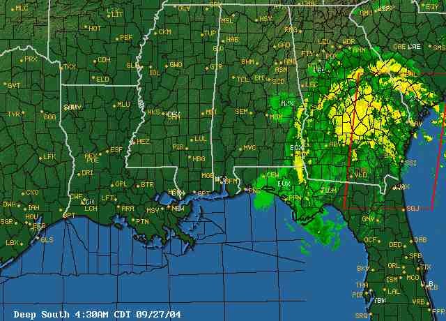
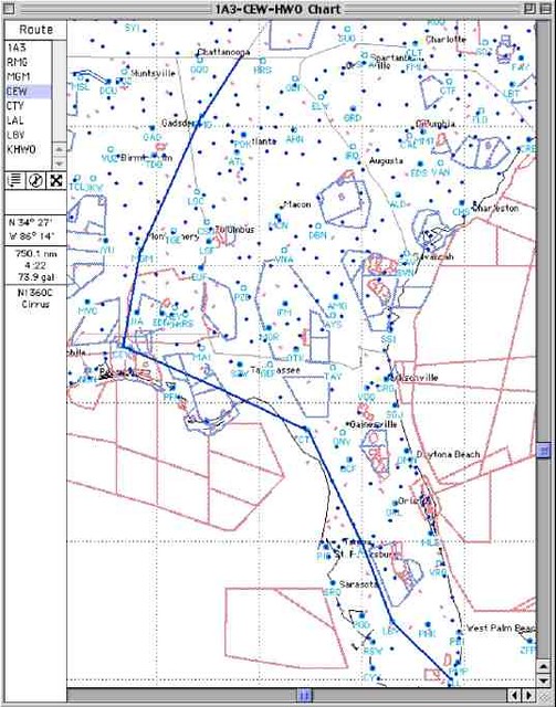
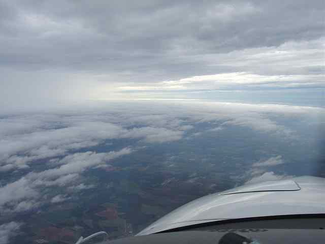
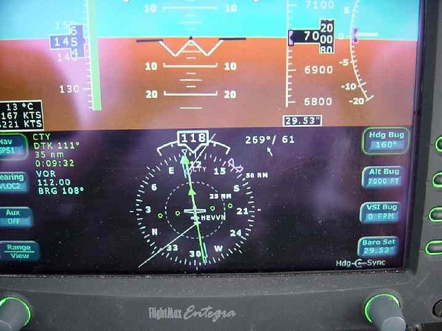
Maybe not exactly on point, but in 2004 I fled S FL to my N GA vacation home in my Cirrus as Hurricane Jeanne approached. Turned out it missed S FL, and I was ready to return home as it was still spinning in S GA. I routed around the west side just clear of the storm, and had smooth air and great tailwinds (61 kts @ 7,000'!).

8135128812_f887f8c45d_z.jpg


8135128460_a085231def_z.jpg


8135100031_c623286877_z.jpg


8135100193_0bd0732cde_z.jpg
 
I mean I get your point but it's really not any kind of helpful advice.

Why bother?


If I had phrased it as "I suggest you not try to fly until the storm is long past, because these big hurricanes spin off bad weather and the cone you're looking at is not indicative of the size of the storm," would that have met your approval? I simply phrased it a bit more concisely.

And your post wasn't any kind of helpful advice, so why did you bother?

Sure, I'd take it as the kind of advice I usually see from "wise" pilots - "avoid risks at all costs" rather than "mitigate risks" but it would have been at least a bit more useful. Every time I fly I recognize there is going to be risk. I'll divert widely if I have to, but my question was how to do it the "most safe" way. Telling me to "fly a week later" is a ****ty/smart-ass suggestion. It doesn't help in any way, and it's not feasible. So again, why take the time to even post it other than to try to be "funny?"

My post was seeking advice - not giving it. Hence why I "bothered."
 
Maybe not exactly on point, but in 2004 I fled S FL to my N GA vacation home in my Cirrus as Hurricane Jeanne approached. Turned out it missed S FL, and I was ready to return home as it was still spinning in S GA. I routed around the west side just clear of the storm, and had smooth air and great tailwinds (61 kts @ 7,000'!).

8135128812_f887f8c45d_z.jpg


8135128460_a085231def_z.jpg


8135100031_c623286877_z.jpg


8135100193_0bd0732cde_z.jpg

Nice! Unfortunately I'm going North instead of South, so going west means I'll be fighting the headwind.

Fortunately with it making landfall last night we have 2-2.5 days for the storm to dissipate a bit and allow us to plan. Looks like the winds will be less of an issue, more of an issue with the temps/winter storm running across the country right now.

221 kts is pretty sweel though. Best I've seen in the Saratoga is about 202 with IAS of about 140....
 
I was referring to post #14, the one I replied to.

New to the internet?

LOL. Wow. You must be a lot of fun at parties.

Made the flight just fine - in case you were wondering or concerned. Flew up the east coast with a smooth ride and 20+ tailwinds. Seeing 190+ over the ground was pretty nice.

Honestly, the hurricane/TS was a non-issue - more of an issue was the ice storm moving across the country. Fortunately got in before that came by.
 
Back
Top