cavmedic
Line Up and Wait
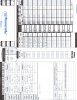
I have entered the xc stages of my training and have a question on something I have noticed while planning my trips .
When I plan my trip using my instructors flight plan form, for giggles I plan the same flight using foreflight for comparison, and come up with some differences.
Difference 1 ,is foreflight will always show about a 10-15 degree difference on my CH than what I figure out.
Now understanding to my knowledge , there is no place in foreflight under aircraft data for compass variation , but that is not a factor in the plane I fly as there is no variation card, therefor no variation is figured.
Difference 2 , when I get the brief from foreflight, the winds aloft always seem to be different than what I get from the live briefer.
Difference 3, fuel burn and time is always off on foreflight from what I calculated.
What are some possibilities ( other than MY planning being off , but kinda debunked as instructor checks and verifies)
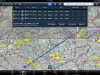
 so that is one good reason to learn it. Also, doing the wind and ground speed deals on the back, once you get it - takes seconds ! Lastly, if you go into Instruments it can be very valuable for determining hold clearance and entries. Also can be useful for determining relative position from VOR's. Quite handy once you get the hang of it.