
First SAR Flight

ARFlyer

En-Route
Joined
Dec 31, 2011
Messages
3,189
Location
Central AR
Display Name
ARFlyer
Friday afternoon an AR Forestry plane went missing in western AR. They have been looking for him, but the weather or terrain hasn't played nice. CAP and the State Police have set up search grids all over Western AR. However, area is very rugged and covered in Pine thickets.

Well this afternoon I got informed that a local pilot was wanting some guys to go help look for him outside of the current search grids. I answered the message in about 30 seconds saying I'd be happy to go. So I spent my afternoon learning about SAR from the seat of a Bell 206.

I found it a very informative learning experience. I've always thought the area was rugged but I was always sure someone could find me. Well after flying low level over ridges for several hours , I've changed my mind. Its extremely hard to see anything on the forest floor. We had three false positives that we found to be ice covered rocks.

For those who might say we were hindering the search efforts: We had informed CAP of our intentions and they were very thankful for the help. The pilot I was flying with is extremely familiar with the area and an experience pilot. When we landed at the CAP base they thanked us and told us additional areas we might look if the weather holds out tomorrow.
 

Attachments
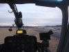
  • 1076969_1961228103493_106588347_o.jpg
    1076969_1961228103493_106588347_o.jpg
    74.2 KB · Views: 58
Last edited:
what area specifically? just curious, we occasionally fly gliders out of Talihina, OK and run the ridges over towards Mena, AR
 
Oden, AR to Wickes, AR. Basically the Mena area. We stayed south southeast of Mena running up and down the North sides of those ridges.
 
I found it a very informative learning experience. I've always thought the area was rugged but I was always sure someone could find me. Well after flying low level over ridges for several hours , I've changed my mind. Its extremely hard to see anything on the forest floor. We had three false positives that we found to be ice covered rocks.

CAP has come up with Probability of Detection charts, and even in open terrain, the odds aren't that great.

http://www.capmembers.com/media/cms/F104a_9C28EC8852937.pdf

The best way to be found is to carry a PLB since installed ELTs often fail on impact.
 
Glad to hear that people can work towards a common goal without getting into each others hair.

Now, if the CAP searchers could use the services of a volunteer helicopter to further check out sightings made from a fixed wing plane......
 
PoD charts were created by USAF.

They can use the helo to check other sightings if they wish. Talk to the Air Ops Branch Director or Incident Commander. Been done before.

They usually will not assign two aircraft to the same search grid at the same time for safety reasons. That's all.

Raining down search aircraft pieces after a mid-air usually plays fairly poorly with the media and volunteer's families.
 
Missing plane is a Cessna 210 with distinctive forestry commission markings (white w/ orange and black). Missing since Friday. Weather conditions have been pretty miserable over the week end.
 
When my brother was an Army helicopter pilot he was tasked to go hunt for 'escapees' trying to evade through a forest in a survival course.

He said it was just about impossible to see people in the forest unless they turned their faces up and looked at him.
 
Well the weather here is c**p. An Ice Storm moved in this morning and is dumping a ton of ice on the trees. I've heard trees snapping right and left.

So if CAP is able to get out tomorrow the job has just gotten harder. I might be going back up if the Heli guy calls.
 
Glad to hear that people can work towards a common goal without getting into each others hair.

Now, if the CAP searchers could use the services of a volunteer helicopter to further check out sightings made from a fixed wing plane......

CAP seems to have a different take on that around here. I got called out through ARES (Amateur Radio Emergency Service) a few years ago to provide radio support to CAP as they were looking for a downed aircraft. When the other ham found out I was a pilot he said, "You take the radio. You speak 'pilot'". He logged. There were some non-CAP planes out looking as well. 2 or 3 IIRC. Flying a search pattern together. The CAP folks were not pleased, probably because they weren't coordinating with them. I'm sure there were concerns about safety, but it sounded more like a turf war to me.
 
CAP seems to have a different take on that around here. I got called out through ARES (Amateur Radio Emergency Service) a few years ago to provide radio support to CAP as they were looking for a downed aircraft. When the other ham found out I was a pilot he said, "You take the radio. You speak 'pilot'". He logged. There were some non-CAP planes out looking as well. 2 or 3 IIRC. Flying a search pattern together. The CAP folks were not pleased, probably because they weren't coordinating with them. I'm sure there were concerns about safety, but it sounded more like a turf war to me.

That is why I said I am glad to hear that in this case they coordinated efforts. CAP is a large organization and the ability to tie in with other efforts, be it goverment or private is very variable on a state by state basis. There is no reason why a private party can't search grids or perform a secondary search on an area that has already been covered. You dont want multiple planes at low altitude in the same area with their eyes on the ground, but with the right coordination and discipline this can be done. Propability of detection in forested terrain is low and something that is not visible on the first pass may visible to a searcher who flies only 1/2 mile offset or 90 degrees from the initial track.

Things can become difficult once personalities get involved.
 
Its been a few years but once while a CAP search was going on, we were going up to just fly around for an hour or so. When we asked the CAP if they had a preference for were we flew, they basically just said don't interfere, they wouldn't tell us where they were searching, where they had searched or were going search. So we couldn't intentionally stay out of their search grids. Ended up a guy in a Pitts of all planes cruising back the airport finally spotted the missing aircraft.

It sure seemed like they should have had a better plan for communicating at least where they were searching, so we could avoid that area.

I have noticed lately they have been issuing TFR's for the main areas they are searching.

Brian
 
This one has had a TFR around it during the afternoons. It's been 10 to 15 mile radius and up to 5000'. It moves with the search grids.
 
Plane and body found today, Tuesday, about 4 PM about 20 miles from last known location near Oden, Ar. Wreckage spotted by a CAP flight.
 
Back
Top