Colorado Springs

Lando

Pre-takeoff checklist
Joined
May 11, 2015
Messages
137
Location
NoDak
Display Name

Display name:
Lando
I’ll be making a weekend trip to Colorado Springs in my Warrior this January. I’ll be coming from the Dakotas and don’t have any mountain flying experience, so the plan was to grab a car and drive into the mountains for a little sight seeing on Saturday. However, after thinking about it more I started wondering if it would be doable to safely make our way west of Colorado Springs for a scenic flight this time of the year. It will only be a friend and me, so we can keep the plane light and I would only go if weather was not an issue. I definitely don’t want to get in any canyons or too close to terrain, but if we could get relatively close to one of the ski resorts or something else scenic it sure would beat being in a car. Does anyone have any recommendations?
 
I’ll be making a weekend trip to Colorado Springs in my Warrior this January. I’ll be coming from the Dakotas and don’t have any mountain flying experience, so the plan was to grab a car and drive into the mountains for a little sight seeing on Saturday. However, after thinking about it more I started wondering if it would be doable to safely make our way west of Colorado Springs for a scenic flight this time of the year. It will only be a friend and me, so we can keep the plane light and I would only go if weather was not an issue. I definitely don’t want to get in any canyons or too close to terrain, but if we could get relatively close to one of the ski resorts or something else scenic it sure would beat being in a car. Does anyone have any recommendations?
Depends on how far west you wanna go. To the mountains to take a look-see? No problem. To the other side of the front range? I’d probably get some more learning under your belt before attempting.
 
There are specific mountain flying courses around here, so I would not recommend heading into the mountains without that kind of experience.

Colorado Springs itself is located in a semi-bowl, so you get fairly close to mountains just flying in and out. It is not close enough to be concerned if you are just heading into the main airport, but something to consider.

Bottom line is what was said above, drive it for now.
 
Winds aloft are almost always a concern in the winter. As long as it’s below about 20-25 it’s at your planned altitude you’ll be okay if you stay on the east side of the Front Range as Nick suggests. Plan to stay at least a couple thousand AGL over the foothills. Engine out options can be a bit thin...

Sightseeing ski areas? Hmmm, Eldora, Broadmoor (abandoned), silvercliff or whatever it’s called...I think that’s about it.

I could tell you how to go around the Front Range and make it to Winter Park but you’d have to swear an oath of secrecy and sell yer first born into sex slavery or something.

An option might be to grab an instructor and get some mountain training.
 
Thanks for the input everyone. I think we’ll stick to a rental car unless I find a local CFI to come along for some mountain flying training. If not, the views should still be spectacular for this flat lander...even on the east side!
 
Winter, even with the unseasonably mild winter this year, is not the time to head into the hills in a small single engine piston airplane. Come back in April and take mtn flying lesson.
 
Take the scenic route.
Fly direct to KFNL then south along the front range, west of the Class B.
A lot to see :
Rocky Mountain NP
Eldora Ski Resort
Boulder
Red Rocks
Ect....
Good way to get close, but not really in the mountains.
Do a bit of research and you will have a great flight.
 
January. Tough call on the flight in general. Can be lovely, can be seriously sucky. I’m sure you’ve thought of that part. Watch for cold frontal movement headed this way from west of you into CO. If a wave is coming it’ll make things gross for a day or two. Often the best weather is the sunny cold day right after the front ripped down from the north, and you’ve probably seen that in the Dakotas too, trying to link it to your local weather experience.

If you’re coming from the Dakotas, you know wind. When we have it, downwind of the big rocks can suck. When we don’t, and you’ve seen that in the Dakotas, when it’s nice out, it’s lovely in winter. Even if it’s cold as hell.

As far as venturing west goes... the performance of a Warrior kinda sucks up high. You probably know that already too. Not highly recommended without training.

So... if you can even make the trip (as @murphey said, it’s been unusually mild this year, La Niña year they say...) there’s tons to see without really being back in the rocks. January is a toss up month. And usually very cold when it decides to finally do it.

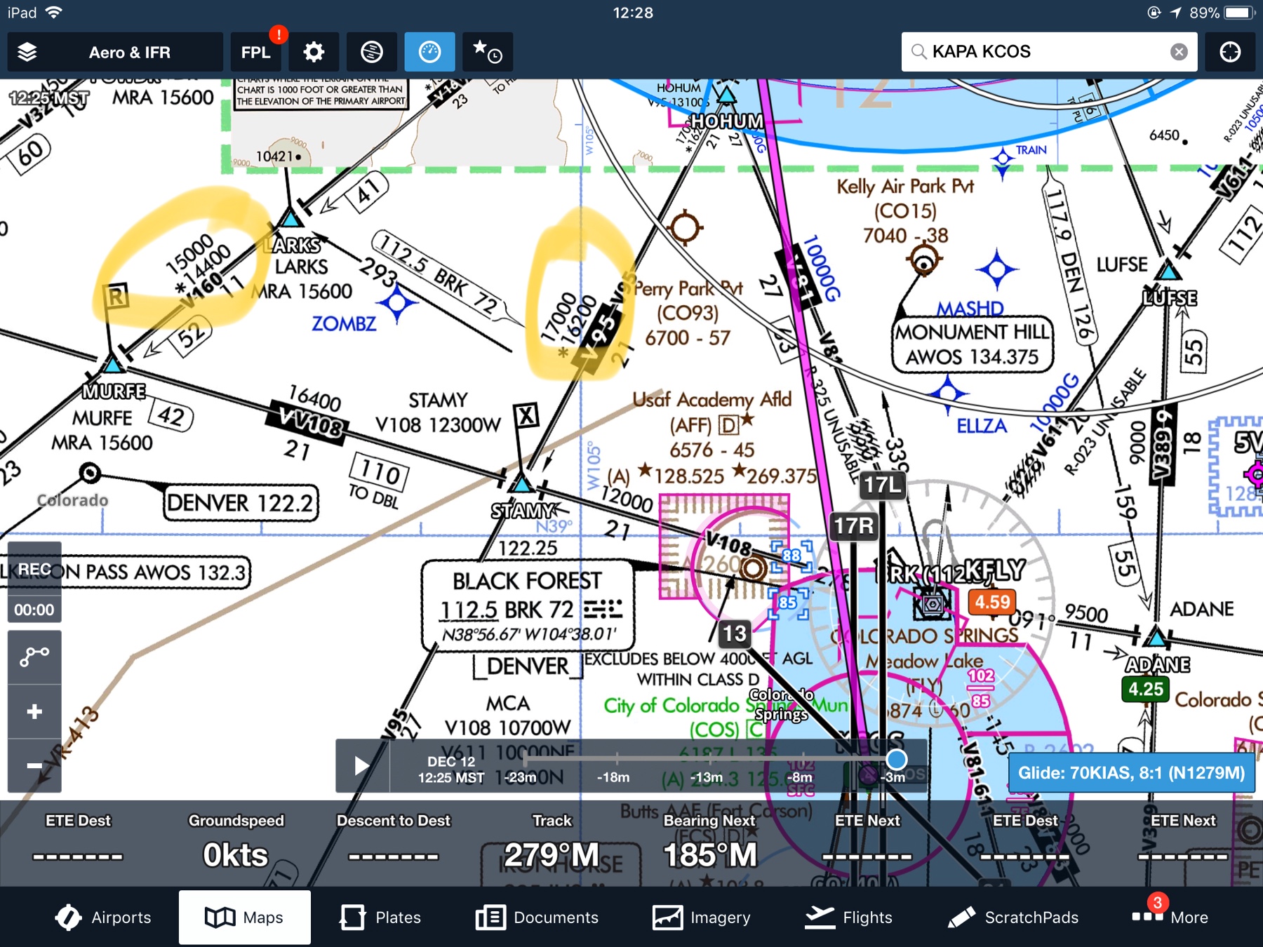
The whole trip down from the KFNL area to KCOS along the foothills is very nice as @Colorado182 mentioned. He forgot Garden of the Gods northwest of KCOS. Same geographic feature that created Red Rocks. Cool to see from the air.

Down in the KCOS area, Pikes Peak sticks way out east of the rest of the Front Range. It’s pretty easy to get a good gander at it from any aloft vantage point. It’s big. And...

You really don’t want to miss driving up the toll road to the top in a rental car anyway... but...

Even driving small rental cars in the mountains can suck royally if the weather isn’t cooperating. Nobody mentioned that! Both Warriors and rental cars can both be no fun at all in a winter storm. :)

And the winter winds aloft are often ripping at the top of Pikes. Even on what looks like a gorgeous day in the KCOS valley. Sunny, bright, and lovely, and massive turbulence and rotors directly downwind of Pikes.

So you’re seeing a theme here. It’s all about wind in January if there’s no storms passing through.

If the winds are howling out of the west like they often are in January, don’t be the leaf floating on the stream behind a bunch of rocks. Ha. It’ll suck. Even sometimes quite far away on the east side.

Again, if you’re from the Dakotas, standing in negative temps in 50 knot winds is probably something you’ve seen before. Hahaha.

You’ve got to do the tourist thing at Pikes if you haven’t. Drive up, go inside at the top and buy the donuts. They’re nothing special but the altitude and the cold makes the donuts and a hot cup of coffee taste really really good.

And I do hope it’s clear and non-windy up there, honestly, if you go up. Clear happens frequently. Non-windy, not so much. Ha.

It’s cool to stand up there on a perfect day and wonder if you can see Kansas out there to the east. You’re used to that view in the airplane, but it’s honestly fun to see that view while standing on solid ground.

Sorry about the toll road thing. We milk all tourists for money, of course.

So... if the winds are whipping... it’s not a fun flight. None of it.

Usually worse over near the foothills. Bumpy and rough on the plains but flyable. If your friend hasn’t done bumps, watch the winds.

If you’re dead set on coming in wind, east around Denver may be less bumpy and not as good a view. Maybe.

You’ll still see nice scenery west of KCOS after you get rocked crossing the Palmer Divide area. (The ridge between Denver and Colorado Springs.)

And a word of warning, when the winds are out of the north or south, that area is often the location of the largest weather changes on either side. Orographic lifting can sock in the Divide and/or split the weather between Denver and Colorado Springs significantly and seemingly schizophrenically. Watch for that. Catches a lot of pilots off guard.

Don’t know where you’re coming from in the Dakotas but that entire route from the KRAP area down to KPUB is like that. Nice when the wind isn’t blowing. Rocked when it is. Coming past KCYS even over the flat there is often a freaking washing machine too. So if you’re used to western SD flying nothing on the Front Range will surprise you, other than that Palmer Divide weather change thing.

Holler when you’ve got a better date and we can tell ya if the usual crappy January winds have set in for the winter yet. Usually they’re here by now or late December. It’s been unusually nice but I doubt it’ll last.

We supposedly get our airplane back from the avionics shop second week of January, so I can almost guarantee the weather will suck immediately thereafter. Haha. Like un-flyable horrible kind of suck.

Because that’s how my 2017 went. I’ll know if 2018 is going to be better if the stupid weather actually behaves once the airplane is back.

The tractor has the three point snowblower attachment on it and is parked in the garage with the battery tender on it, if you want to know whether I think the weather is about to suck or not. Hahahaha. I don’t trust it this time of year. One big “Arctic Express” and then we all freeze our butts off for a week or two.

Oh. Almost forgot. Drink lots of water if you go up Pikes. Stay hydrated. Drink more at the top. And drink again at the bottom. And plan for an altitude headache if you don’t. :)

The road up Pikes is very twisty and no fun when slippery.

That’s all I’ve got. When are you coming? The Winter PoA “fun” is usually freezing our butts off at Clark’s hangar at KFTG. Colorado pilots are unusually fond of grilling in freezing weather. Ha.
 
Love, Love, LOVE Colorado. Any time of the year. Have immediate family from Grand Junction and have friends in Westminster and Colorado Springs. I go there any chance I get. But I take a car, personally.
 
Wow. I can’t believe people are telling you to park it and drive. Watch the winds, keep it light, don’t plan on crossing any divides/passes, always be able to turn downhill. You can check all those boxes and still do a ton of sight-seeing perfectly safely.
 
Wow. I can’t believe people are telling you to park it and drive. Watch the winds, keep it light, don’t plan on crossing any divides/passes, always be able to turn downhill. You can check all those boxes and still do a ton of sight-seeing perfectly safely.
Aint no way to avoid a pass in Colorado if you want to get from one side of the state to the other, other than going almost to the CO-WY state line. In an underpowere warrior, there's not much extra HP if you run into weather.
 
Aint no way to avoid a pass in Colorado if you want to get from one side of the state to the other, other than going almost to the CO-WY state line. In an underpowere warrior, there's not much extra HP if you run into weather.

He said sight-seeing. Not crossing the state (and even then, it's doable). I even looked at a map before posting so I wouldn't be a moron, but there is plenty of sight-seeing west of Colorado Springs that wouldn't require putting oneself in any sort of predicament provided winds are light. Even in an under-powered Warrior.
 
He said sight-seeing. Not crossing the state (and even then, it's doable). I even looked at a map before posting so I wouldn't be a moron, but there is plenty of sight-seeing west of Colorado Springs that wouldn't require putting oneself in any sort of predicament provided winds are light. Even in an under-powered Warrior.

Kinda... it’s no man’s land. Not many engine out options either. The foothills between DEN and COS are kinda a high plateau covered in big bumps. The area around Cheeseman Reservoir is nice sightseeing in flat calm weather but it’s still 10,000’ terrain.

We tend, as a group, to recommend training over none, once people start wandering west. We don’t know anyone’s skill set or mindset.

So sure, if he gets to the area, it’s a bright sunny day with zero wind, and nothing going on weather-wise at all, poking around the foothills can be fine. At least if it’s real cold the performance will be better.

The other problem with the cold is if you do go down up there, even just in the foothills, and you’re not prepped for winter camping, your chances of expiring from exposure are fairly good. The real problem with back up in there is lack of cell coverage if you do end up on the ground in one piece.

Attaching an image of the area, there’s two things to point out...

Normal winter winds are northwesterly. The arrow depicts where they hit the rocks and it makes a flight in that high plateau area miserable quite often. Downwind of that is often very turbulent.

Second, I like that route as a scenic and slightly longer way to KPUB from KAPA in summer, and it keeps you out of the busy KCOS airspace, but there’s two problems with going back there to/from KCOS... one is the Manitou Springs valley and Highway 24 is a very narrow canyon. Not something I normally recommend to out of towners and the Alert Area and the Air Force Academy and all sorts of crap to deal with when you come through that to the Springs. You can get to KPUB easily because there’s a drainage valley further south that leads out to KPUB. But once you’re in behind Pikes (remember I said it sticks out?) you don’t have great options for getting out to KCOS.

Second, it really is com quiet back in that valley unless you’re high. I mentioned cells don’t work, but you’re radio blocked from KCOS and Denver Center has a rough time with their remote comm outlet back in there also. Flight following isn’t usually available in that valley. I’ve highlighted where you can see that on the IFR Low chart.

The old schoolers remember when the Denver FSS would track mountain flights for VFR and recommend a radio call through the Badger Mountain RCO, but a) AFSS is utterly clueless about mountain flight tracking anymore, and B) Badger Mtn RCO breaks quite a bit nowadays in winter, sadly. That site is a pain to get to in winter. You can see it and the entrance to Wilkerson Pass to the far left in the screenshot.

18457400a819bd9408a38456077dcbaf.jpg


b15f6d8dcf48827cf18410790e80b0ec.jpg
 
The annotations and drawings didn’t show up in the VFR chart, but the big pile of rocks under V160 at the northwest corner of the screenshot are the turbulence makers.
 
Wow. I can’t believe people are telling you to park it and drive. Watch the winds, keep it light, don’t plan on crossing any divides/passes, always be able to turn downhill. You can check all those boxes and still do a ton of sight-seeing perfectly safely.
The short way to rephrase Nate's post is "better pilots than us have died doing stupid stuff in the hills." Nobody here knows the OP or the condition of his equipment so the conservative approach is to suggest the auto-tour. The foothills flight was mentioned by a couple of us with some reasonable warnings. I do know a couple folks who avoid flying over the foothills west southwest of Denver because they think the engine out options are lousy. About the best you can do in that area is climb, climb, climb and a Warrior is gonna run outta climb sooner rather than later.
 
OP, what is the ceiling of your Warrior? How long do you want to fly?
One of the most beautiful places in CO is the valley between Salida and Buena Vista. You will be flying next to many 14,000 peaks, while having a lot lower terrain in the valley and east of the valley.
I recommend you go south of CS, turn west once you clear R-2601, and follow the highway to Salida. Turn north and go as far north as you are comfortable, then turn around. If you can go up to 12,000-13,000 ft, you can go all the way to Leadville and turn around. Note that westerly winds >10 kts will cause downdrafts in that valley. If you are caught by surprise winds, just fly east until you hit updrafts.
Bring tissues to wipe the drool off your face.
 
I'm going to reiterate - there is no danger whatsoever in flying around Colorado provided you are not planning on crossing the front range. Its all plains up until the point that it isn't. Don't enter passes, and don't fly over massive mountains, and you'll be just fine everywhere, including flying right up against the mountains west of Colorado Springs.

You may experience turbulence. You may experience downdrafts. You will have the most amazing view ever. Enjoy.
 
I am not one to minimize risk taking, but this thread is so lame.
 
I am not one to minimize risk taking, but this thread is so lame.
Mike....every mountain area is different. I would never fly the Appalacians or the Cal/Nev mountains without training, no matter how many years I've lived and flown in Colorado. Different geography makes different weather, right? I also get the reports on accidents in Colorado, often from onsite SAR, One of the most recent was the Cirrus near Grand Junction. Newbie pilot, no actual mountain experience, entire family and dog killed because the pilot got in over his head in the mountains. So many of us here encourage caution to those not familiar with the area.
 
The map of crash sites that CAP keeps (to avoid identifying old airplane parts as the new airplane parts you’re looking for) for Colorado is impressive. Unfortunately they can’t share it.

You’d think the number of people who went from flying in a lovely open valley enjoying themselves who next flew up a box canyon, and were in the wrong place, would go down with the advent of GPS over the time I’ve been here... but it hasn’t.
 
Mike....every mountain area is different. I would never fly the Appalacians or the Cal/Nev mountains without training, no matter how many years I've lived and flown in Colorado. Different geography makes different weather, right? I also get the reports on accidents in Colorado, often from onsite SAR, One of the most recent was the Cirrus near Grand Junction. Newbie pilot, no actual mountain experience, entire family and dog killed because the pilot got in over his head in the mountains. So many of us here encourage caution to those not familiar with the area.

Completely different. That was at night. And maybe even IFR at night. Come on.

You wouldn't fly the Appalachian mountains? At all? Even in good weather? You wouldn't even venture over to take a look at the foothills?

OP - do what you will. The simple fact that you're on here asking questions means you probably have the attitude and conservatism that will keep you alive. My advice is to keep it front range and watch the weather and winds. Don't fly over passes. And sure, don't fly up box canyons.
 
Last edited:
Completely different. That was at night. And maybe even IFR at night. Come on.
IMC. The guy was not rated for IFR. Killed himself and his family. How many times has that story been repeated? How many more times does it have to be repeated?

What was that about taking a cautious approach to learning to fly in the mountains? Speak up now you’re mumbling.
 
IMC. The guy was not rated for IFR. Killed himself and his family. How many times has that story been repeated? How many more times does it have to be repeated?

What was that about taking a cautious approach to learning to fly in the mountains? Speak up now you’re mumbling.

Well exactly! How can you equate flying over the mountains between Denver and Aspen, at night, in IMC, with a pilot that was not rated for IFR flight, with daytime sightseeing around the foothills? Was this a serious comment? Maybe I'm getting trolled...

Speak up, I think you're mumbling.
 
Last edited:
Hey everybody, skier mike says it’s ok to fly all around Colorado for the next 6 weeks, so stop being lame. He’s a skier, so he must know Colorado. Sometimes he mumbles, sometimes he flies at night, etc, and sometimes he’s invincible, so you should be, too, ya bunch of lamos! :D
 
Hey everybody, skier mike says it’s ok to fly all around Colorado for the next 6 weeks, so stop being lame. He’s a skier, so he must know Colorado. Sometimes he mumbles, sometimes he flies at night, etc, and sometimes he’s invincible, so you should be, too, ya bunch of lamos! :D

This is just dumb. It's not even close to what I'm advocating and doesn't add anything to the conversation.
 
This sort of argument starts every time there’s a non-Mountain trained pilot asking this question. Some of us take the conservative route and say, “We’d really rather see you grab a class first or at least a CFI who’s been there, done that...” and others say “Go for it!”... and everything in between.

The reality of the valley behind KCOS is that it’s relatively easy to get into and nice to look around in, but there’s no good route that isn’t an hour out of the way in a Warrior to get out of it into KCOS. You can make a big loop from Denver to almost Pueblo and then backtrack, is about it. The canyon down Highway 24 isn’t a great option.

And as we’ve said, that area is a bunch of Nothingburger for civilization. There’s a couple of ranches and a scattering of houses, and little cell coverage, and no place good to land.

I’ll fly through there but I know the risk I’m taking. And usually to go to PUB, not COS.

So my answer was pragmatic. If someone wants to wander back up in there and look around on a perfect day, nobody can stop them. There’s just not a great route to COS.

FSDO stopped putting out official pubs about how to fly up there a long time ago. Wish they still published stuff like that. Sparky Imeson wrote a great book about it, many of us met or knew him, and doing this stuff killed him in Idaho after he moved there from here.

I like people too much to recommend anyone I don’t know go wandering up there without training. I’m not fond of hearing we pulled out more people in body bags. So, I start with, “I’d rather you get some training.”

There’s nothing particularly hard about the flying, it’s about poor aircraft performance and how to approach that (stuff like “don’t fly directly at ridge lines, and never up canyons, only down...” as well as how to escape the consequences of it (max performance slow turns with flaps, usually nose down to maintain airspeed, etc).

If you respect the mountains and know how to fly them, you *should* be okay, but like Clark said, better mountain pilots are no longer with us, and we all miss them. Lots of untrained folks also manage to fly in them every year, too.

It’s like anything else that adds risk to flying. Choose wisely. None of us wants to make it seem like it’s all rosy and rainbows.

The quintessential crash and training video is the Bird Dog video. L-19 is a plenty capable airplane for this flight, day was perfect but a bit warm, and the pilot only made a couple of mistakes, but they were fatal. To the untrained eye, the flight looks normal. To the trained eye, we see him making some errors in judgement on where to place the aircraft. He gets away with it until the last few seconds of the video.

As the video captioning points out, the aircraft and deceased occupants (his grandson was the passenger he yells at to hang on) were not found for nearly three years. The video camera was shattered and the tape was strung all over the crash site, and it was painstakingly collected and restored to bring everyone the video. The family was gracious about releasing it as a training aid long before the Internet.

Perfect day, no wind, no weather, very capable aircraft, couple of easy to avoid mistakes, dual fatality.

 
The map of crash sites that CAP keeps (to avoid identifying old airplane parts as the new airplane parts you’re looking for) for Colorado is impressive. Unfortunately they can’t share it.

You’d think the number of people who went from flying in a lovely open valley enjoying themselves who next flew up a box canyon, and were in the wrong place, would go down with the advent of GPS over the time I’ve been here... but it hasn’t.
Well....Colorado Pilots Assoc has a similar map, sorely out of date (I haven't been keeping it updated) but check it out here:

http://coloradopilots.org/maps.asp?Show_Mt_AWOS=true&Show_Accident=true&UpdateMap=Refresh+Map

And select the little red airplane at the bottom.

Guess I ought to start updating it. The NTSB has gone to a dynamic search engine, which means I'll need to rewrite some of the code. bah humbug...it's written in asp. Perhaps another time. At least I can get the accidents updated without the details.
 
Last edited:
Completely different. That was at night. And maybe even IFR at night. Come on.
No it wasn't. The flight started in the Ft Collins area during the day. The pilot was NOT instrument rated, was a new pilot in a TAA (classic example of more money than common sense) and departed in daylight. As the flight progressed, the weather got worse, the pilot was overwhelmed, could not see land below due to the weather, and kept going. You can find the ATC transcript someplace. I spoke in person to the lead of the SAR team a couple weeks after, who provided more details.
You wouldn't fly the Appalachian mountains? At all? Even in good weather? You wouldn't even venture over to take a look at the foothills?
Not without a good briefing by someone very knowledgeable about the passes, weather effects, etc.
OP - do what you will. The simple fact that you're on here asking questions means you probably have the attitude and conservatism that will keep you alive. My advice is to keep it front range and watch the weather and winds. Don't fly over passes. And sure, don't fly up box canyons.
 
No it wasn't. The flight started in the Ft Collins area during the day. The pilot was NOT instrument rated, was a new pilot in a TAA (classic example of more money than common sense) and departed in daylight. As the flight progressed, the weather got worse, the pilot was overwhelmed, could not see land below due to the weather, and kept going. You can find the ATC transcript someplace. I spoke in person to the lead of the SAR team a couple weeks after, who provided more details.

I wasn’t following the beginning of this one, the list of accidents just grows every year and the details run together with the same stories every year.

But was this the Cirrus north of Glenwood Springs? That one I looked at and couldn’t believe how well the magenta line drove right into the only mountain they could hit on the entire route.

Reminded me of the same thing in AZ many years ago with a G1000 equipped CAP 182 and two experienced instrument pilots. Drove it right into the only mountain for a hundred miles.

I was remarking that the GPS (when used correctly) has probably lowered the number of people turning up the wrong valley, but the trade off seems to be the people who set the A/P and let the airplane drive itself into a rock. Insanity.
 
The map of crash sites that CAP keeps (to avoid identifying old airplane parts as the new airplane parts you’re looking for) for Colorado is impressive. Unfortunately they can’t share it.

Are they available to members in other wings?
 
Are they available to members in other wings?

No idea. I usually saw them in the hands of Mission staff and some of the more prominent wrecks were user waypoints in the aircraft GPSs.

Good for training, you could put the aircraft right on top of many of them and still have trouble seeing them.

But I don’t know who the “owners” of the data were in the organization nor if the user waypoints ever got put in the G1000 aircraft.

An MC from another Wing requesting it from an MC here would probably dig up something. But don’t know.
 
I wasn’t following the beginning of this one, the list of accidents just grows every year and the details run together with the same stories every year.

But was this the Cirrus north of Glenwood Springs? That one I looked at and couldn’t believe how well the magenta line drove right into the only mountain they could hit on the entire route.
https://app.ntsb.gov/pdfgenerator/R...tID=20170916X12649&AKey=1&RType=HTML&IType=FA

Newbie pilot. He'd taken the CPA mountain ground school the previous month but didn't bother with the practical training. Haven't heard if he'd gotten any mountain flight training at either FNL (Jer) or Boulder (John Bowman ?)
 
I’ve heard third hand that John stopped doing mountain training. Dunno if it’s true or not. I think he really enjoys flying amongst the rocks.
I heard this as well. I really enjoyed flying in his 150/150 with him on several occasions.
 
I was remarking that the GPS (when used correctly) has probably lowered the number of people turning up the wrong valley, but the trade off seems to be the people who set the A/P and let the airplane drive itself into a rock. Insanity.
The couple that departed PUB in a Malibu and flew straight into a mountain is one of the shining examples of that. No need to look out the window or glance at a chart...

Anyway, I’ve yet to see “box canyon” as a label on a chart. Don’t fly up any canyon. Get enough altitude to fly over the rocks (a bit of mountain training required) then you can fly down and out of the canyon if you want the canyon flying experience. I’ve done a little training on the up the canyon stuff and ya really don’t want to go there.
 
Love, Love, LOVE Colorado. Any time of the year.
Me also. But Colorado Springs definitely isn't my favorite part of Colorado. It's one of the most whacked out places I've been to outside of the Greenville Spartanburg area. At least it was 15 years ago, can't attest to how it is today. I used to have to go out there regularly because one of our redundant IT centers was there. It could get quite interesting.
 
Back
Top