Kenny Taylor
Pre-takeoff checklist
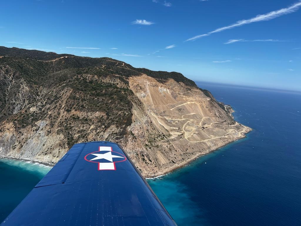
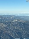
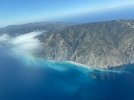
We finally made it to Catalina Island yesterday. Awesome trip all around. We'd intended to cross the LAX SFRA and buzz over LAX at 3,500. Established at 3,500, a few miles north of SMO, Socal handed us off, and we couldn't receive the SMO VOR to cross. We ended up looping back to the west side of the bravo shelf and shooting down across the ocean. In hindsight, that was way easier.
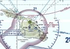
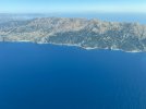
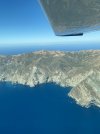
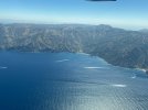
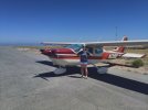
We went direct Two Harbors and joined the 45 for rwy 22. The approach and landing weren't bad at all. The advice I'd received was 2,100 ft when turning final and a steeper than normal descent. We caught a bit of a downdraft when approaching the runway and added some power to compensate. The first 1,800 ft of runway is sloped up, and it gives the illusion that you're running out of runway on the ground roll. Counting the taxiways is a sanity check--there are two between the runway ends, and we were down and slowing before the first.
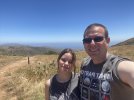
Upon arriving, we went up to the 'tower' to pay the landing fee and chat. The restaurant was pretty good (burgers, sandwiches, hot dogs). We did a 2.8-mile hike around the airport. If we were there longer, we would have taken the shuttle bus down to Avalon. It's a bit pricey and only runs at specific times during the day. Awesome experience overall, and it's definitely getting added to the weekend fly to lunch list.
We went direct Two Harbors and joined the 45 for rwy 22. The approach and landing weren't bad at all. The advice I'd received was 2,100 ft when turning final and a steeper than normal descent. We caught a bit of a downdraft when approaching the runway and added some power to compensate. The first 1,800 ft of runway is sloped up, and it gives the illusion that you're running out of runway on the ground roll. Counting the taxiways is a sanity check--there are two between the runway ends, and we were down and slowing before the first.
Upon arriving, we went up to the 'tower' to pay the landing fee and chat. The restaurant was pretty good (burgers, sandwiches, hot dogs). We did a 2.8-mile hike around the airport. If we were there longer, we would have taken the shuttle bus down to Avalon. It's a bit pricey and only runs at specific times during the day. Awesome experience overall, and it's definitely getting added to the weekend fly to lunch list.
 Other than that, it was a great flight.